

A Severe Weather Threat in the South + Some Keys to Spring
Let's get down to business for 2026 shall we?

As is typically the case, the severe weather this year is mostly starting in the southeastern U.S., closer to the Gulf and all the moisture/instability it can provide.
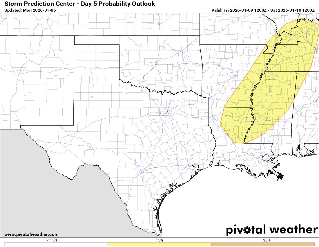
1. Severe Weather Possible This Week
Friday should see a severe weather risk develop over the Mississippi River Valley as a strong storm system moves overhead, bringing ample Gulf moisture at the surface. The degree of instability is in question, but this is a classic cool-season setup at this stage.
Big Jet Energy: A powerful storm system aloft will move east, bringing with it heavy rain to parts of the Plains and snow to the Southern Rockies (both much needed!). As it moves east, moisture will surge northward from the Gulf, creating at least a modestly favorable setup for severe weather.
But Instability? One problem that plagues systems this time of year is the degree of forcing. The jet stream is stronger in the winter months, leading to more dynamic forcing that can crowd the warm sector with weaker storms and showers rather than robust supercells. That’s an easy-to-see possible failure mode this time.
What We’re Watching:
Will instability rise to the point of supporting a more widespread threat, or will it remain marginal in nature?
Will storms crowd out before they can take advantage of strengthening low-level shear later in the day? This would modulate the tornado threat.
2. Three Keys To Watch Before Spring
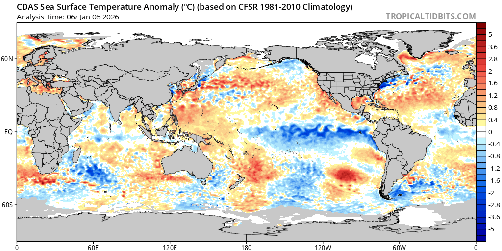
La Niña → El Niño? The degree to which La Nina weakens and the waters in the equatorial Pacific warm will be a key deciding factor in where the jet stream ends up this Spring. The most idealized big tornado setup on the Plains is for warmer waters to emerge over the eastern equatorial Pacific and cooler waters to persist into Spring in the central Pacific. That’s actually a possible combo this Spring.
Gulf is Toasty. But will that remain? The Gulf remains very warm this Winter. Whenever the GoM SSTs are this warm, it helps moisture return more quickly between systems during Spring (and the moisture quality is just higher). What we’ll watch the rest of the winter is if we get a significant surge (or repeated major surges) of cold air to take the edge off of the Gulf.
Drought expansion. Right now, drought conditions are widespread across the country, especially in the region where our EML (the cap) originates. This can usually put a lid on things early in the season, but may create a more explosive season later if the jet stream lines up with a warm Gulf.
3. The 2025 Recap
If you’ve missed our video series on our chases from this last year, we’ve got an excellent spot for you to start your viewing journey: a full recap of our 2025 Spring chase season. Check it out: