

Wind Bags Today, More of the Same Tomorrow
But rising tornado risk tomorrow too...

1. Today’s Setup
I’ve been chasing storms for over 20 years, and there’s a category of day that I just kind of shrug my shoulders at. Today is that day.
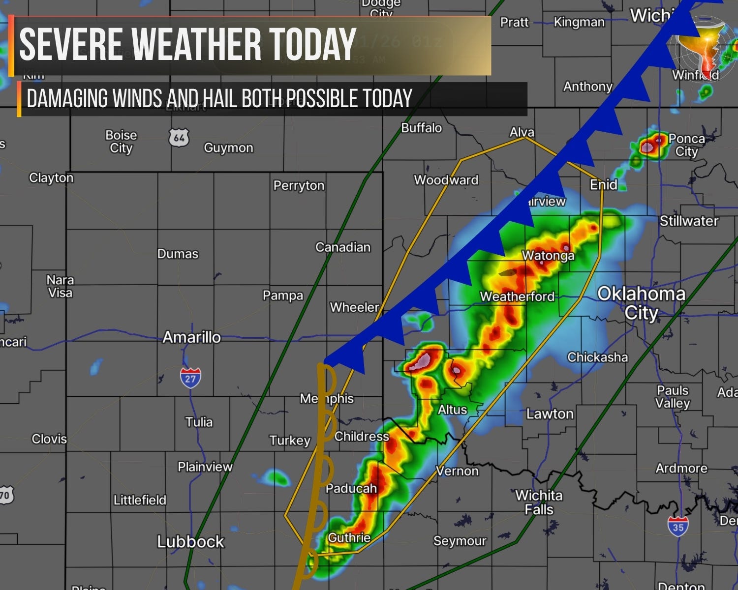
It’s the textbook Plains setup. Hail, wind, a bunch of storms firing off by late afternoon. If you asked me to draw it on a whiteboard, I’d probably sketch something almost identical to what’s happening right now. Moisture is creeping up a little from yesterday but still on the low end of useful. A system moving in will steepen lapse rates and add lift, and that’s going to be just enough to get things going.
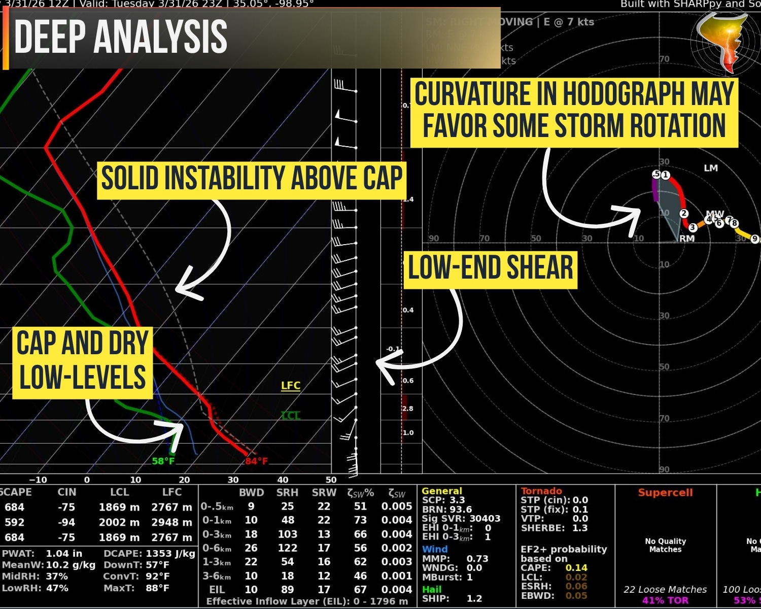
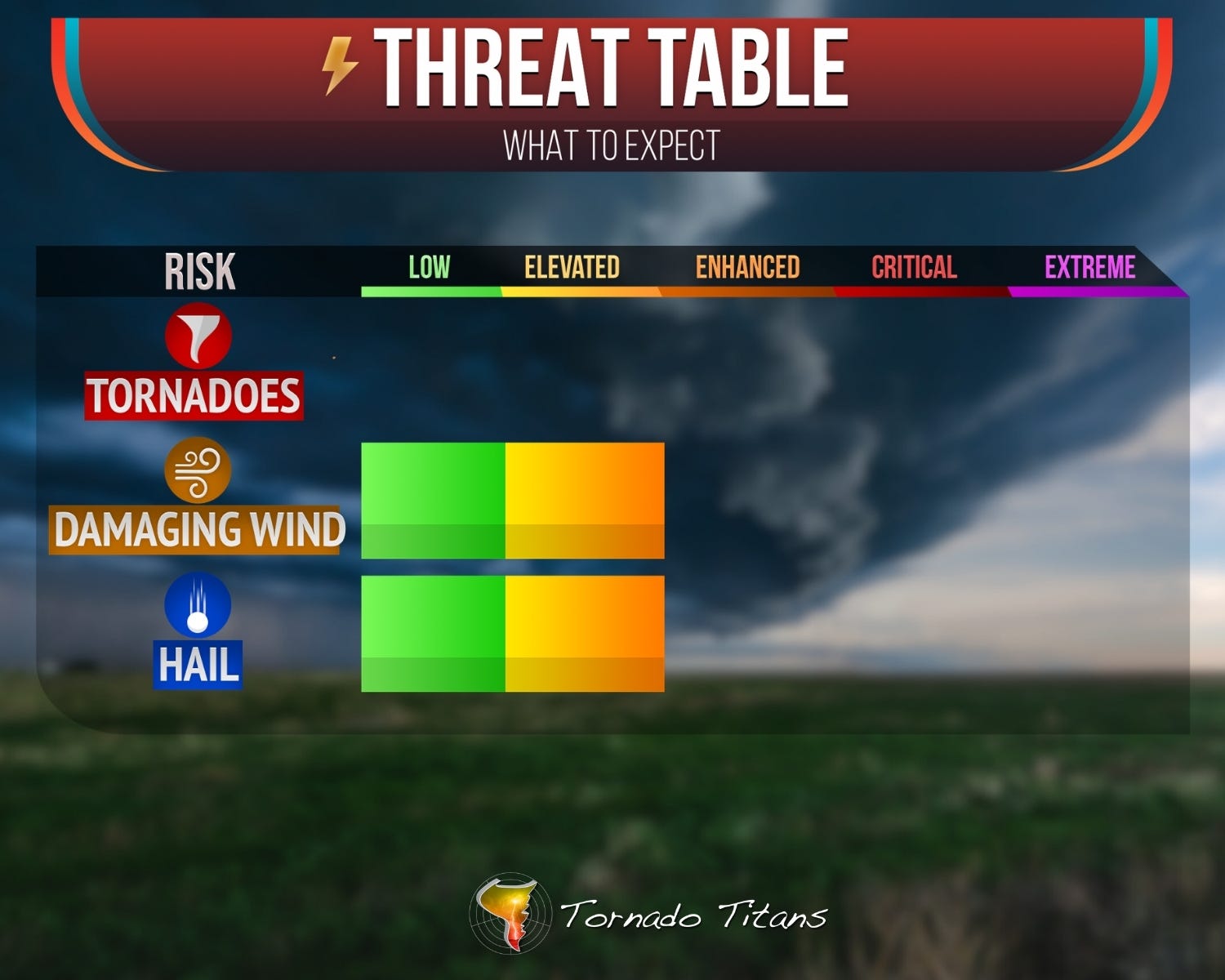
The wind fields are weak with the main system still well to the west, so storm organization is going to be a struggle. Could a transient supercell sneak in? Sure. But the most likely storm mode today is what I lovingly call blobby wind bags with some hail mixed in early. If the low levels mix out, you’re looking at damaging gusts near 70 mph in spots. That’s not nothing.
I have never once loaded up the car with vigor for a setup like this. But that’s a chaser problem, not a you problem. If you’re in the path, have a plan. We’ve all been through days like this before. Just respect it and move on with your evening.
2. Tomorrow
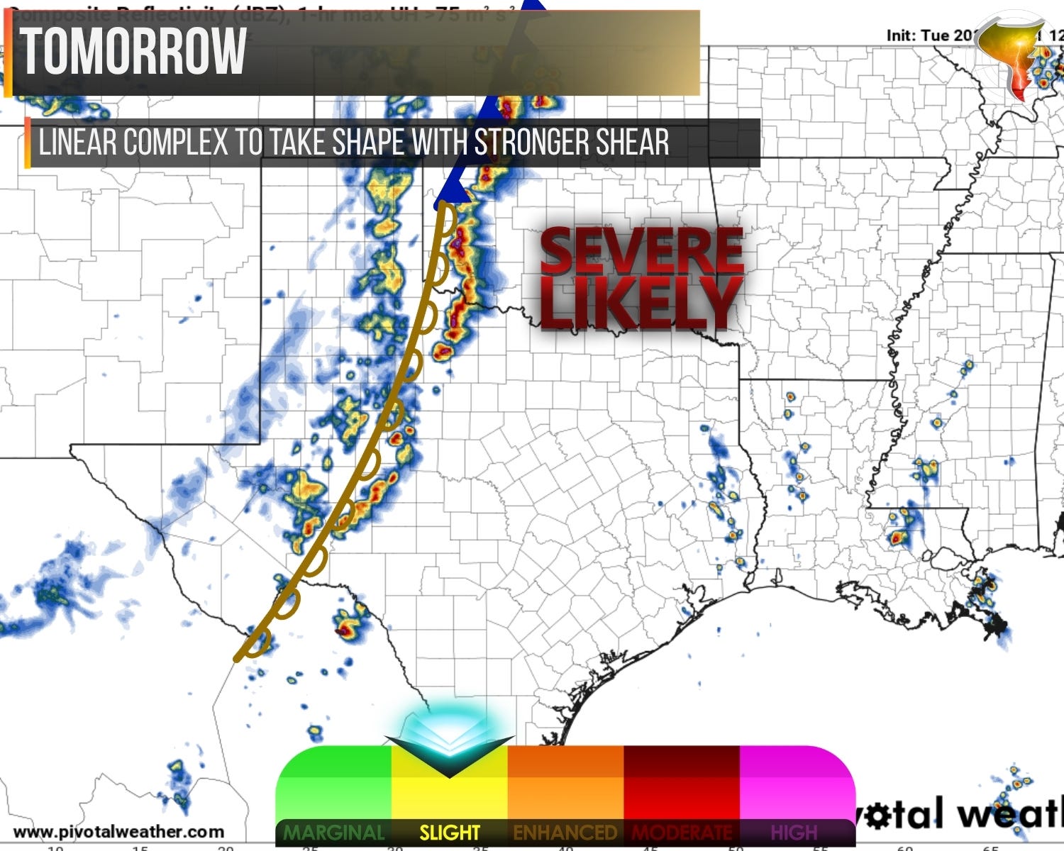
Looking ahead to tomorrow, the best thing I can say is it looks like today just with better ingredients from top to bottom. Slightly better moisture, much stronger shear, slightly higher instability.
This will still lead, thanks to stronger lift as well, to a linear complex with time. We may also see initial supercells for a brief window, depending on how strong the lift is when it arrives. But the stronger shear, especially at low levels, may lead to at least a low tornado threat tomorrow with storms near and after dark.
This could be twisters of the QLCS variety, so they’ll be quick spin-up things.