

Widespread Storms Today
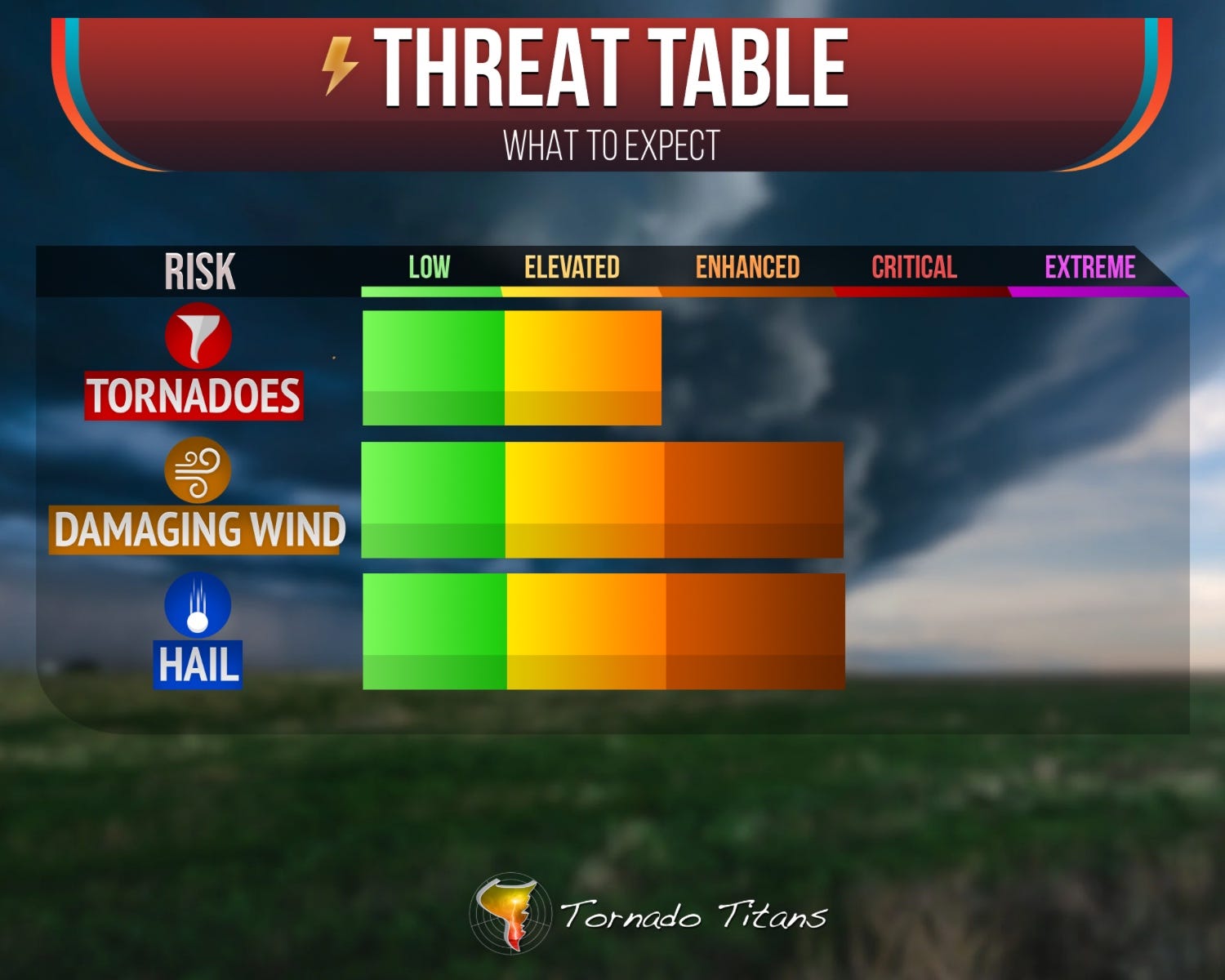
Lots of hail, damaging winds in TX and east. Elevated tornado threat too.

1. A Busy Day From Start to Finish
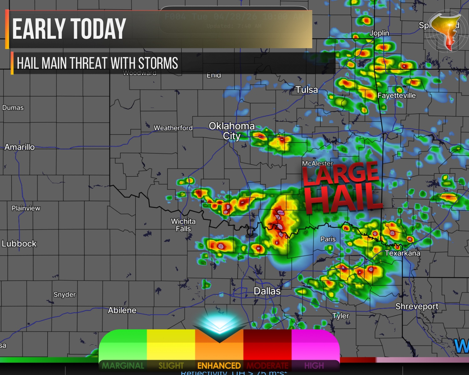
A lot is happening today, and it’s already underway. Elevated supercells are firing across western north Texas this morning, and they’re not messing around.
Strong deep-layer shear and an ejecting mid-level shortwave are fueling organized storms that will continue spreading east-northeast through north Texas and into southern Oklahoma.
Large to very large hail is the main threat through the morning. As these storms cross the warm front and tap into deeper moisture and instability across Arkansas and the Ozarks this afternoon, expect them to cluster up with a growing damaging wind threat.
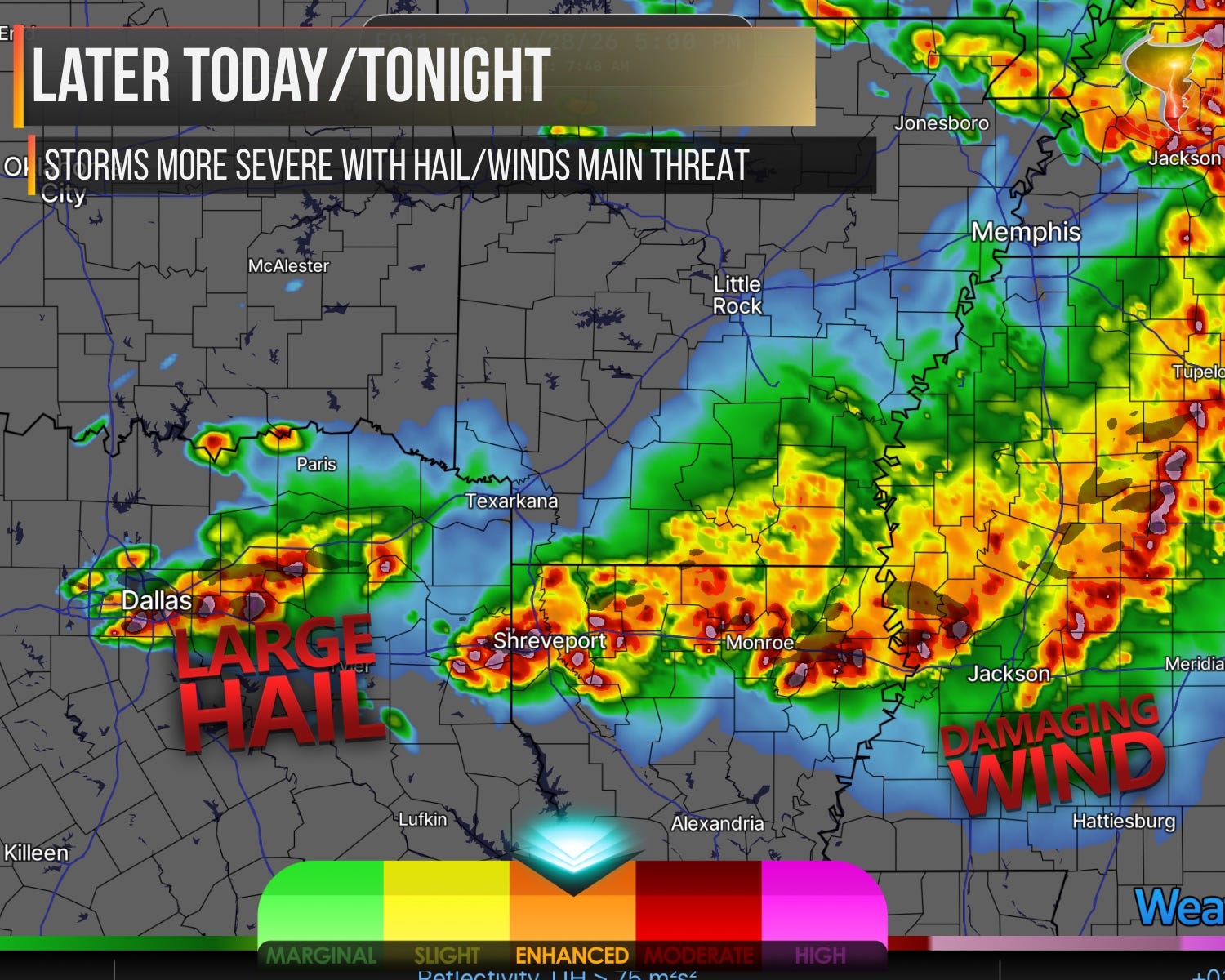
The afternoon is where things escalate. New surface-based storms are expected to fire near the triple point from north-central Texas toward the ArkLaTex, and the environment waiting for them is very potent. We’re talking 4000+ J/kg of MLCAPE with 50 to 60+ knot deep-layer shear and steep mid-level lapse rates.
That’s the kind of atmosphere that produces very large to giant hail, two to four inches or more, with the strongest supercells. A tornado threat exists as well, though low-level shear isn’t screaming, so it’s more of an “any supercell that gets its act together could produce” situation rather than a high-end tornado setup.
Further east across the lower Mississippi Valley and Mid-South, the atmosphere is trying to recover from overnight convection.
A boundary left behind should lift north through the day, and as instability rebuilds, multiple rounds of supercells and multicell clusters look likely by evening. Large hail, widespread damaging winds, and a few tornadoes are all on the table across that region. The Tennessee Valley gets less instability to work with but isn’t completely off the hook by late afternoon.
Busy day from Texas to the Mid-South. Stay weather aware, especially this afternoon into tonight.