

Wet Pattern For Late Week, But Severe Weather?
The signs are all there for a deluge to hit the Plains, but severe weather chances are more uncertain.

You’d be forgiven for assuming a dry/cool fall pattern was going to settle in, given the strong frontal passage yesterday, which wiped out moisture over much of the Plains, but…that same moisture will make a big U-turn ahead of an upcoming system and return north by late week.
We’ll have plenty of wind shear thanks to the system bringing that moisture north — and lots of lift. But the instability will be the thing in question. Let’s look at it.
Where We’re At
A low centered over the Great Lakes has pushed a front down to southern Texas this afternoon.
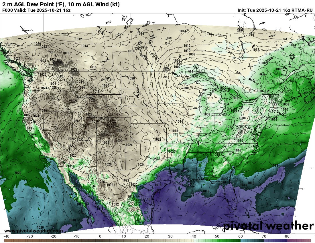
The rich, tropical air over the Gulf of Mexico will help stall this front out (along with the departing push from the low over the Great Lakes), which will set the stage for this moisture’s return trip.
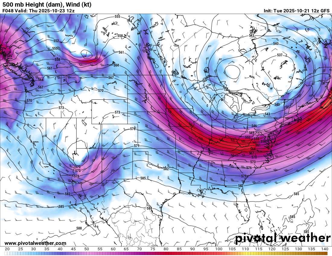
The culprit for the return northwards of moisture is the low in this GFS model depiction sitting over NW Arizona. This low will shift east, and induce cyclogenesis on the lee side of the Rockies, bringing upper 50s to low 60 dewpoints back north over the Plains.
However, it’s also going to generate a lot of storms over the ensuing period from Thursday into Friday morning.
Instability, Instability, Where Art Thou?
The first sign of trouble, at least when it comes to generating ample instability, is how this low touches off thunderstorms in low 40 dewpoints that even present updraft helicity tracks on the RRFS model Thursday afternoon in the Four Corners region. This area has been a hotbed of severe weather and even tornado activity this fall. The divergent flow aloft with cool temps aloft makes this a plausible possibility.
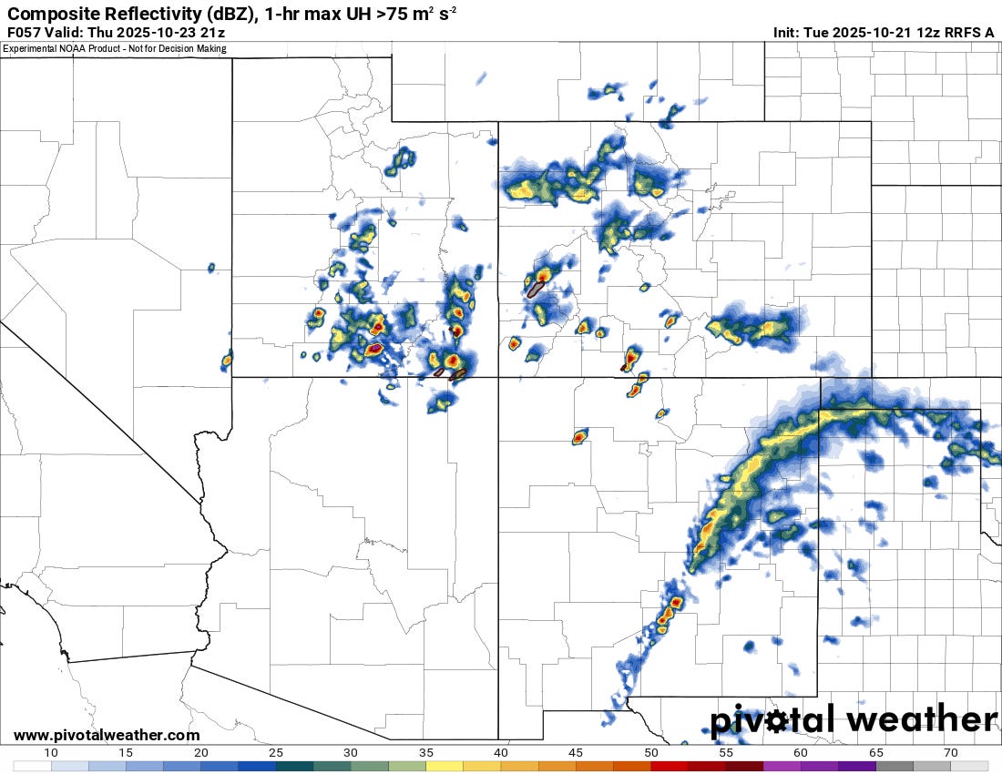
But the other thing to note is the rain over the eastern Plains of New Mexico, which will likely expand according to most models overnight Thursday into Friday.
The RRFS does produce what I would assume are severe storms over the Texas Panhandle on Thursday, with solid flow but meager moisture and instability. Still, this would be sufficient for a severe weather risk to be introduced if later CAM solutions maintain this.
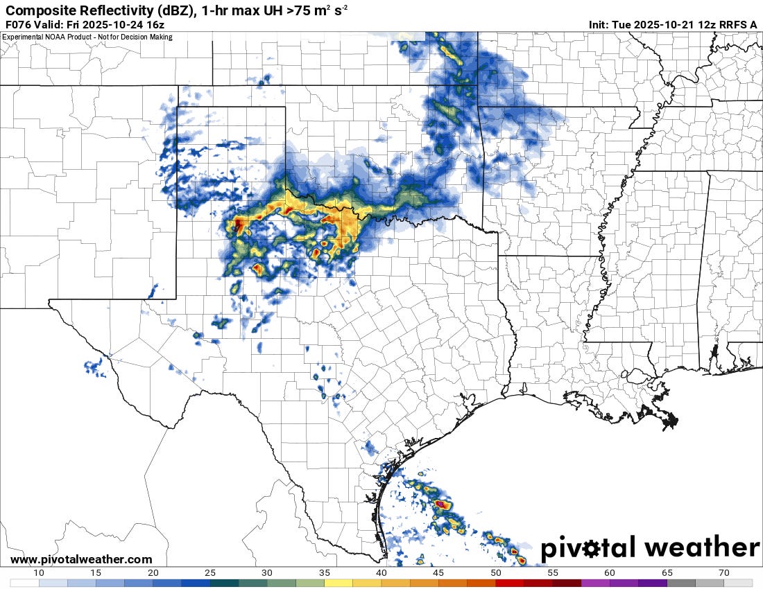
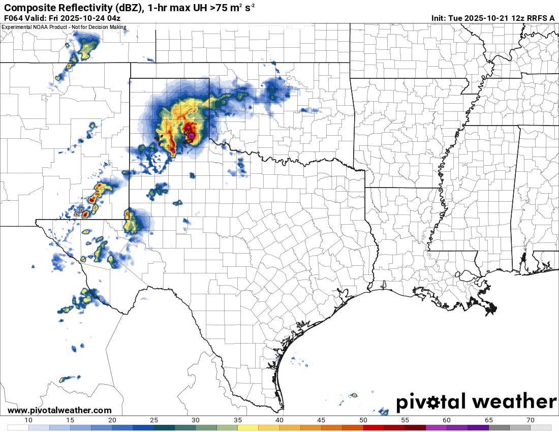
Overnight, the RRFS (and GFS/Euro to a broader extent) maintains rain and storm activity, extending them all the way into the next morning. This scenario happens a lot in the fall, when the cap isn’t nearly as strong and systems are very dynamic. The extensive rain/clouds ahead of the system would tend to limit instability almost everywhere if this comes to pass, except on the southern fringes of morning activity.
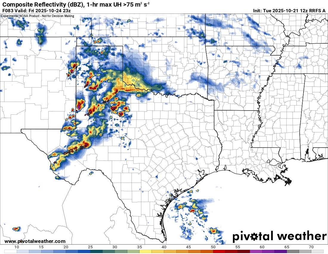
Thanks to some surface heating, lots of lift, meager but positive instability, and no cap, widespread storms form on most models into the afternoon hours on Friday. Again, this would likely present as a severe weather risk if there is even a reasonably minimal amount of instability. I’m not seeing a major day out of this system’s passage, but some hail/damaging winds, along with a low, conditional tornado threat could come to pass.
Beyond
This system isn’t that strong and likely won’t drag a massive cold front through the Gulf. There are indications on both the Euro and GFS that the stormy pattern will continue. Depending on how much moisture is available, a bigger system next week could bring a classic fall setup with a big cold front and a linear system with conditional supercells by midweek. We’re watching that one closely.
Memorable Fall Twister Chases
Believe it or not, we do chase storms still (it feels like it’s been forever). Here are some big past fall chase days in our latest video: