

We’re Watching for Severe Weather Potential Wednesday/Thursday
The return of severe weather risks are here by late Wednesday and into Thursday.

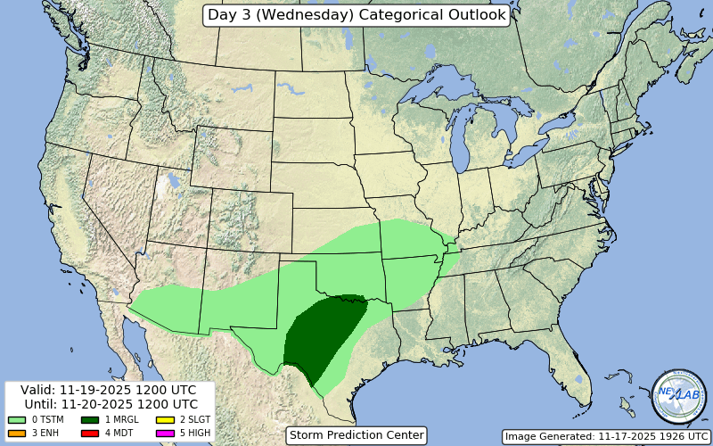
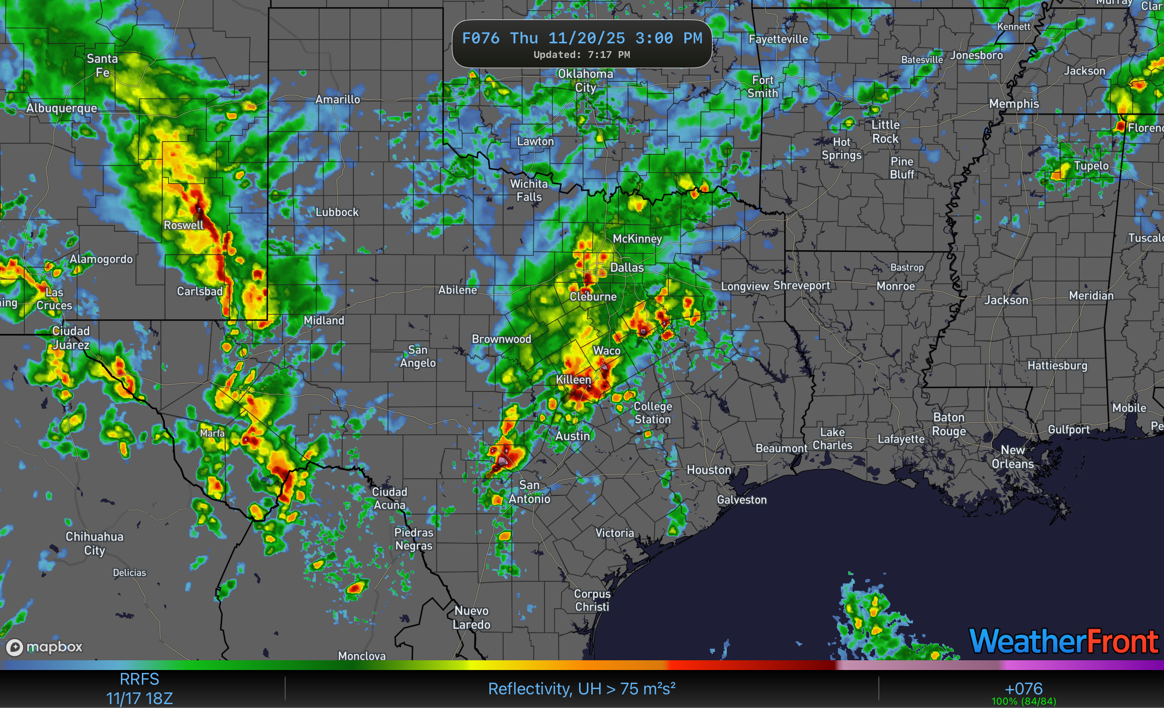
This afternoon, the SPC confirmed what we had been seeing the past few days by introducing a low risk of severe weather across portions of the Lone Star State effective Wednesday.
The culprit behind this? A powerful low pressure system that’s going to bring flooding rains, heavy snow, and thunderstorms to the southwest as well.

That low will help touch off a lot of storms over the Plains and into the South from the Wednesday into Thursday time period.
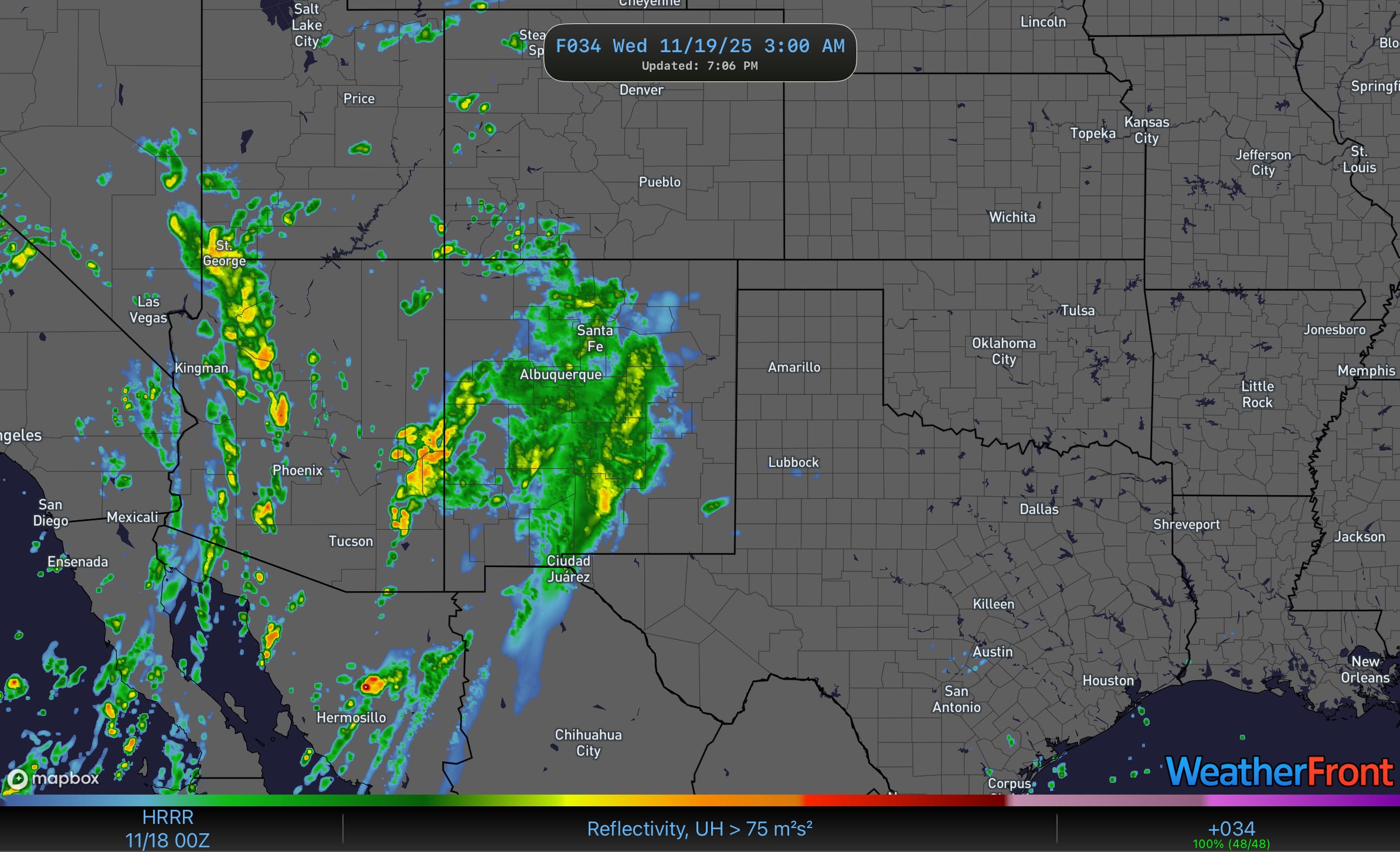
Overnight tomorrow into Wednesday morning, widespread precipitation will form and make its way north and east across New Mexico. This precip will fall as rain in the valleys and snow in the higher elevations.
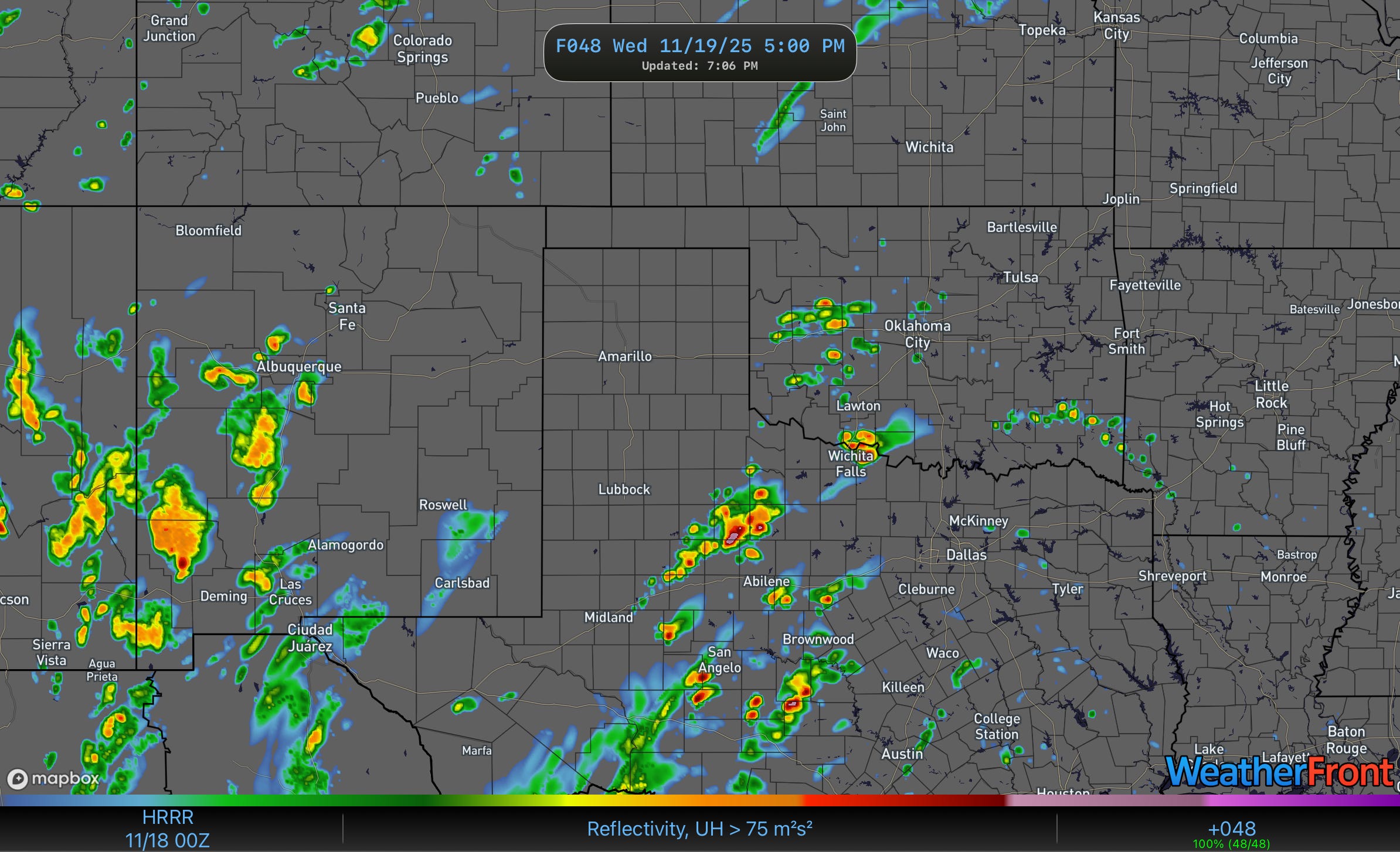
Most of Wednesday should be dry, but storms will likely form in the mid-late afternoon hours as energy from that low ejects out.

These storms will strengthen and expand in coverage through the afternoon hours and into the evening.
The environment is the key question to ponder for Wednesday. It will be at least marginally supportive of severe storms and supercells with large hail and damaging winds the primary threats.
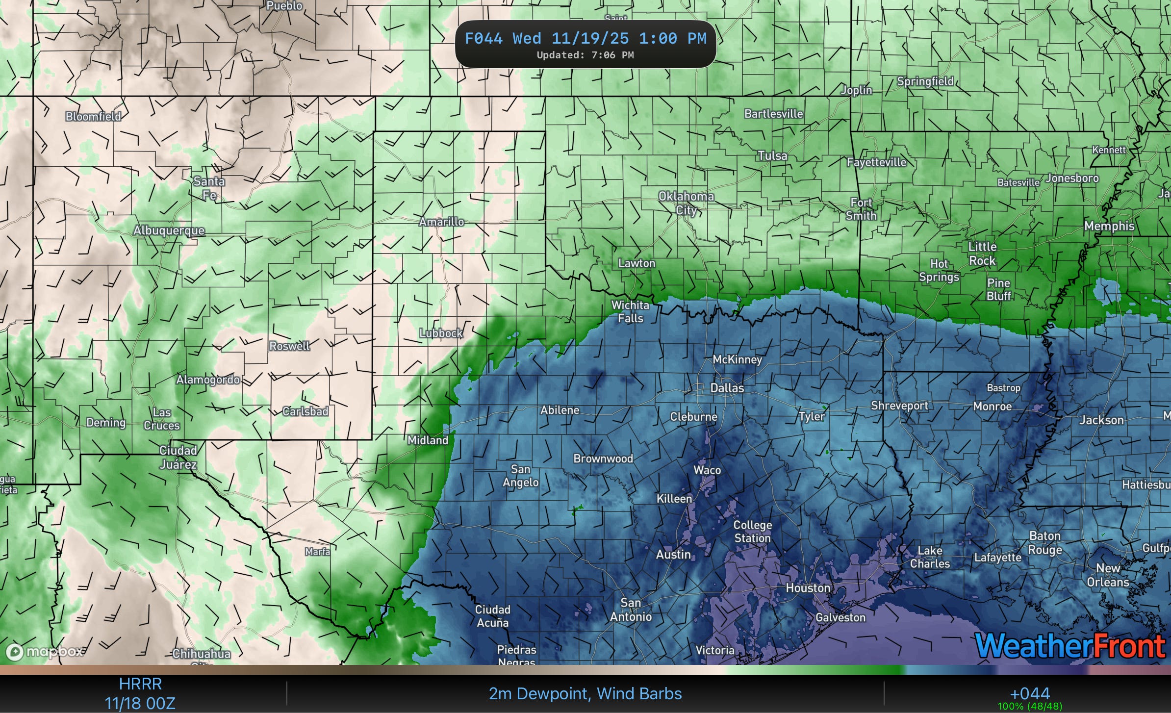
Mid to upper 60 dewpoints will be in place across Texas, which is seasonally quite rich moisture. This will fuel weak to moderate instability in the warm sector.
However, Wednesday will see the warm sector just a bit too far east of the main upper energy, which is keeping the low-level wind fields veered and weaker and preventing a higher tornado threat.

Still, the degree of 0-6km bulk wind shear (45kt or larger) mixed with the strong turning with height will allow for storms to organize and rotate.
Things should continue to be active into Thursday, but a lot of what happens on Thursday will depend heavily on how Wednesday goes — but expect a south and east shading for the strongest storms into east and southeast Texas.
This twister grew to be a very large tornado that exhibited incredibly strong motion in its base. This tornado, which formed near Dougherty, Texas, formed just a couple of miles north of me, and I stayed until I saw the very edge of the circulation just down the road.