

🌪️⚠️ Tornado Risk Sunday With Fast Moving Storms
Another early season setup on the Great Plains brings a lot of questions at this hour.

It’s time to visit Sunday again (we’ll try to get another blog out on the morning of). Overall, still think a tornado risk will be present in the early evening, but the main severe threat might end up being damaging winds with this one.
We finally have some higher resolution guidance and more models having a look at the setup so let’s dive in.
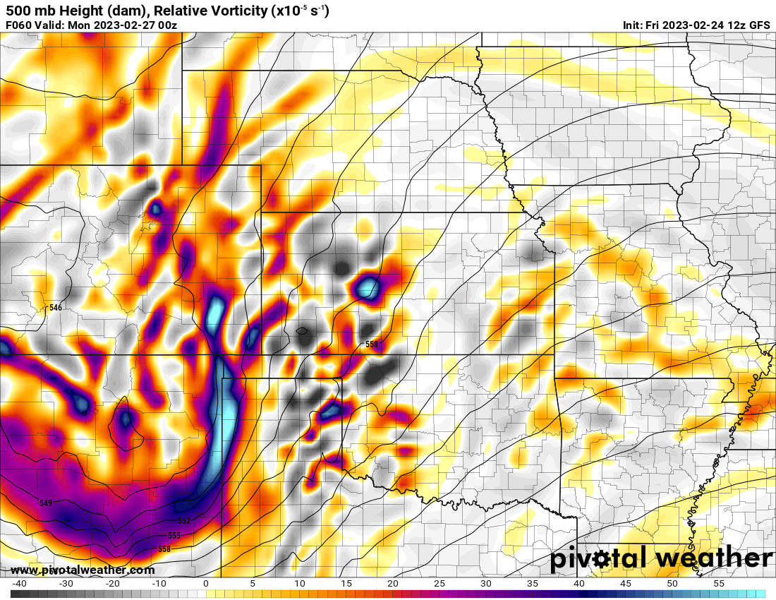
Big, Fast Moving System
The amount of forcing quickly ejecting over an unstable airmass is impressive on Sunday. The system quickly ramps up lift after mid afternoon and towards sunset. Depending on cap strength and moisture return, we’ll see storms form around 4 p.m. on Sunday give or take an hour or two.
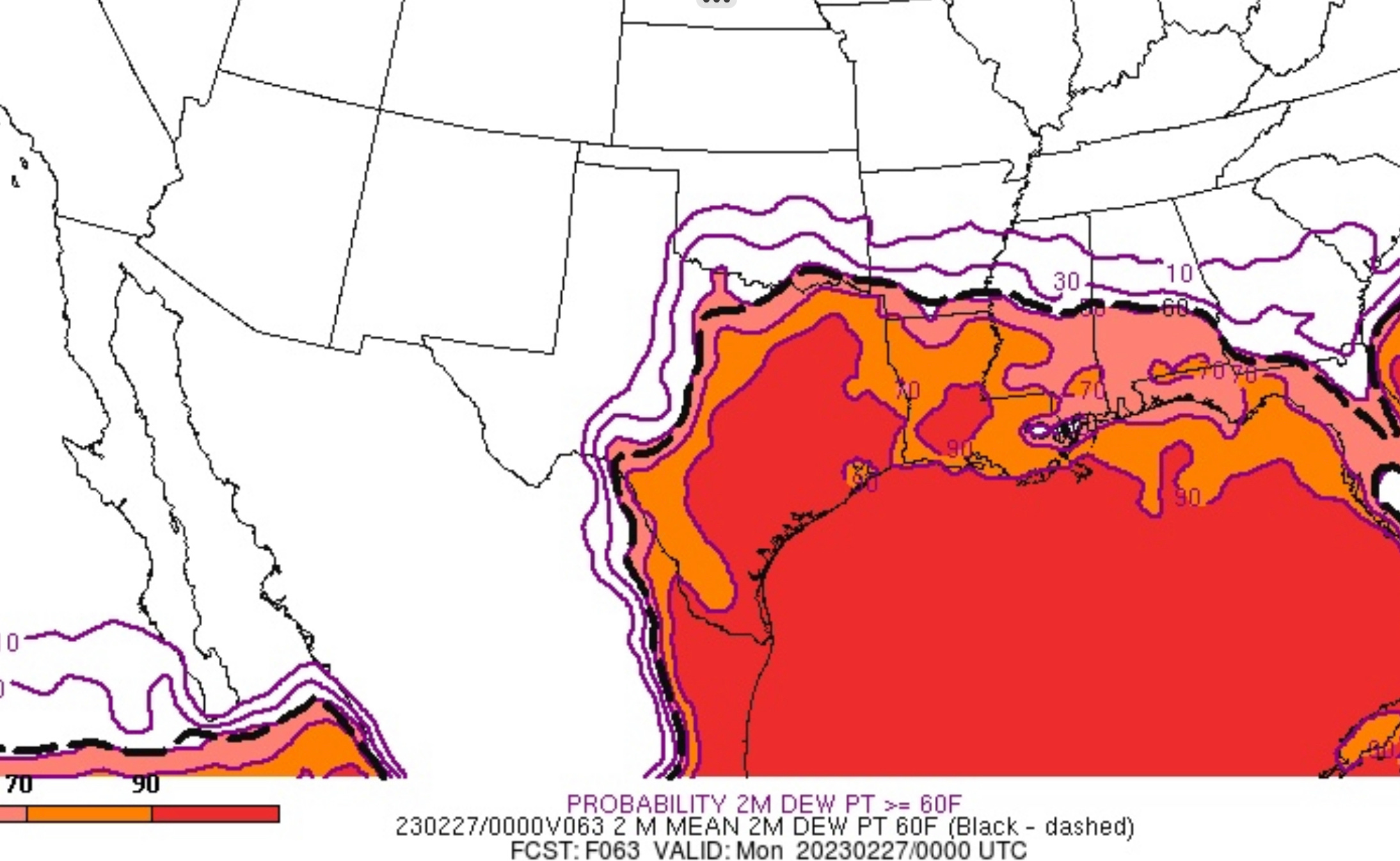
Moisture Return?
This setup is a great primer for analyzing the evolution of an atmosphere over time. On the Plains, moisture quality and depth is everything. In the wake of this week’s arctic front, getting that warm and unstable air back north will require some work by the atmosphere.
Right now, models continue to run too warm on the temperatures behind the front, meaning they are modifying it a bit too quickly.
The NAM on the other hand, which has been the outlier on very poor moisture return, seems to be holding onto the arctic airmass a bit too long.
I think you have to split the difference a bit. This is a situation where looking at the SREF is a good idea.
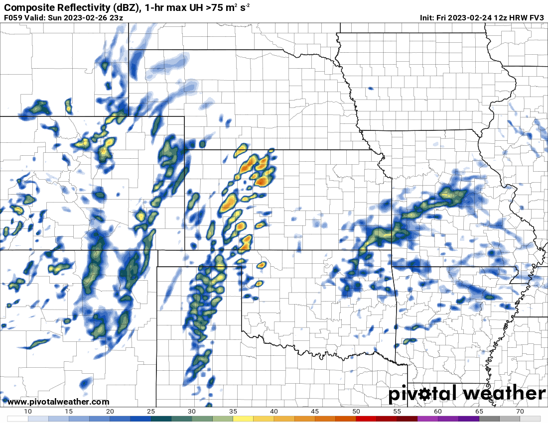
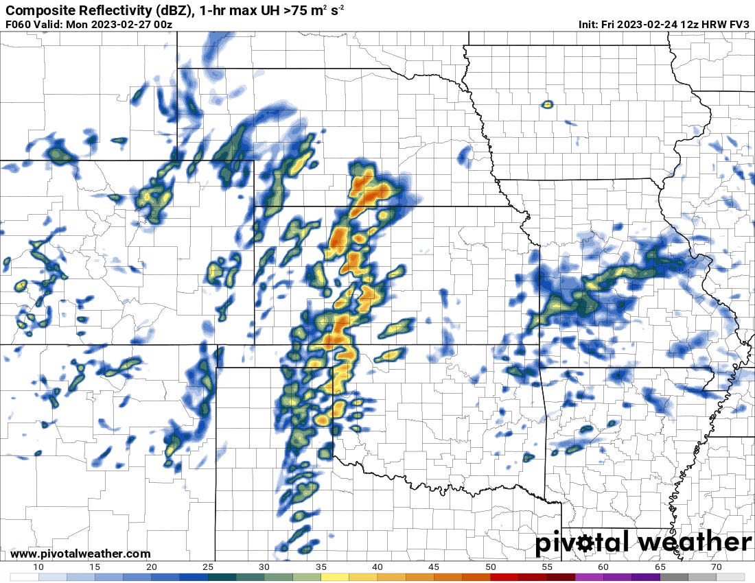
Storm Mode
Another thing to question for setups at this range that you can reasonably start answering is what mode will storms be in? This is important because a more linear mode is less favorable for stronger tornadoes *generally*. QLCS tornado events are real and dangerous so its reason to give this setup respect, but from a storm chasing perspective I’ll just say they’re much less interesting.
The Bottom Line
Storms, and a line of storms, are a sure bet on Sunday. Given the amount of low-level shear, tornadoes are also going to be a risk, especially from 6-9 p.m. Damaging winds will probably be the main risk with the line, which should slowly weaken starting 8-9 p.m.
However, the storm chaser ‘pretty supercell’ and ‘supercell tornado’ index is not very high for Sunday.
Storm motions all but guarantee storms move into a less unstable airmass within an hour or two and they’ll likely be crowded and line out fast too.
Chaser traffic isn’t often a problem with storm chasing but this time might be one of the exceptions. The fast storm motions are admittedly a nightmare for chasing with any traffic also on the roads.
This setup is a slightly better version of the last one that produced a couple of tornado warned supercells embedded in a line for a brief bit in S/SE OK.