

The Tropics Are Awake + Plains Severe Weather?
The weather is not taking time off to enjoy some pumpkin spice, that's for sure.

Sometimes when you try to write an intro, you sit down at the keyboard and try to think of a witty way to say something similar to what you’ve said before.
Something like, “Tropics double trouble!”
Or maybe, “Fujiwhara! Fujiwhara effect! Except not.”
But we’re going to skip all of that hard work, because you are here for the weather.
Because this tropics double trouble hurricane threat will pose risks to the Southeast U.S. this weekend into next week.
Tropics Double Trouble
As of this writing (by the time you read this it might have changed) we have Tropical Depression 9 and Hurricane Humberto in the Atlantic. Both storms will mirror the other and move to the north and west over the next few days before making striking east turns.
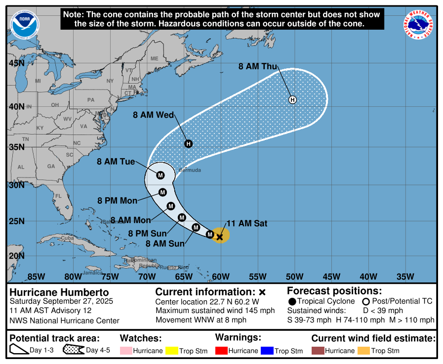
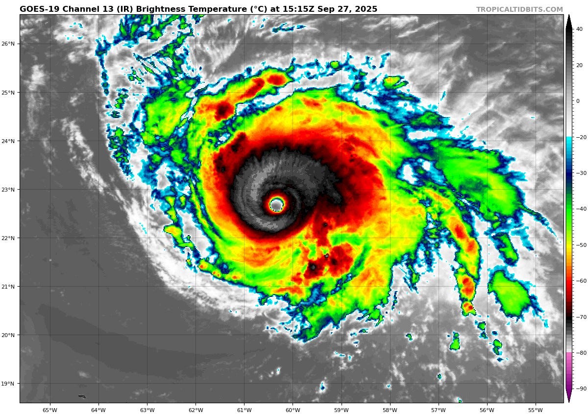
Major Hurricane Humberto features winds of 145mph as it moves to the WNW at around 8 mph this morning. A look at vis sat shows an impressive storm:
All indications show this one moving alongside eventual Storm Imelda before turning to the north and east, likely just slipping past Bermuda. This major storm poses almost no threat to land otherwise in the immediate future.
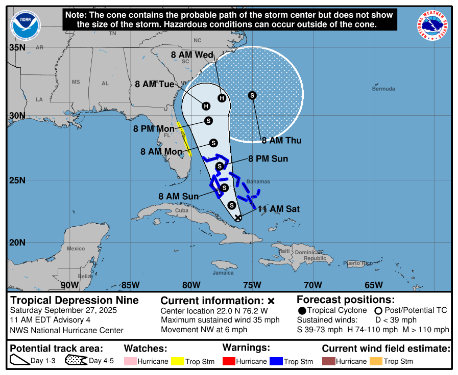
Tropical Depression Nine, on the other hand, will move through the Bahamas as a likely tropical storm while scraping the east coast of Florida. As it moves north and west, it will make a close approach to the Georgia/South Carolina coast. From here, models have really struggled with what will happen over the past few days — but the general consensus now seems to be that the storm will stall and then be pulled offshore by the upper flow.
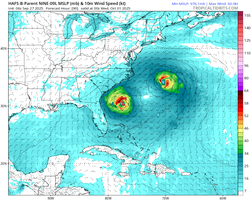
Intensity wise, Nine probably won’t undergo the rapid intensification that has become relatively commonplace in the Atlantic over the past several seasons (including Humberto). This is due to shear/dry air, land interactions, and the lack of time over open waters the storm will get. The more likely scenario is a slow but steady strengthening trend, bringing it to a Cat 1/2 before it turns and weakens.
A U.S. landfall can’t be ruled out entirely, especially if the turn to the east isn’t that sharp or fast — but the environment looks to become more prohibitive to tropical systems with time regardless of the eventual track.
And The Plains…
Back closer to home, we’re watching a pretty stagnant pattern over the middle of the country.
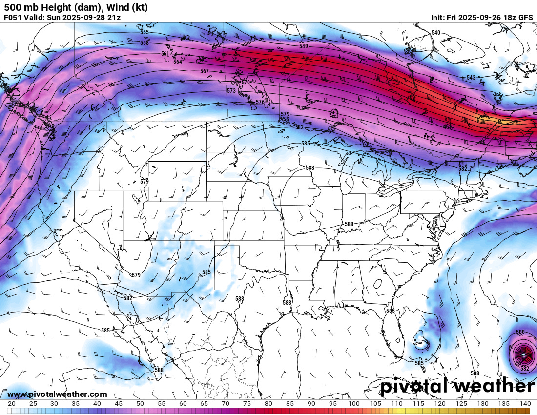
A closed upper low has been dominating the weather over the Southwest and will continue to do so through this weekend. As that low opens up and slides east, it may bring continued low-end severe weather chances at least over New Mexico.
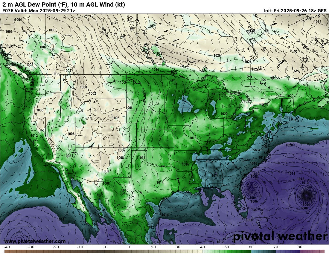
As the low opens up into early next week, it’ll weaken and move over a pretty dry plains airmass. The large-scale pattern supports continued offshore-ish flow over the Gulf, with dewpoints well below traditional severe weather thresholds over the Plains. My best guess is that the low will be weak enough and moisture scarce enough that any severe weather chances will be long gone by the time the low fully emerges over the Plains.
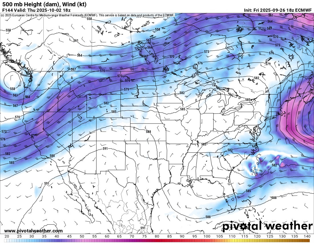
By midweek, a ridge will reestablish itself over the southwest, with dry air flowing over the middle of the country. Thus, that’s a lot of words to say that, apart from this weekend over New Mexico and parts of Arizona, we’re expecting a quieter week of severe weather chances.