

☈ 👀The Squall Line Cometh (But Supercells?)
A line of storms is guaranteed along a surging cold front. But will the dryline initiate storms too?

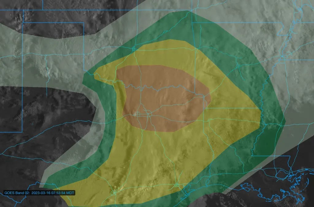
Severe storms will form in the early-mid afternoon hours along a crashing cold front and will quickly move east. Most of the severe weather threat should be centered east of I-35 this afternoon and evening with damaging hail and wind gusts and a low tornado threat.
All Roads Lead Linear
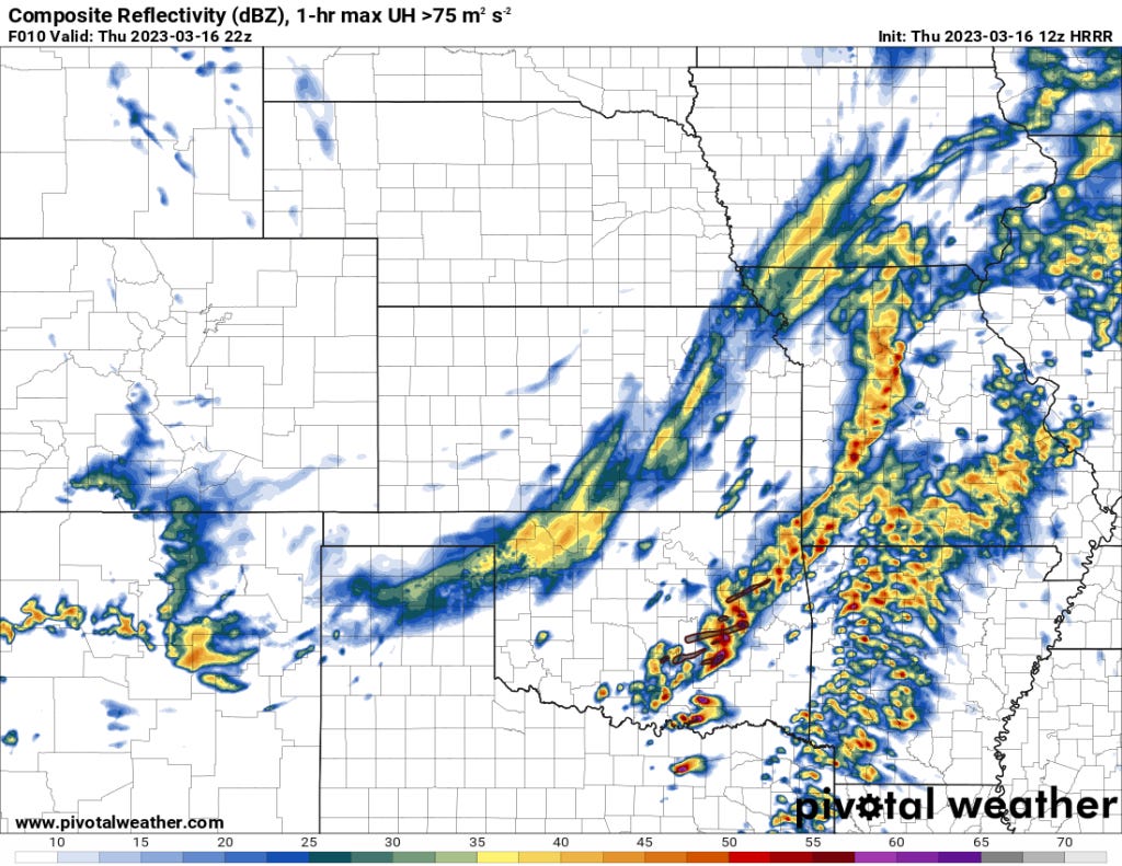
Storms are going to form into a line along the crashing cold front, the only question I think I have at this point is how many hours (if any) will we see isolated supercells that can take full advantage of the atmosphere.
The timing of when storms form into a line is a subject of great debate amongst the models it seems. Some do this faster than others.
Of particular note is that the HRRR does initiate supercells but it also does so where they are anafrontal, or trailing the cold front. This is pretty common this time of year with fronts that are crashing.
Cold fronts also typically crash a lot quicker than expected. Sometimes by as much as a county-ish worth. I’m not sure if that happens or not today, but it I something to watch out for.
The Threats
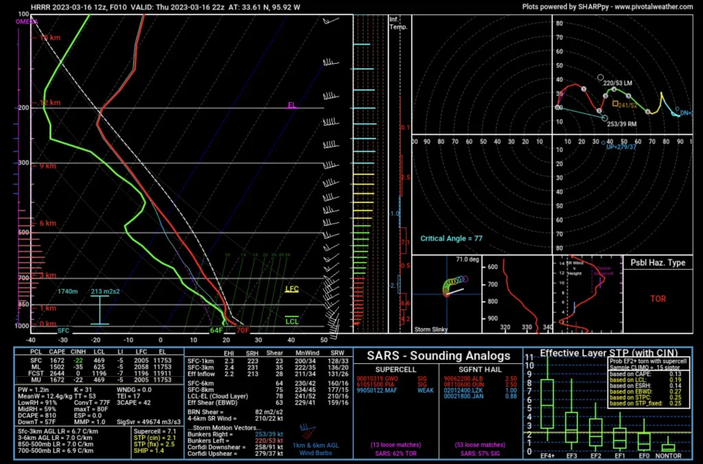
The most obvious threat today is large to huge hail with any supercells initially. As recent research has shown, smaller low level hodographs mixed with strong wind shear and moderate-ish instability are a really favorable combo.
However, if storms are continually undercut by the cold front — this will mitigate that threat somewhat.
Damaging winds along the front, which will definitely begin surging when storms start pushing on it, will be possible.
The tornado threat is more conditional. If you get sustained supercells off of the dryline/triple point in South-Central Oklahoma and far North Texas, things could get interesting.
I don’t recall many tornado events in this part of the world with surface winds much west of due south though. They happen of course, but that thought sticks in my head right now as I see the low level wind profiles until about sunset.
Over I think the tornado threat is low — but the upside potential is there for a more enhanced threat if you can get more isolated development off of the dryline. If that threat does take shape, it will be along a 50-75 mile stretch on either side of the Red River most likely.
Storm Timing
Expect storms to form pretty early today. Upper forcing is speeding eastward, with storms probably forming as soon as noon to 2 p.m. this afternoon.
Storms will absolutely form along the cold front. The only question is how early and some indications are it could happen very early today. Definitely earlier than you would otherwise expect.
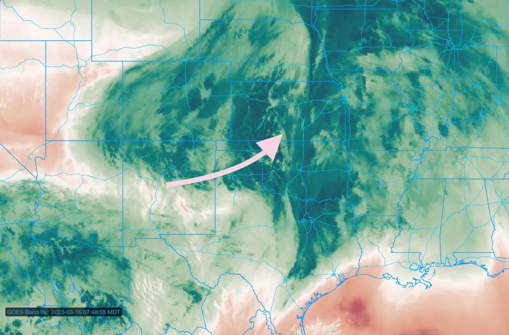
The dryline is a more interesting and open question. This is a great lesson in it takes more than cap/no cap for storms along a dryline.
While the airmass is pretty uncapped, the upper wave that causes storms early in the afternoon will not have much of a dryline to form storms on.
The dryline moisture gradient is pretty diffuse until about 21-22z (4-5pm). It sharpens up by then, but the upper wave’s main lift will be north and east by then — which could result in air that is somewhat sinking aloft.
I wouldn’t rule out a storm near a triple point-ish feature in South-Central Oklahoma. But I think the further south you go, chances of storm initiation in the afternoon decrease dramatically.
The Bottom Line
How high impact today is all about storm mode. There is plenty of wind shear for supercells with generally over 50kt of 0-6km shear, and probably just enough wind shear for a tornado or two (0-1km SRH values of over 200, despite WSW/SSW surface winds).
But will we get isolated storms or will they go linear almost immediately? And relatedly, will they form and stay ahead of the cold front? Both of those are open questions.
Today is a day where the baseline seems pretty obvious, but there is certainly upside potential if storm mode is more isolated than expected.