

The Pattern is Slow...But Only for Now
The end of the month is a different story...

The rest of this month will most likely be a mixture of two extremes.
This next week or so, the pattern looks mostly quiet for the Plains. As we approach the end of the month? The opposite of that.
Let’s look at it all.
This Week
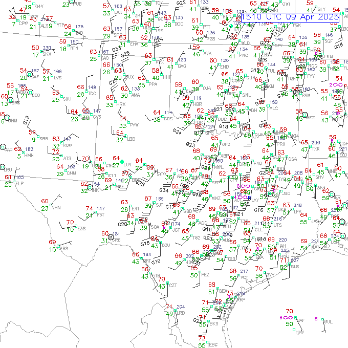
Looking at this week means starting on the big story driving the surface weather: the good tropical moisture is located way offshore. This surface map shows only 50 dews well into the Gulf of Mexico this A.M.
And when we look at models, we see not much recovery going on over the next few days:

Northerly (offshore) winds will continue in the Gulf over the next several days, with the best ‘storm juice’ well beyond even the Yucatán.

Even into the upcoming weekend, you see the moisture values over the Gulf do not improve a lot, but southerly flow will drive what is best described as ‘low-quality’ moisture northwards.
It is something that is not taught to most budding weather enthusiasts and storm chasers, but not all 60 dewpoints are created equal. And in this case, the moisture making its way north by the weekend will be of the lower-quality variety.
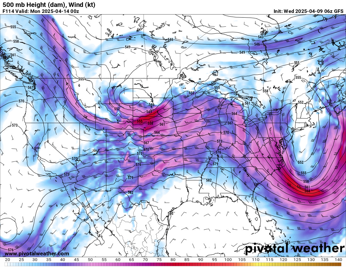
The reason moisture is surging back north is that the jet stream pattern is otherwise pretty favorable for unsettled weather, which is why you can’t entirely rule out a lower-end risk day or two in this pattern.

As we move into the extended, there are signs of more frontal passages in the Gulf, which will likely keep a check on dews through about 4/20 or so. These fronts will likely lead to lower-end severe risks at the very least.
After that is when things are set to get more interesting.
Late Month
Ensembles and teleconnections point to a massive pattern change towards the end of the month, with a very favorable and classic pattern for severe weather setting up over the Plains.
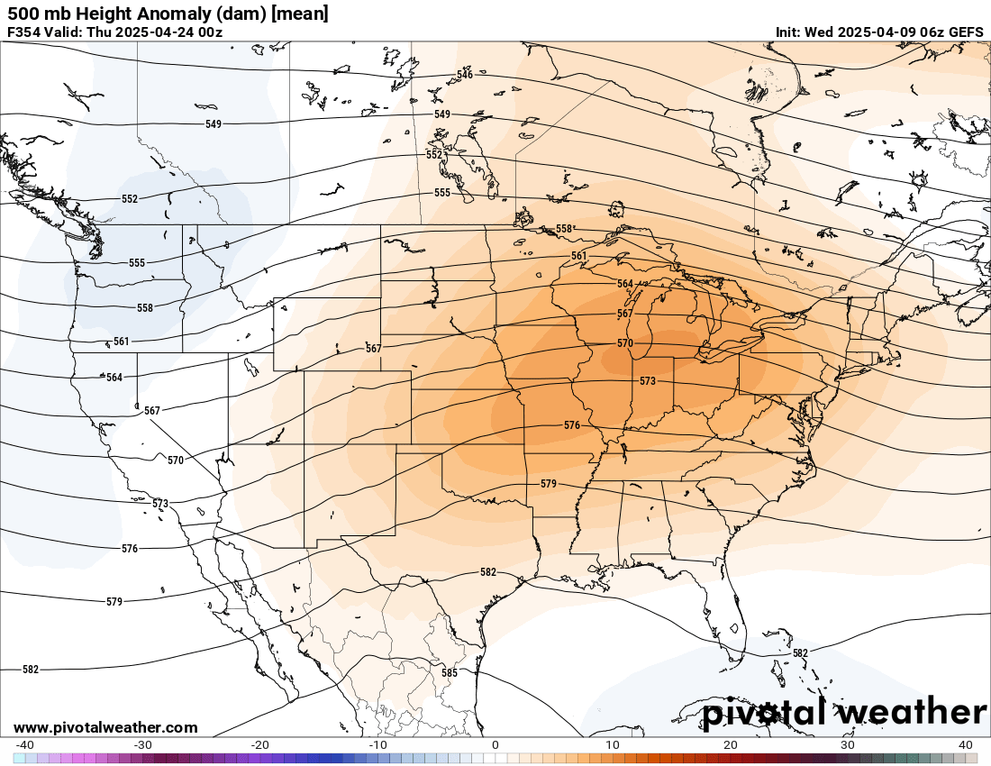
Most ensembles look something like this: they have a deep trough over the west and are ridging in the eastern U.S. This time of year, that’s tornado time.
Long-term climate models generally keep us in this pattern for a few weeks, which could mean a longer and steadier peak in tornado activity on the Plains. But this would be interspersed with some breaks in between atmospheric waves, and it would also be heavily dependent on the details.
We don’t know the timing of fronts, the strength of the cap, the quality of the moisture, or the timing of individual waves on individual days — much less locations or days that will be more active than others. What we do know is a pattern such as this (if it were to set up) favors severe weather over longer stretches in the classic Tornado Alley.
The best we can say is stay tuned…there will be more updates both here and on our YouTube channel for members (more in-depth) over the coming 10 days or so.
Thank you for saying Gulf of Mexico🙂
I agree totally that it is the Gulf of Mexico. Been that way my whole life, ain't changing now.