

The First Tornadoes of the Year in Oklahoma: Analysis
Here's how they happened...

Storms beat most models and ended up producing a couple/few QLCS driven tornadoes across Oklahoma. Here’s what happened…
1. Analysis of Oklahoma Tornadoes
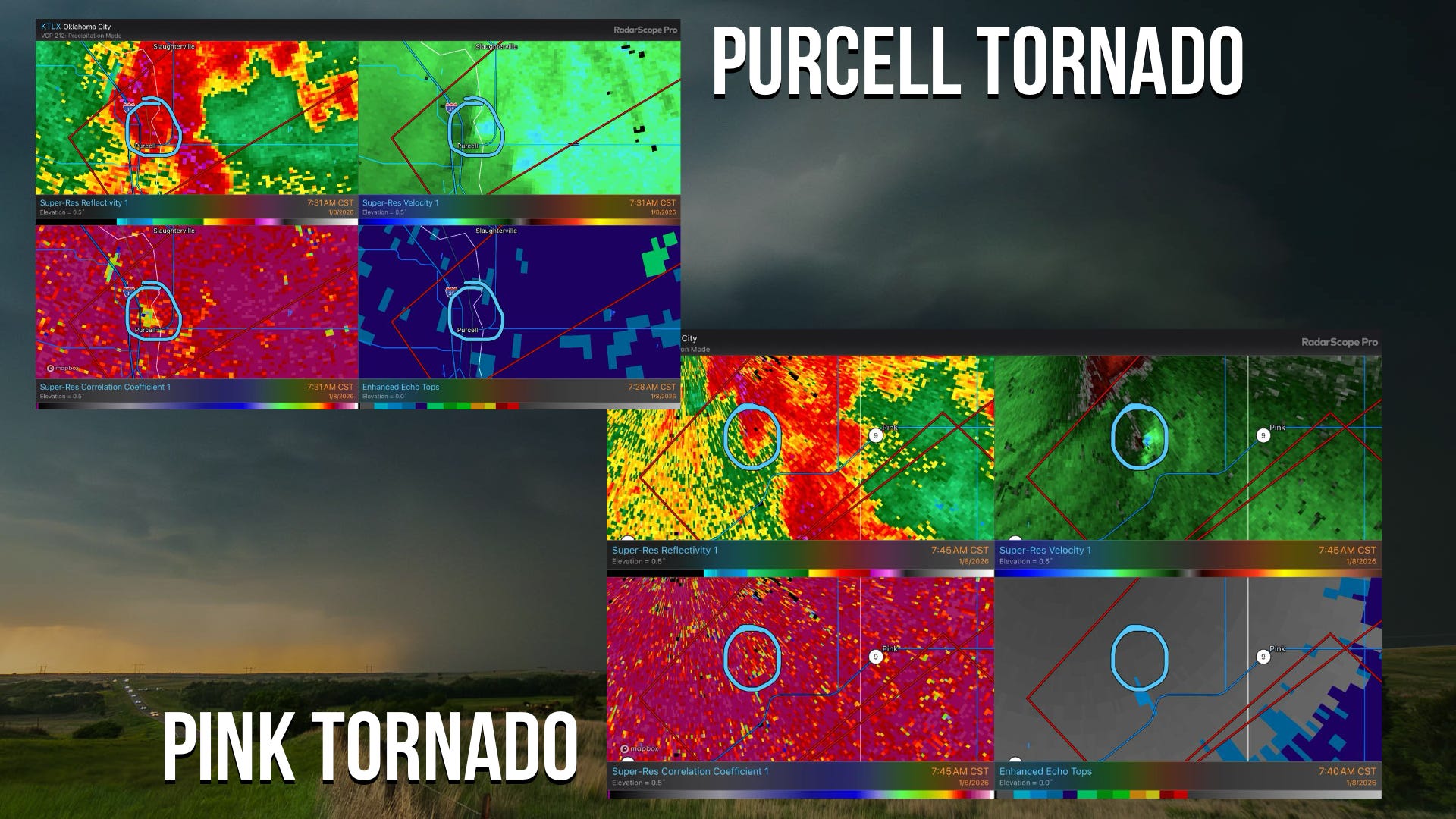
Two tornadoes tore through Central Oklahoma, leaving behind damage this morning. Above you can see a pair of radar images of both twisters.
Initial environmental analysis shows an uncapped low-level warm-sector with extremely low LCLs (cloud bases). This, combined with very strong low-level shear (EIL SRH at 279) created an environment that was favorable for this QLCS line to produce quick spin-up tornadoes. These tornadoes don’t form the way a supercell tornado does, with a deep mesocyclone and persistent supercell; they tend to be more transient and form quickly as conditions in a local area spin up along the line just enough to create a tornado.
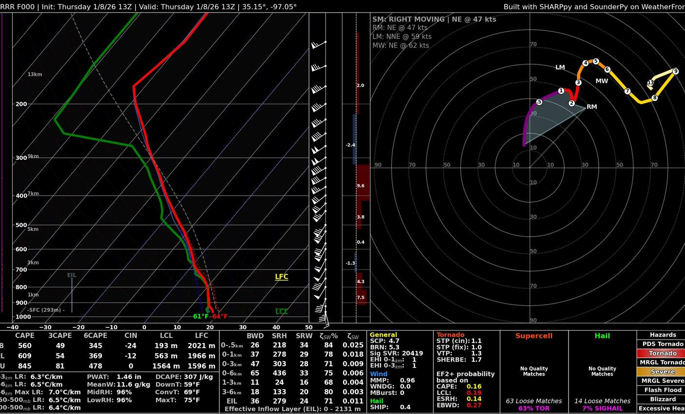
Some recent studies have shown that these types of tornadoes are increasing in frequency across the Southern Plains, while Supercell-type tornadoes are tending to decrease slightly. Climatologically, Oklahoma behaves much like the Southeast this time of year, when the Gulf is as warm as it has been. The strong shear this time of year is always present. But when the Gulf is persistently warm, systems moving through can pull up richer/deeper moisture more quickly to take advantage of that shear more robustly.
Oklahoma has set records for cool-season tornado counts (October - February) in every month just since 2021. If you extend that out to April, Oklahoma has set a new record for tornadoes every month but March, when the jet stream is typically strongest. The Gulf has been anomalously warm throughout much of that period, including all the record-setting months!
2. Severe Threat Continues East Today
The threat continues as of the writing of this newsletter. The initial line this morning has been gradually weakening, but more storms may fire and the line may re-intensify as we move into the evening hours.
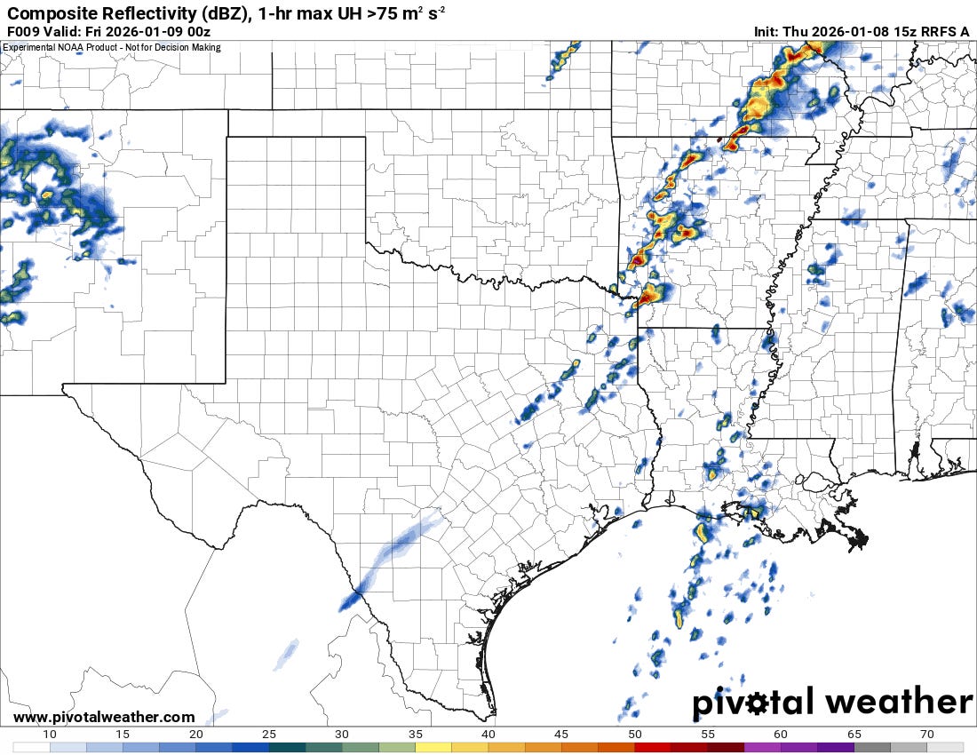
By evening, more storms will be taking shape across Arkansas, with a similar type of environment to this morning in Oklahoma. Very strong low-level shear combined with low cloud bases and just enough instability could pose a low tornado threat into the evening hours tonight.
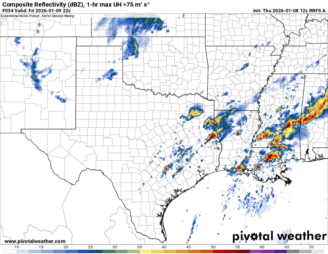
The story doesn’t change into tomorrow as storms are expected to become widespread from the Arklatex and east into the Gulf coast states. Tornadoes will be possible (low risk) along with damaging winds and perhaps some hail with these. Storms will be rather crowded, so the risk will be limited a bit, but with such rich moisture and instability, it stands to reason we could see a couple/few more tornadoes in the next 36 hours across the South.
3. Monster Tornado, Uncut Footage!
We just released, for the first time, the full, uncut footage of the Dougherty, TX tornado we documented last Spring. This was one of the biggest tornadoes we saw last year, and it was certainly capable of some rather strong damage. Thankfully, it moved over mostly open land throughout its life-cycle!