

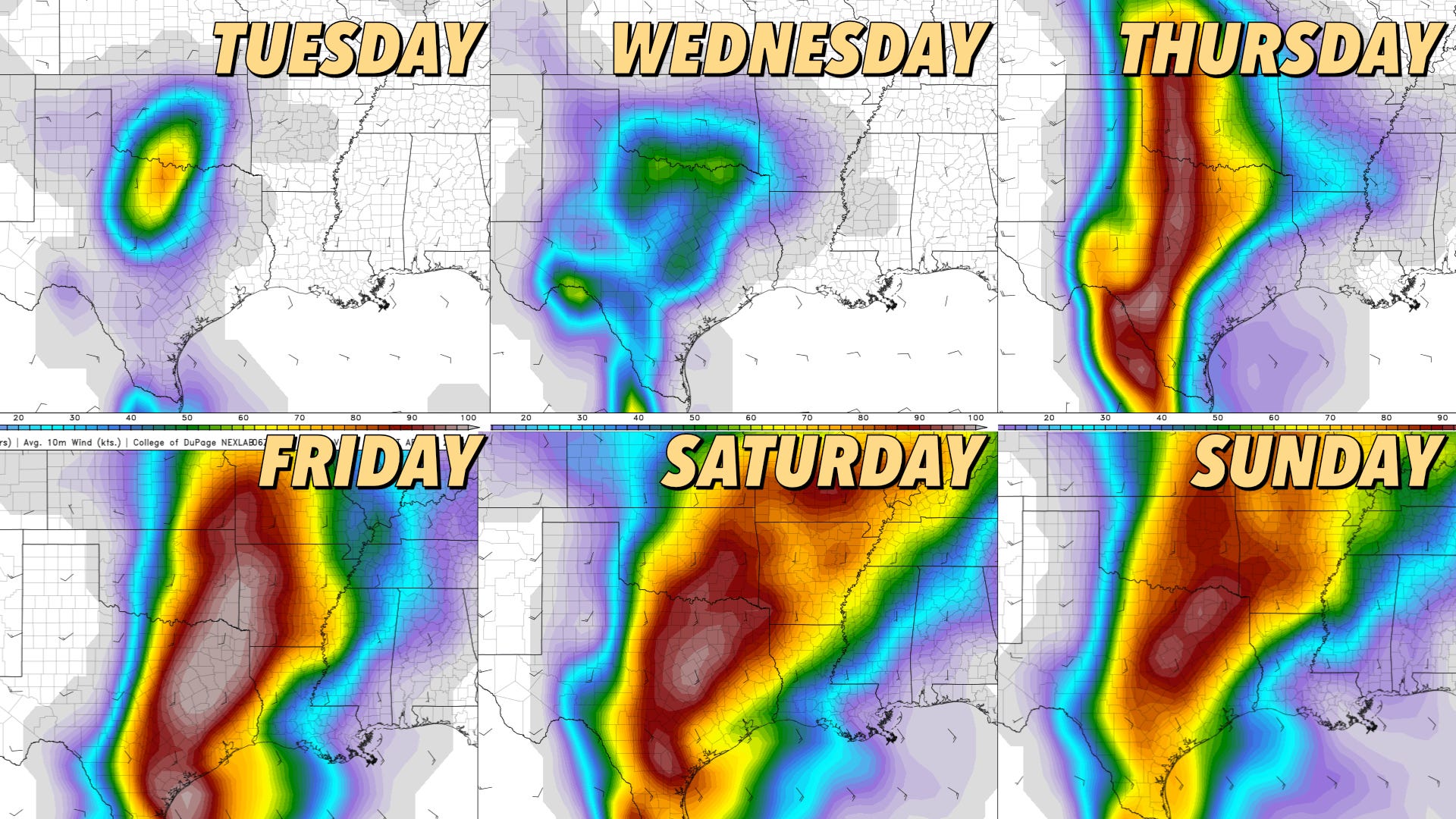
‼️ The Details Are Critical, But This Week Looks Busy
The Southern-Central Plains could be in for a long week of severe weather risks.

You probably don’t need to hear this, but the details will be absolutely critical in terms of how the upcoming week goes in terms of severe weather. But on the surface, this looks like a very busy week ahead, with risks in the SC Plains starting on Tuesday and lasting through the weekend and into next week.
The Big Picture
The driving force behind our upcoming pattern is a pair of storm systems that will move into the middle of the country. The first will arrive on Thursday, and the second will arrive a bit later.

The first system is small, compact, and relatively fast-moving on Thursday. Moisture quality will be lower on the front end of this week (Tue-Thursday) but will quickly improve Thursday night into Friday.

The second system is a broad SW US trough that will induce strong cyclogenesis on the lee side of the Rocky Mountains. This is a classic signal for severe weather on the Plains this time of year.
The Details Will Matter
Currently, there will likely be robust risks of severe weather from Thursday to Sunday at the very least, but the details will matter a lot in terms of what days see the most severe weather. Here are a few of the things we’re seeing:
The highest chances of severe weather are on the front end of this string of setups for now. While this may not remain the case depending on the factors below, the most likely days to see severe weather during this string of setups will be early on before rounds of storms likely move across the Plains. Experience says that we may end up in a situation where one day bleeds into another in terms of where/how severe storms are. If storms don’t pollute the atmosphere, the look of the later part of this string would imply significant severe weather risks lurk.
The cap will be around: The cap will also be a factor, especially early in the week. This may limit storm coverage through at least Thursday. As the initial trough departs, we’ll likely see the cap weakened for the rest of the weekend, which may help form more widespread storms on Friday and through the weekend.
There may be disruptive early-day storms some days. The Euro especially wants to form storms at inopportune times for big severe weather, sometimes as early as 10-11 a.m. Because of that, there is far less instability on some Euro runs than the GFS runs.
Depending on storm evolution, tornado risks could become concentrated some days. Another thing to look out for will be remnant outflow boundaries (mini stalled fronts) which could locally focus tornado risks some days in the wake of overnight and early day storms. We’re late enough in the year that the atmosphere will be able to recover most days if storms depart early enough.
There could be a significant risk type of day lurking: The details regarding big risks matter. As we discussed in prior ones, small things can take a big day and make them small. That’s why we weren’t as bullish on previous ‘big risk’ days on the Plains as others seemed. But the conditions you do look for this far in advance (a warm/moist airmass, ample SW flow, strong low-level jets) are there for a notable tornado event. Will it come to pass? The details will matter.
The Bottom Line
We will have much to discuss in this space throughout the week. There’s no point in getting too weedy on anything but Tuesday at the moment (you can find our blog post on that here) — but you can rest assured there will be near-daily risks of severe weather, with some significant risks possible, through this week and into the next.
It’s an excellent time to subscribe to our YouTube channel and enable notifications, as we’ll be live in the field each day starting Friday.
Looking Ahead
There is consensus agreement amongst weather models, from ensembles to climate models, etc., on big-picture details of how the pattern is set to evolve in the coming weeks. This is highly unusual and somewhat alarming, given that they're all agreeing on a traditionally favorable pattern for severe weather in the Central U.S. through much of May.