

The Battle Between Spring and Winter Begins
February will be a month where the gradient between Winter and Spring may be tight but real.

The big chill that seems to come every La Niña winter will persist through this weekend, but will soon be replaced by a big pattern change.
1. Cold Continues, But Dry
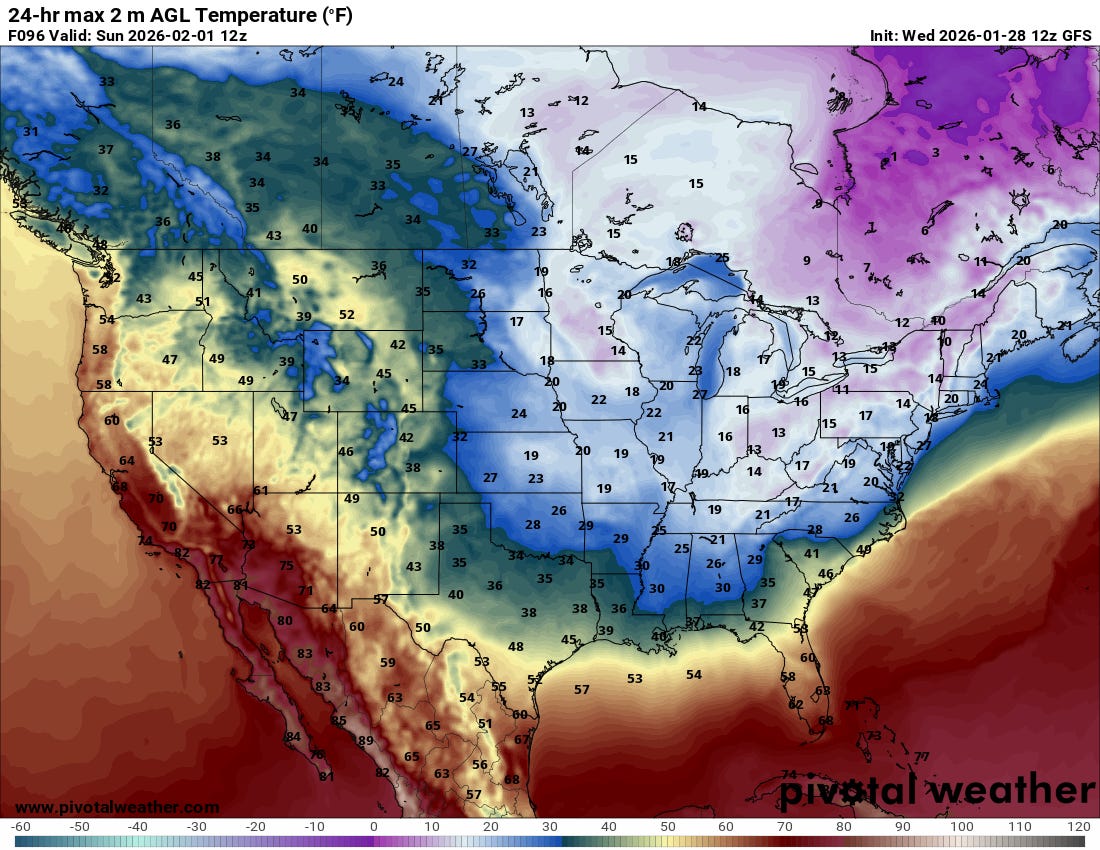
The colder temperatures the region is locked in are the result of the arctic air intrusions that have repeatedly worked their way south. Another big one is set for Saturday, which should drop temperatures down into the 10s and 20s for highs on the Southern Plains. Brrr!
However, these repeated frontal intrusions are very efficient at moving the moisture needed for big precipitation patterns south and away from the region — and there’s no Pacific plume in sight for a while, at least.
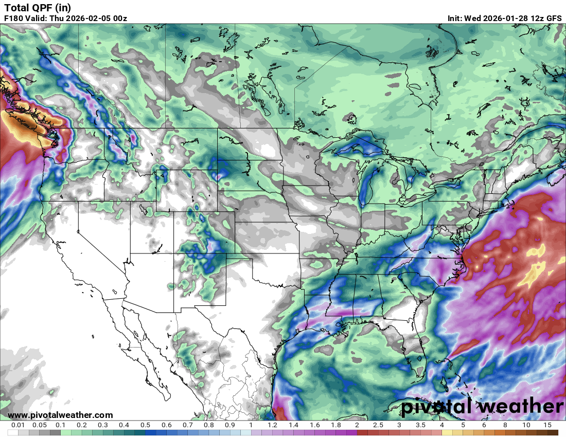
Looking at the pattern ahead, there is a chance of a system or two working their way through the region, especially early next week — but models have been trending east with them and drier with time. Of note was a system that slides down the Rockies midweek next week, bringing snow to Colorado and New Mexico. We’ll be watching for that possibility.
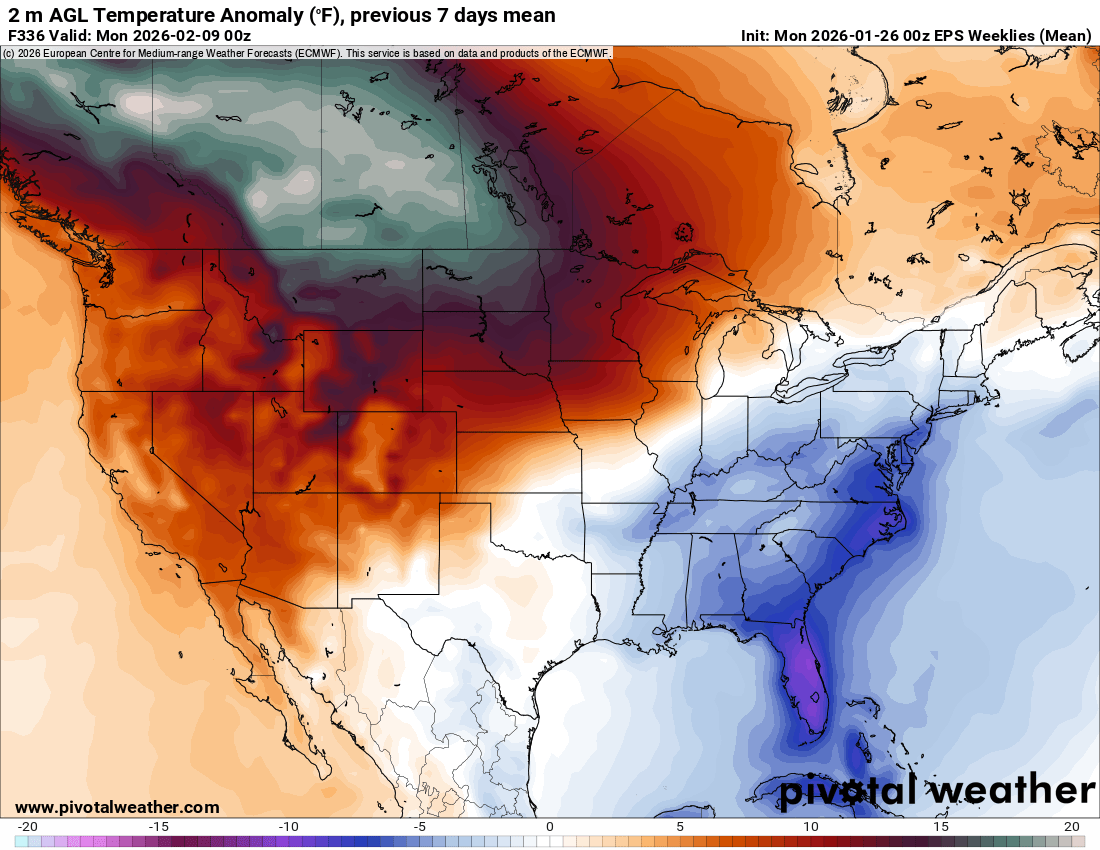
Over the extended period, we are seeing a significant warm-up by the first week of February in the Arctic air source region in almost all of our data, which eventually translates downstream into much warmer-than-normal conditions over the Plains in the wintertime. It seems somewhat possible that we’ll be talking about our first Spring-ish severe weather setups at some point in late February or early March if we can get the pattern to fully flip. But nothing before then looks all that interesting…
2. What Ingredients Lead to What Storms
Our newest YouTube channel video is here: we’re talking about which ingredient mixtures lead to which types of storms. This is a great baseline if you’ve ever heard multicells, single cells, or supercells and wondered what that was all about. Check out the video below:
3. Weather Model Basics
The second class of our severe weather masterclass series hit last weekend, with great participation from the live audience. You can find the class archived below.
Our third class, Advanced Forecasting, will take place in February, as will our fourth class, Satellite and Radar 101.
How can I view the class that I miss so I can be ready for the next class.