

Surging Severe Weather Risks This Week
Tuesday and Wednesday will probably be quite busy...

The fits and spurts part of the tornado season is upon us, and this is either a fit or a spurt — I’m not sure how the saying is technically supposed to work. A fit would be…but yet a spurt.
Oh, wait, where was I?
Oh yes, this week will be busy with tornadoes possible on both Tuesday and Wednesday. Another system is coming in on that one’s heels that will bring cooler/rainier weather to the Plains. Let’s dive in.
Tuesday
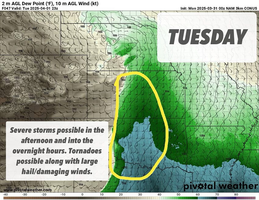
The first day for us to examine is tomorrow (Tuesday). Moisture will begin surging north later today, with a sharp dryline taking shape by the afternoon hours tomorrow.
A strong cap aloft will largely inhibit storms until later in the day, but increasing upper lift combined with strong mixing in the dryline zone will bring about an increasingly likely chance of storms developing towards the sunset hour.
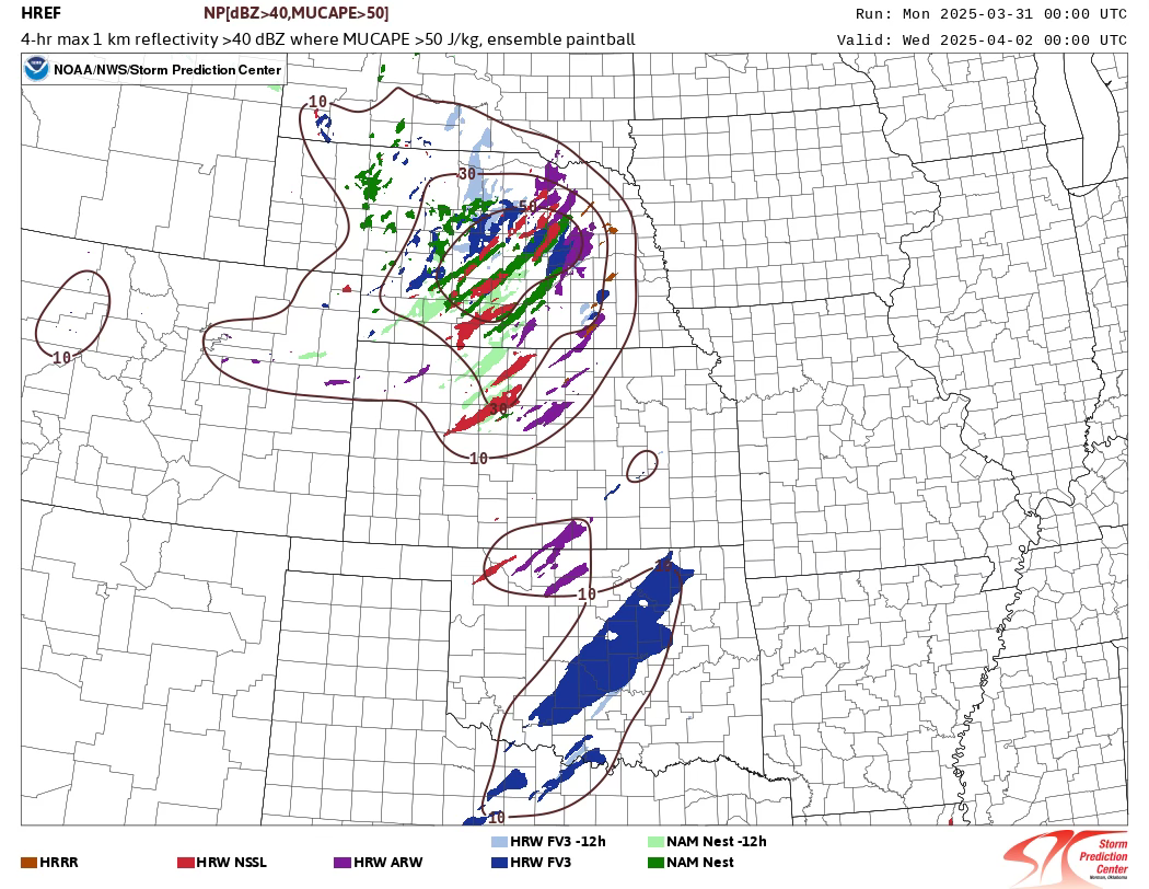
The HREF guides the way, with a look at storm initiation probabilities across the region showing potential from Nebraska to Texas. We will be keeping an eye on the possibility of storms initiating further south down the dryline into Southern Oklahoma, where better moisture return is noted on models.
Most models show 60°F+ dewpoints surging north of the Red River on Tuesday afternoon. This will help increase instability AND weaken the cap. All models but the NAM 3KM and HRRR develop storms on the dryline, and those two models will likely follow as their well-known biases about the dryline self-correct closer in to the event.
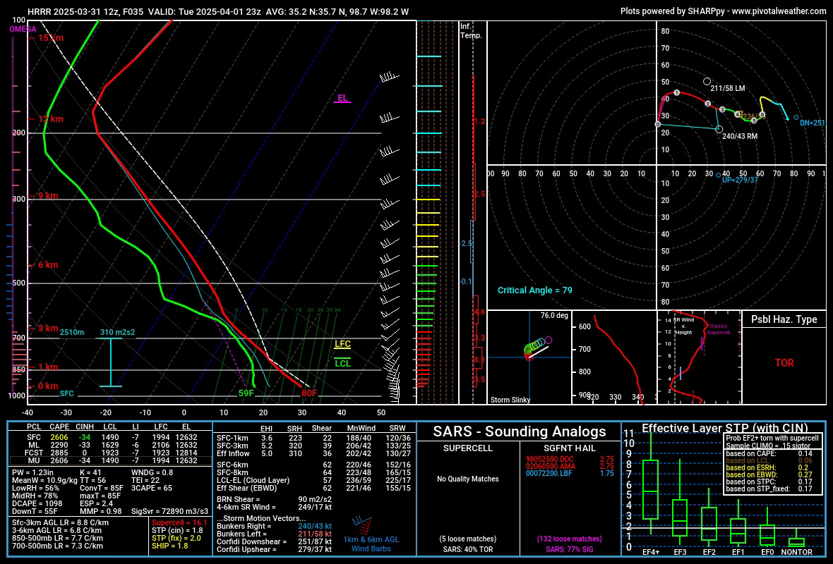
A forecast sounding on the HRRR shows a lack of inhibition by the near sunset hour coupled with very favorable shear profiles. The 0-1km helicity of 223, along with critical angles at/near 80°, all show the potential for rotating storms. Additionally, strong 3CAPE values and an overall MLCAPE of over 2000 j/kg give this event the feel of a later-in-season offering. The negative omegas aloft give me some pause about storm formation, but I haven’t seen that consistent signal across models.
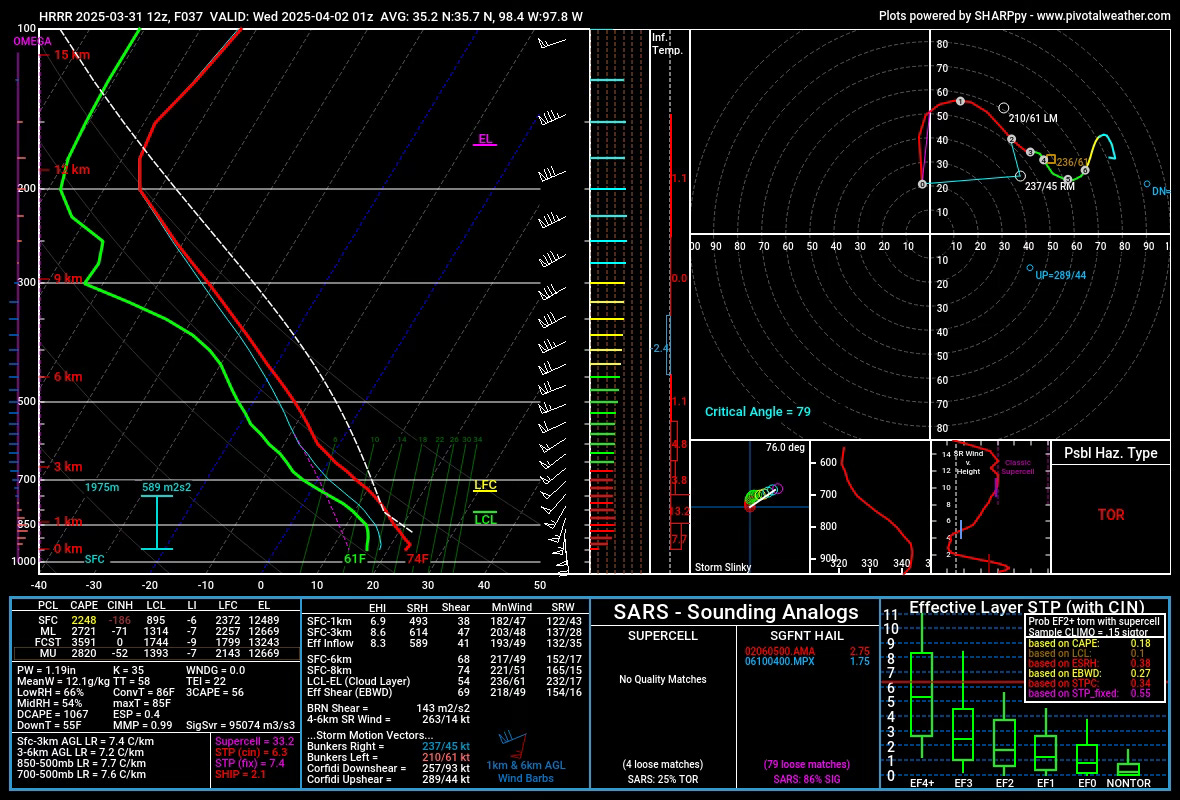
By sunset, the environment rapidly improves for supercell and low-level mesocyclone intensification. The 0-1km SRH nears 500 m2s2 (!!!) with 3CAPE values still above 50 j/kg. Inhibition does increase at this time, but an ongoing supercell would likely be able to maintain surface-based characteristics for a time, even in this environment. Any isolated, robust supercells would pose a tornado threat to be sure off of the dryline in Oklahoma and Kansas.
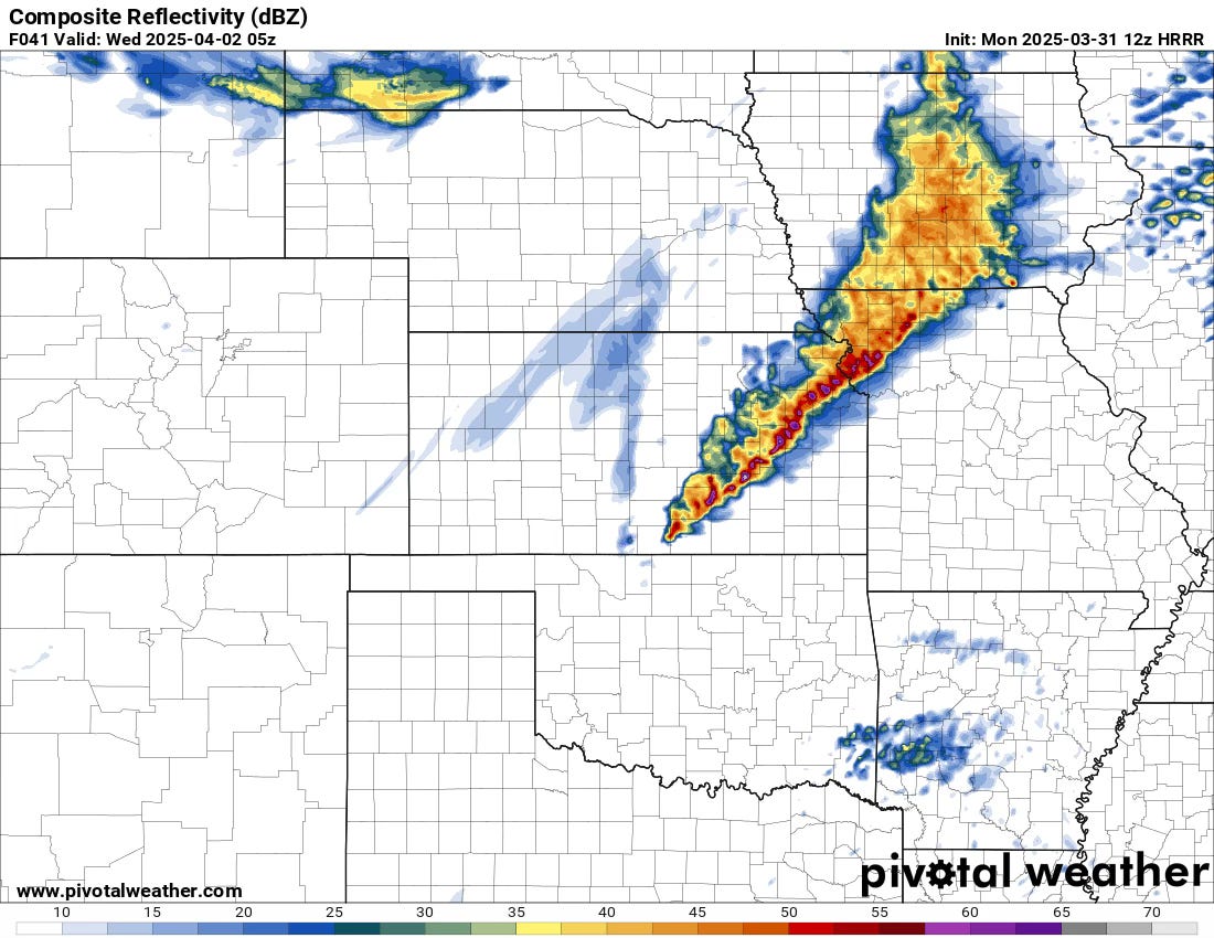
Overnight, a line will take shape along a surging cold front, with the line possibly extending down into Oklahoma. Damaging winds and tornadoes will be possible.
Wednesday
The main event of the week is Wednesday, with the only question in my mind at this point being the eventual storm mode. A high risk is a distinct possibility for this day, as the environment is on the higher end of the spectrum.
It’s a little bit more difficult to write about Wednesday because it will largely depend on how things go on Tuesday/Tuesday night. But some broad takeaways are obvious at this time…
First, there will be a lot of storms from the Midwest down into the Arklatex. Many of these storms will be supercells, with some line segments also part of the mixed-modes. The exact locations most favored for isolated supercells are not known at this time, but expect that question to clear up and higher risk categories to be assigned in the coming hours.
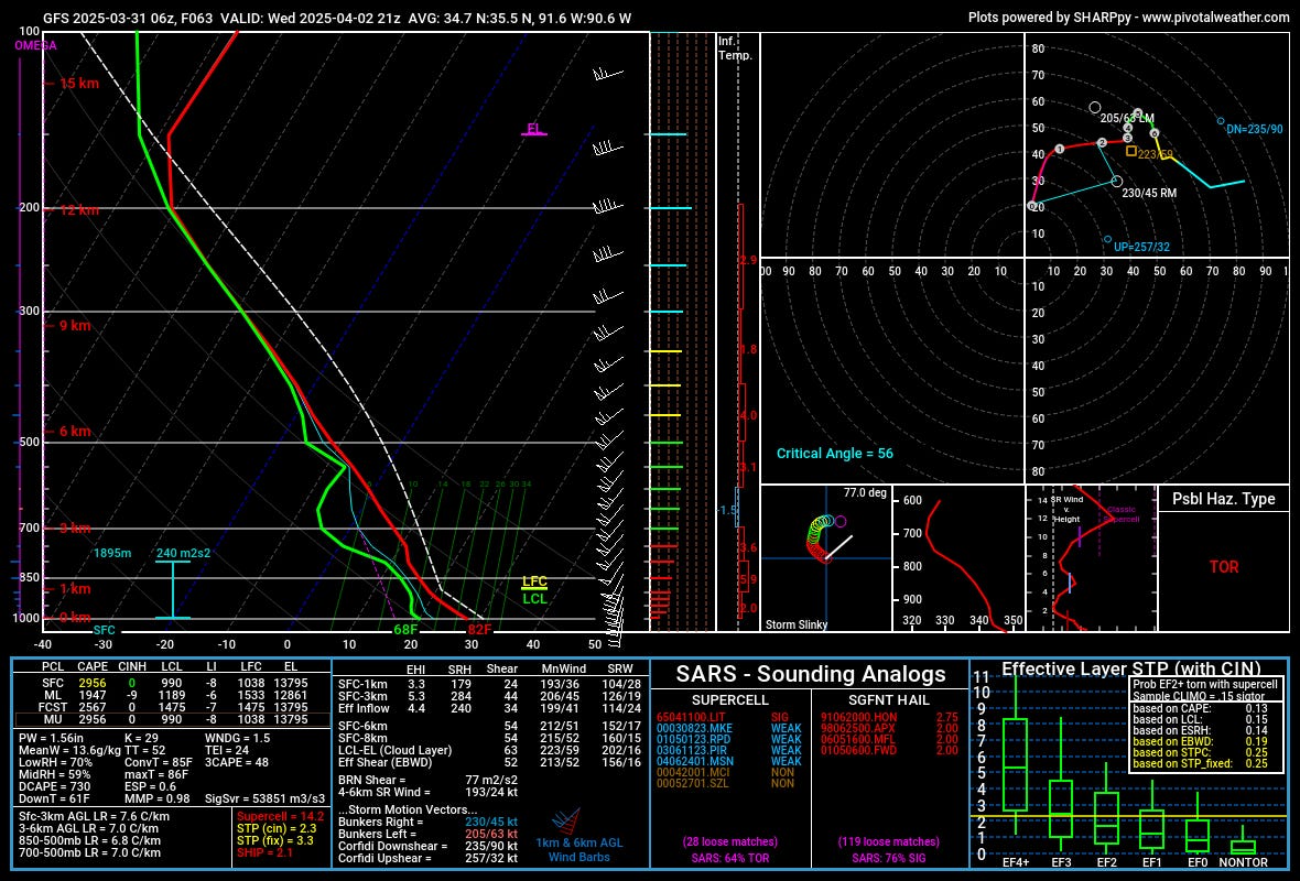
Second, the environment, even in the afternoon hours, will be favorable for tornadoes. Overall shear magnitudes of 50+ knots and 0-1km SRH nearing 200 m2/s2 in the mid-afternoon hours will favor tornadic supercells across the entire risk area.
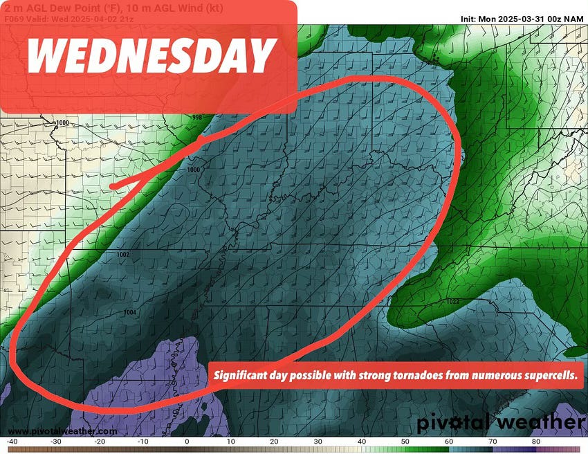
Third, the risk area is very broad, and will comprise of multiple modes/evolutions of severe weather over the entire period. This will include a morning risk, a separately developing afternoon risk in multiple locations, and an additional overnight risk that will be different. This is a classic big system/big risk day with a complex storm evolution throughout the day. Nothing we haven’t seen before, but something that often results in lots of tornadoes.
We’ll have a lot more on Wednesday on our socials, and you can bet we’ll be live streaming both days from the field as storms allow.
Looking Beyond Wednesday
There will be additional severe storms on Thursday and Friday, though locations and confidence will shrink substantially after Wednesday’s event.
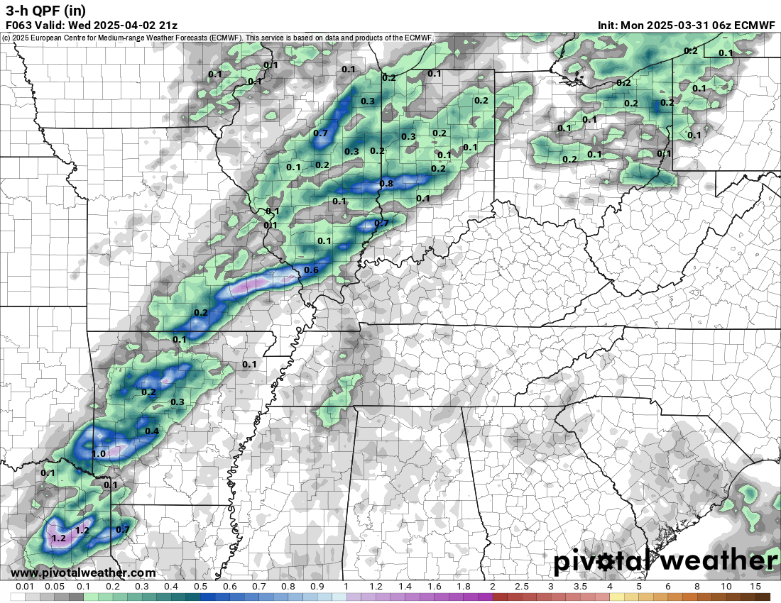
Models have the look of an almost trailing/fading risk of severe storms on Thursday and then a rainout/washout mostly on Friday into Saturday. In fact, the overall rain totals for this upcoming system will be very beneficial towards drought reduction in the heart of tornado season.
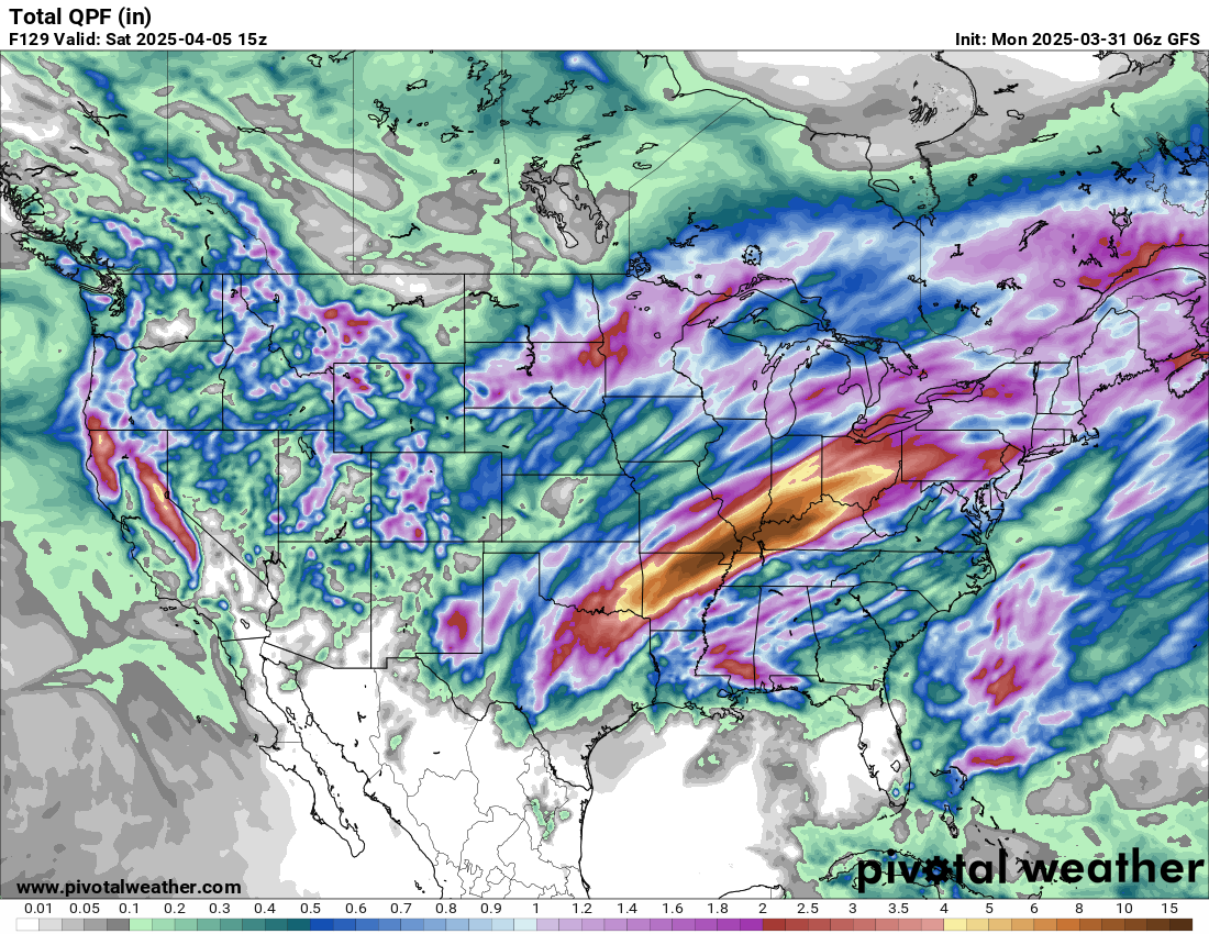
I continue to see 2”+ of rainfall across drought-stricken areas on models for the late week system. This will help take a bite out of the extreme EMLs we’ve seen already this year, which are caused by very dry/very hot conditions in the SE NM into northern Mexico region.
After this upcoming week, next week looks much tamer in comparison. This late week system will shove in driver/milder air for several days, giving us a reset pattern of sorts. This rest/lull may last into mid to even late April before a more active pattern resumes.
We’ll see you on our live streams later this week!