

Storm Summer Begins
June 1 marks the start of the meteorological summer season, and the storms will be on brand.

As the Spring season comes to a close today, we’re now looking ahead to the summer and what's to come.
You may know that June is also a big tornado month historically, and I suspect we’ll see a few notable events in the coming month, but the ridge that has been setting in earlier over the past decade will likely lift flow well to the north in short order.
This Next Week
We talked about this upcoming week in our prior newsletter, but let’s briefly touch base on it again to note the changes.
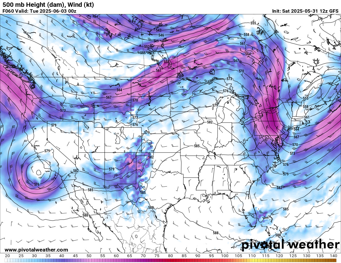
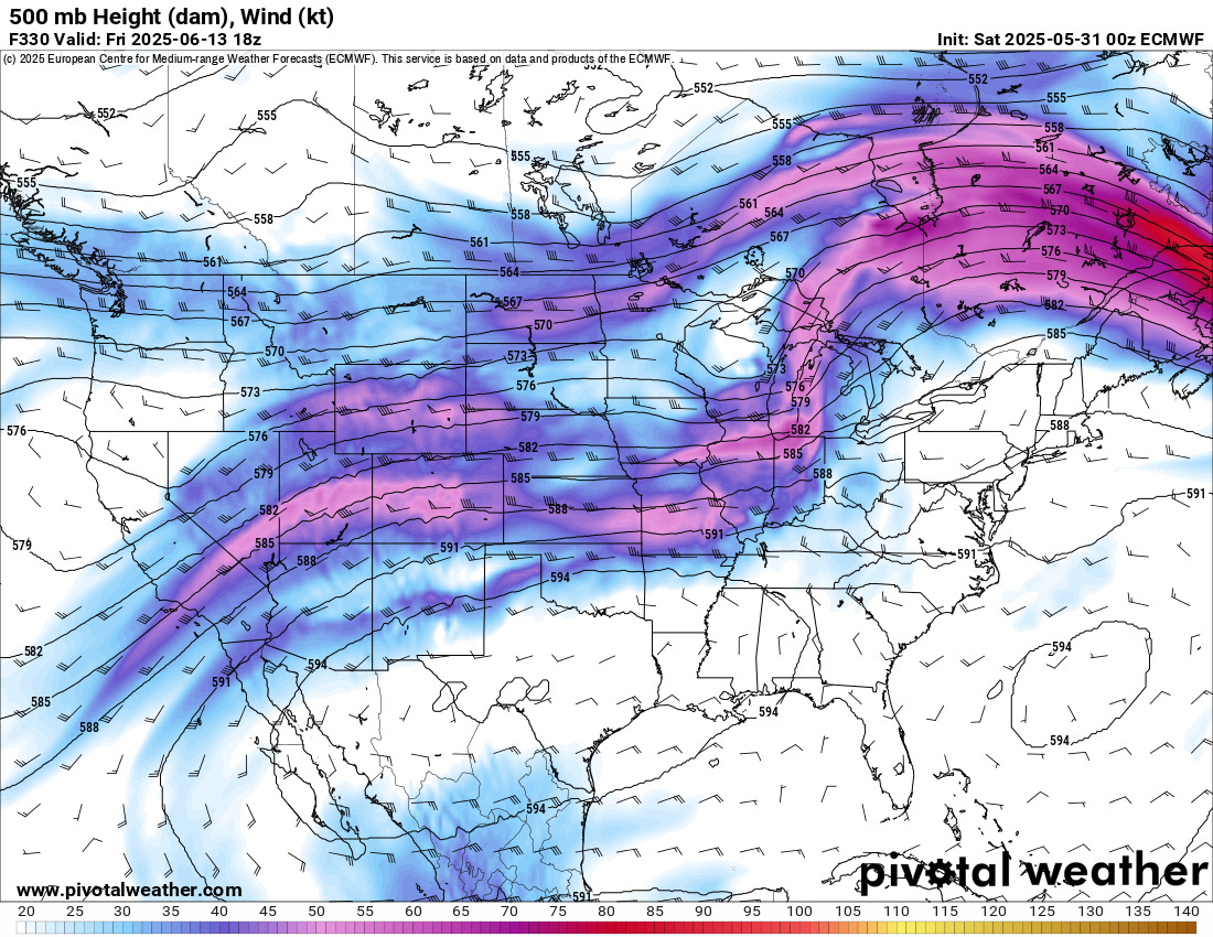
Notably, the GFS is less excited about the degree of flow atop the strong ridge (and its location). Overall, this year, models are showing a shockingly low skill level at range compared to prior years. So I am not confident in much beyond just a few days into the future.
Still, I suspect that, if one were a chasecationer or a storm chaser who chases a lot, the pattern will support continued opportunities into the middle of the month at least.
Back Half of June
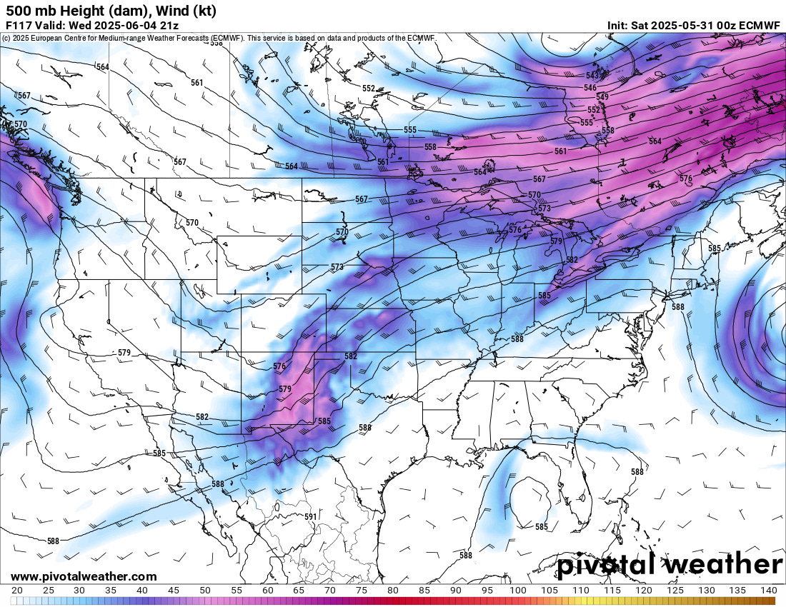
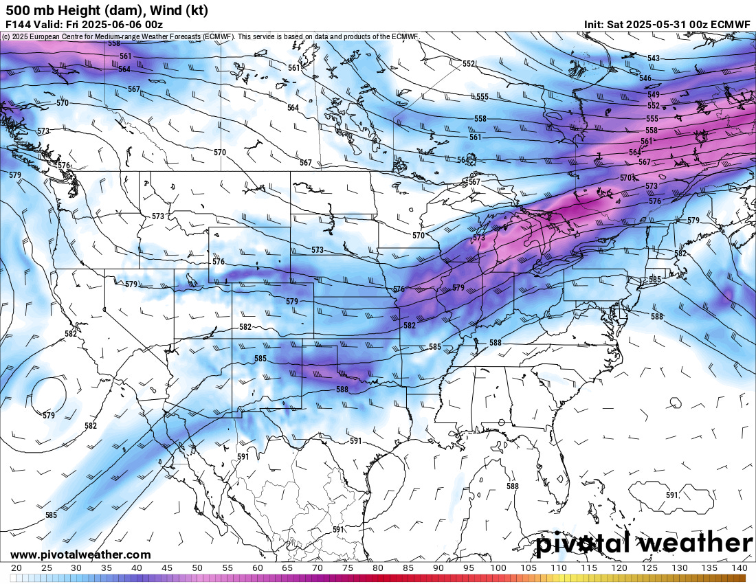
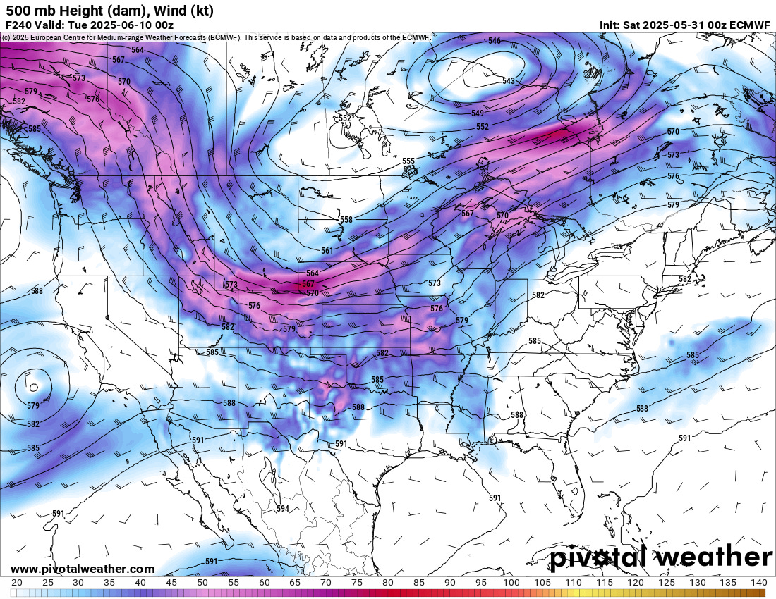
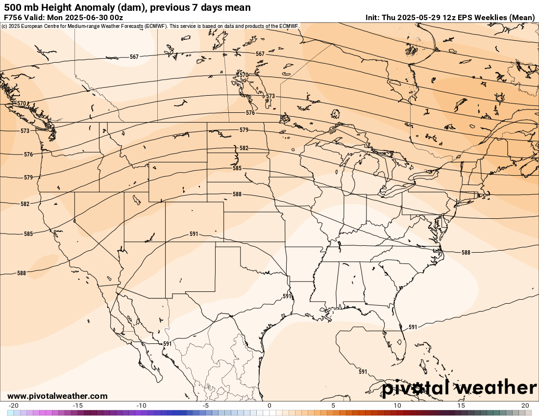
There is a fairly strong consensus among ensembles that the second half of June will continue to experience increased ridging and the northward shift of the jet stream. This is both expected and seasonal, so the confidence in this is somewhat higher, but I do stress my confidence in models overall this year is low. They’ve shown a remarkably poor level of skill over the past few months.
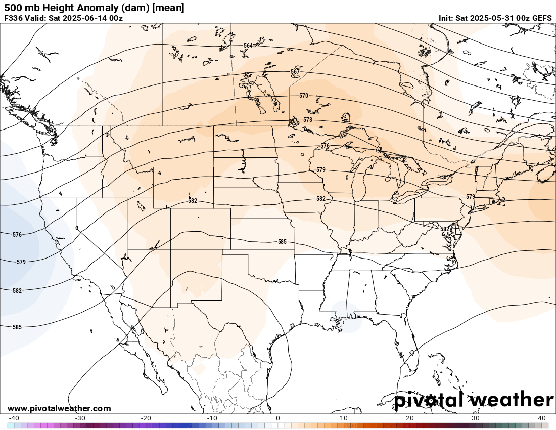
In fact, the Euro weeklies continue to amplify the pattern north throughout the month. This will mean summer vibes will stretch across a broad swath of the country.
Overall, I suspect that June will end up about average for tornadoes across the Plains. There is some definite upside potential given the active flow, and I’ll be watching for one or two final trips out myself to round out the season for me.
A Little Bit of the Monsoon
With summer comes the southwest monsoon. So to bring the vibes forth, be sure to watch one of our most recent videos on our trip to Arizona last year. Finishing out a several-day storm photography journey strong is something I've always struggled with. I often become more lazy with time on a trip, and I don't work as hard as I did at the start, especially if we've had a particularly successful experience. But these two days were just perfect in Northeast Arizona to finish up our High Desert monsoon documentation extravaganza.
See you all next time!