

Standard-Issue Severe Weather Threat OK/TX
Large hail, damaging winds, and a low tornado risk on tap.


1. Today’s Threat
April on the Southern Plains. Storms everywhere, nothing to fall in love with as a storm chaser most likely. That’s today.
From the Rio Grande up through Oklahoma and into the Midwest, storms will fire by 3-4 p.m. and crowd together early before a front pushes through and builds a stout line heading into tonight. This is the kind of day where the atmosphere checks every box on a technical level but the storm mode keeps things from getting too interesting.

Instability is moderate with CAPE values of 2000-2500 j/kg common at peak heating, and 0-6km bulk shear in the 30-40kt range. Just enough of both for robust severe storms. Shear is good enough that you could convince me a couple of storms might rotate early on. That early window is where the biggest hail lives and where a low tornado risk sneaks in.

While the severe weather environment is favorable, the tornado parameters aren’t really there. 3CAPE values are sitting below 100 j/kg and 0-1km SRH is generally well below 100 m2/s2 across the region. Those two values are the ones that make storm chasers lean forward in their chair if they are higher, and today they’re just not there. It’s April, though, and flukes happen. I’ve learned to never say never in this month.
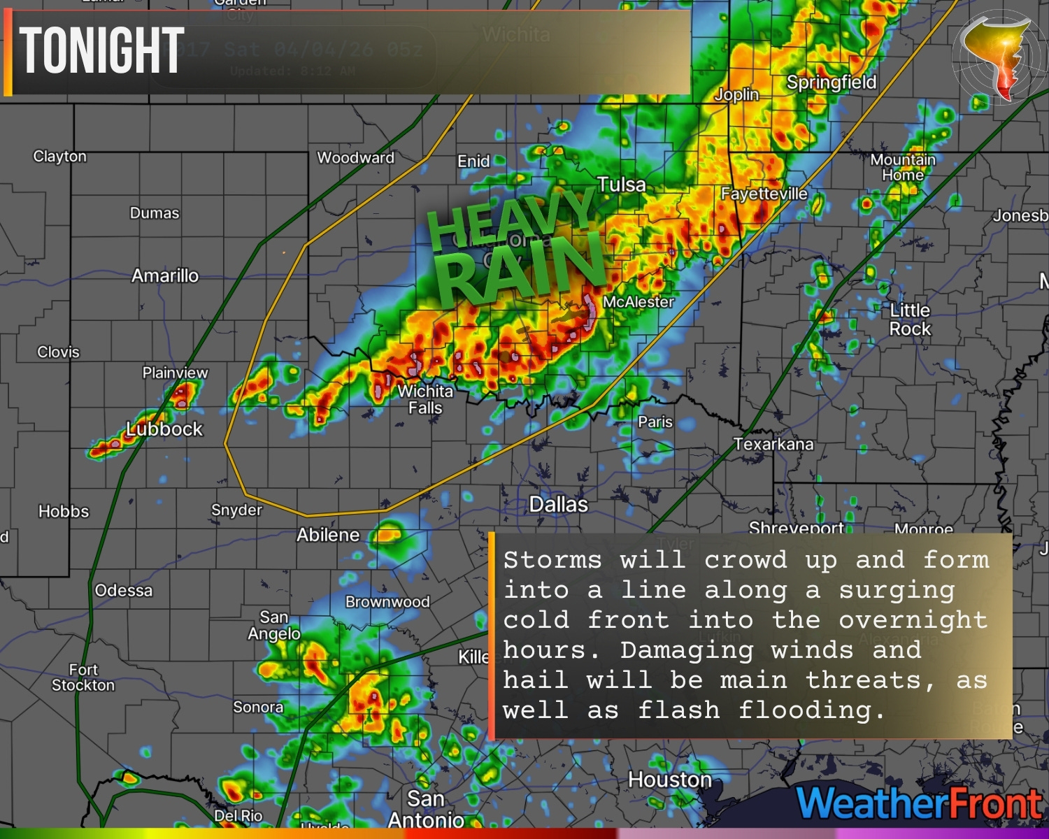
As the evening wears on, the threat shifts to damaging winds as the line takes over. That’s the main headline for most of you, especially overnight.
This is unlikely to be a day we can all recall from memory as a day of note this season, but it’s a day worth paying attention to if storms are heading your way. It could be a loud night at the very least.
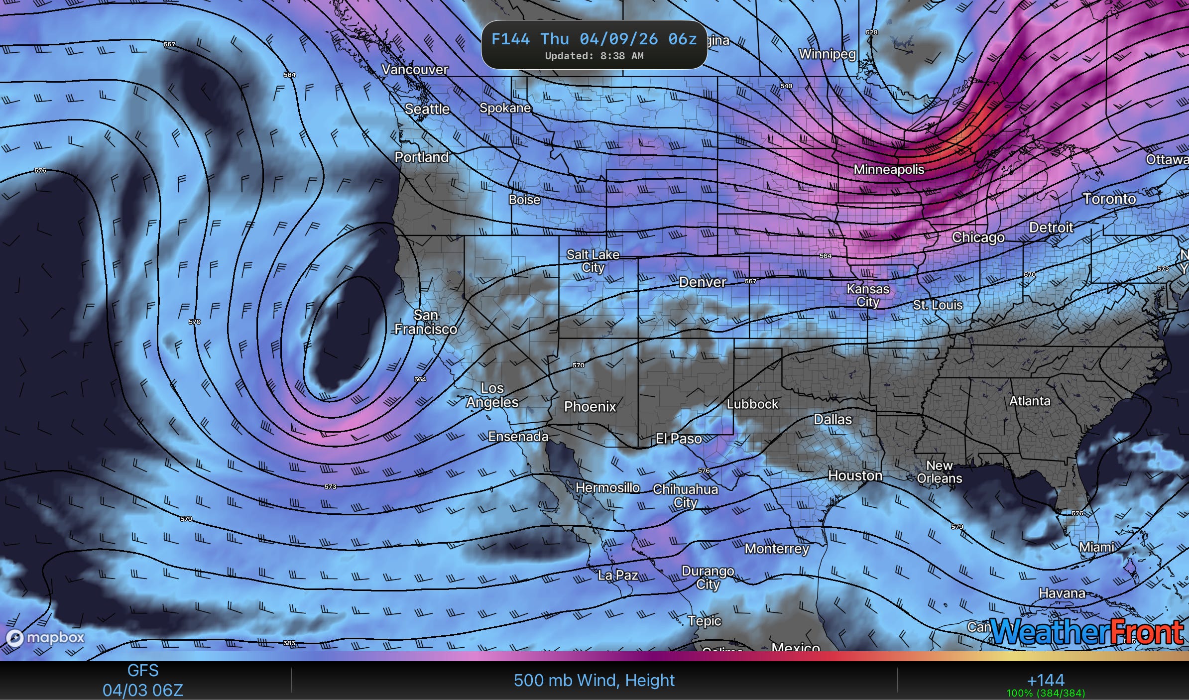
2. A Look Into The Extended
Most, if not all, of next week will be remarkably quiet across the SC Plains back into the Southwest as ridging in the west wins out again for a period of time. But, it is now Spring and things do not stay static for long this time of year.
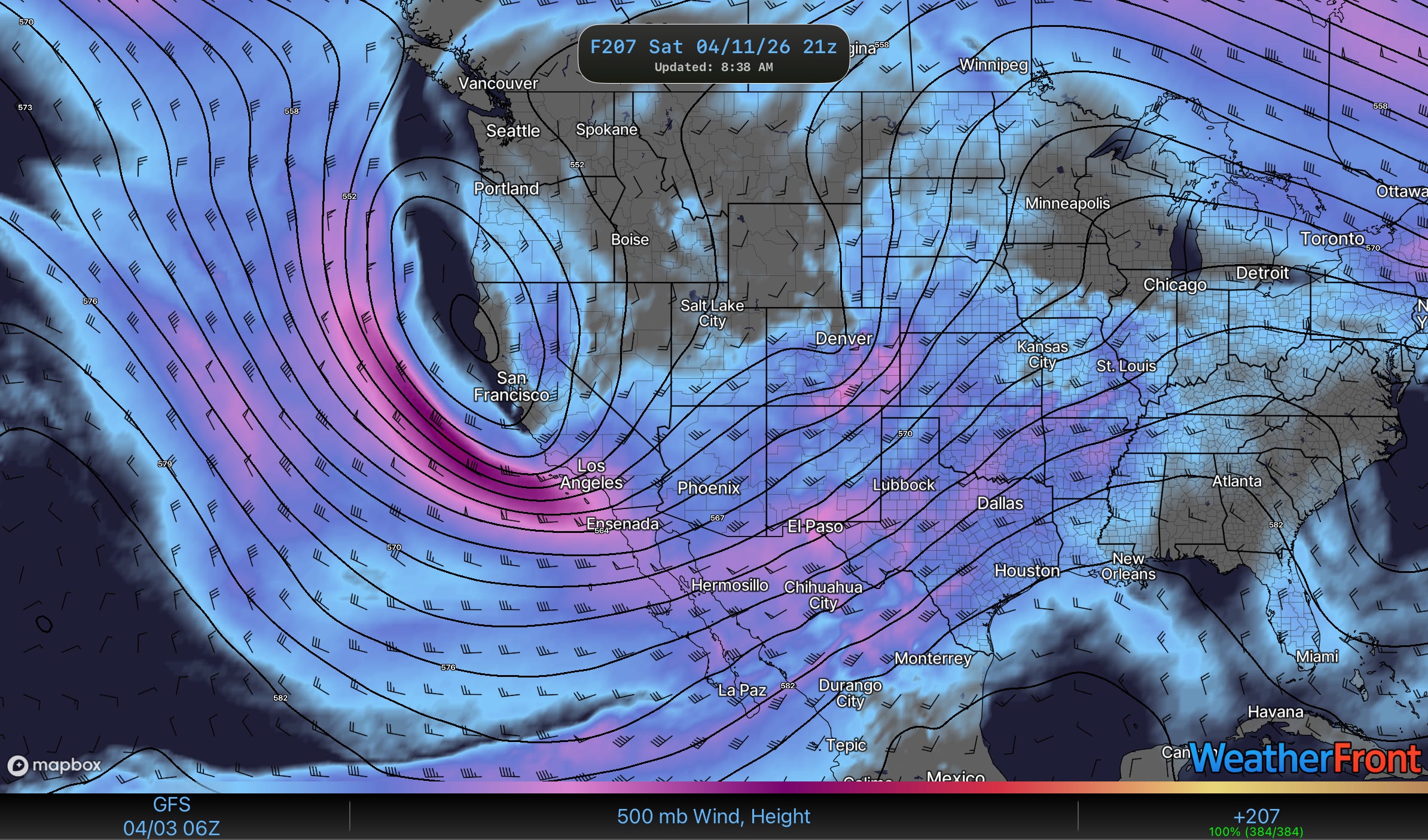
By the weekend, SW flow aloft will begin to take shape over the SC Plains with the subtropical jet and polar jet phasing over the middle of the country. I’ll just be honest, models aren’t quite sure what to make of this pattern on th severe weather side yet, and neither do I.
But given the time of year this is a stormy pattern at the very least. How stormy/how severe is the question we’ll probably need a few more days of model data for. As of last night the Euro was still pretty aggressive on rain but not on severe weather while the GFS really liked the idea of more severe storms.
Stay tuned!