Some Storms on the Dryline Today ⛈️
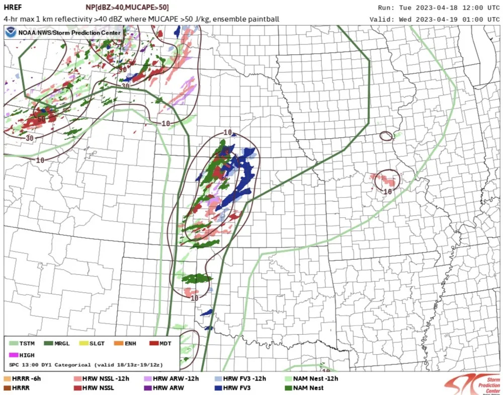
Some hail/damaging winds in West Kansas down to the Rio Grande possible.
A dryline will sharpen up a bit today as moisture screams northwards, setting the stage for a couple of storms to form along and ahead of it this afternoon. The best chance of storms firing is in Kansas, but a trailing risk extends all the way down to the Rio Grande in Texas.
A compact and weak upper wave will move east across the Central and Southern Plains today, which should probably be enough to get a few storms through a stout capping inversion observed on 12z soundings from across the region. The mid-level jet stream winds with this feature will be pretty modest, which means storms may take time and even struggle to organize.
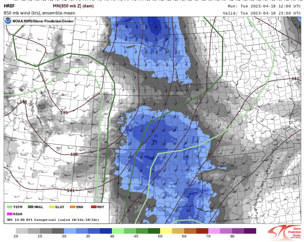
A respectable low-level jet will be in place today though, carrying richer moisture into the target zone throughout the day. If dews were a little higher, you could almost imagine this to be a fluky tornado day — but I don’t see anything close to that materializing.
Dewpoints will range from the mid-upper 40s into the mid 50s along and ahead of the dryline. The capping inversion is weaker to the north and stronger to the south. Also, the passing weak wave will be centered more on Kansas than Oklahoma/Texas. This likely means storms, if they happen further south, will be very isolated.
The overwhelming signal from CAMs this morning is to develop storms in Kansas if they form anywhere, with a couple of more bullish models (notably the NAM and NSSL) have storms a bit further south as well. It is notable that any storm attempts further south are very short-lived on CAMs, which is likely due to very strong capping just east of the dryline.
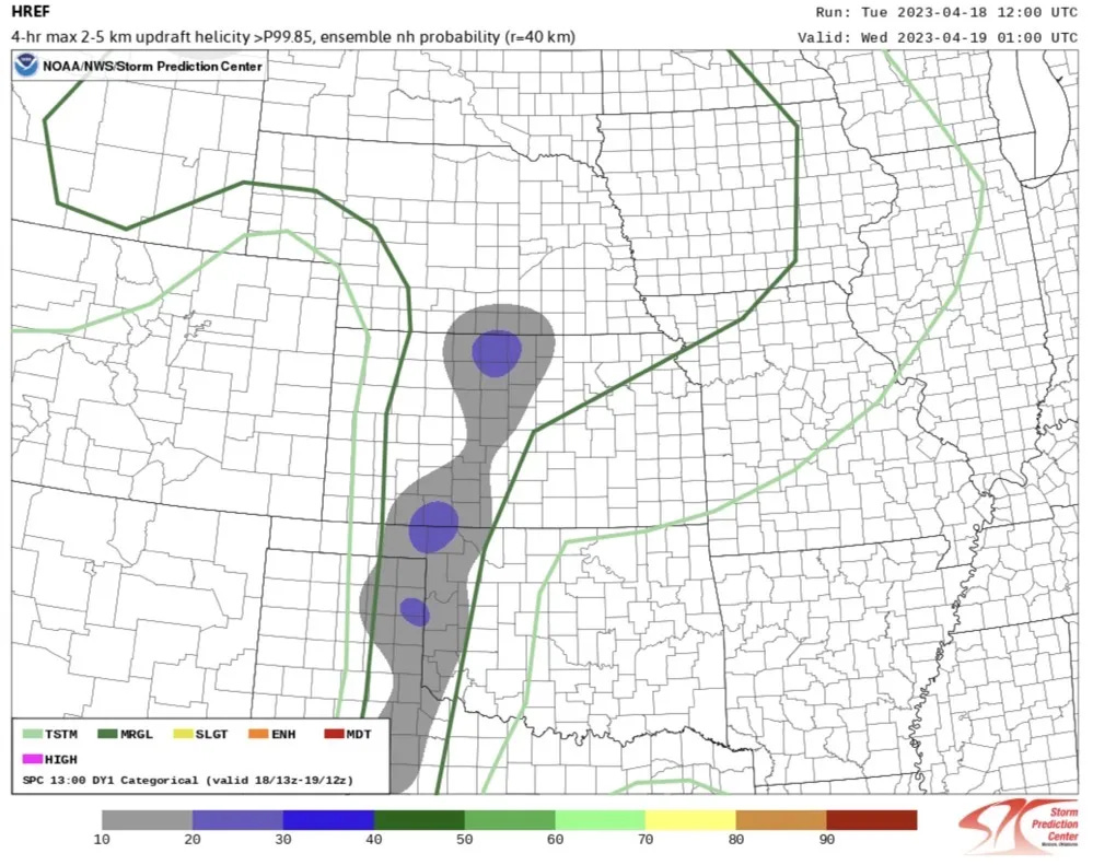
There is a very weak signal for a supercell or two today off of the dryline. I find it interesting that the odds of supercells are nearly 100% on the dryline if a storm can go given the modest flow — but a rogue, isolated storm would probably tend to rotate given the directional shear.
Models aren’t handling moisture fields very well generally today, so I’m choosing the NAM as the model I think that handles it as close to the HREF as possible. Today, there is just enough shear for supercells (35-40kts of 0-6km bulk shear), and there’s lenty of instability and length on the hodographs for some big hail with any sustained storms. The things I think that make storms more difficult are the very dry low-levels, and the fact there is still -50 MLCINH or so on soundings along the dryline despite temperatures reaching the mid-80s.
The moisture is more deeply mixed within the dryline circulation, but it becomes shallow just east. The most likely scenario would be a few robust towers taking shape, one or two actually becoming storms, and then they’d quickly die east of the dryline (at least from SW Kansas through Oklahoma/Texas).
The Bottom Line
I don’t think today is a major league today by any stretch of the imagination. In a typical storm season, days like today are very skippable for even the most aggressive storm chasers because they’re usually pretty uneventful and relatively common this time of year.
Any storm that goes up will pose a large hail threat (maybe up to ping-pong balls or even golfballs) — but their threat should be relatively short lived. The high values of DCAPE (1500+) suggest storms will be very outflow dominant and if a few go up in the same spot, they’ll likely coalesce their cold pools. I think this means, with the strong capping in mind, that any isolated storms are pretty short-lived and if anything lasts awhile, it’ll be part of a cluster that is somewhat linear.


