

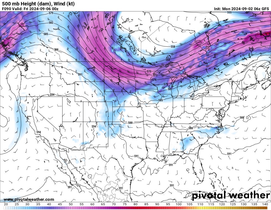
Some Flow Slides South This Week
We could see a small chance of severe storms on the C/S Plains.

A ‘cold front’ will slide south this week, riding cyclonic flow around a prominent ridge in the Western U.S. These two factors should increase shear and lift, leading to a chance of some severe storms as soon as Wednesday/Thursday this week.

Ridge Reasserts Itself
This slight break in the action will not last long, as the Western U.S. ridge will reassert itself further east, shutting off the upper flow and increasing subsidence across the Plains into this weekend. This will also, not surprisingly, bring temps up a few degrees.

Long Term
There remains a consistent signal of a large-scale pattern change by the last 1/2 of the month, with the ridge tending to flatten out on ensembles and climo models as we head into October. This is pretty seasonal and, thus, not unexpected. It also tends to bias me because it looks like it should be for this time of year.

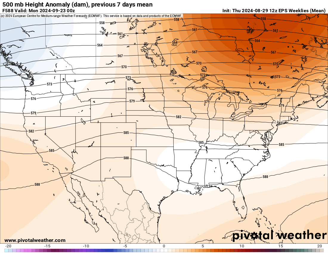
Overall, the Western U.S. ridge that has dominated our weather for the last few months should weaken into the fall. This will provide an opportunity for a more favorable pattern for severe thunderstorms and our prototypical fall season. But, as with most fall severe weather seasons, it will likely be short-lived and pretty fast. When the seasons change, they really tend to change this time of year.
SUPPORT US!
We are exploring a paid subscription model here on Substack. Additionally, there is already one way to support our educational mission, and that is on YouTube! Become a Titan Supporters Club member for $2.99/mo, get exclusive early access to all videos (and some exclusive ones), and help further our cause of making weather accessible for everyone!