

🚨🚨Significant Tornado Outbreak Expected🚨🚨
We don't use those words often, here's what to expect...

Just like we mentioned yesterday, if we ever say the words in the headline above know we don’t do that often. I know some groups out there say these words a lot, but this is a case when it really is true. Today is going to be a long day.
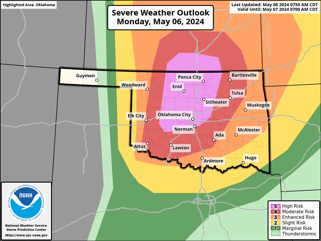
An intense regional outbreak of severe weather is expected today, from this afternoon through evening, across parts of the south-central Plains. The most severe activity, characterized by multiple strong, long-tracked tornadoes, very large hail, and severe thunderstorm gusts, is anticipated over western, central, and northern Oklahoma to south-central Kansas.
Locations:
High Risk Area: Western, central, and northern Oklahoma to south-central Kansas.
Broader Risk Areas: Surrounding areas could also experience severe weather conditions but at a slightly lower intensity.
Threats:
Tornadoes: Multiple strong, long-tracked tornadoes are highly likely.
Hail: Very large to giant hail, potentially over 3 inches in diameter.
Wind: Severe thunderstorm gusts capable of significant damage.
Timing:
Initial Storm Development: Expected by mid to late afternoon along and ahead of the dryline, near the eastern Texas Panhandle/western Oklahoma line extending into southern Kansas. More storms could form over the open warm sector to the east, posing similar threats as those to the west.
Peak Activity: Late afternoon through late evening as conditions become increasingly favorable for severe weather.
Discussion
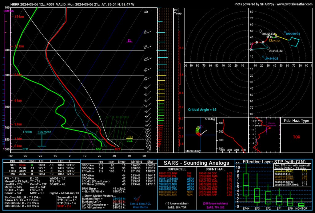
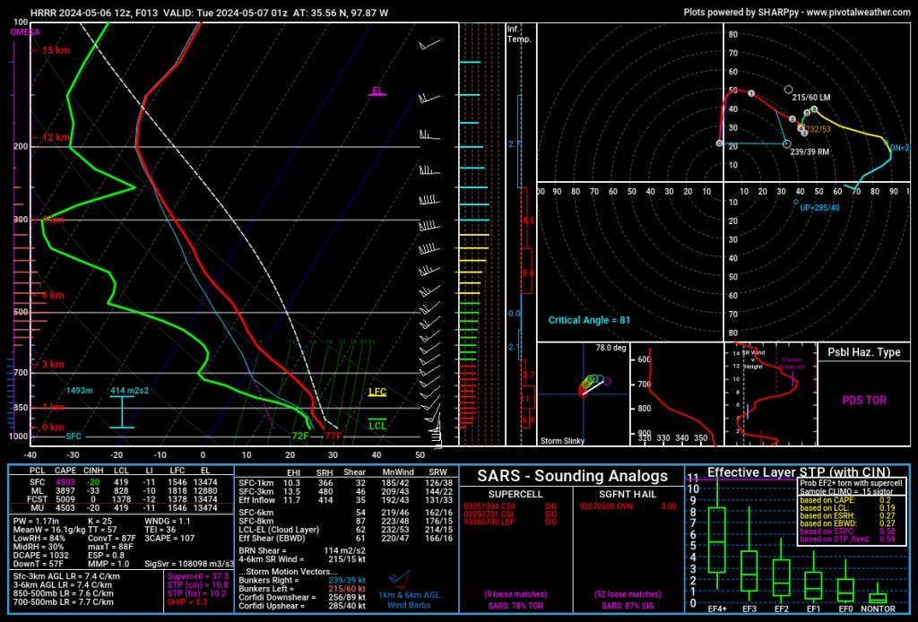
Weather Patterns: A strong synoptic-scale trough is moving from the northern Rockies through the central U.S., accompanied by a basal shortwave trough that will influence severe weather development as it swings northeastward. This system will become negatively tilted, enhancing its severe weather potential.
Atmospheric Dynamics:
Surface Features: A surface low analyzed over eastern Wyoming, with a cold front extending across eastern Colorado into north-central New Mexico, will progress eastward. This front will interact with a dryline that will advance to southwestern Kansas, eastern Oklahoma, and Texas Panhandles by late afternoon.
Severe Potential: The approach of the shortwave trough will enhance lifting mechanisms across the risk area. Combined with high instability and significant moisture (dewpoints in the upper 60s to low 70s Fahrenheit), the environment will be highly conducive to the development of supercells capable of producing all forms of severe weather.
Impact: Today’s severe weather setup indicates a critical risk level for parts of Oklahoma and south-central Kansas, where communities should prepare for potentially life-threatening conditions. The forecast suggests an unusually favorable environment for the development of strong, long-tracked tornadoes and resembles past major tornado outbreaks in the region. This is a day to cancel plans and prepare to take quick action.
Technical Discussion


Thank you. I have been in contact with my family in Kansas and Oklahoma today.