

🚨 Significant Threat of Tornadoes Today 🌪️
The South is looking at a potentially very hazardous day and night.

Storms, including supercells, will form this afternoon into the overnight hours with a significant threat of tornadoes, especially in the sunset hour and a couple of hours beyond. There are a few questions on storm mode and where storms will be able to keep and maintain clean inflow -- but the environment largely supports tornado formation with any storms that can remain isolated.
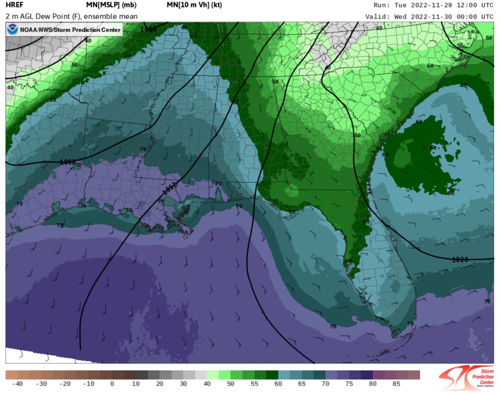
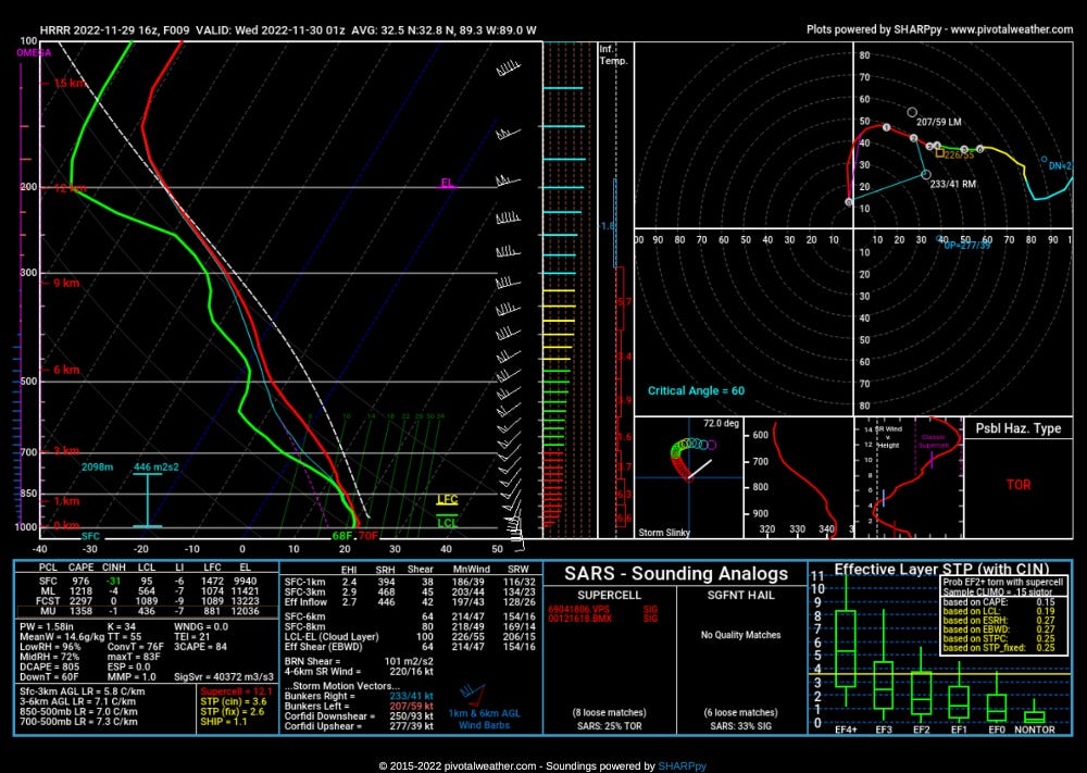
Prime ingredients for severe storms and tornadoes: Mid to upper 60 dewpoints are in place this morning ahead of an approaching upper storm system, which will set the stage for an instability/wind shear parameter space favorable for tornado formation.
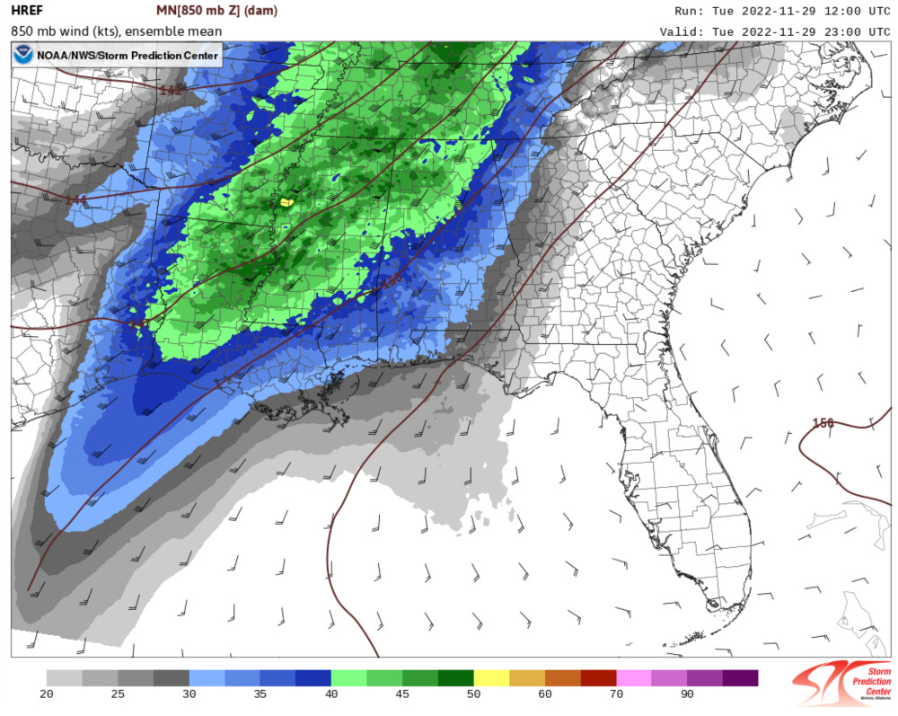
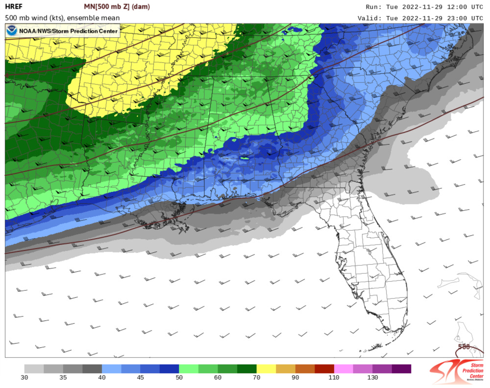
Forecast soundings show 1000-1500 j/kg MLCAPE along with strong 0-6km wind shear of over 60 knots. This is a classic cool season low cape/high wind shear event.
Because of the strength of the wind shear, storms will move quickly at 40-50 mph.
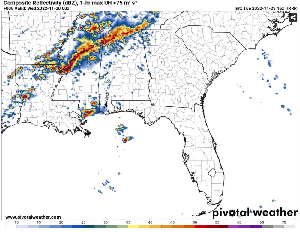
Storm Mode is Everything: We say this for many events, especially in the South -- but storm mode is everything today. Any storms that can remain isolated with clean inflow into an updraft with little to no rain falling through it will likely pose the threat of a strong tornado.
Storms will likely increase in number and intensity throughout the day, with the tornado threat beginning as early as this afternoon.
The environment will only become more favorable throughout the afternoon into the evening, with the potential peaking from late afternoon into the early nighttime hours.
The key to whether there are a lot of tornadoes, including strong and long tracked tornadoes, will come down to how long storms remain isolated. If storms are able to keep their supercell characteristics, the environment is highly supportive of tornadoes.
If storms do line out/congeal their cold pools (outflows) instead -- there will still be a tornado threat on the front edge of the line, but it will be less significant overall.
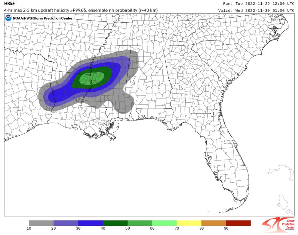
Tornado Threat Timing: Tornadoes will be possible with even the initial storms early this afternoon, but the most favorable time will likely be 23z-03z (or roughly 5-9 p.m. CT) across this region.
Spread the word: It is proven that awareness is something we all must do to ensure as many people as possible are prepared ahead of incoming severe weather threats. In this case, today's threat is well advertised, but it is important to continually ensure people see news of the potential.
You can share this post on Facebook -- but also feel free to share the SPC Day 1 Outlook as well.