

Severe Weather This Week
Storm season kicks into gear...

1. Today’s Risk
Listen, a marginal risk of severe storms is still a severe risk. But I can’t help it. Look at these little storms. So full of potential and energy and vigor and…
Ok, I’m not sure where I was going with that either.
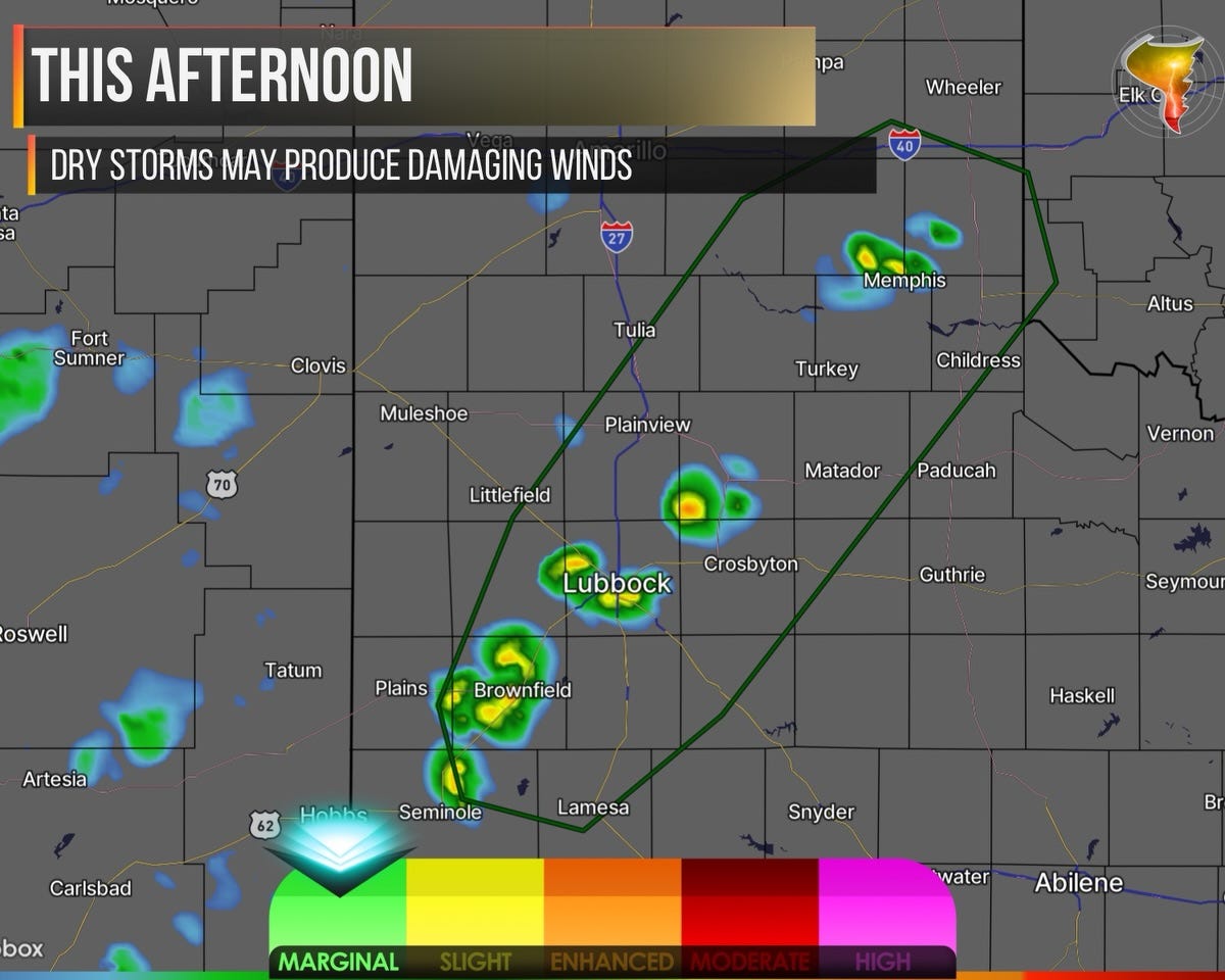
Here’s what’s actually happening: damaging winds are possible today from dry thunderstorms. These storms form very high up in the atmosphere, and most of the rain evaporates before it ever hits the ground. That can produce dry microbursts, basically a sudden punch of wind hitting the surface with nothing to show for it rain wise.
It’s a genuinely cool atmospheric trick. Right up until you’re standing outside in 60mph gusts, watching your neighbor’s trampoline achieve flight as dust fills the scene.
This threat peaks late afternoon and fades at sunset. More classic setups are coming in the next few weeks. Consider this one the opening act.
2. Rest of the Week
I’m genuinely tempted to chase both Wednesday and Friday this week, though there’s a voice in the back of my head saying “don’t burn yourself out before June.” We’ll see who wins that argument.
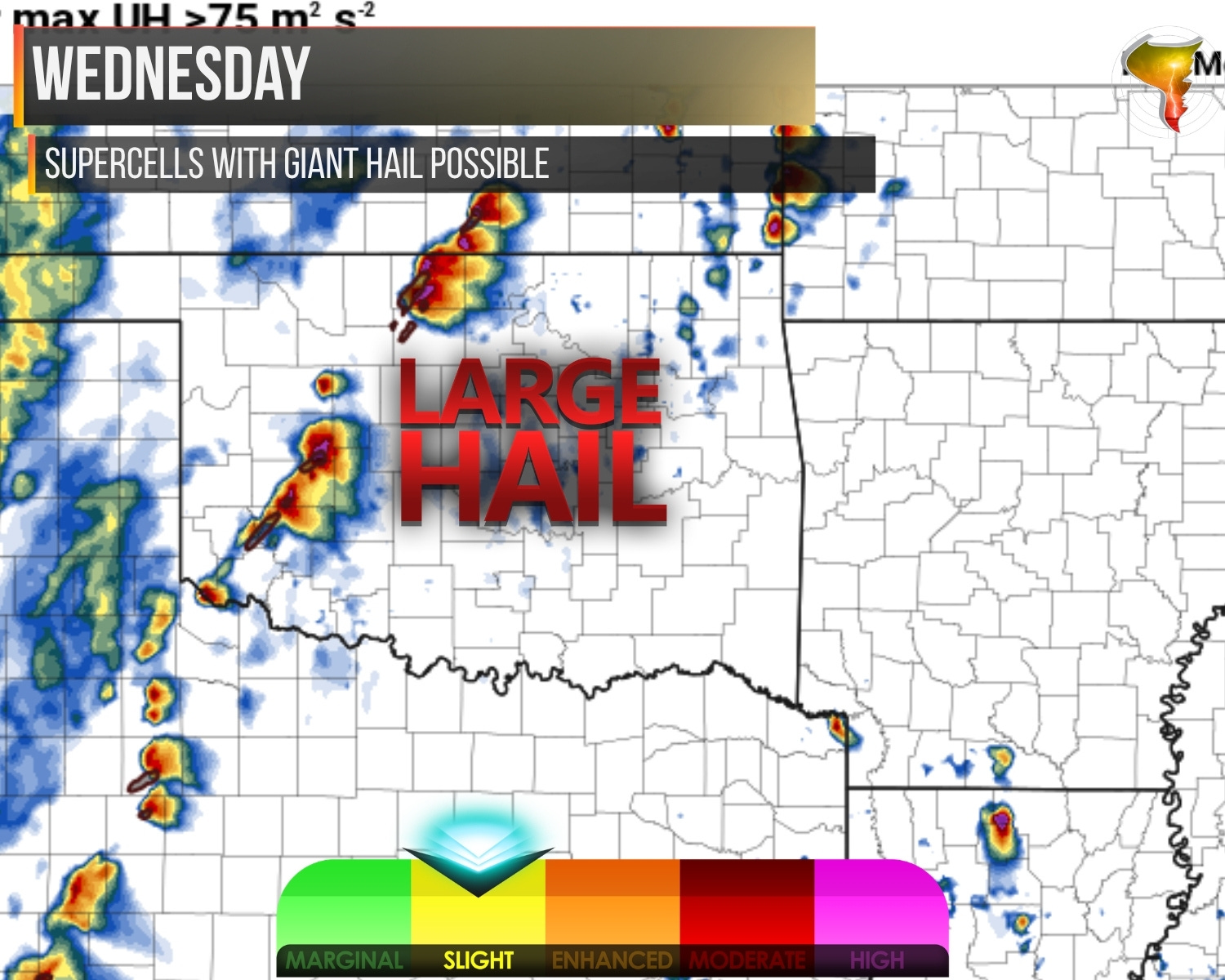
Wednesday is the day that has my attention. A dryline sets up across the western parts of the region as an upper storm system moves overhead, and that should weaken the cap enough for several storms to fire in a supercell-friendly environment. The ingredients for big hail are all there: solid lapse rates, plenty of instability in the hail growth zone. Wednesday afternoon could be a classic early spring hail festival. Later in the evening, storms will line out along a surging cold front with damaging winds, and there’s at least a low tornado threat as low-level shear cranks up. I’m not convinced this is a big tornado day, but that early supercell window before things go linear? That’s the part I want to be out for.
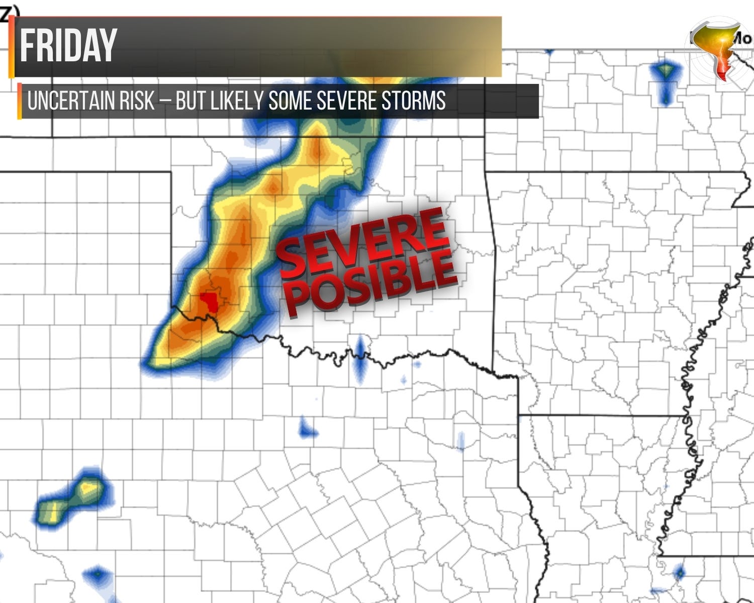
Friday is the next candidate, but I’m less confident. Wednesday’s cold front will push through and could leave us short on moisture, plus capping could be an issue. The upper system tracks further north, which limits the overall lift. Storms should still manage to form in a supercell-favorable environment, possibly high-based. Another cold front surge in the evening is likely to organize things into a line again, but the low-level shear is weaker, so the tornado threat drops another notch.
In between, Tuesday and Thursday both carry lower-end severe risks with damaging winds and hail possible. Not chase days for me, but worth watching if you’re in the path.