

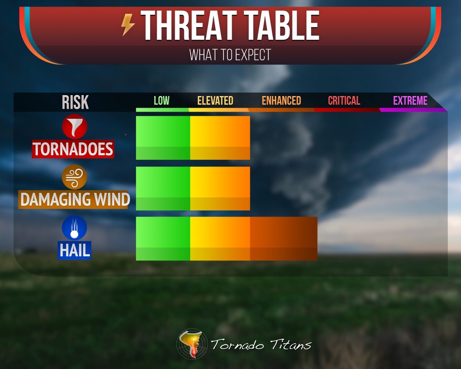
Severe Weather Risks Rising Thu/Fri
Tornado risk also apparent!

The first real severe weather setup of the season on the Southern Plains is here, and I’d be lying if I said I wasn’t staring at model data way too much this week.
Thursday and Friday both carry our first legitimate supercell tornado threats of the year. I’m really only considering chasing Thursday at this point, but even that’s a coin flip for me. The late storm initiation, the long drive, and the very real chance that things aren’t photogenic near the warm front all have me hesitant.
Friday is even more uncertain with storm formation, making it hard to commit to gas money. But after months of watching the Gulf get swept clean and the pattern go dead, just having two days worth REALLY talking about feels like spring finally remembered where it left its keys.
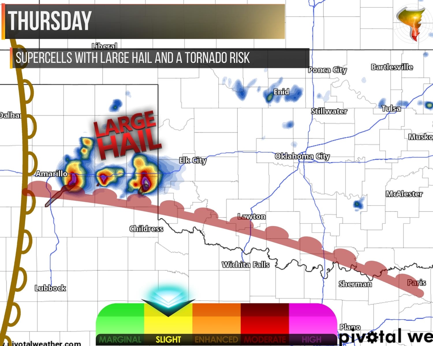
Thursday
Storms likely fire late, maybe not until 5 or 6 p.m., popping just east of the dryline and maturing fast. Large hail tops the threat list, but a tornado risk exists as well, especially early in the event. Low-level shear is solid.
The complication is a slowly advancing warm front with stubborn near-surface stability on its north side that could put a ceiling on what the shear profiles are otherwise screaming about.
Imperfect, but it’s the first real opportunity of the year for a lot of chasers.
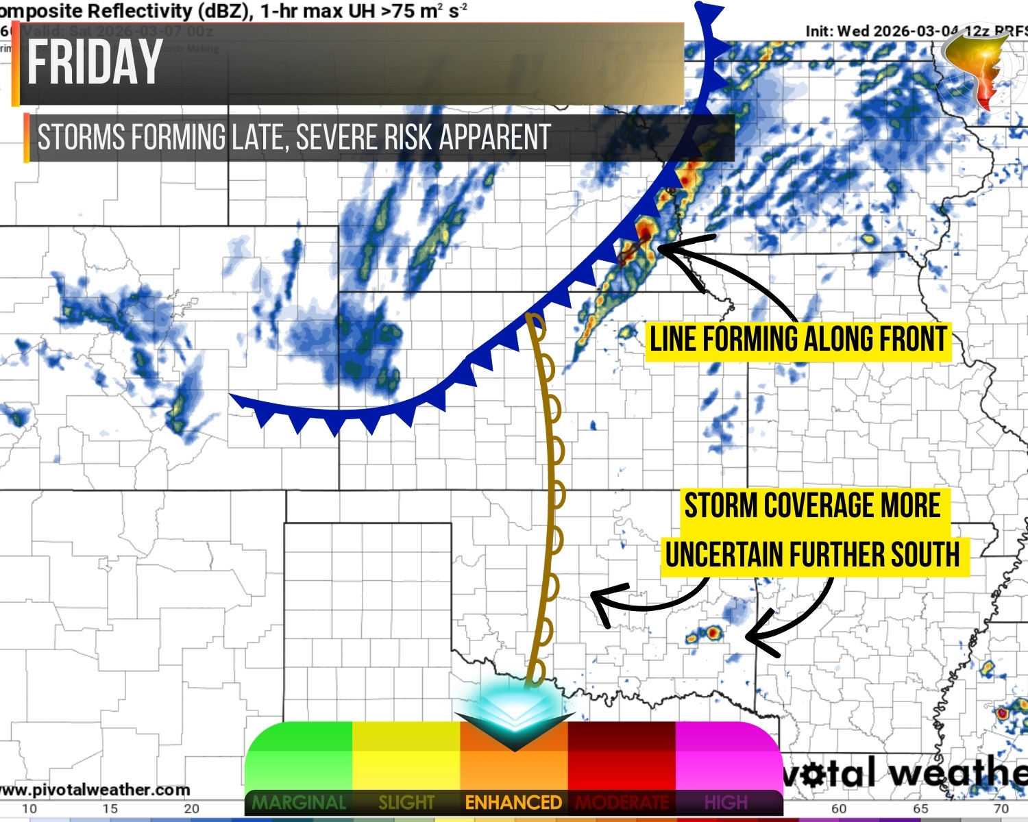
Friday
The wilder card. Main energy passes north and west of the warm sector, leaving the question of where storms actually form feeling wide open.
Rising heights, a dryline without much punch, and I’m not loving what I see for afternoon initiation further south. If storms can get going, the tornado and large hail threat will be real, but “if” is doing a lot of heavy lifting in that sentence.
Overnight brings a surging cold front with more of a damaging wind story as storms take shape along it.
Stay tuned to our FB/IG stories for updates as these days sharpen up. This week is going to be interesting to watch come together.
9670 Halsey St, Lenexa, KS 66215