

🌪️❗️Severe Weather on the Southern Plains
The risk for severe storms will rise into tonight and will last throughout the day tomorrow.

It is going to be a busy 48 hours or so with severe storms forming overnight and moving east and south through the Southern Plains. Ample wind shear combined with low instability will create an environment favorable for rotating storms, with tornadoes possible.
Today
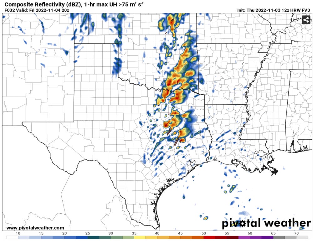
Storms should hold off on forming much of the day. By tonight, a powerful upper storm system will eject over the region, causing numerous storms to form along a crashing cold front
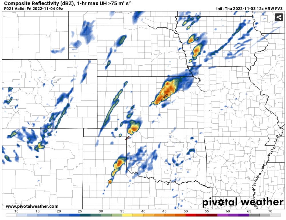
Overnight severe threats: The main threat with storms overnight will be hail and damaging winds, but there will be a very low chance of a tornado or two, especially as storms form into a line with QLCS tendencies.
Tomorrow
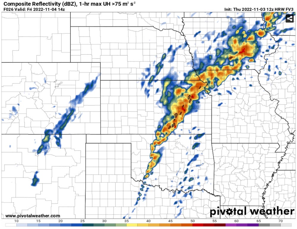
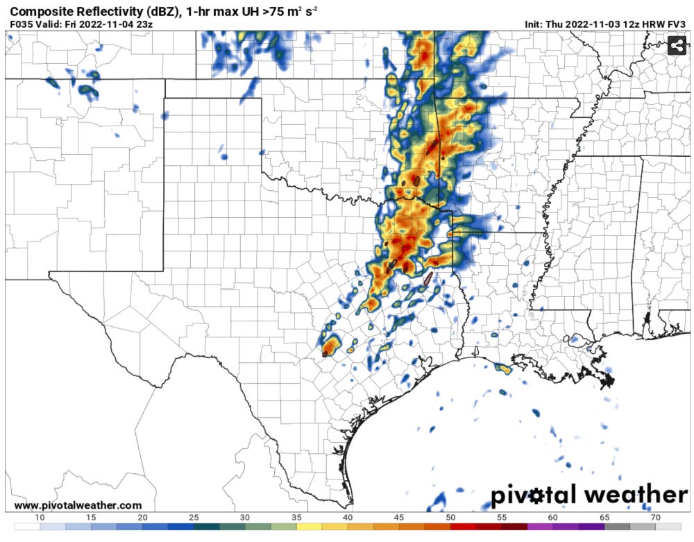
The line of storms along the cold front should weaken a bit Friday morning before regenerating through the day. Of more pressing concern is the consistent signal of storm formation ahead of the cold front in the warm sector. This is highly reminiscent of severe weather events further east in Mississippi and Alabama.
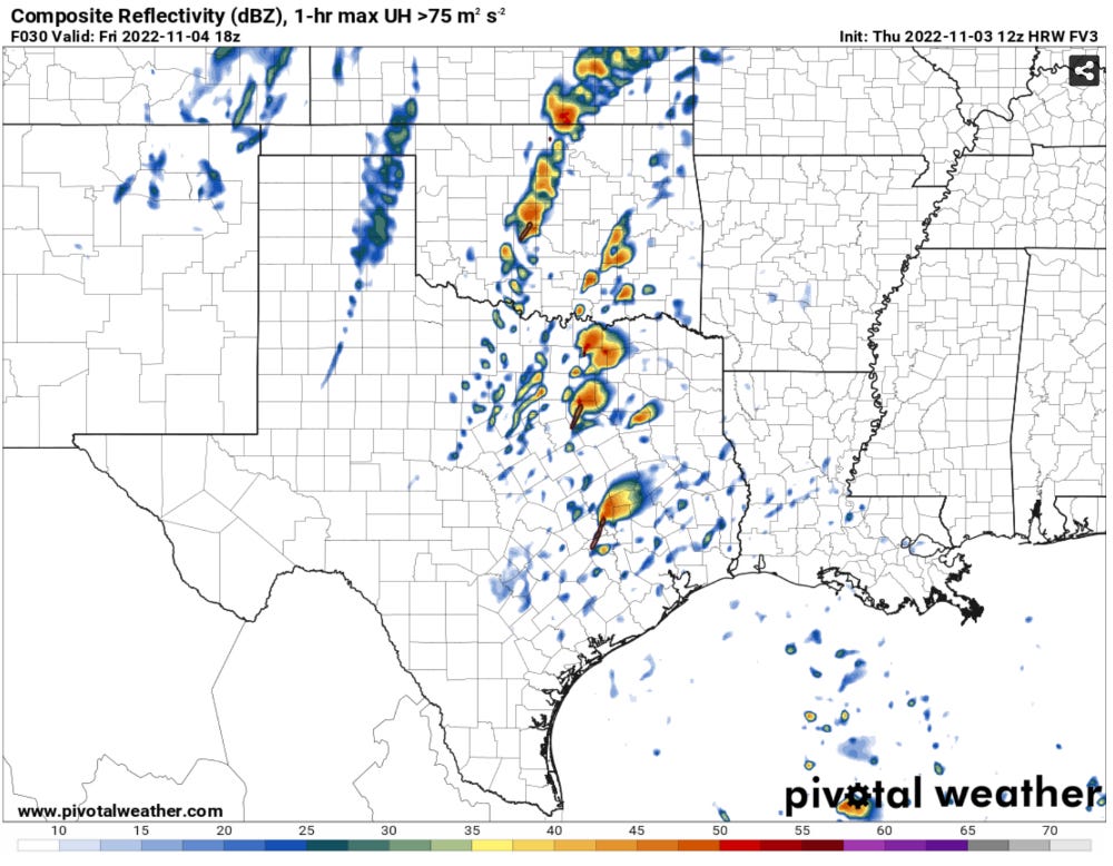
Early Day Peak? As storms form early in the day ahead of the cold front, the initial isolated storm modes may be the most ideal time for tornado formation. The environment will not be at its most favorable at this time, but will still be supportive of tornadoes with very low cloud bases and ample low-level wind shear.
Will storms be by themselves? The question on whether tomorrow has a lot of tornado warned cells or not comes down to two things: 1)Will there be cloud breaks to allow the low levels to destabilize tomorrow? and 2)Will storm modes be less crowded at least initially?
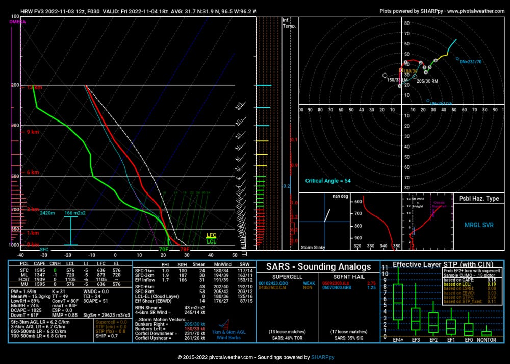
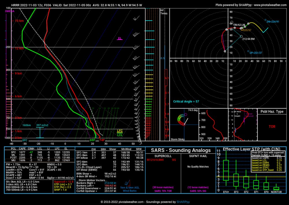
One is important because we know 0-3km instability is very important towards getting tornadoes.
Two is important because the instability is not very high end tomorrow and storms raining into each other will lower instability, including 0-3km instability, quickly to a point where storms will be more limited in strength.
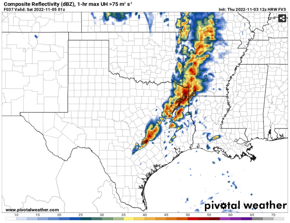
Wind shear increasing with time: The wind shear will increase substantially after dark. This will lead to an increasingly favorable shear environment for tornadoes. The wind shear is clearly not going to be an issue tomorrow. The question will remain instability.
This is a really challenging storm chase: Listen, I’m not going to lie to you…the storm chaseability (that’s now a word) of this event kind of sucks. Low cloud bases + fast storm motions + bad terrain + almost certain HP storm modes means this isn’t that great of a setup for storm chasing. I also think it is likely that storms will be enshrouded by low clouds so there won’t be much storm structure to be seen either. It really just looks grungy in challenging terrain.
Watch the low-level instability then the storm mode: The key to whether tomorrow has a lot of tornado reports or not I think comes down to if you can get cloud breaks early in the day that leads to ample low-level instability. The next concern will be how many storms form and how fast they form. More crowded storm modes are always unfavorable for tornado formation, and tomorrow will be no different.
Stay tuned to our social media for the latest updates.
Instagram | Facebook