

Severe Weather Incoming in the Northern U.S.
A typical summertime pattern is here.

It’s hard to imagine a more traditional summertime pattern than the one setting up over the next week with a strong ridge of high pressure dominating the southern and central Plains. Over the top of that ridge will be some meaningful jet stream energy, which will lead to the chance of severe weather through much of the next week across the Northern U.S.
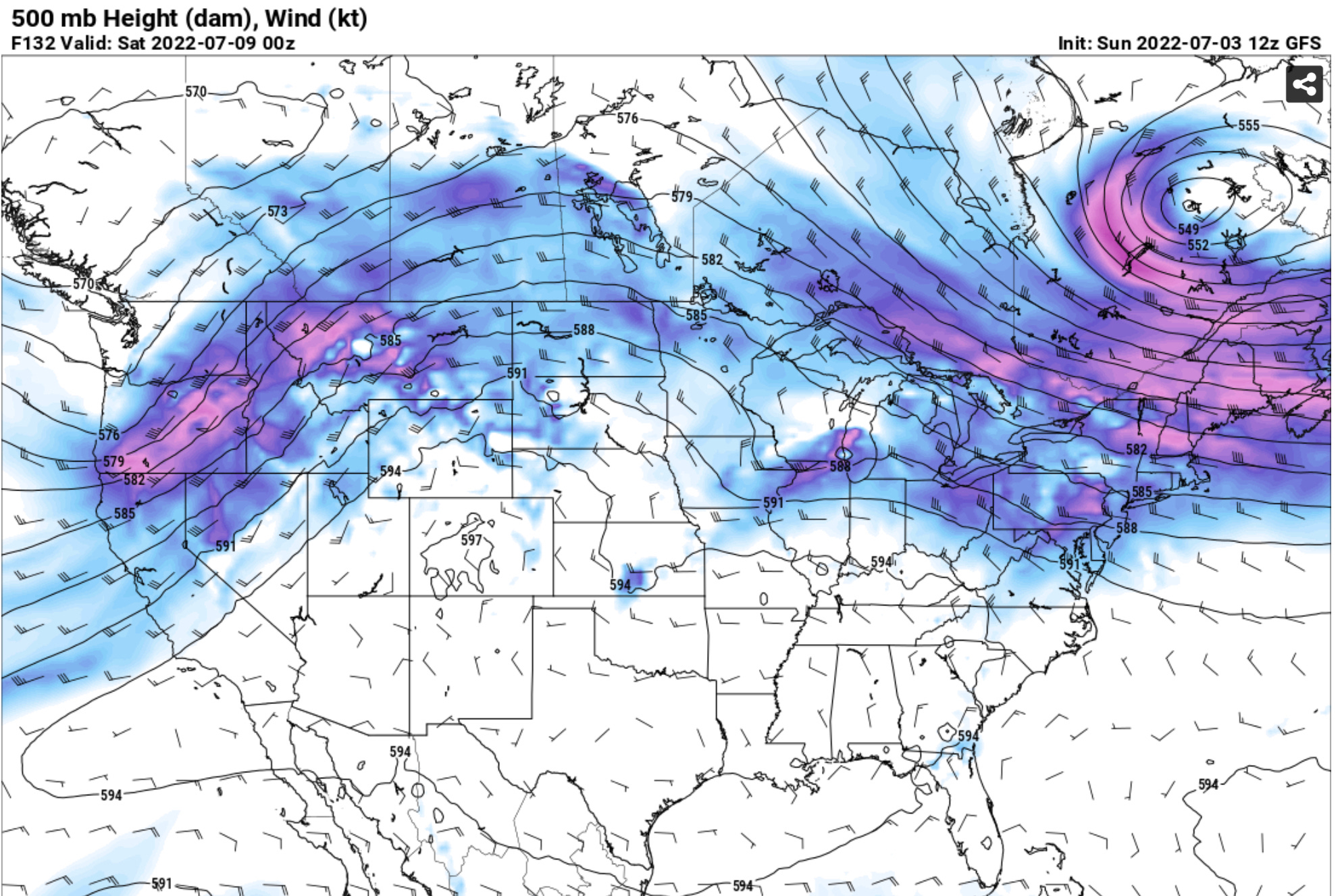
Overall, the pattern evolution over the next week is a very classic one for this time of year, with ample moisture and wind shear for severe weather. A couple of glances at model forecast soundings show pretty favorable environments for supercells with some photogenic qualities if not outright a couple of tornado events. This is largely the best severe weather pattern to emerge over the Plains since early June.
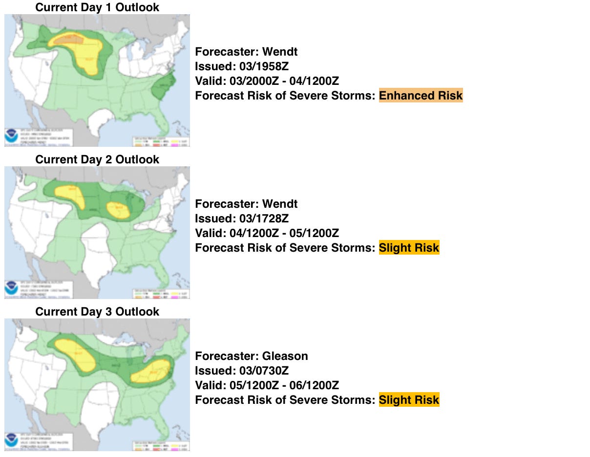
In fact, the SPC has areas highlighted for severe weather risks all the way through Tuesday already this next week. The main areas to watch would be S/E Montana and into the Dakotas for this activity, with all modes of severe weather being possible at times through the week.
But That Heat
Not lost in all of this is that, underneath the ridge, we will be seeing a pretty substantial heat wave through this week. High temps well over 100F will be pretty common across Oklahoma, Texas, Arkansas, and Kansas.
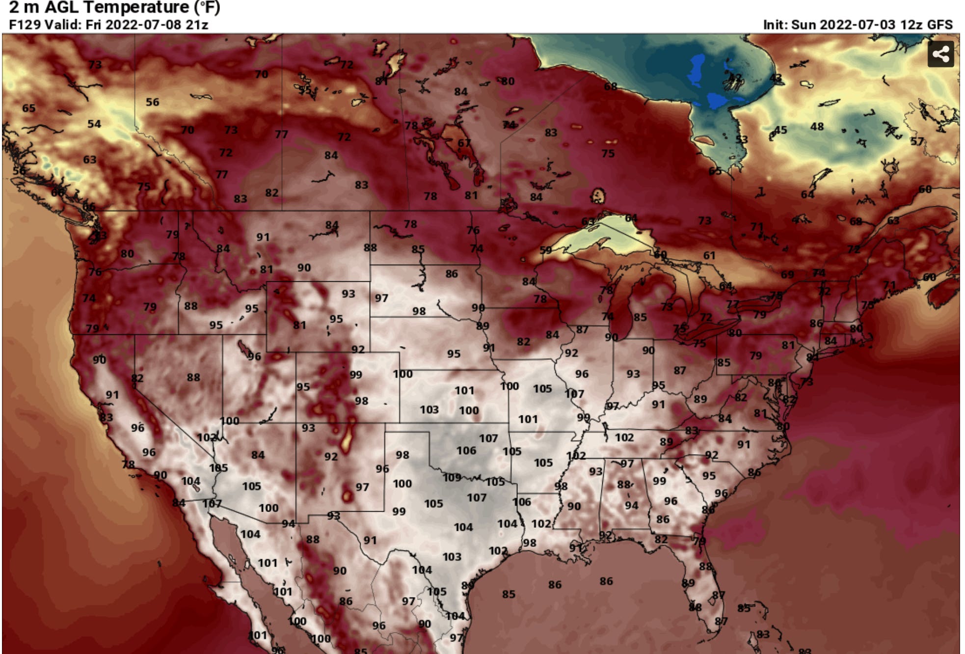
The ridge should begin to slowly shift west into next week, which may give some places on the eastern fringes of this upcoming heat wave some relief as cooler air can fill in.
As the high amplifies and drifts west, we will likely see the southwest dry out a bit, bringing a break in the monsoon as we move deeper into this week.
New YouTube Content Coming Soon!
Last but not least, we’re going to be rolling out new videos on our YouTube channel FINALLY after I took a pretty long break to recharge the creative senses. If you haven’t done so, it’s a good time to subscribe to our YouTube channel!