

Severe Weather Chances for the Plains Fri/Sat
Is it time to chase again?

It gives me great joy to announce that the sky booms have returned to the forecast with flashy boom booms expected over a large part of the area. Unfortunately, though, some of these will be severe with hail and damaging winds as the primary threats. Let’s talk about it.
1. Friday/Saturday Severe Threat
On Friday, we’ll see lift increase near and after sunset over the Southern Plains, allowing for several storms to form into the overnight hours. The main threat with these will be large hail.
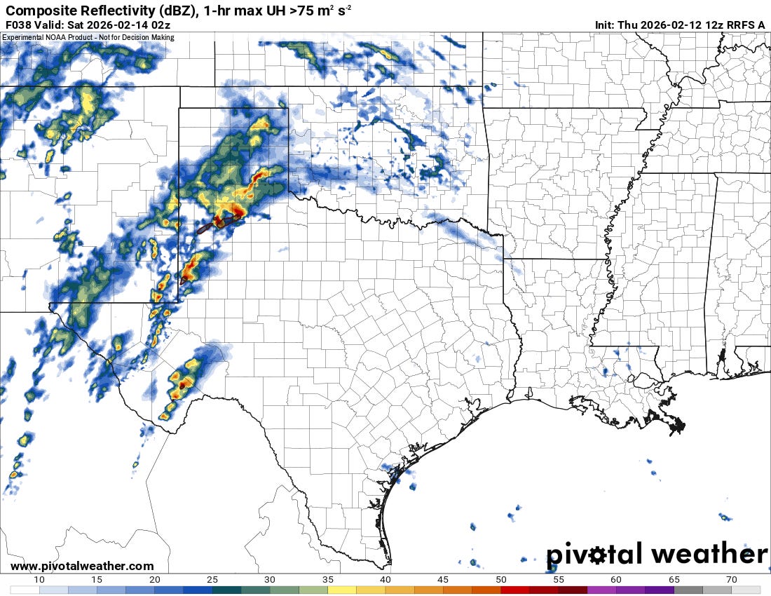
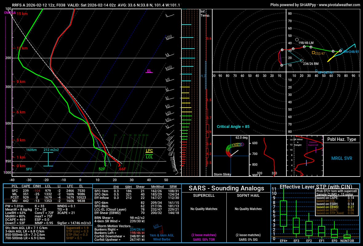
We likely won’t see a lot of damaging wind reports, but the storms will not be elevated above the surface layer fully, so it wouldn’t be surprising to see some blue dots on the map as we move into the morning hours on Saturday. Another thing to watch is that, despite the modest low-level moisture, there is a lot of shear in the lowest levels. I don’t think a tornado risk is really warranted, but stranger things have happened.
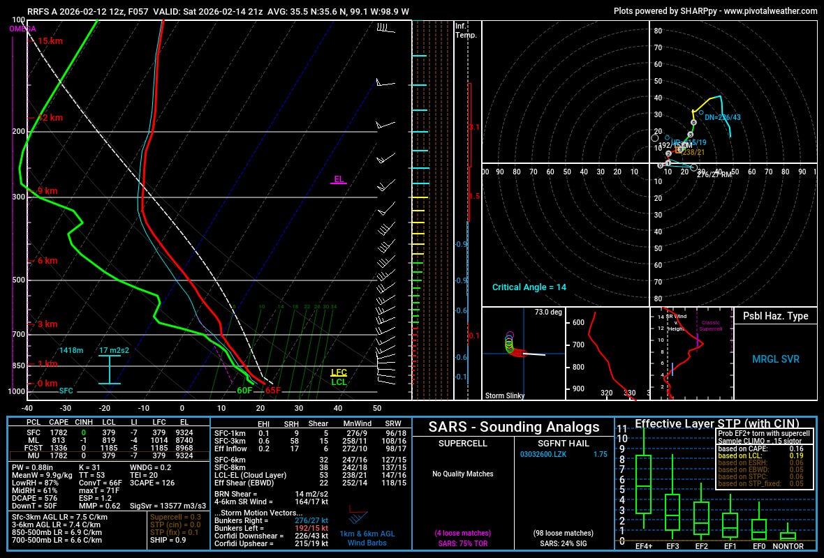
Storms should be ongoing throughout much of the day on Saturday with a linear system taking shape over Texas into SE OK.
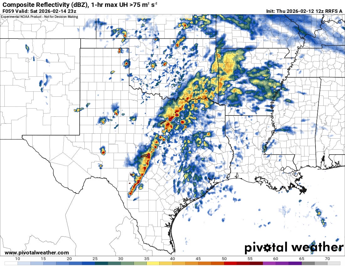
I’m not finding a lot of areas where low-level shear will necessarily overlap with low-level instability, so I’m not sure there’s much of a tornado threat with the linear system — but hail and damaging winds will be possible.
However, underneath the low over W/NW Oklahoma there’s A LOT of 3CAPE showing up on models with scattered storms. With a cold-core-like setup here, I wouldn’t rule out the atmosphere given the vorticity and stretching near a low. Never say never when this combo comes to town — I think a lot will ride on there being a lot more surface heating. But this will be something to watch in the coming 24 hours.
2. Watch a Tornado Form in Real Time
Watch every second of this tornado's brief lifecycle in raw, uncut 4K. This 6-minute sequence captures the atmospheric process from start to finish near Las Vegas, NM. For the weather nerds: watch closely as the RFD surges and wraps around the mesocyclone once then twice. You’ll see the wall cloud quickly organize before the funnel finally drops. No music, no cuts, and no labels—just the raw science of a developing storm.