

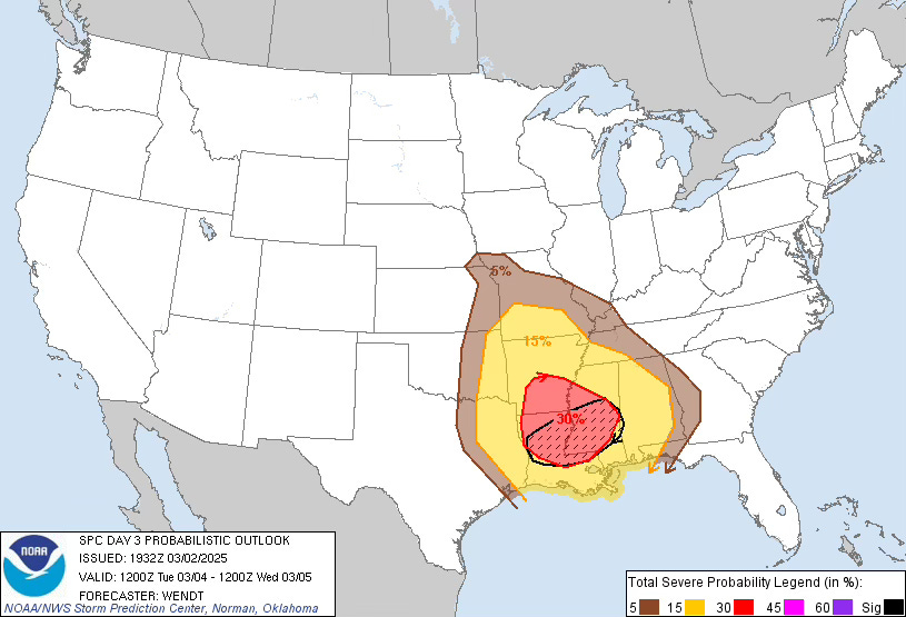
Severe Risks This Week, March is Storming In
Tornadoes possible from the Plains to the Southeast

Spring is BACK!
If you follow us on social media (and you admittedly probably do if you are reading this), you know there was a very low-end threat today in the Southern Plains. As we move through this upcoming week, more threat days are coming up. Let’s break it all down.
Monday Night Into Tuesday Morning
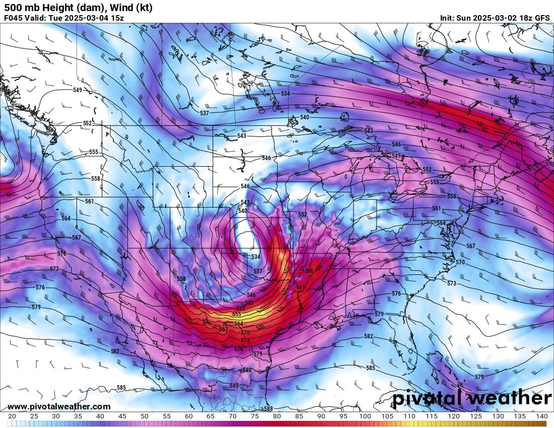
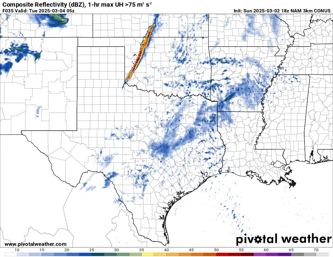
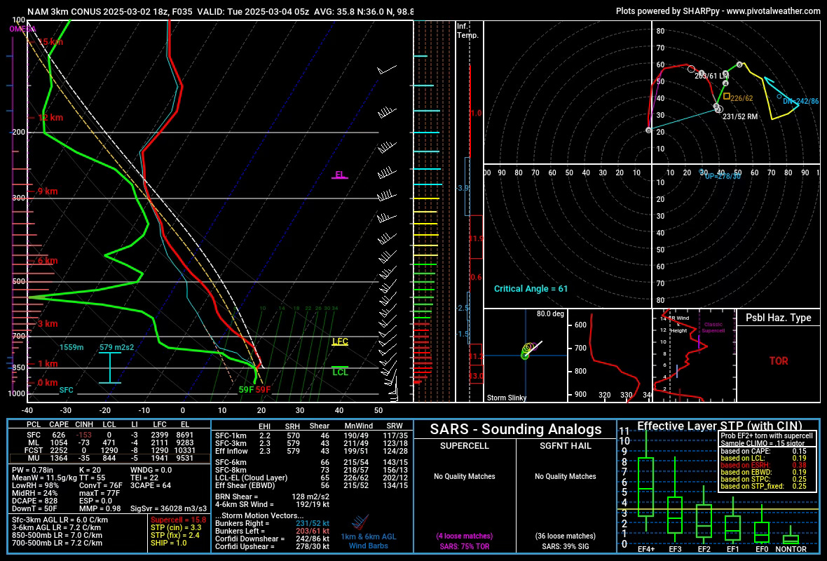
A powerful storm system will emerge onto the Plains, bringing storm development during the overnight hours from Monday into Tuesday morning.
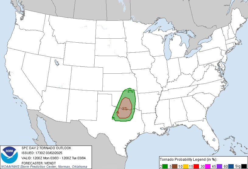
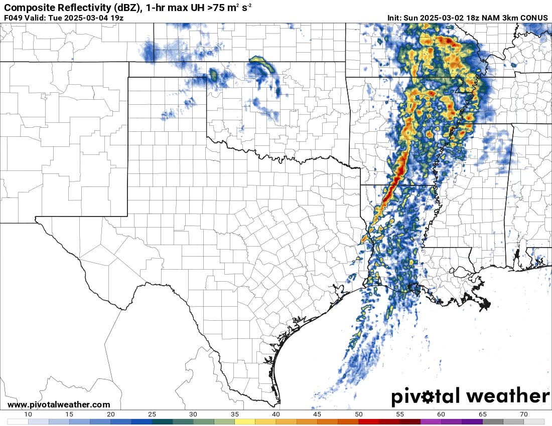
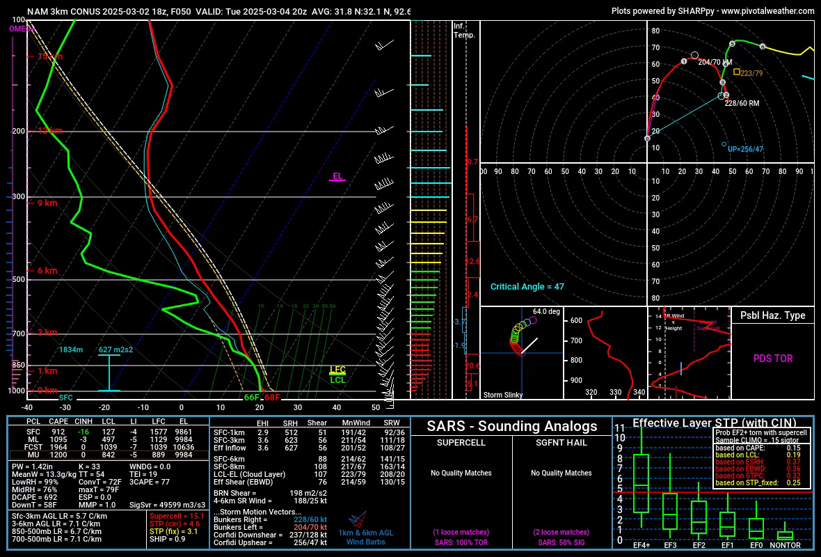
Tuesday: The Main Event?
As the system moves east and brings its energy over increasingly moist low levels, the threat of severe weather may peak from Tuesday afternoon into the early evening. Storm mode and the degree of destabilization ahead of this system are in question.
Our 2025 Tornado Season Outlook
Our channel members have exclusive access to our 2025 tornado season outlook. It’ll go live to everyone soon enough, but you can still score early access by signing up, and you’ll be helping our educational mission in the process.
We Saw Just About Every Storm Type This Day
I had pretty high hopes heading into this chase day of active weather over the open desolate landscape of SE NM and W. Texas. However, storms from overnight pushed an outflow boundary strongly south, which complicated our chase by quite a bit. Still, by afternoon, the sky exploded with storms, and what followed next was a literal sampler platter of different types of supercells.