⛈️ 🍁 Severe Risks This Week and Cooler
Fall vibes all around us now.

Bust out your favorite boots. Get those flannel pieces of your wardrobe ready. If you don’t experience an outbreak of pumpkin spice, corn mazes, and earthy tones this week, you just aren’t cut out for this season.
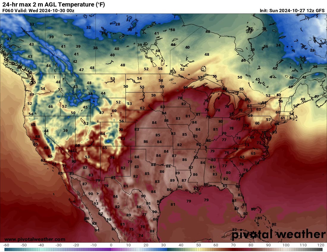
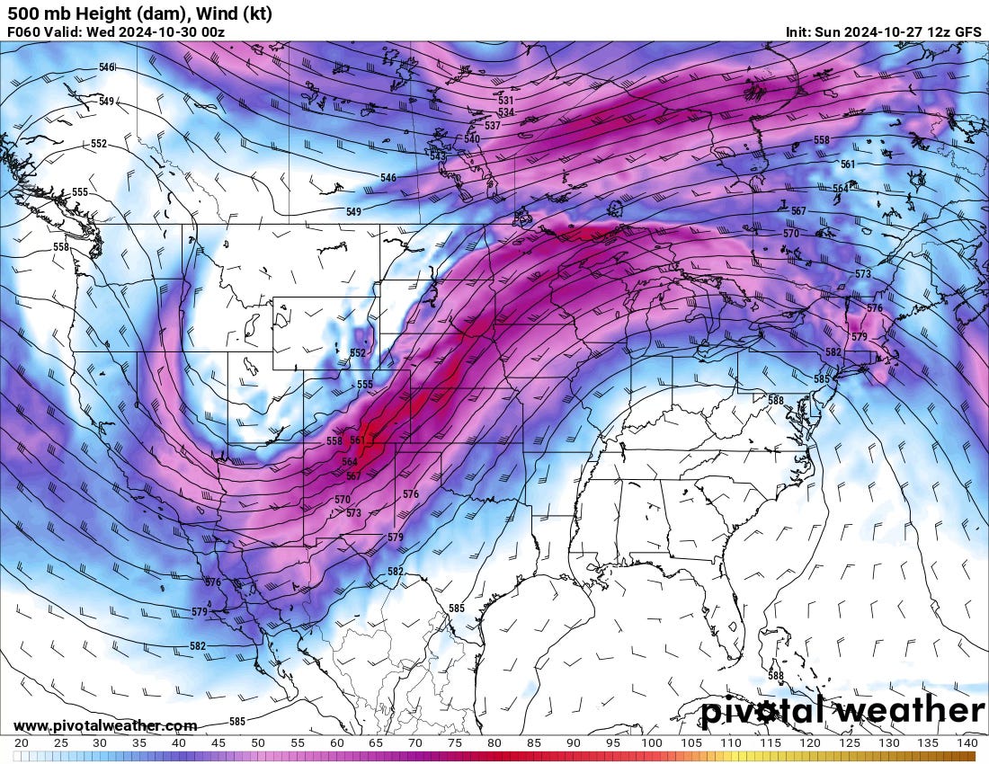
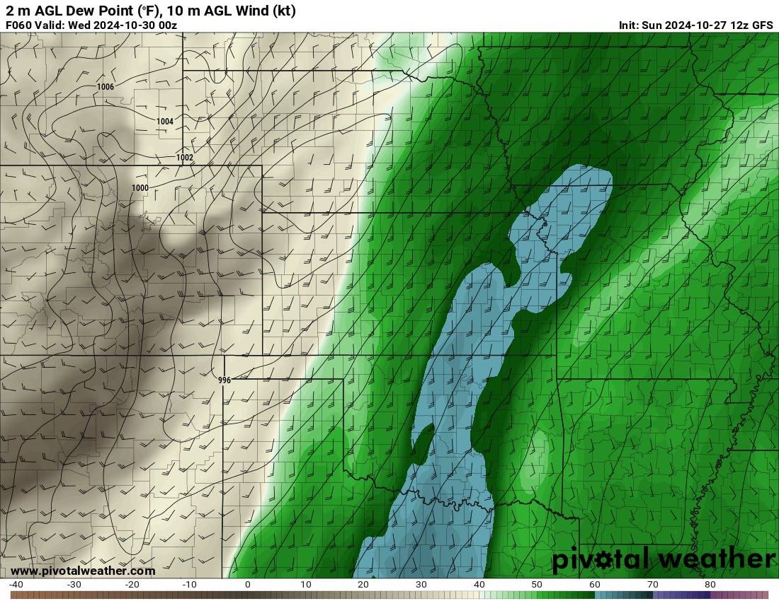
But this week will have more than an autumn chill; we’ll also see severe weather as a trough moves in from the west by midweek.
Overall Thoughts
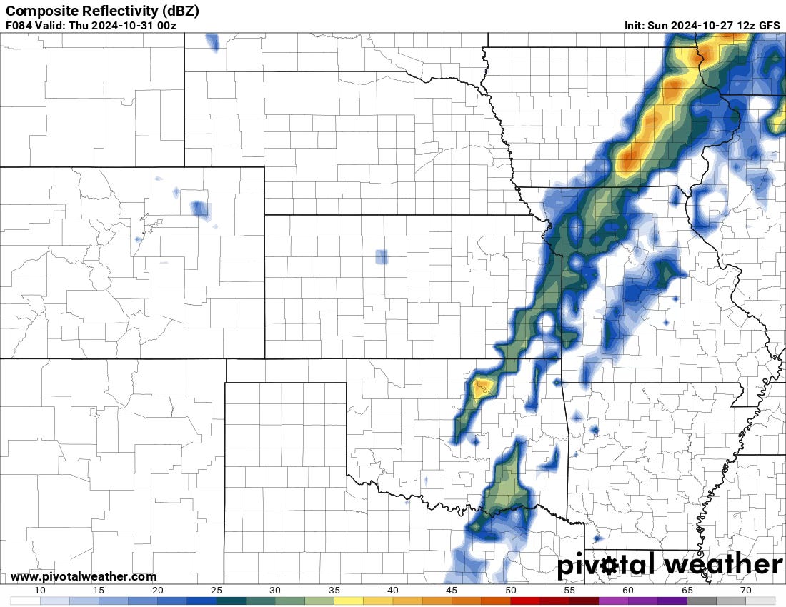
It’s early, and if the day warrants it, we’ll do a full-dive forecast blog on Wednesday. But for now, it looks like Wednesday is the classic autumn linear cold front day, with hail/damaging winds as the primary threat. With the storm system moving past by Wednesday afternoon, the low-level flow doesn’t ramp up much into the evening comparatively, with some weirdly shaped hodographs present on most models.
In the most basic terms, this is a classic elevated hail/wind risk right now.
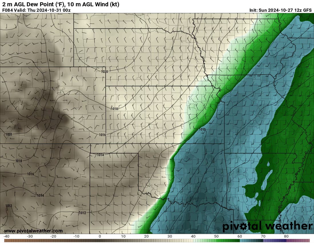
Beyond Wednesday
As we move beyond Wednesday, it becomes apparent that our stormy period is not over. There will likely be a cooler day on Thursday on the Plains before another trough approaches from the west with renewed moisture and storm chances into next weekend and early election week. A severe risk could materialize in the South, but the trough’s energy will be well separated to the north so it might be a continuation of the risks on Wednesday as the cold front marches east.
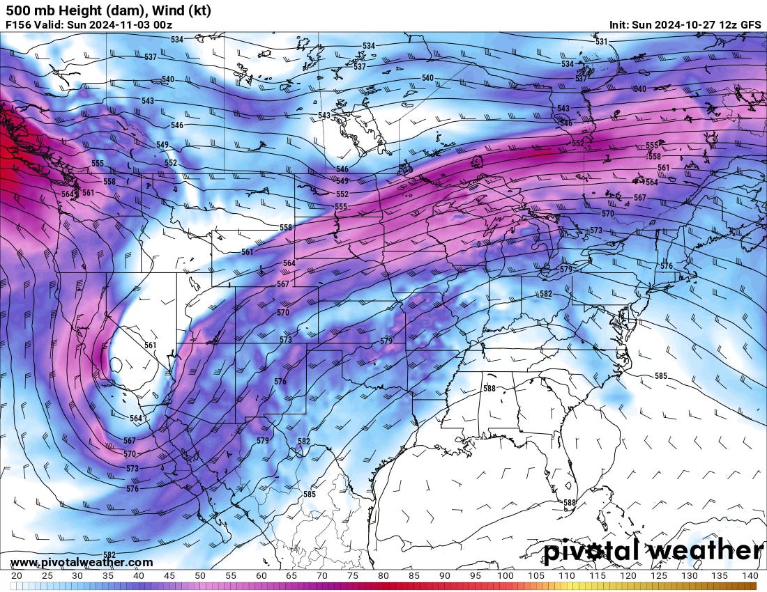
Photo of the Week
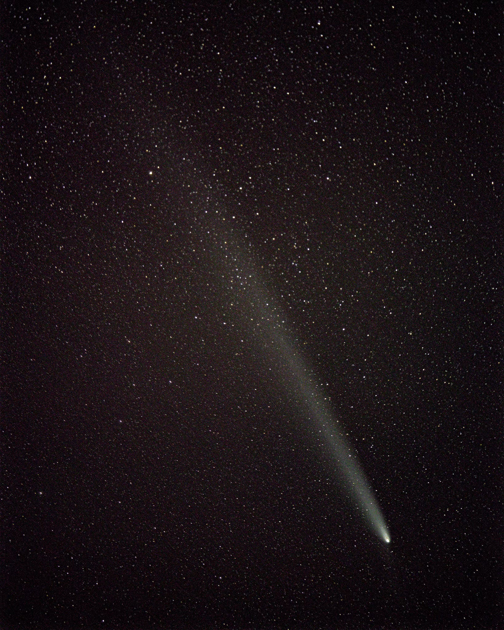
This week, Tornado Titan Eugene Thieszen shares a stunning photo captured on the evening of October 22. Taken at 200mm, this close-up of Comet C/2023 A3 (Tsuchinshan-ATLAS) reveals remarkable detail. Although the comet is fading, it remained visible to the unaided eye in dark skies. Eugene stacked 20 images to achieve this clarity, enhancing detail and reducing noise. The photo was captured in Hodgeman County, KS.