

Severe Risk on Tuesday And Then...
Here's what we're looking at beyond this extended severe weather sequence.

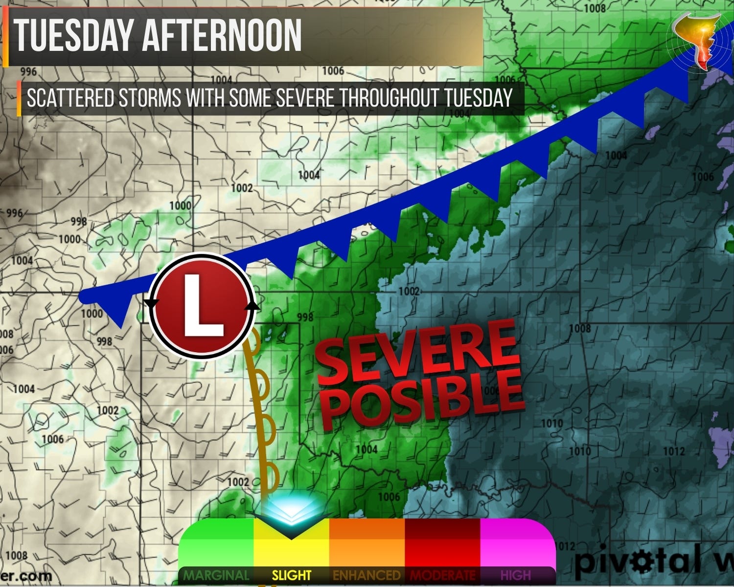
1. Tuesday Severe Threat
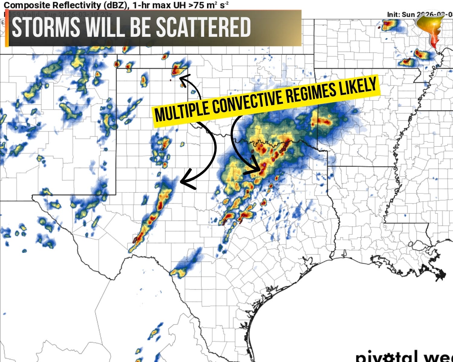
Tuesday is going to be busy.
Storms will fire along the dryline, a cold front, and in the open warm sector throughout the day. This is one of those setups where convection will be scattered across a large area, so don’t expect a single clean target. It’s going to be messy, and that’s what spring looks like sometimes.
Moisture gets a little thin out west near the dryline, but wind shear should be enough to get storms organized. Low-level shear isn’t nearly as impressive as late last week, so the tornado threat is lower, but it hasn’t left the building. Boundaries will be all over the place on Tuesday, so any tornado threats may increase in the vicinity of them.
The bigger story for our area is large hail where storms stay discrete, and the potential for things to go linear after dark. That’s when damaging winds take over.
There is uncertainty on two fronts: where exactly the surface features set up, and how much of a cap we’ll deal with across Oklahoma. In plain terms, the details are still sharpening and Tuesday’s outlook could shift. I’ll update as we get closer.
2. Why Do Some Tornadoes Turn Suddenly and Mysteriously?
Deviant tornado motion is one of the most dangerous and least understood phenomena in storm chasing — and it can turn a routine chase day into a life-or-death situation in seconds. In this members-first lesson, we break down two real-world case studies: the lesser-known May 6, 2015 Lake Chickasha tornado and the infamous El Reno tornado. Using hodographs, surface boundaries, and CAPE values, we walk through exactly how to spot the signs that tornadoes could do something completely unexpected.

3. Looking Out a Little Longer
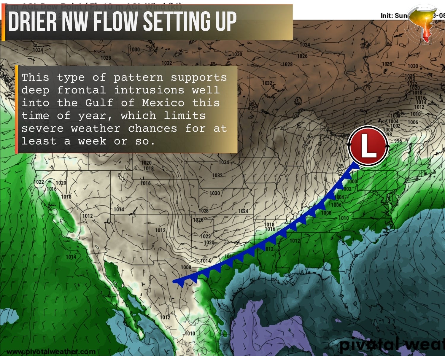
After Tuesday’s system clears out, winter wants one more word with the eastern half of the country.
A ridge looks to build in the west, shoving the jet stream north before diving it south through the Plains. If you’ve been around severe weather long enough, you know what this pattern means: dry. Cold fronts will race through with little to no rain, and more importantly, they’ll shove our moisture south into the Gulf and Caribbean. No moisture, no storm fuel. No storm fuel, no severe weather. Simple math.

The global models agree on the general idea but disagree on the details. The GEFS wants to bring moisture back north sooner. The EPS warms the Plains back up but keeps us locked under dry northwest flow, which looks impressive on a temperature map and produces exactly zero notable severe weather. I’m leaning toward the quieter solution for now, but we’ll see.
The honest truth? A two to three week break from severe weather is fine by me. This year is off to a deadly start, and a pause for everyone to catch their breath isn’t the worst thing in the world.
Pattern could flip back to something more active by the end of the month. Maybe. I’ll believe it when the models stop arguing about it.
Thank you for the information!