

Quiet Pattern Continues
This is an only for now statement. Mid-Month will bring changes.

The lack of surface moisture is causing an almost completely dry pattern to persist for at least 5-7 days over the Plains and extend back into the Southwest. However, we may start to see changes emerge by mid-month.
Why So Dry?
Repeated cold fronts (which haven’t been THAT cold but still bring northerly flow) have been slamming south through the Gulf of Mexico, sending moisture away from the CONUS.
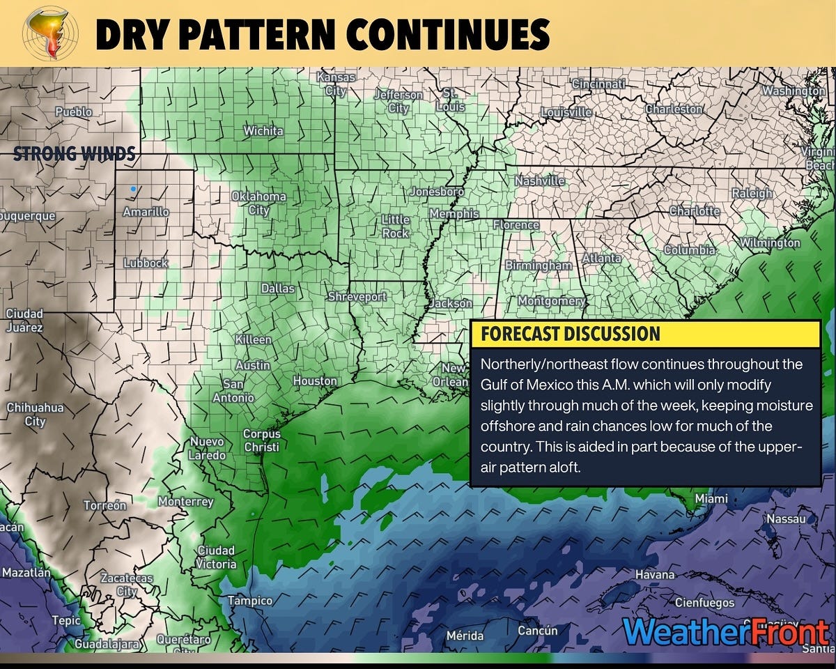
This is not a surprising pattern for this time of year. November to February are the driest months of the year for the Plains, after all. But it does create a situation where getting rich, tropical moisture back north is quite difficult for the atmosphere. However, this is only part 1 of a 2-part series.
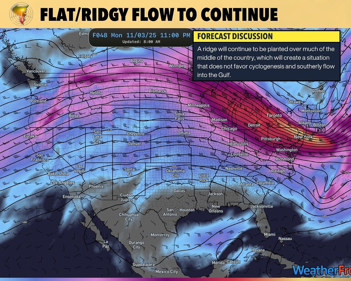
The other problem is that we have a western ridge/eastern trough pattern, with anticyclonic flow over the Gulf. This is the second hit to keep things dry over the middle of the country. The western trough/eastern ridge is a common feature in La Niña and is likely to remain a dominant weather pattern throughout much of the cool season. We could see drought conditions return to the Plains by Spring.
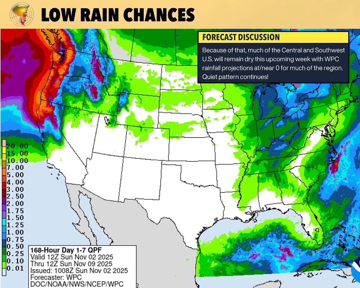
As such, and unsurprisingly, the pattern will remain mostly dry over the next seven days.
Winter Outlook
While I don’t want to do a full-fledged winter season outlook since it’s not really our forte being in the “1 inch of snow shuts the city down” club — I do want to look at what the official NOAA forecast says and infer a bit based on experience on what that could mean for tornado season (this is an early not fully formed thoughts look).
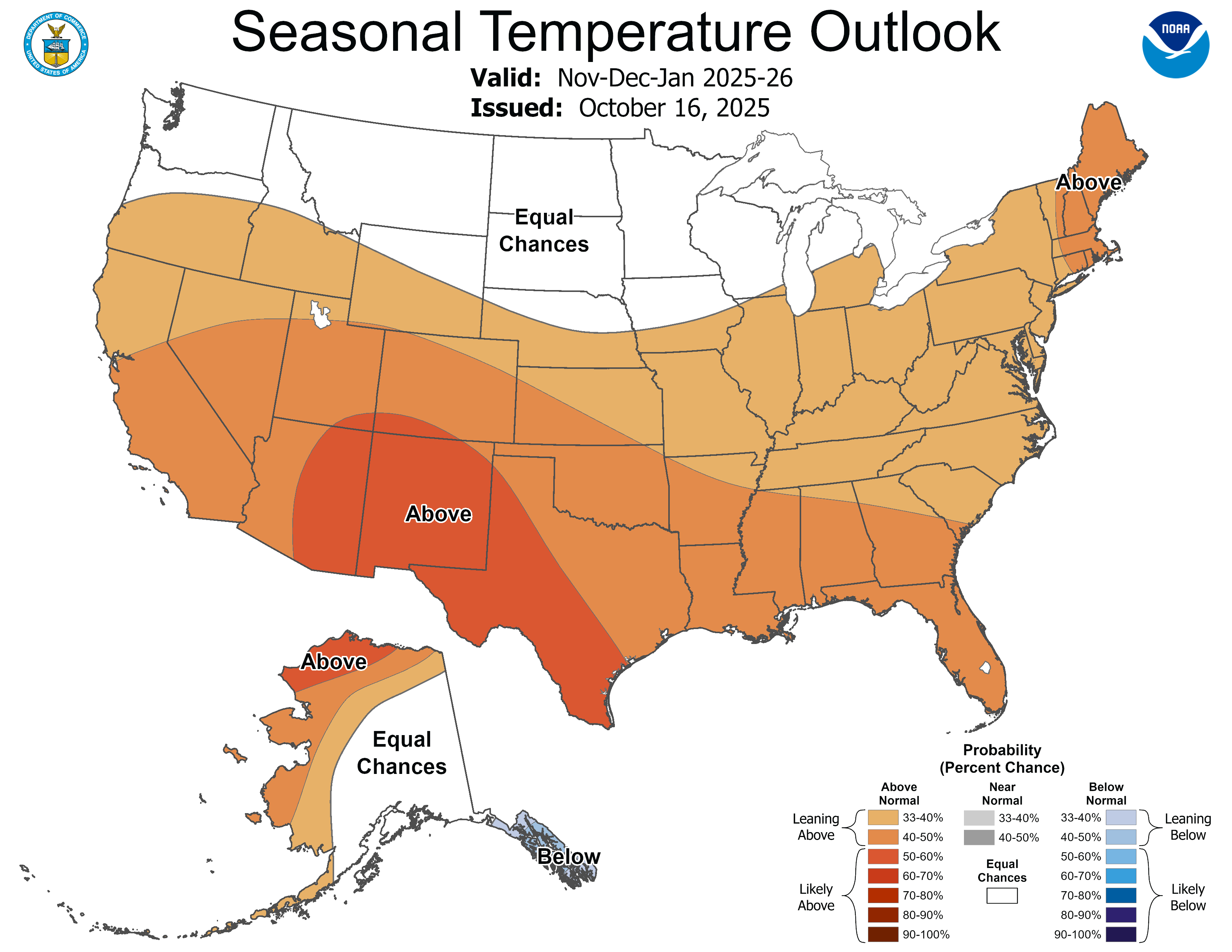
One thing that does seem clear is that the average temperature much of the winter will be at/above normal for much of the country. This doesn’t mean it won’t get cold ever; it also doesn’t mean it’ll be in the 80s in OKC all winter. However, if you averaged the temperature over the three-month period of November to January, you’d likely find it was warmer than the average.
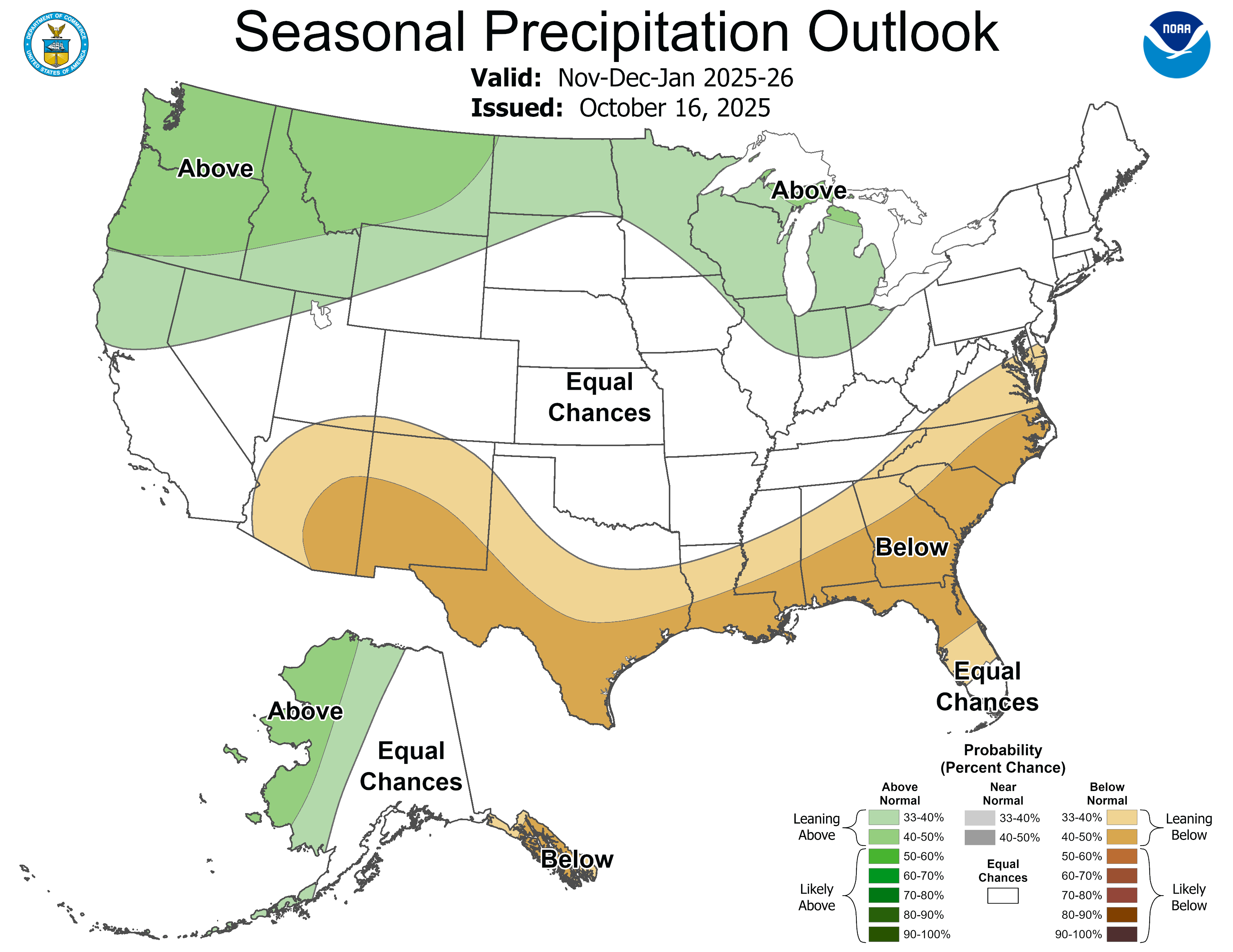
Another characteristic of the La Niña pattern we’re heading into is a dry Southwest/Southern Plains pattern. While much of the middle of the country falls into the dreaded 'equal chances' category (i.e., you might be above, you might be below), there is a strip of below-normal precipitation across the Southern U.S.
What Can We Infer About Next Tornado Season?
Right now, not much.
However, this shift from an El Niño back to a neutral pattern for a season and then transitioning into Niña hasn’t occurred often. The most recent examples I can find that are only loosely correlated are 2004 - 2006 and 2015-2017. In addition, the blob of warm temperatures across the Pacific remains present this winter, which can help amplify the pattern over the U.S. if it persists (though it has cooled significantly this year).
I don’t have a high degree of confidence in the current tornado season forecast, given the mixed signals we're receiving. This is not unlike last year, when I leaned into the average, but we actually ended up well above it. When signals are mixed or weak, it can mean things tip either direction pretty quickly.
Maybe we’ll have more confidence next time around as conditions develop.
How This Atmospheric Feature Can Shut Down Storm Season
On April 27, 2025, we were locked in a familiar battle with an old storm chasing nemesis: the ‘Cap’. All the signs pointed to explosive storms, but an invisible, stubborn lid on the atmosphere was about to shut the whole show down.
In this video, we break down why this invisible barrier is one of the most critical and misunderstood features of the tornado season. We’ll show you what it’s like to chase on a day when the atmosphere is fighting back, how we use tools like Echo Tops to see the battle in real-time, and why this chase became our first “cap bust” of the year.