

Pattern Resets Back to Default
Drought builds and a battleground of cold and warmer air setting up.

In the long-arc of history, please let it be known that cold air meeting warm air alone does not directly cause tornadoes — case in point this week.
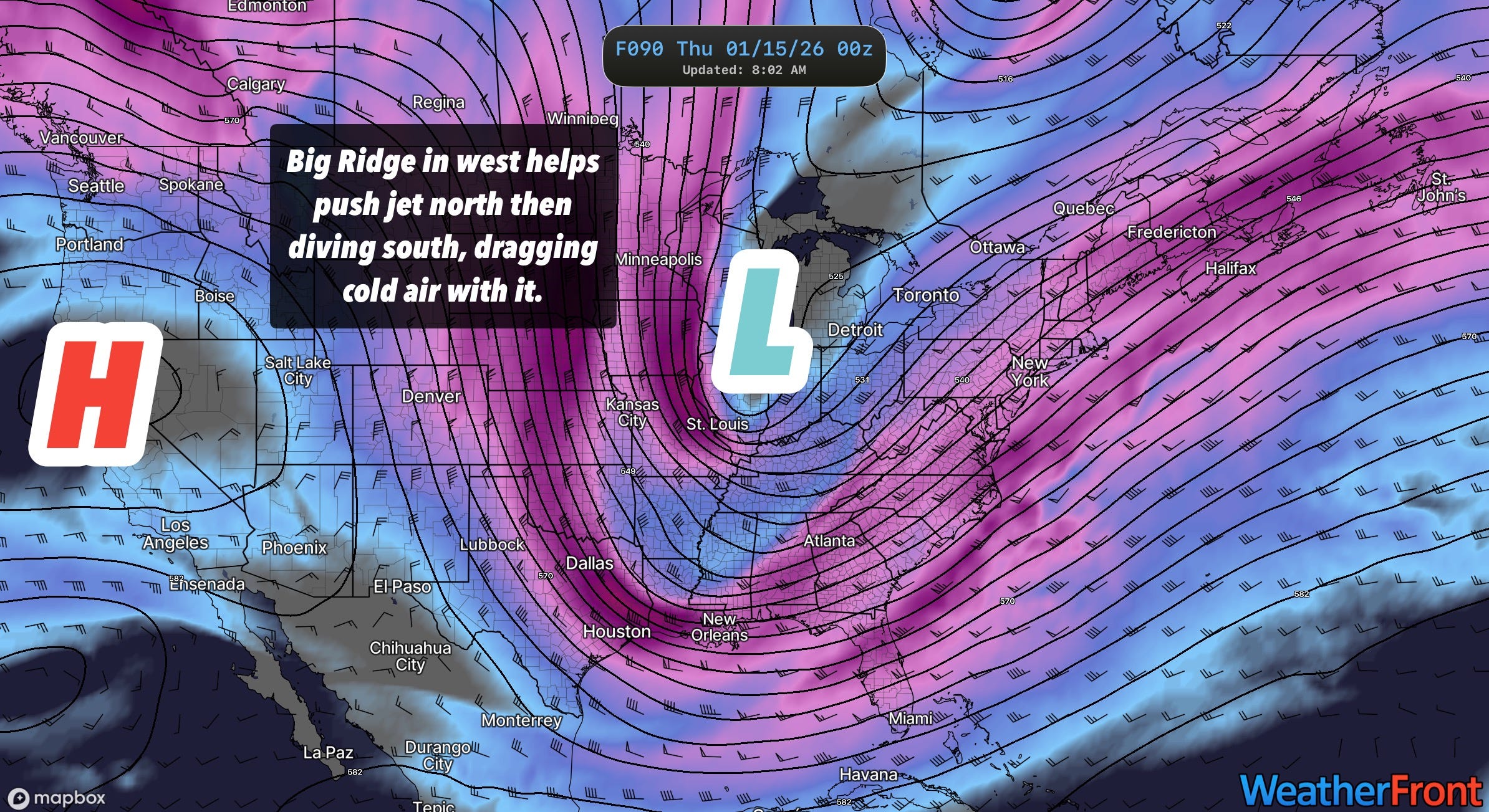
1. The Jet Stream’s Default State
With a weak La Niña, the tendency for a ridge in the west to push the jet stream up and then down over the eastern U.S. is strong — which I call its current default state. As some folks are dealing with tornado damage in Oklahoma, the jet stream is set to deliver a winter blow to the temperatures, dragging cold air south.
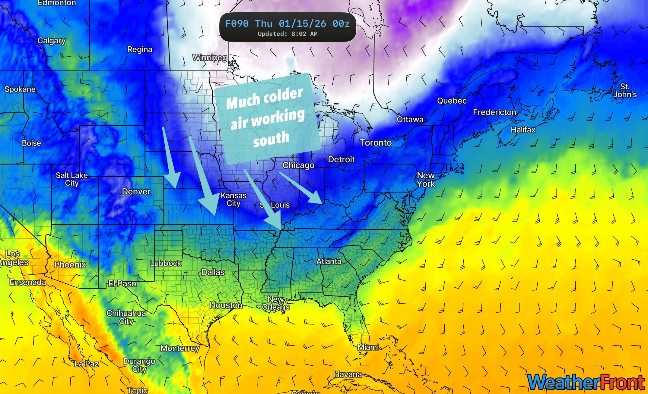
Context Matters: Luckily for us, the temperatures to the north are not that cold. There should be a sharp cut-off line between very cold to mild and even warm over the Plains. So while it’ll be noticeably colder for a lot of folks in the eastern 1/2 of the country, the Western half of the country will continue to ask the important questions like, “When is winter?”
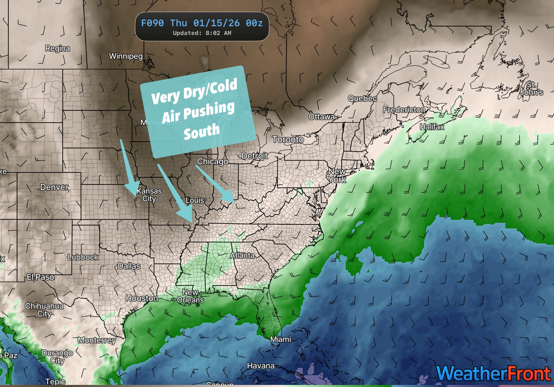
A cold airmass is a dry airmass: The air temperature can’t be colder than the dewpoint except in super specialized cases above the surface, so when cold air dives south, so are very low dewpoints. We’re already well below normal across much of the country in terms of dewpoint temperatures thanks to this last week’s system. Bottom line? Precipitation chances are limited this week.
It’s Active Weather Somewhere: The east coast will have varying storm impacts late this week. The track of the low will determine if this is a classic nor’easter or a baby snowstorm.
2. Looking Further Out
We’re now at the point in the year when we have to start taking seriously the possibility of an early Spring emergence or the reassertion of winter and a delayed start to storm season. Here’s what the data says…
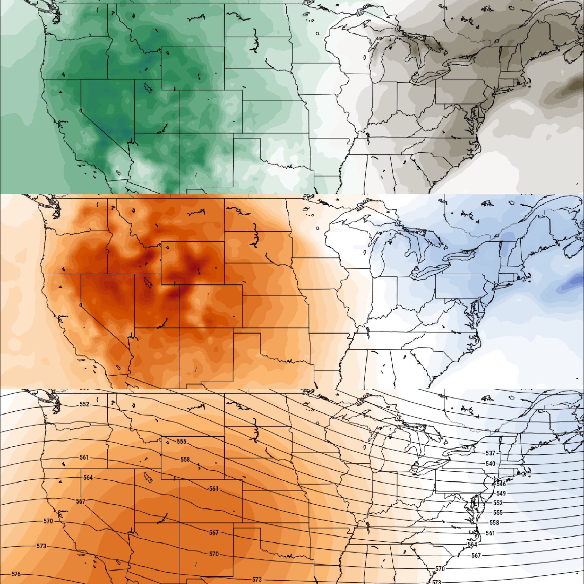
Ridge Continues in the West: A big trend that’ll impact storm season is the continued persistence of ridging in the western U.S. into next month which will continue to worsen drought conditions for a lot of us.
Similar Temp Patterns: Most longer range models are showing a warmer period for the western U.S. and cooler for the eastern U.S., not unlike what we’re experiencing this week (but perhaps warmer overall) into early-mid February. The caveat here is models at this range are very broad and the cut-off line for cold vs. warm will likely be over the middle of the country. We might have a situation where its 21 in Tulsa and 78 in Lubbock like we’ve seen this winter already.
Dewpoints Anomalously High But Will There Be Energy? Dewpoints in the extended period look higher than normal, which could fuel some big snowstorms in the west and some active weather in the Southern U.S., if we can get a jet stream reset.
So will we see an early Spring emergence?
Right now its more doubtful than not. The thing I’m actually eyeing is a potential major late-winter cold snap that might delay Spring tornado activity for a lot of the country versus an early and rapid start to the year. My non scientific take is it almost feels like we owe a tax to the atmosphere for so many nice weather days thus far as well.
2026 Will Look A Lot Different Than Other Years
2026 will bring a lot of changes to how we consume storm and educational content, so it only makes sense we change with it. PLUS a look at how the heck we're going to beat this drought this winter into next Spring and what it might mean for storm season...