

Pattern Change Coming Mid-Late Month
Is it time for a brief but eventful Plains autumn severe weather burst?

We’ve been locked in a pretty June-like pattern for much of the last few weeks in many ways, but we’re looking at a more seasonable transition moving through soon that should bring us at least some low severe weather chances on the Plains.
Where We Are, Where We’re Going
Currently, a ridge of high pressure sits over the Southern Plains, with a stream of rich, tropical moisture from a pair of tropical systems moving over the Southwest. Flooding rains are likely in the coming weekend there.
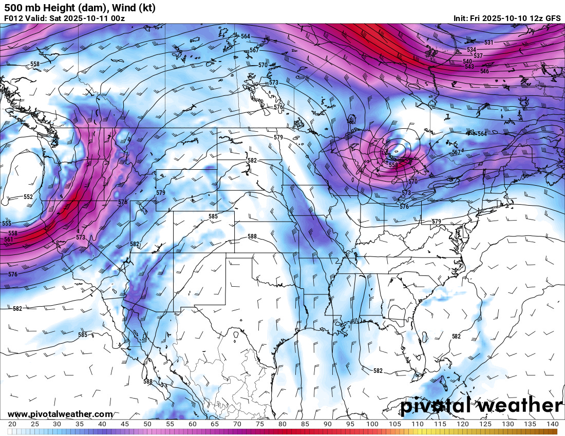
In fact, with the trough just off the west coast moving inland and a moist and unstable airmass at the surface, some severe storms may be possible in the West this coming weekend, with large hail the primary threat.
With time, the strong ridging over the Southern United States will weaken and shift south and east, finally bringing an end to the sunny/hot pattern with near record high temperatures.
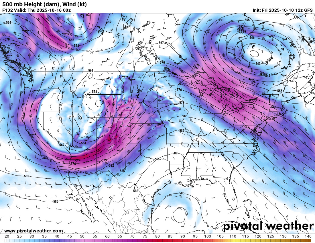
As a strong trough approaches the middle of the country next week, unsettled weather will be on the menu. However, that weak low in the Gulf of Mexico may portend serious issues for moisture quality.
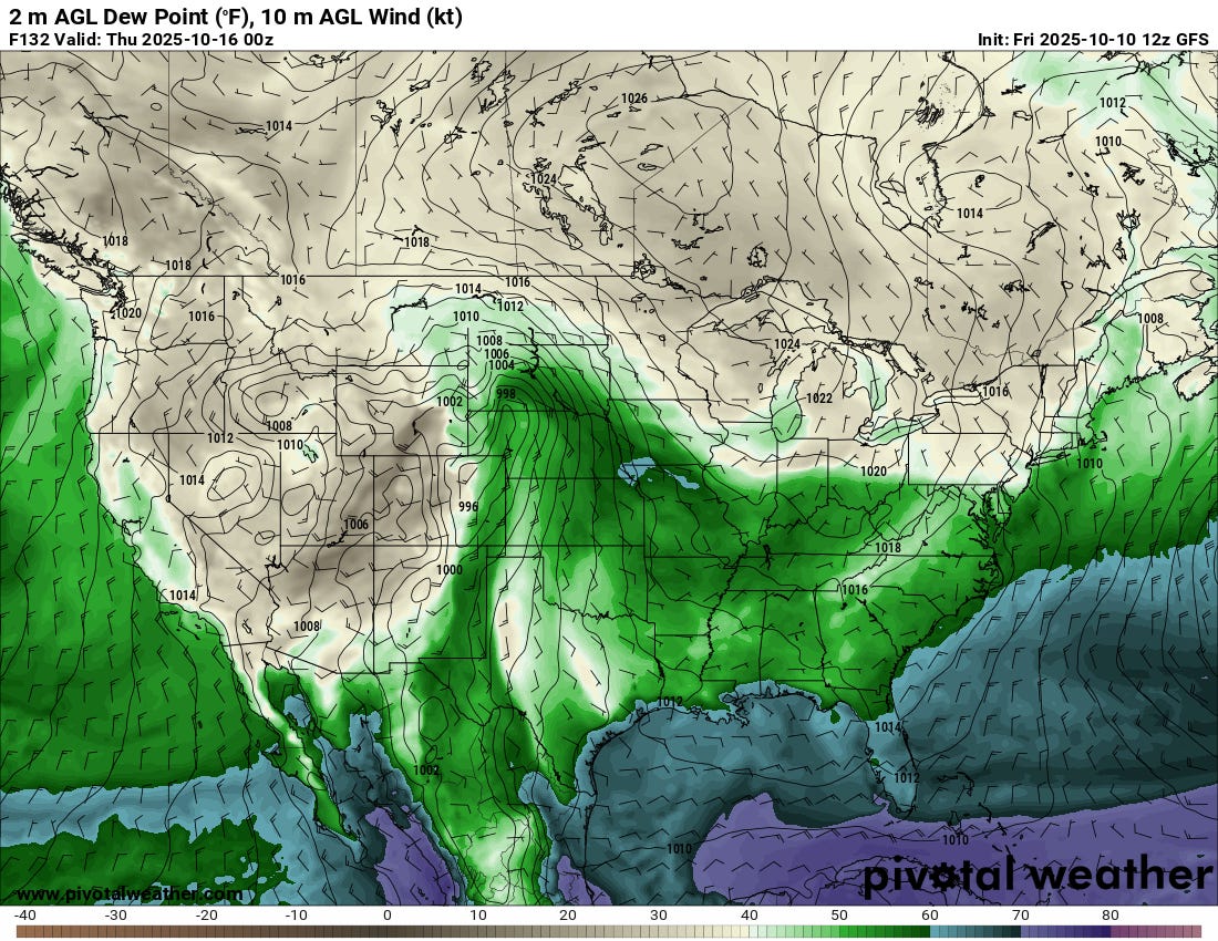
The east/northeast surface flow in the Gulf will limit the overall quality of moisture, but I am anticipating a pretty large threat area this next week, depending on the low track. There will be a risk in the Central/Northern Plains amidst 50 dewpoints, as well as further south in New Mexico and even SE Colorado, where strong flow aloft will mix with an upslope component to create an environment favorable for severe storms.
This is not an ideal setup, though, with such poor quality moisture, but it is somewhat fortunate if the moisture can stay anchored closer to the Sangre De Cristos over the higher terrain. Higher terrain means you need less moisture to make interesting things happen.
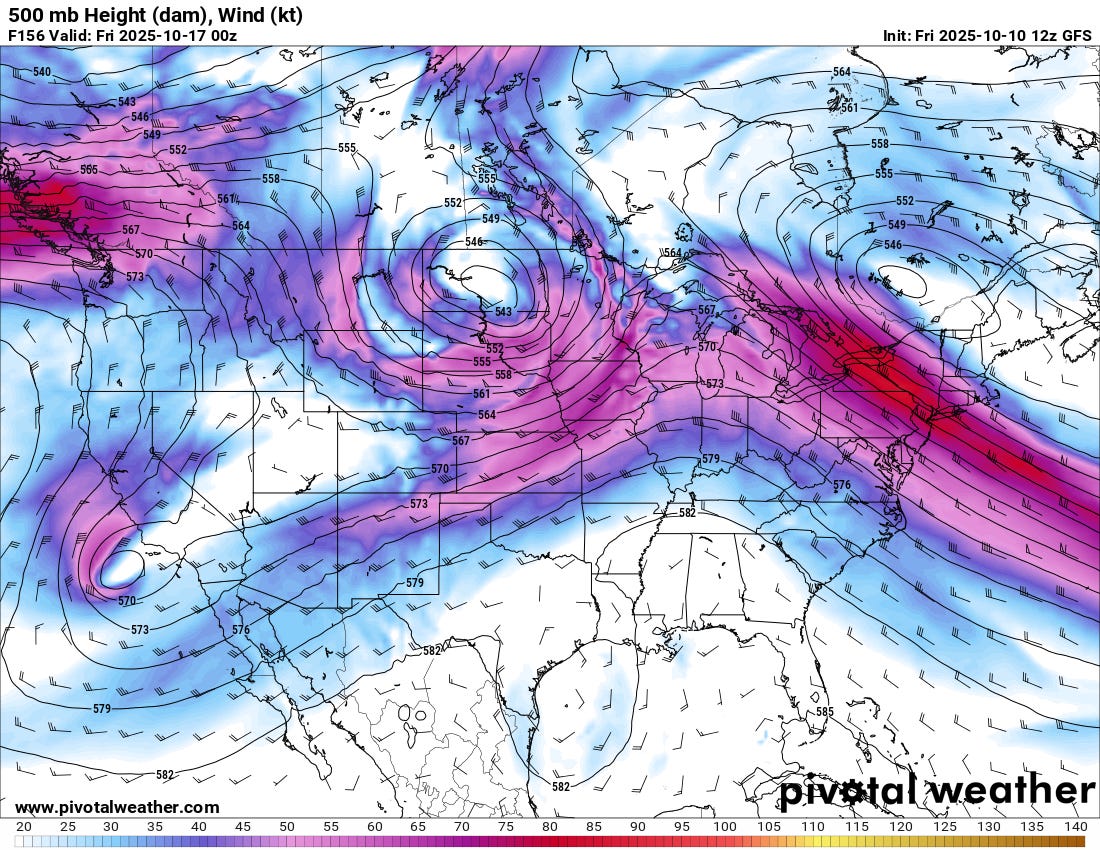
As the week goes on, SW flow will remain as the low shifts north and east. The ridge over the SE US will have weakened substantially, with cooler/more unsettled weather for the central U.S.
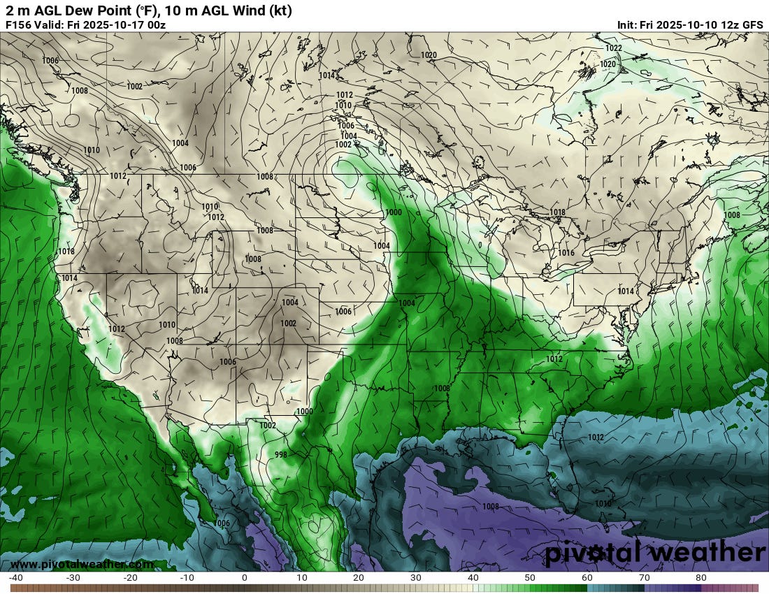
Moisture will remain an issue, and as the dryline shifts east, you can bet a few strong to severe storms will form in an environment that favors high-based cells. However, I’m not as keen on the chances as the week goes on and the low occludes to the north.
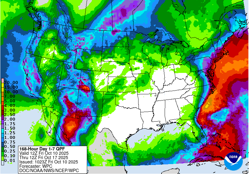
The WPC is fairly bullish, forecasting rainfall totals over the Southwest, with some additional storm activity stretching into the Plains. Overall, I think we’ll need another system to possibly reset the pattern in the Gulf to draw a richer/more widespread warm sector north.
The Euro evolves the pattern differently than the GFS, in some ways very meaningfully so, with richer moisture making its way northwards by the end of the month. That’s the solution I would actually bet on for some severe weather chances on or after the 20th of this month that are more robust in nature. But that’s also a bit far out for me to get too specific on just yet.
Long-Long Term
And a quick note on the long-term forecast: overall, we’re seeing continued signs of a warmer-than-typical autumn, which will likely lead to an extended fall season into November this year. The pattern is fairly dry and resembles a La Niña in a few ways, but a notable system or two will probably sweep through, bringing severe weather chances in the cooler season months. We’ll be watching for that as well.