

🌪️ Our first tornado risk of the year is here!
I guess its time to talk severe weather!

Our first tornado risk of the year on the Plains is arriving today, but that risk is extremely low. It’s the type of risk that I’d classify as non-zero but not likely. Still, there will be a lot of storms around, and hail seems a good bet. Let’s dive in.

Today’s four-panel risk area outline from the Storm Prediction Center.
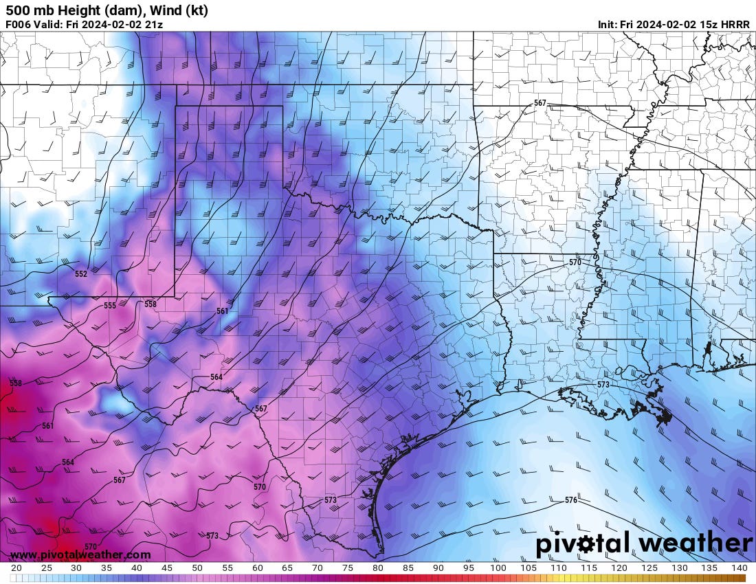
Aloft, winds in the mid-levels of the jet stream will increase throughout the day in response to the approaching upper-level storm system.
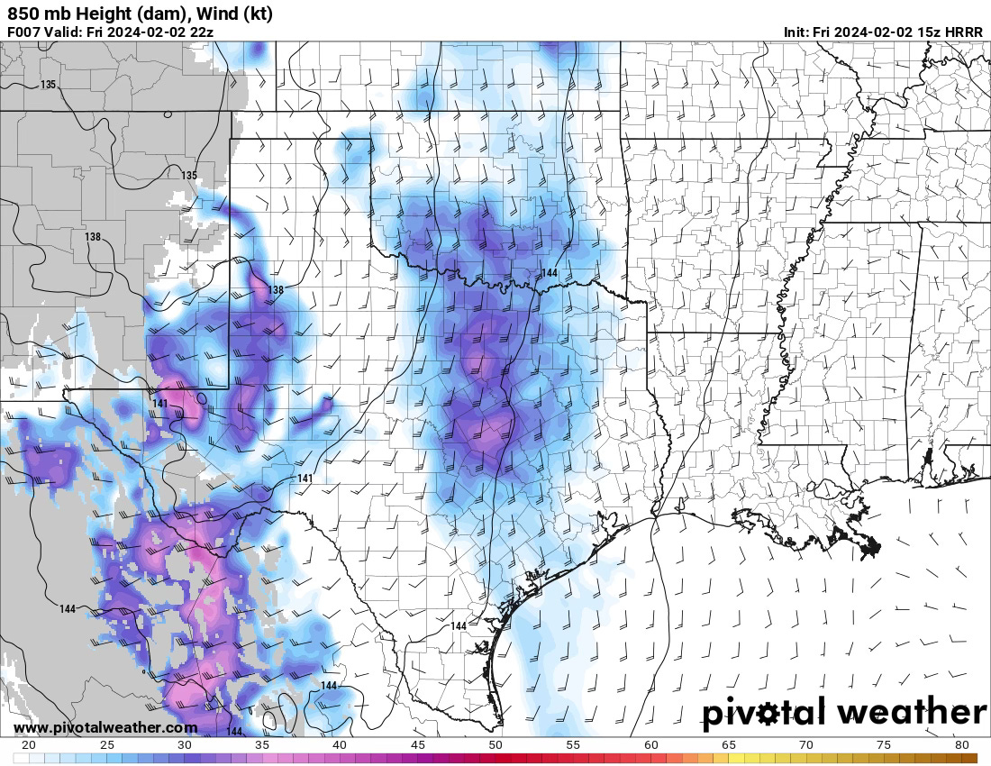
In the low levels, the winds at 850mb are not particularly strong by early evening, but they could be enough to get a low-level mesocyclone going if a few things go a storm’s way.

Low-level instability won’t be that robust down in Texas, except for a narrow zone in the vicinity of the dryline. Still, further north, there will be a more expansive zone for storms to operate within.
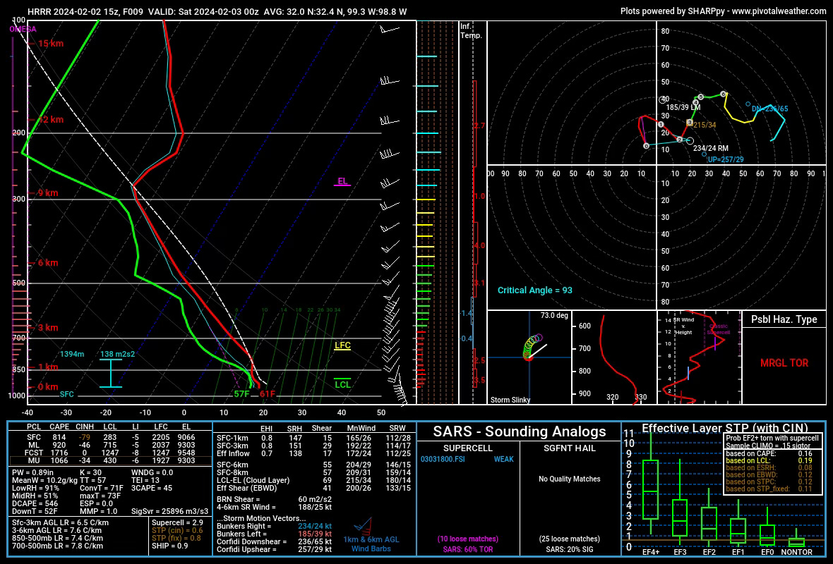
The initial environment down in Texas will be characterized by some capping remaining in the lower levels, which may indicate storms will tend to be more elevated into the evening hours. Due to the excessive amount of lift, getting storms is not an issue. Getting surface-based storms might be. Regardless, this is a sounding that’d support some large hail with organized storms.
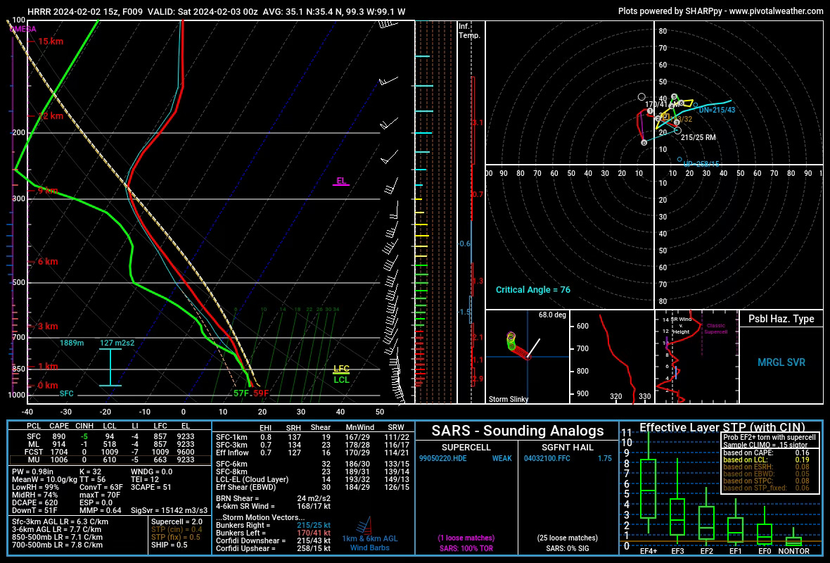
Further north, the surface layer will likely be cooler, but the overall thermodynamic environment will be better for surface-based storms. Capping will be more limited and lift will still be quite plentiful. The Shear could be more impressive (0-6km bulk shear of 32 kts). That in the face of low instability may mean that storms take a while to get going and organized. But large hail and a very low tornado chance will exist with these smaller storms.
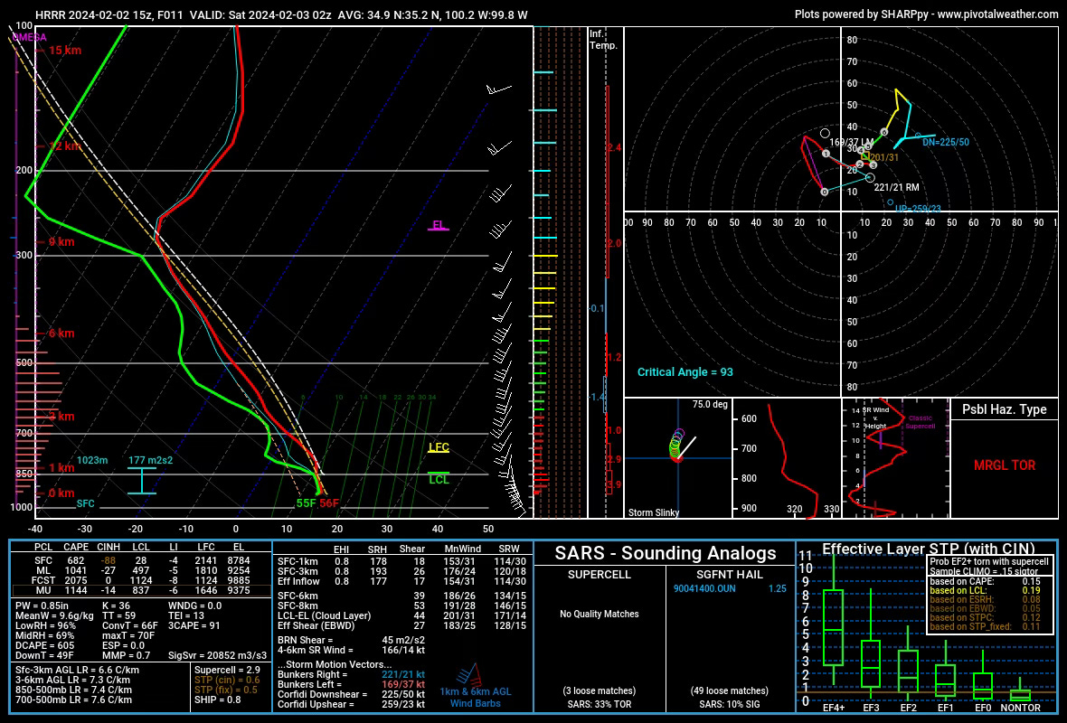
As you’d expect, the low-level winds increase in the evening/overnight hours, but the surface layer should cool with increasing capping aloft. This will lead to increasingly elevated storms with a large hail threat.
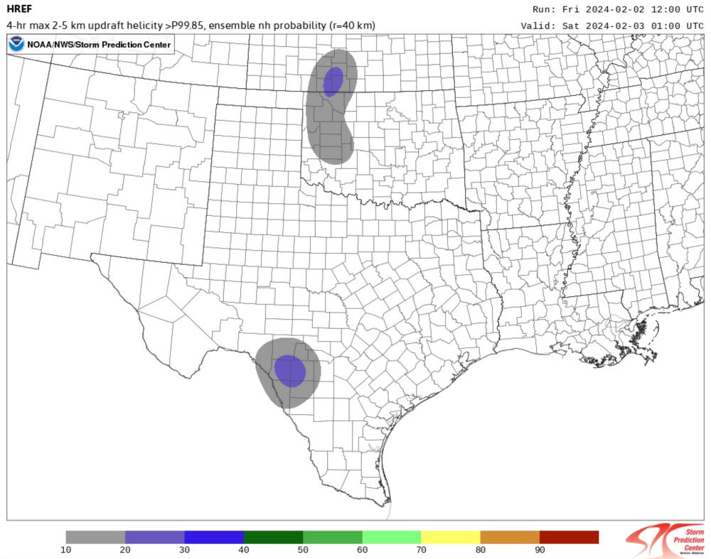
For its part, the HREF is not that impressed with today’s overall supercell risk.
The Bottom Line
Storms look certain today, and some severe weather also seems inevitable. I don’t know if this type of setup results in many storm reports, but it will likely be a day when you have a watch and some warnings out.
The tornado risk appears very low, and I’m most curious about Western Oklahoma in that regard this afternoon.
Overall, it’s nothing we’ve not seen before. But still, it’s our first risk of the year!
LIMITED SPACE - CHASE WITH US THIS YEAR!
We have an open seat for our May 28-31 storm chasing workshop! If you are interested in joining us on the chase this year, check out the link below.