

Monsoon Season Outlook
It’s time to fire up desert thunder…

My spring supercell storm season is officially over, and while that is always a bittersweet feeling, I always have monsoon season to tide me over for a few months — and the occasional summer supercell off of the front ranges of the Rockies.
Here’s my official forecast (of sorts) for the upcoming monsoon season:
The spoiler version of the video (short-version too) is that I am pretty happy with what I’m seeing in terms of having a solid season with some active bursts. In fact, we just went through one here in New Mexico with us getting nearly 1” of rain at the house. That’s a big time rain in the Land of Enchantment!
A Few Pics From This Year
We’re already showing off a lot of pics from this past season, you should follow us on Instagram if you haven’t already!
But if you haven’t, here’s a few we’ve shared on there but also a couple that are exclusive first releases to our subscribers!
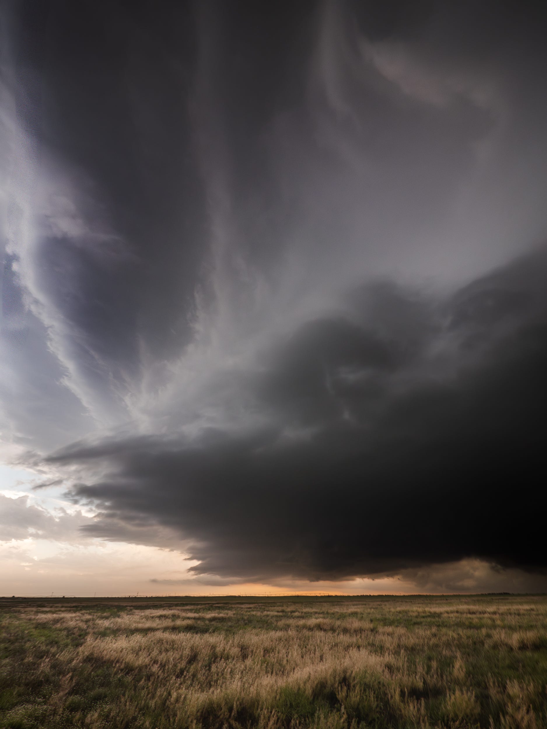
A towering supercell approaches us near Olton, Texas.
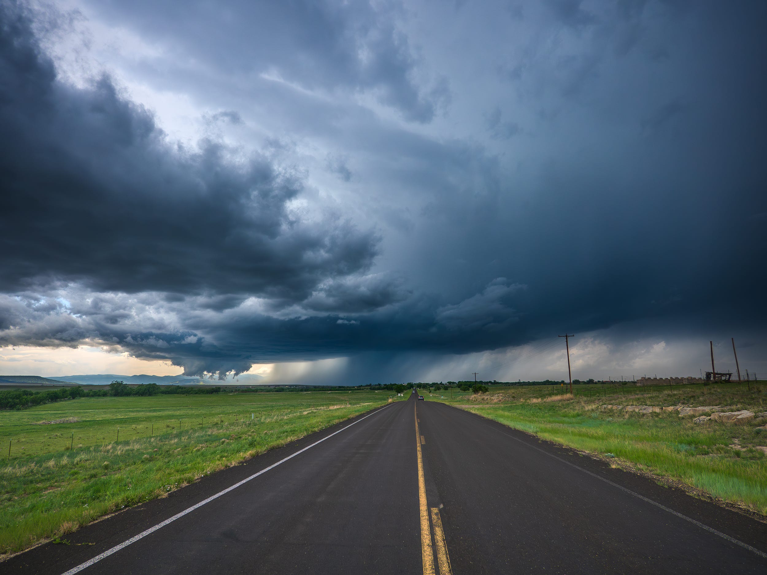
Looking down the highway at a supercell with a ground-scraping wall cloud near Springer, New Mexico.
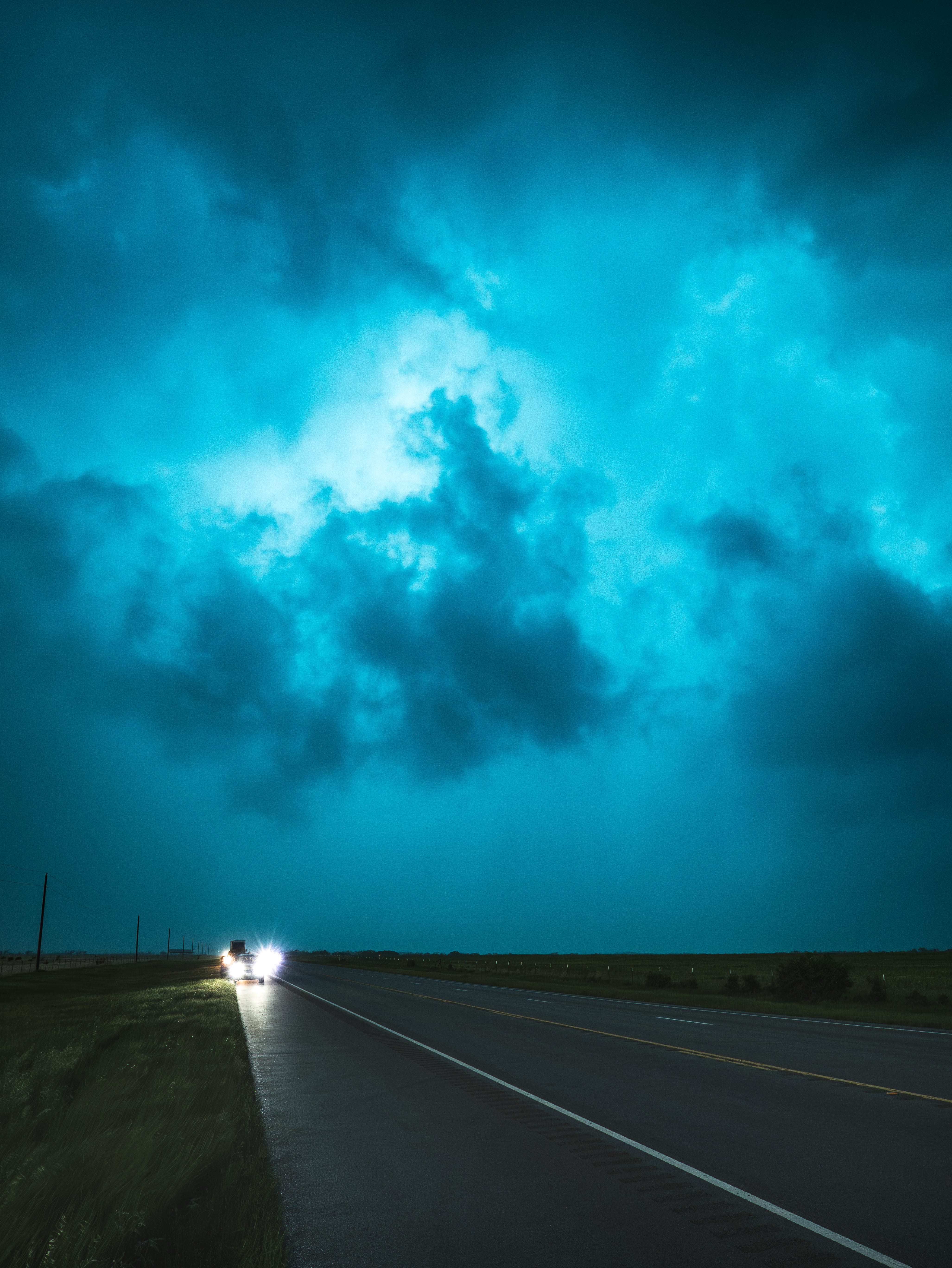
Staring into the core of an HP supercell near Benjamin, Texas that was in the process of producing a rain-wrapped tornado.

A supercell approaching South Plains, Texas — this storm produced an extremely photogenic anticyclonic tornado just minutes later.
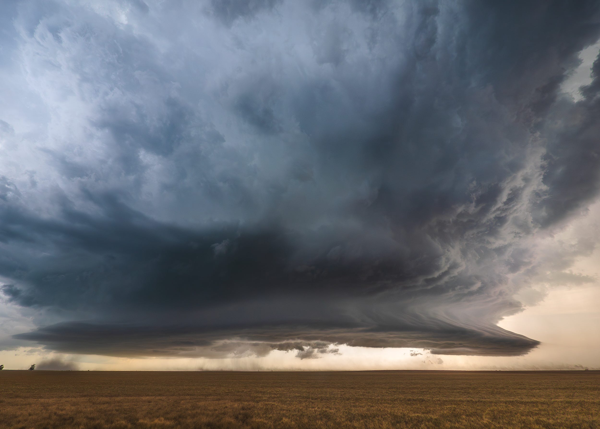
A sculpted out base of a supercell just outside of Hardesty, Oklahoma. This storm was struggling with ingesting surface-based air parcels or otherwise we would have probably witnessed many tornadoes out of it as it moved SE through the Panhandles.
Coming up this year…education!
With the primary storm chase season in the rearview mirror, and I am having trouble processing that still, production season is here! That means we have a whole lot of videos to produce to teach, to show off, and to show our explorations with you.
If you have specific weather, storm chasing, or photography questions, please ask them in the chat! This is the best time to sway us in terms of what videos we make!
Have a safe, happy, and fun-filled summer!