

☝️ Lots of Severe Weather Reports Possible Today
The threat area is centered over Texas, with large hail and damaging winds the main threats.

Today isn’t a huge day on the surface, but a couple of supercells will likely merge with a growing cluster as a linear complex tonight and sweep south and east, possibly right across the DFW metroplex. Large hail will be the biggest threat initially, but damaging winds and a tornado or two could become threats with time overnight.

Only very modest MLCAPE will make its way northwards today thanks to pretty low-end mositure values for severe weather this time of year. The wind shear will be rather weak initially, with 0-6km bulk shear coming in below 35kt, which means supercells are going to struggle to take shape for a bit.
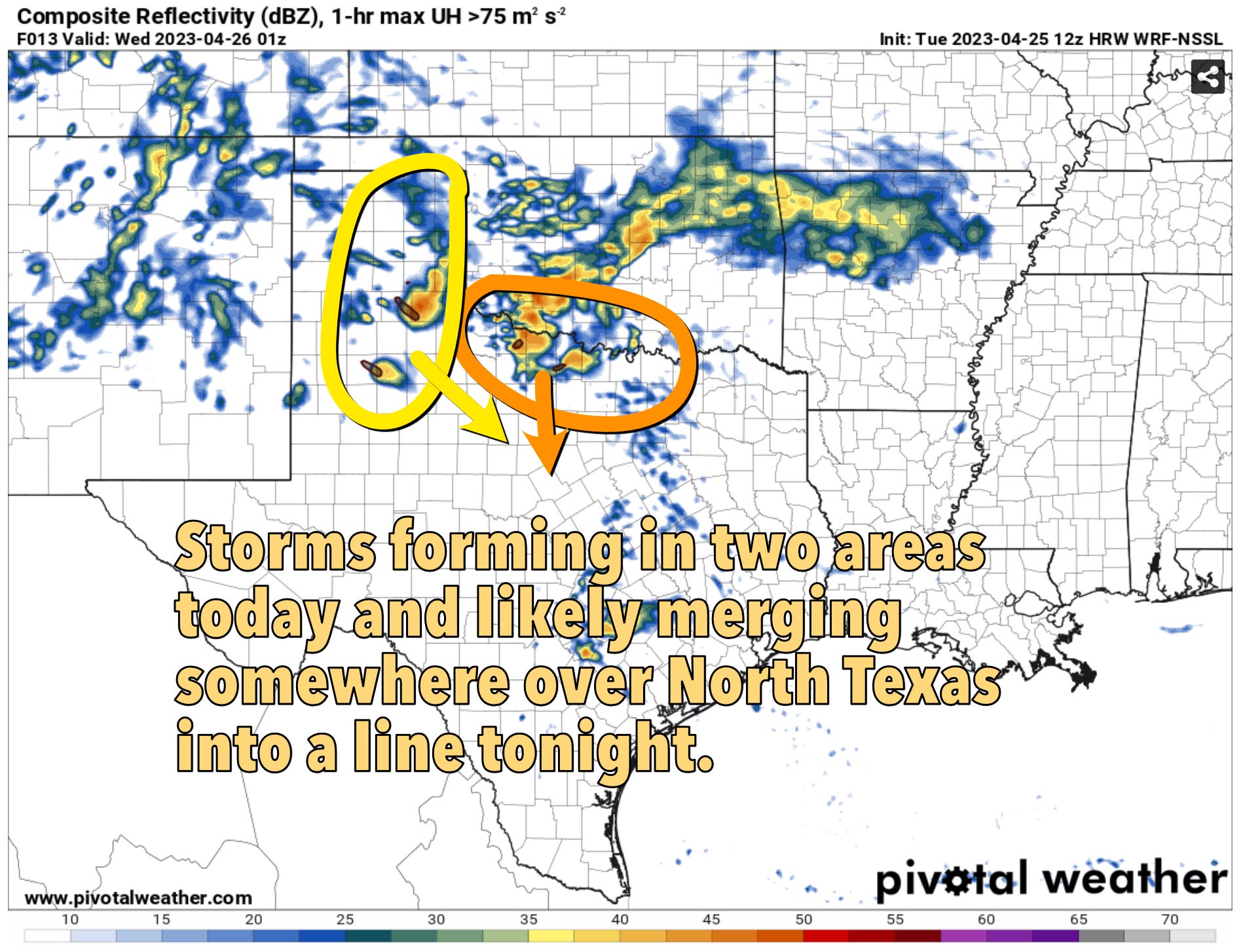
Most of the CAMs this morning show two areas of robust storm formation. One along/north of a warm front on the Red River in Northern Texas, another in the Texas Panhandle. The cells in the Panhandle will be the ones most likely to evolve into a supercell or two. I think storms will take a bit to get going out there, but eventually a robust enough updraft will likely turn the storm right enough to increase the wind shear to a point supercells become more likely despite seemingly marginal wind shear numbers.

With time, the supercells from the west and the messy cluster from the north will likely merge into a progressive line overnight. This will effectively send the warm front back south as a cold front to set up tomorrow’s severe weather event.

Initial wind shear values are very poor if you are looking for robust supercells. While the 0-6km bulk shear numbers are 39, the overall SRH values leave much to be desired. If you do get supercells, they likely wouldn’t be that impressive initially.

In time, there will be more curvature introduced into the hodograph towards sunset. This will make supercells a bit more robust with prehaps a bit of solid structure nearer to sunset. However, the cooler surface temperatures and weak instability may modulate the structure show a bit for storm chasers.
The Bottom Line
Storms will form this afternoon and we won’t have a period without storms for at least 36-48 hours after that in the Central/Southern Plains. Today’s risk is low, but some hail could happen early before a damaging wind threat becomes more dominant after dark. A tornado or two is certainly possible, setups find weird ways to make that stuff happen this time of year — but I’m not fired up about that potential whatsoever.
I suspect this is the start of a two-day stretch with lots of severe weather, perhaps some notable large hail/damaging wind reports, but very low quality storm chasing (for our purposes). But this author has been wrong many times before!