

Looking ahead at the rest of May
Will we finish as active as we started?

Phew! That run from the end of April into Early May felt relentless in terms of severe weather threats and tornadoes — even though we thankfully saw the overall number of reports stay on the lower side despite the high-end outlooks issued several days. This entire run has resulted in us entering May above normal for tornadoes on the year for the first time in awhile.
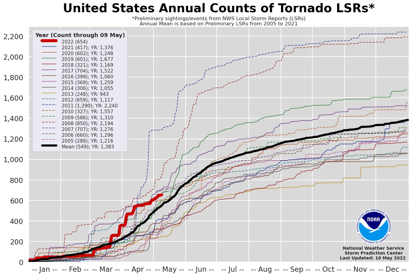
With the mid-late May period being the historically most active period for tornadoes, and the period where many vacationing storm chasers plan their trips, will we see the climatological peak be busy? Read on to find out.
The Pattern Rests
The relentless troughing pattern we’ve grown used to is going to give way to a much more stale pattern over the country, with a low pressure system centered over the western U.S. becoming blocked and lifting north over the coming days. A retrograding low in the Gulf will limit moisture quality over the middle of the country this next week, resulting in a pretty meager environment by May standards for severe weather.
Thereafter, ridging will amplify over the southern U.S. with the jet stream lifting north.
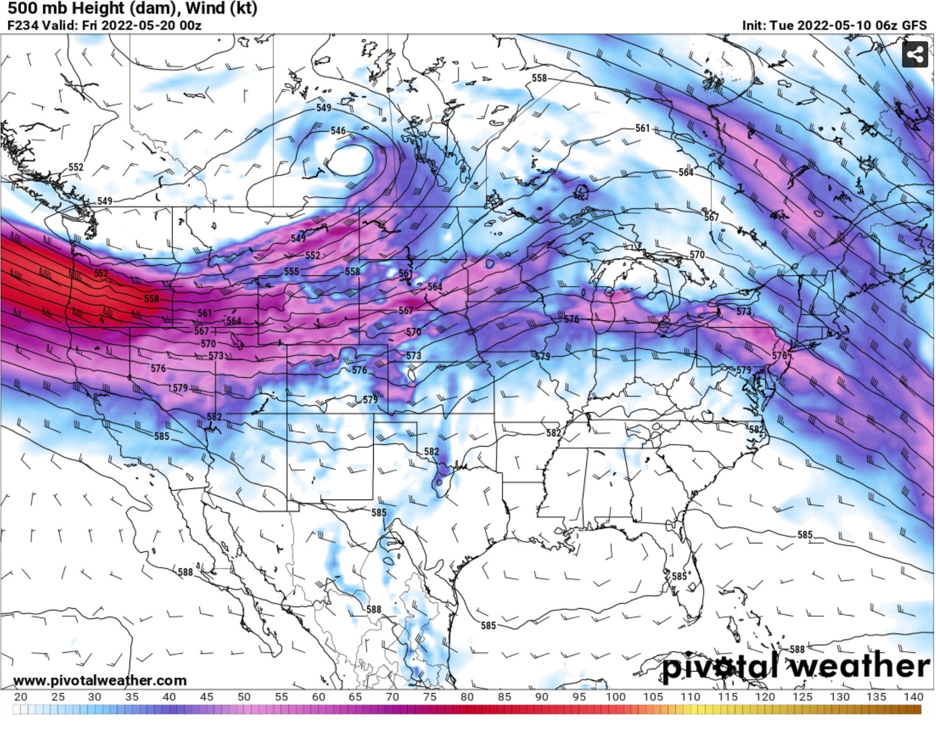
Overall, operational models and ensembles are in pretty strong agreement with this evolution, which will keep the main jet stream energy north over the central and northern Plains. There will still be enough energy in this to drive down fronts over the Plains which will result in a warm sector displaced from the jet stream for a time.
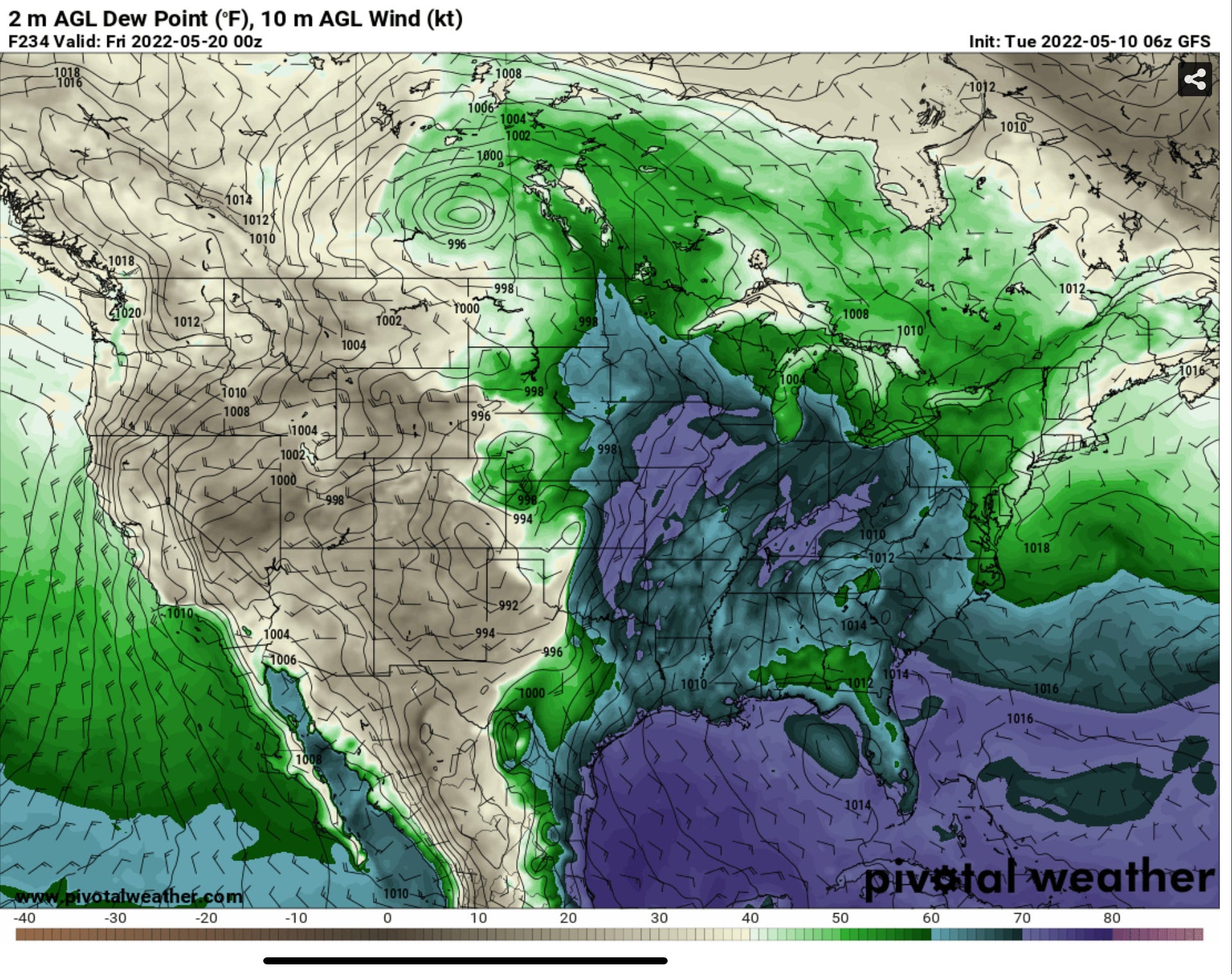
Wherever this flow can meet up with moisture, there will certainly be chances of severe weather given the time of the year — but this is actually a setup that favors very subtle and not so obvious severe weather events well in advance, which is in direct contrast to the pattern we just left where periods of severe weather were pretty obvious 10 and even more days out.
What to look for
Currently, climo models mixed with operational and ensembles all point to a relative lull in big-time severe weather activity for the next week or two. There will still be some lower-end chances, like with today’s likely severe thunderstorm wind event in the Texas Panhandle today. Still, the lift, jet stream, and moisture won’t fully line up through May 20th or so it appears.
Thereafter, there will probably be a slow march to a meet up somewhere over the Central Plains back to the Southern High Plains for some severe weather chances the back 1/3 of May into the first week of June. The pattern overall looks slower/more subtle than it did the first half of storm season as we move into the back half of May and into June so some risks won’t be as obvious until you get to within 48 hours or so.
So ready for the spring time and the storms that come with it!