

Large Hail, Non-Zero Tornado Chance in SC US Tomorrow
Threat starts as soon as the early, early morning hours and persists through the day!

Here we are, the first severe weather risk of 2026 for the region. That’s my fancy intro, let’s get into the forecast.
1. Low-End Threat of Severe Storms Tomorrow
Storms will form overnight and into tomorrow morning, with large hail the main threat from elevated cells. As the day goes on, renewed or continued storm development will occur further east, with a very low tornado risk.
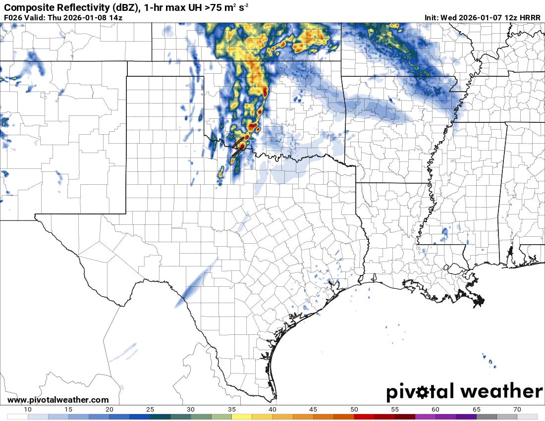
The initial storms may form as early as 3 a.m. across portions of Central/West Texas, then race to the northeast into Oklahoma and even Kansas. These initial storms will pose a large hail threat mainly, as they should be rooted above the surface layer, perhaps by a good bit.
By afternoon, storms will be moving to the northeast into E. Oklahoma, Arkansas, and Missouri. These cells may weaken through the afternoon before a new round begins later. Still, these cells will likely pose a severe weather risk into the early afternoon, with large hail and perhaps damaging winds as threats.
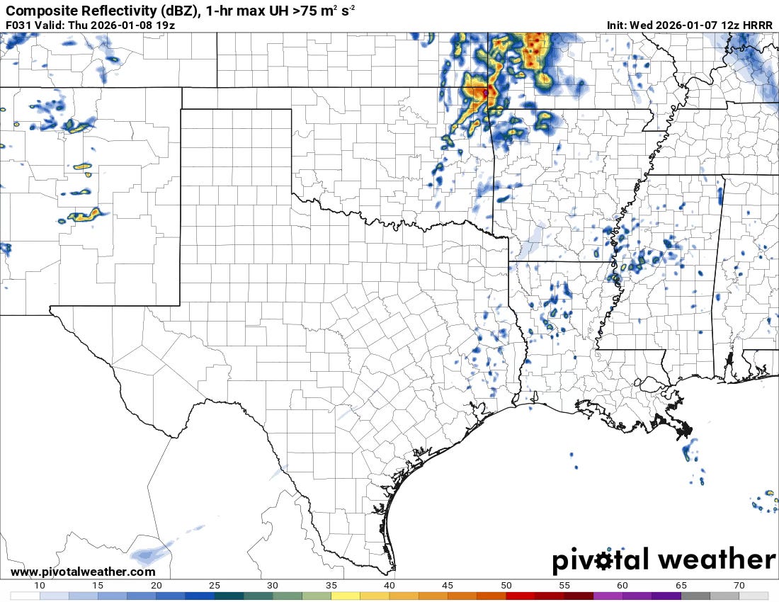
By tomorrow, late in the afternoon or early evening, renewed storm development should begin anew. Depending on how much sunshine this region gets, these cells could be surface-based cells in a strongly sheared environment. The 0-1km SRH values of 350 m2/s2 or more will be more than capable of tornadic development if a storm can get firmly rooted in the surface layer.
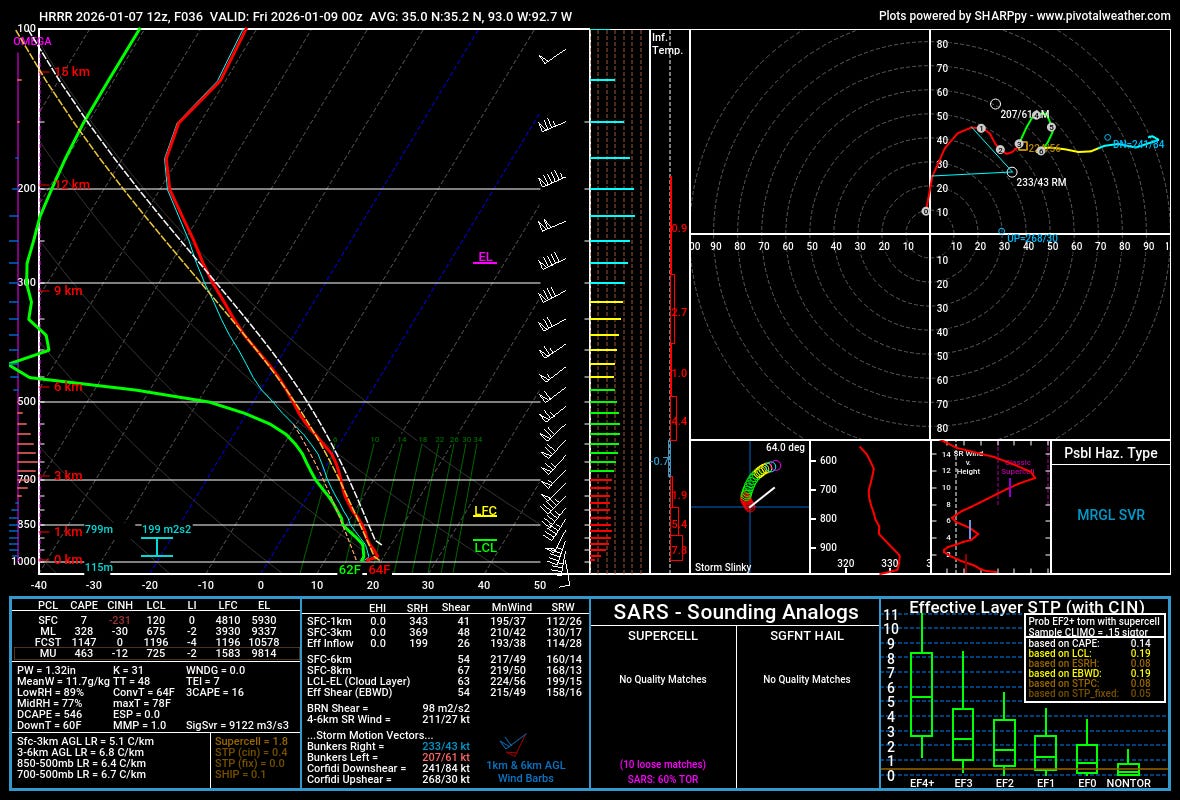
A close look at the HRRR soundings shows a weakly unstable environment, which is a significant limiter on tomorrow’s potential. MLCAPE around or below 500 J/kg is generally unfavorable. Other models show higher instability, which is something to watch, since the wind shear across all models is very favorable for severe weather (not that unusual this time of year).
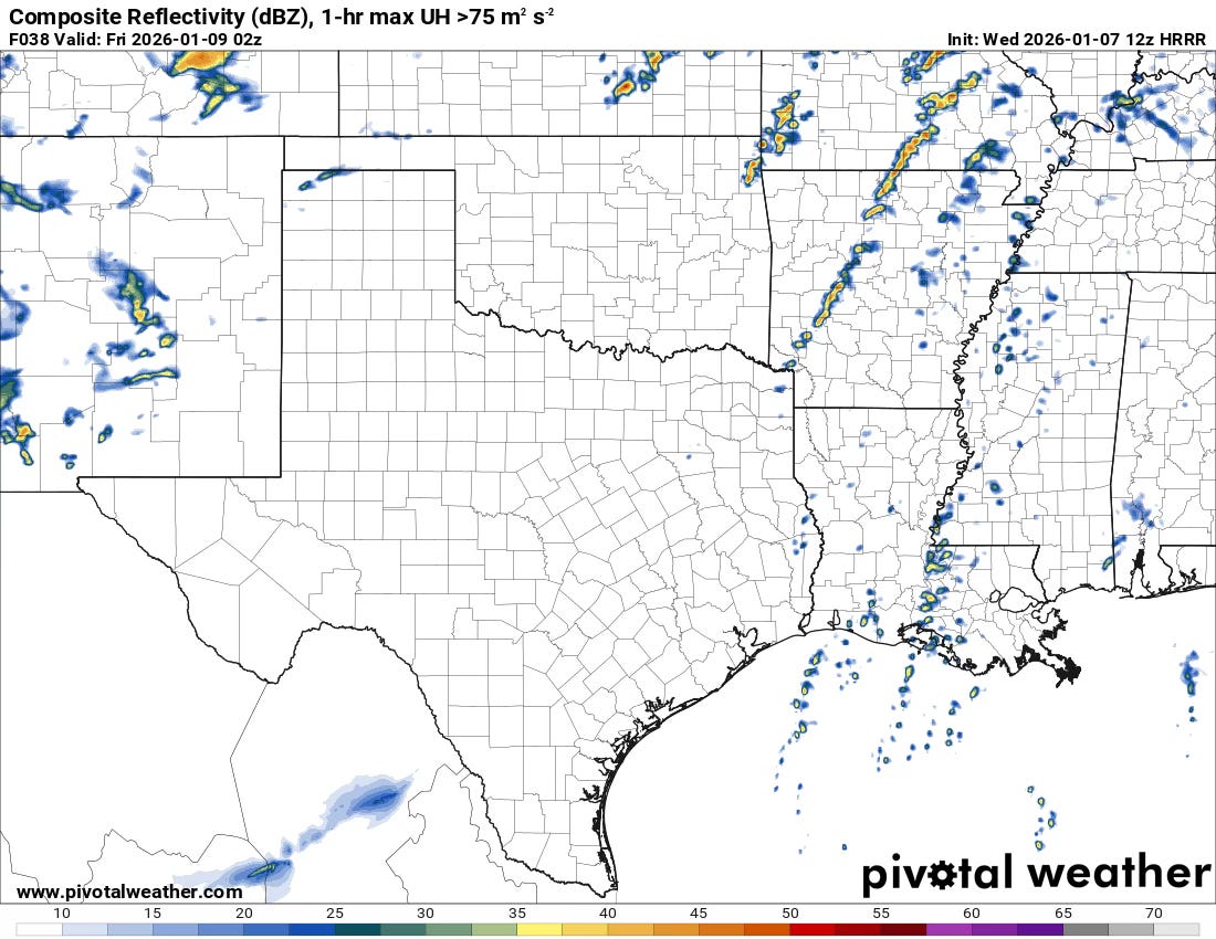
Overall, I suspect a tornado window, if there is one, exists tomorrow around/after sunset. Though it is a very small, very low risk window at this point (only a 2% risk on the SPC).

Otherwise, some areas will be seeing some of their first rainfalls in quite a while (or snow if you are in New Mexico/Colorado) — but the overall precipitation map has trended much drier with time on most models over the Plains.
What models were you using? HRRR?