

Is Erin Coming to the U.S.?
And how storm chasers read wind direction to know what a storm is going to do next...

Tropical Storm Erin is sitting out in the Atlantic and is days away from any meaningful impacts to land, if it has any.
But that hasn’t stopped hype pages on social media from going all in on major impacts for the U.S. as they do with just about every storm. *Sigh*
We’ve discussed this on our social media profiles, but it is another reminder to work hard to have a good set of information on storms as we move further into hurricane season. The National Hurricane Center should always be your first stop.
Erin, Currently
Right now, Erin is a tropical storm with 45mph winds and a low center at 1006mb. It’s rather weak as it meanders slowly over a cooler patch of waters in the Atlantic.
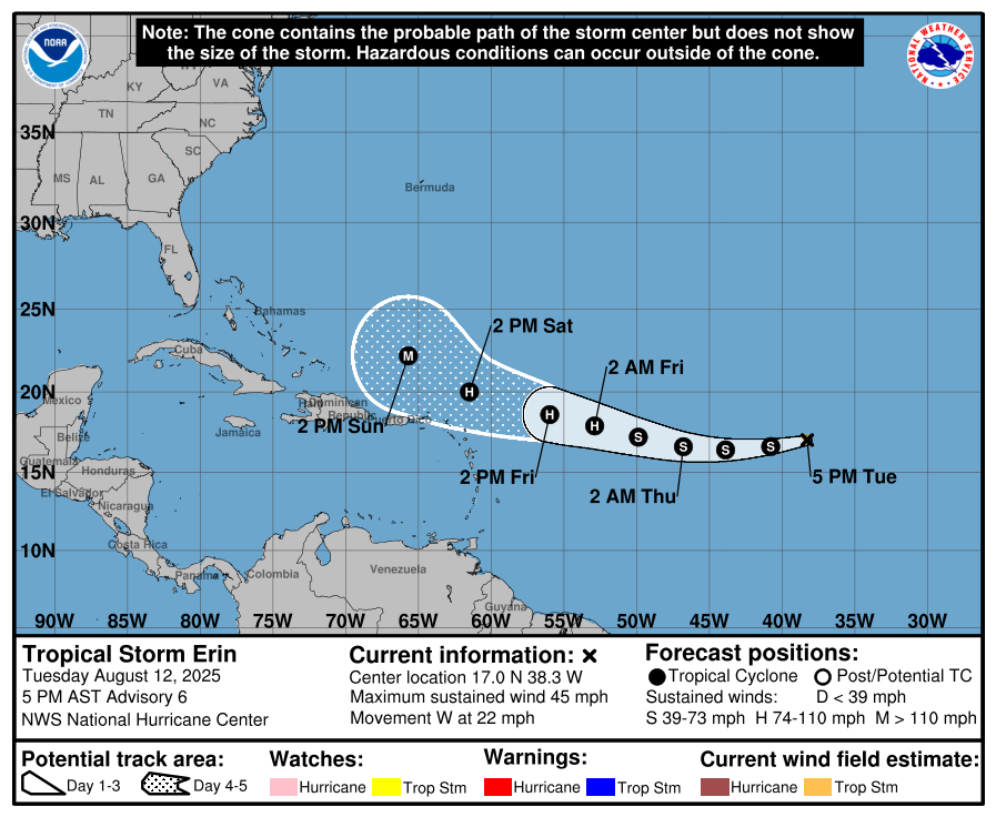
The storm should strengthen into the weekend with it becoming a major hurricane by Sunday.
The map above does look concerning (and why some pages are really capitalizing on the clickbait), but that is because it runs to right about when the storm should make a rather sharp northerly turn. The question of when that happens is open, for now.
Some Technical Details
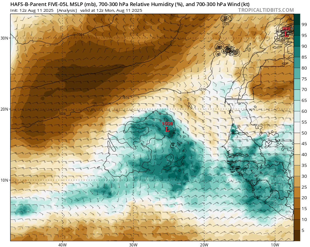
Right now, there’s a swath of dry air north and west of Erin, which is going to impact its ability to strengthen if it wraps into the inner circulation. With the cooler waters delaying things today and dry air possibly doing that tomorrow, Erin may drive towards the southernmost portion of the cone of uncertainty in the coming days.
Generally speaking, the storm should move west towards the Leeward islands by this weekend, slowly strengthening — especially as we move into the latter portions of this week.
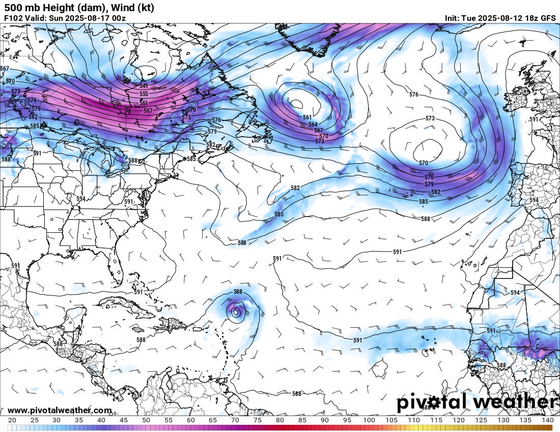
By this weekend, Erin will be positioned between two ridges with a trough over eastern Canada/New England. All of this in the upper levels will help bring Erin northward at some point, starting late this weekend.
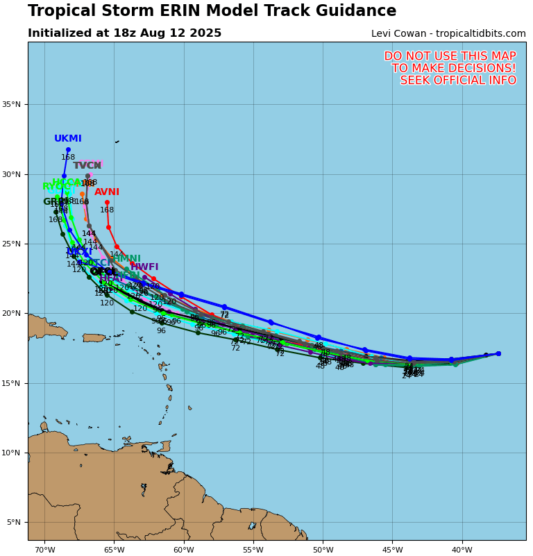
Models have a good grasp on things right now, it seems, with a tight spread amongst several different suites.
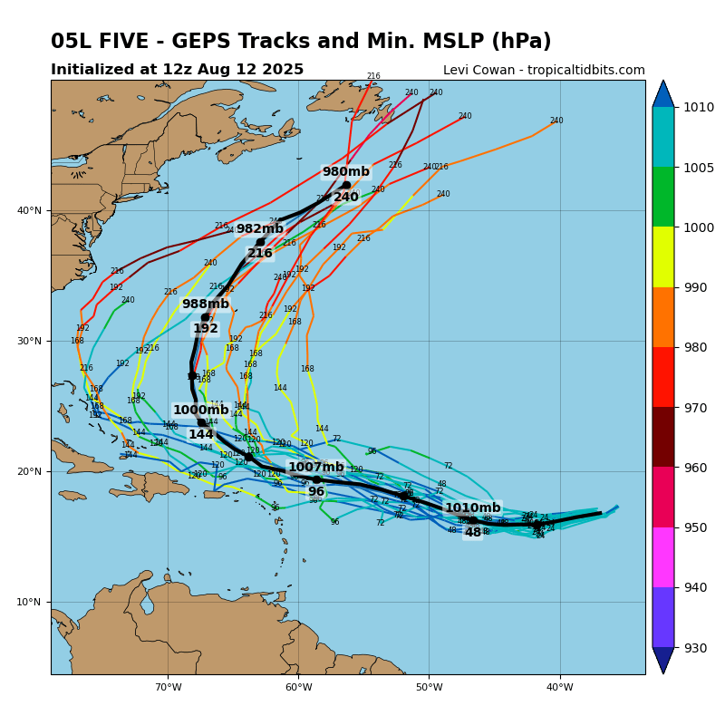
As we expand out with the ensembles over time, you can see the spread does increase on possible outcomes, with a couple of members bringing the storm a little closer to the East Coast before it curves out to sea. While that looks like a lower probability outcome at this time, it’s worth folks keeping an eye on this for a couple of days just to be sure. The data in the coming days will increase certainty and likely (in my opinion) signal this is a fish storm.
The key takeaway is that Erin is going to move west and strengthen into what will likely be a major hurricane by this weekend. It will also curve north around the same time, with the spread being just missing the east coast (less likely) to recurving strongly out to sea with minimal land impacts (more likely).
How Storm Chasers Read Wind Direction
Ever wonder what that wind hitting your face during a storm is telling you?
Learn to read nature's signals with this guide to storm inflow and outflow. Discover how warm wind at your back signals a strengthening storm with tornado potential, while cold wind in your face reveals whether a storm is weakening or finding a dangerous balance.
We'll break down the atmospheric physics behind these processes—from pressure deficits driving inflow to precipitation cooling creating dense outflow. Watch below!