

Heavy Rain + Severe Weather
Get ready for this drought to end in a flood.

A few select people will wake up on Tuesday, possibly after receiving 7 inches of rain. Many will wake up with 3 inches of rain having fallen.
That’s a really intense/unusual heavy rain event over several days! But that those numbers keep appearing in model forecasts, and I tend to believe it being possible.
However, severe weather will also be possible, and in fact, it is already underway. Let’s break down this weekend and early next week.
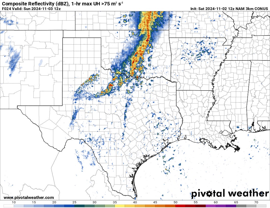
Today: Linear Action, Supercells Maybe
If one were looking for supercells and a tornado risk, today is the day. They will be centered over the far SE corner of New Mexico and far West Texas.

The ongoing storms will continue to lift north and east and sweep across the Southern Plains with renewed development well to the west.

A careful environmental analysis this morning shows strong 0-6km shear across the region by this afternoon, nearing 60 knots. Effective SRH values though, are quite a bit lower on the scale at 125 m2/s2. Moderate instability is in place though, with solid MLCAPE values and 3CAPE values.
Any storms that go in this environment will be supercells before lining out into yet another linear complex tonight. The main threats will be large hail and perhaps a tornado before moving into a damaging wind threat.
Sunday Morning: Another Line
The storms from tonight will push east and spread in coverage, with damaging winds the primary threat as this activity moves east into tomorrow morning and eventually weakens.
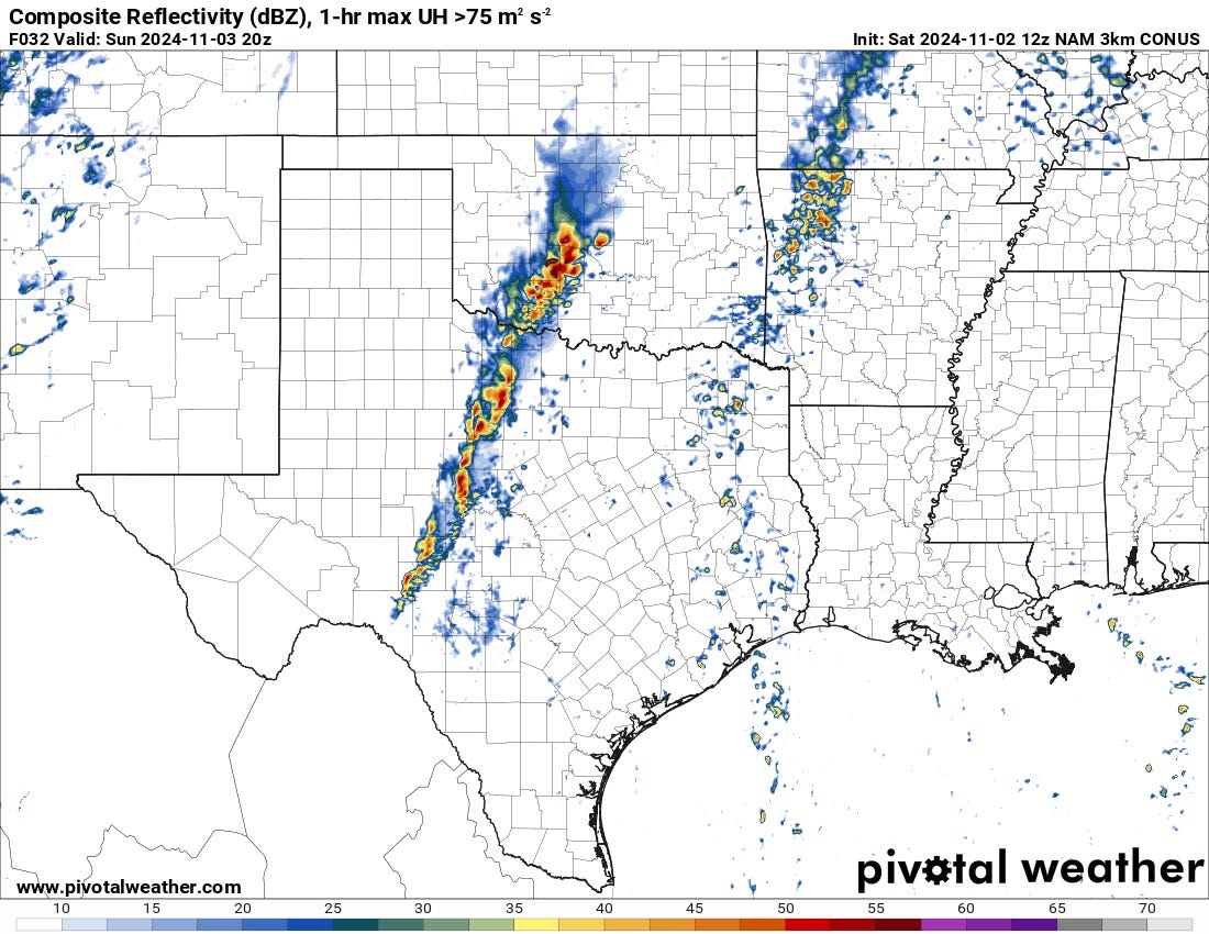
Sunday Afternoon: ANOTHER LINE
Another piece of strong energy will round out from the trough on Sunday afternoon and bring renewed, vigorous storm development over the Southern Plains. There may be a brief window for supercells, but all models quickly develop yet another line of storms. This line will have the capability of damaging winds and a low tornado risk. But I’m not that sold on the latter piece.
Monday: I heard you like lines? Here’s a line with your line
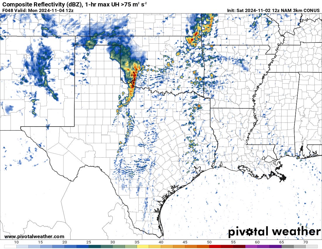
Monday will bring yet another line that develops early as a mistimed piece of energy ejects over the Southern Plains. This complex will expand and strengthen into the afternoon, with damaging winds and a low tornado threat.
Uncertainties: Day to Day Storm Mode
It is possible there will be a day where a line doesn’t form as quickly as it is hard to anticipate stuff since activity one day affects the next. However, strong pieces of energy will eject out with very little capping. This reminds me of the early May run in 2015 where we saw initial supercells give way to linear activity very quickly every day except the 6th.
Flooding Risk: Real

As I said in the intro, several areas are going to have at least an inch of rain, with some localized swaths that are over five inches. It will not be surprising to see a mesonet site record a 10 inch reading somewhere, but definitely some with 5 inches. This will undoubtedly swell creeks and rivers, so many of your farm ponds will be doing good as we head into the driest months of the year.