

Four Days of Increasing Severe Risks
Risks start small but might grow to be pretty big by early next week...

The next four days are a classic case of pattern escalation, where we start with a pretty mild pattern and then the ingredients slowly increase day to day until we end up with a big risk-type day early next week.
Finally, we’re seeing hints of a ‘bigger’ day out of this pattern, which was expected but uncertain about when. Let’s talk about it.
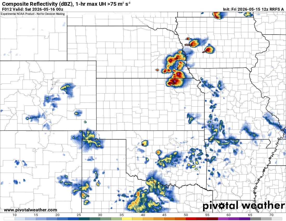
Today
Today, ingredients are pretty low-end across much of the region, with a bit more oomph in the atmosphere up into KS and Iowa. Still, even there, the main risk today will be hail and damaging winds as moisture isn’t quite where it needs to be, and shear is still lower end.
Further south, moisture is very limited, and the overall risk of severe weather is on the lower end. Hail and damaging winds are the main threats north, with damaging winds the dominant threat further south (but hail is a secondary threat).
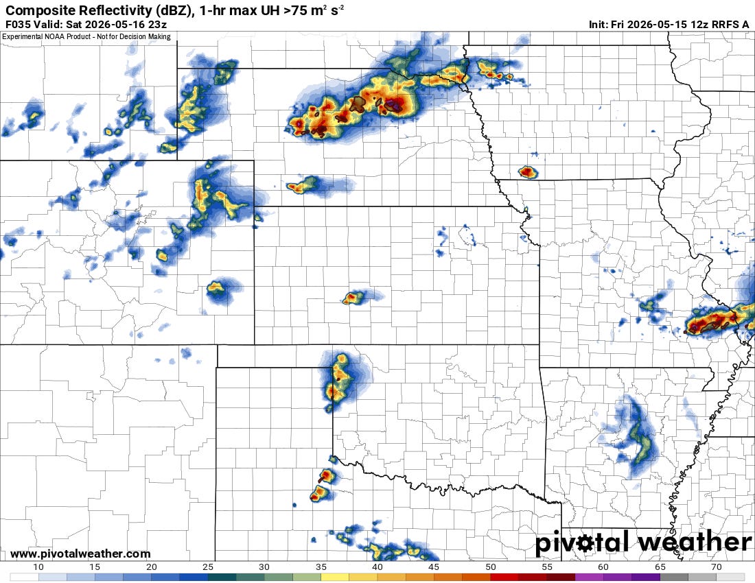
Tomorrow
Tomorrow, the ingredients are just a little more favorable across the board on the Plains. In Nebraska, shear and instability will be enough to support a sustained supercell threat — though high-based most likely. Models are pretty insistent that storms will eventually form into a linear complex tomorrow up that way as the cold pools from the high-based cells merge. A low tornado threat, but mainly hail/damaging winds.
Further south, the tornado threat is very low, but hail and damaging winds will be possible with any storms that can get going along a dryline. High-cloud bases are certain down in OK/TX, as is a stronger cap. Historically, I’ve seen some dynamic storms in those environments for sure, but they tend to struggle in terms of tornadoes because the high bases and capping both make sustaining low-level mesocyclones difficult.
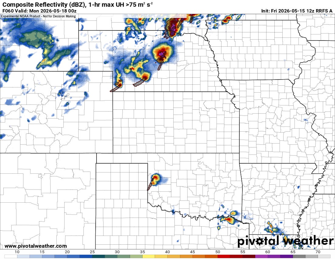
Sunday
The big question for me on Sunday is where will storms form?
The most likely area is up in Nebraska again, but moisture is more limited so bases may initially be higher. Still, I could see a supercell, hail, and tornado threat emerging that way into the evening.
Further south on the dryline in KS and OK, the shear and moisture combos tend to suggest a more classic supercell and tornado threat — lower-end due to capping and storm-coverage uncertainty, but present.
What I think happens is that a few supercells break through the cap in the afternoon hours and persist for 3-5 hours before dissipating into the evening. A classic dryline chase with a small window for a tornado or two and some giant hail.
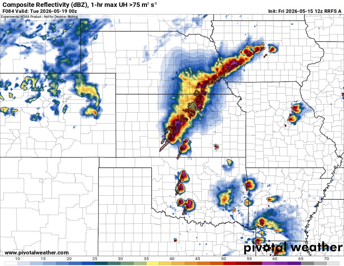
Monday
By Monday, forcing aloft will increase as will shear and moisture.
I’m not going to mince words: pattern recognition tells me a big risk (and big hype) is coming on Monday from Oklahoma to Nebraska/Iowa.
Overall profiles look extremely favorable for supercells and tornadoes on this day. As with any possible ‘big’ day, the questions I have are the details we can’t see at this range.
If I can find some time, I’ll write about Monday more in-depth in this newsletter over the weekend, as well as what I’m seeing beyond Monday. But for now, just circle that day, especially bright, as it’ll probably be a day that demands attention.
If you haven’t done so, be sure to subscribe to us on YouTube — we’re debuting TitanTrack this weekend and into next week, and it’ll represent a brand new way to watch live storm chasing streams.