

Fall Severe Weather Season Update
Severe weather risks the next two days over the middle of the country!

We’ve talked about the upcoming pattern mid-late month for a bit, and it is fully here with severe weather risks expected over the coming couple of days after what was a busy day yesterday!
Let’s take a look.
Today
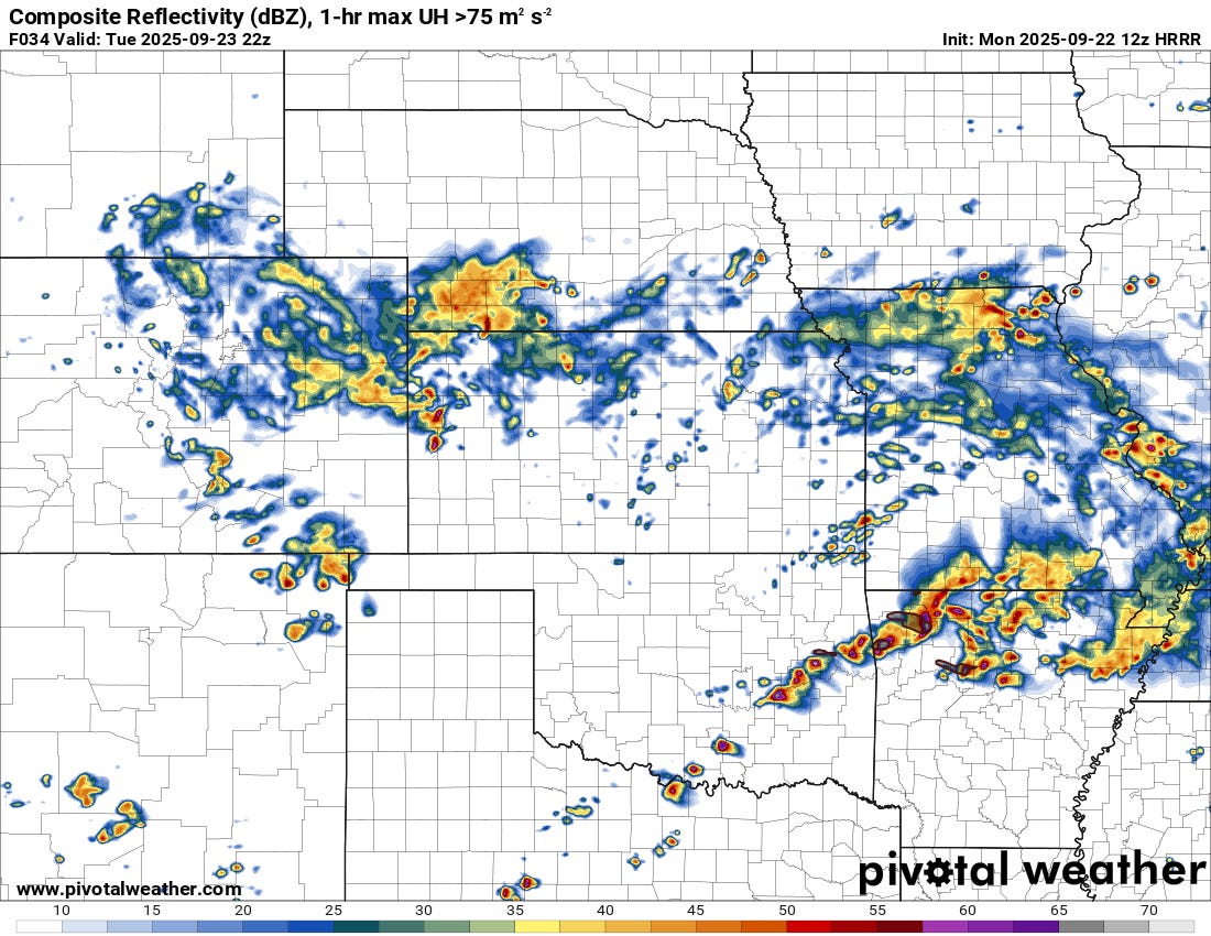
A stout shortwave is located west of the Southern/Central Plains this morning, but should nose into the region near/just after sunset.
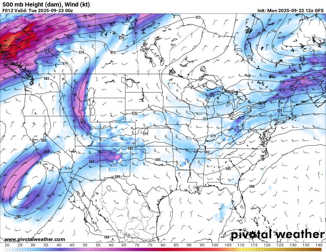
While strong capping should be in place across much of the region through the afternoon, preventing storm development until later, when storms do occur, they should be fairly robust, with large hail and damaging winds possible.
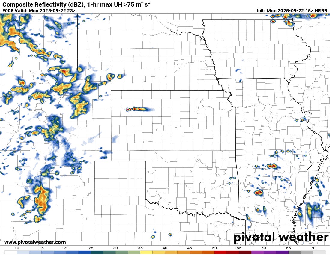
Initial development may take shape across Kansas/NM/CO during the afternoon hours, with a threat of damaging winds and maybe some hail. The real show will begin near/after dark as the lift increases.
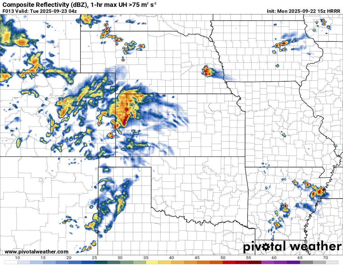
As storms increase in number and intensity, severe weather will become more likely into the overnight hours, with hail/damaging winds the primary threat.
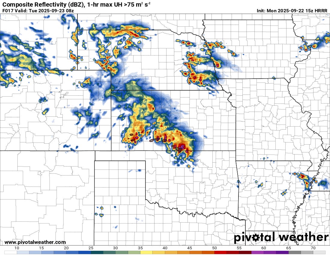
We actually expect the storm threat to last well into the overnight hours and even into tomorrow morning as the main body of lift emerges out over the Plains. These storms will likely be at least partially elevated above the surface layer, so I don’t think tornadoes are a huge threat — but hail will certainly be possible throughout the entirety of the event.
Tomorrow
Tonight’s storms will bleed right into tomorrow’s activity, though the morning hours should see a weakening trend of sorts for activity before things reintensify by mid-afternoon.
Unlike today, we should get robust storm development pretty early in the day, with supercells possible from the get-go along an advancing cold front.
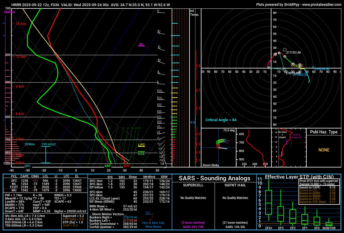
The environment across eastern Oklahoma into Arkansas tomorrow will support an elevated tornado risk, most likely, along with large hail/damaging winds. Effective SRH values of 175+ m2/s2 coupled with strong 0-6km bulk shear values of over 40kt will allow for storm organization and rotation. I have seen some signs of some LCL/LFC separation on soundings in the region, which could mitigate the tornado risk a bit, but I’m not fully sold on that being real or a quirk of models just yet.
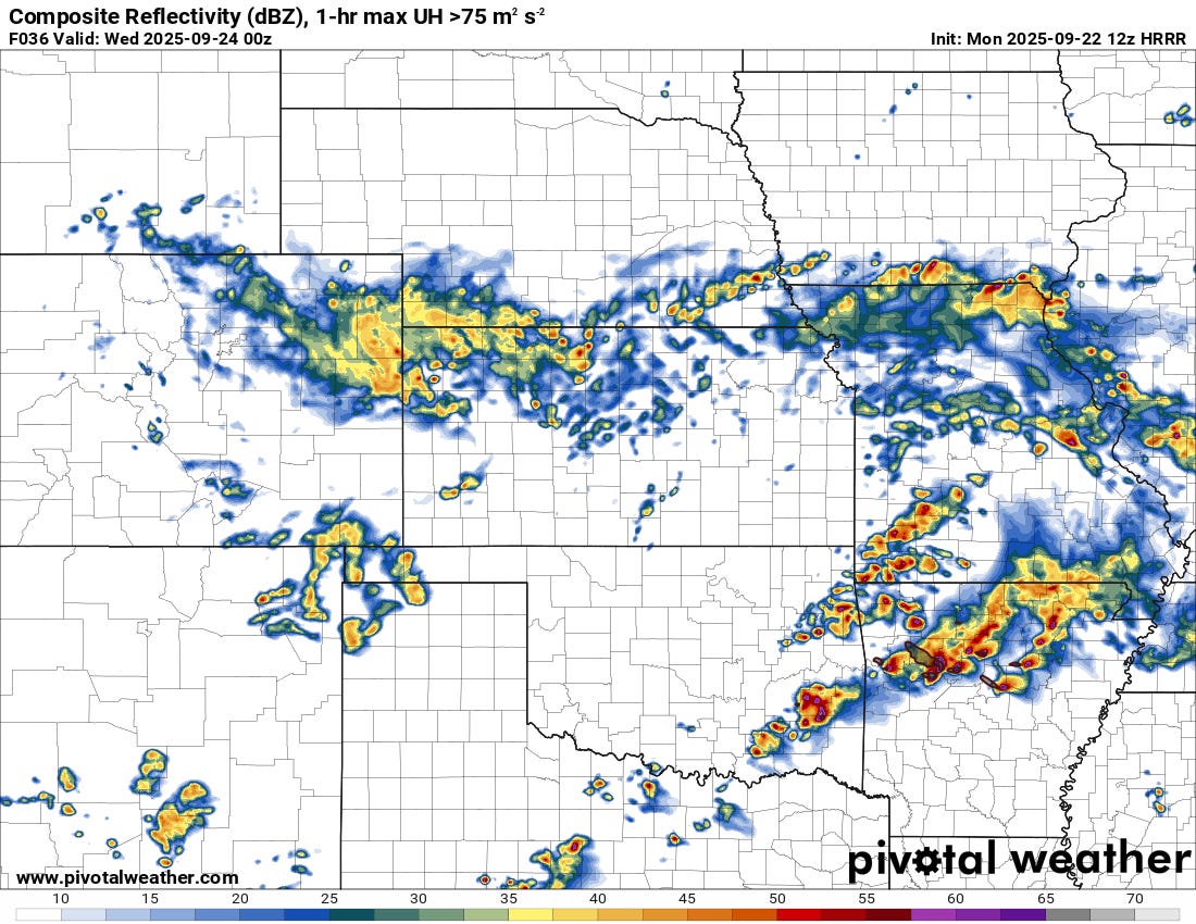
Storms will likely diminish a bit near/after sunset tomorrow, as the main lift exits the region and storms are forced to rely on diurnal cycles a bit more. Still, large hail and damaging winds will be a continued threat into the overnight hours.
Rest of the Week
While the week is starting off red-hot, we likely won’t end it that way. As this system exits, dry northerly flow from the surface into the mid-atmosphere will filter in. Milder weather with limited rain chances is in the offing instead.
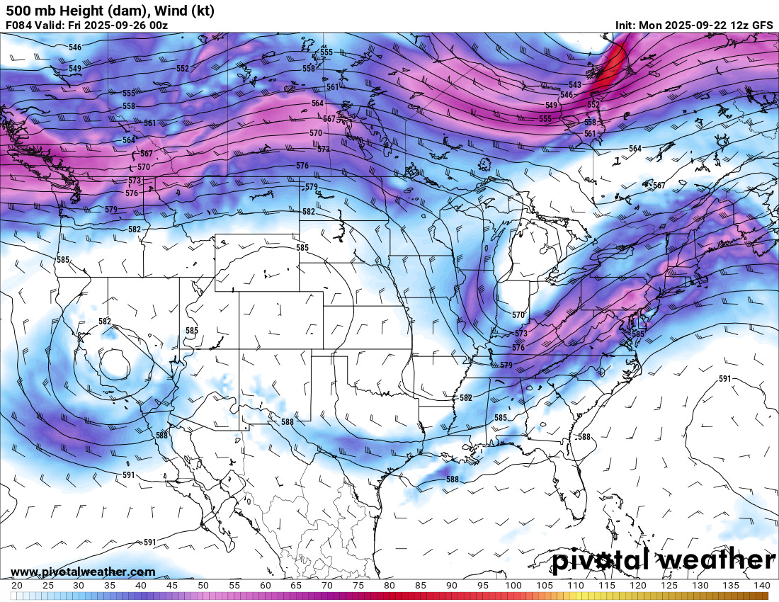
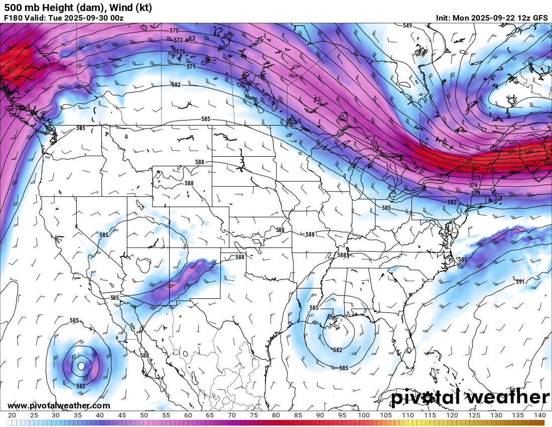
After mid-late week, there’s some disagreement about what that little low over CA does. The GFS operational run this morning cuts it off and keeps it stalled west of the Plains this weekend into next week. That’d likely keep storm chances to a minimum as a ridge builds in.
I will say the combination of tropical moisture with lift may result in a shot of heavy rain and severe weather over parts of West Texas, New Mexico, and Arizona — so that is a solution I’m still mildly interested in. Overall, this ridging pattern with lows stuck underneath it usually doesn’t result in much in terms of active weather for the C/S Plains.
The Euro is slightly different in progressing that low through a drier low-atmosphere. So there might be some limited severe weather chances this weekend into early next week if that verifies.