

Enhanced Threat S KS to N TX Today
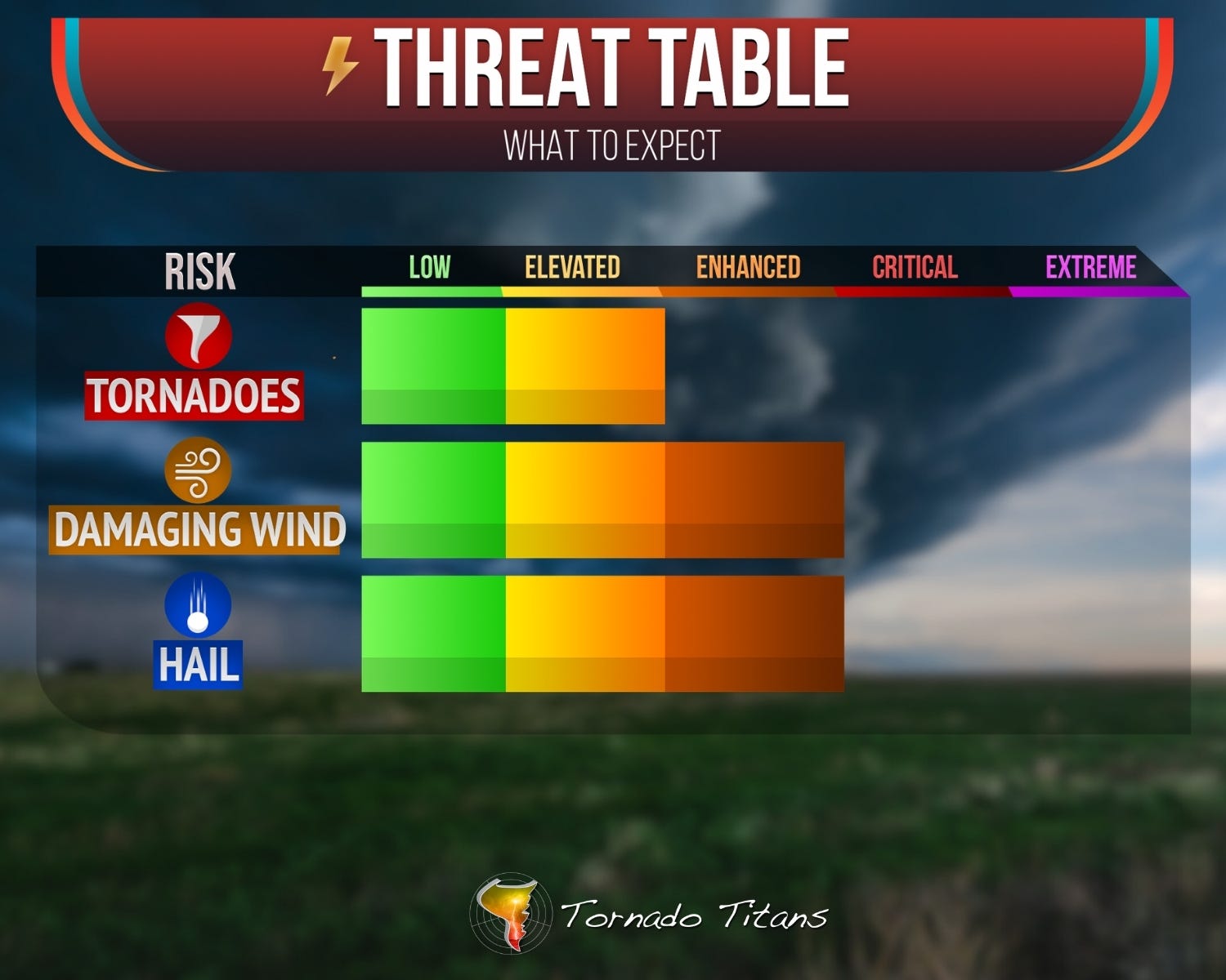
Hail, Damaging Winds, and a Tornado Threat…

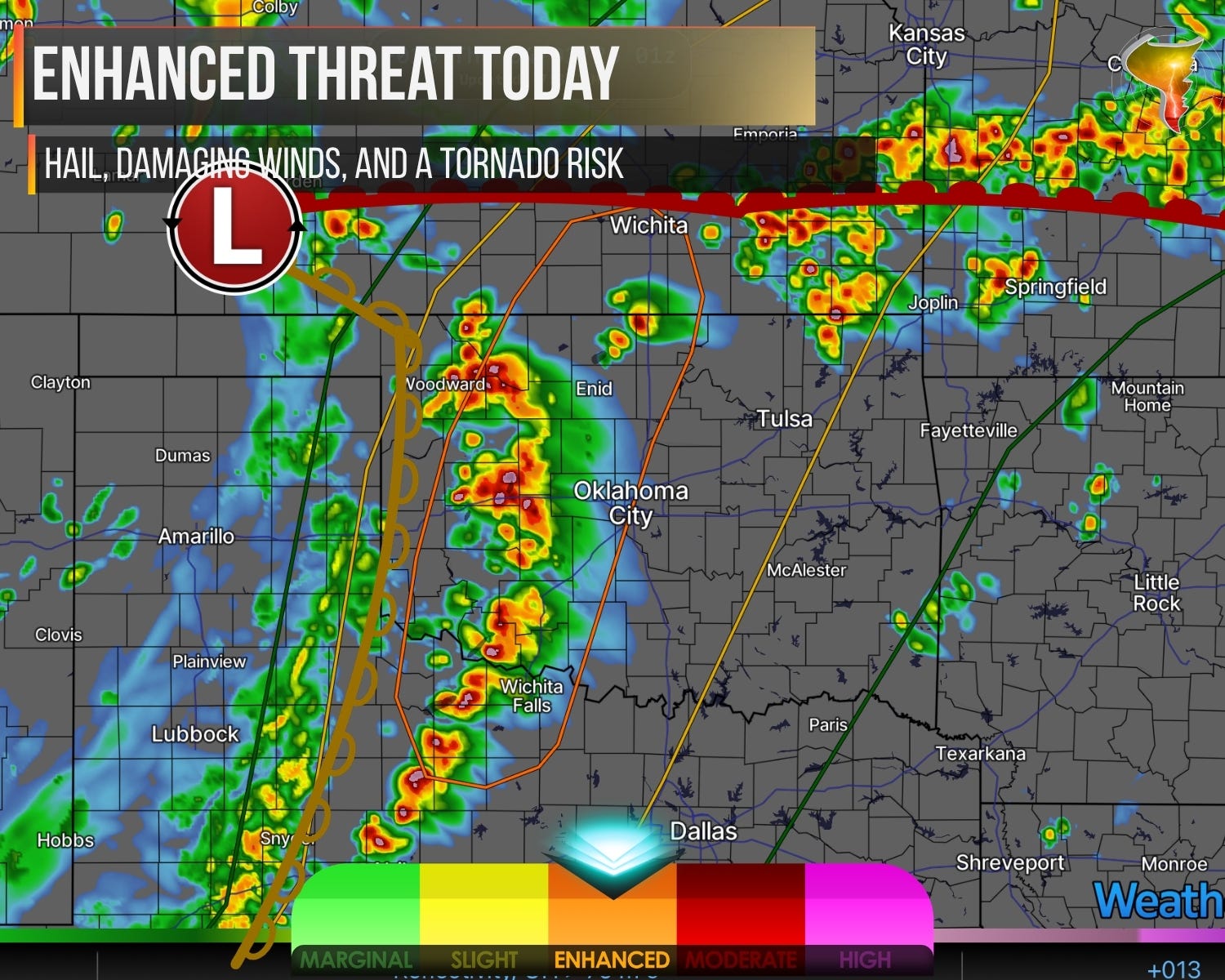
1. Threat Centers on W. OK Today
Okay, now we’re talking. After yesterday’s hail/wind event, today feels like an atmosphere on a new level, and I could see it the moment I pulled up the data this morning.
This is a real severe weather day. Hail, damaging winds, tornadoes, the full menu is on the table. Every single one of those threats comes with caveats, but with a strong wave arriving late this afternoon and a ton of storms expected across the South Central Plains, severe weather reports are basically inevitable. It’s not a question of if, just how many.
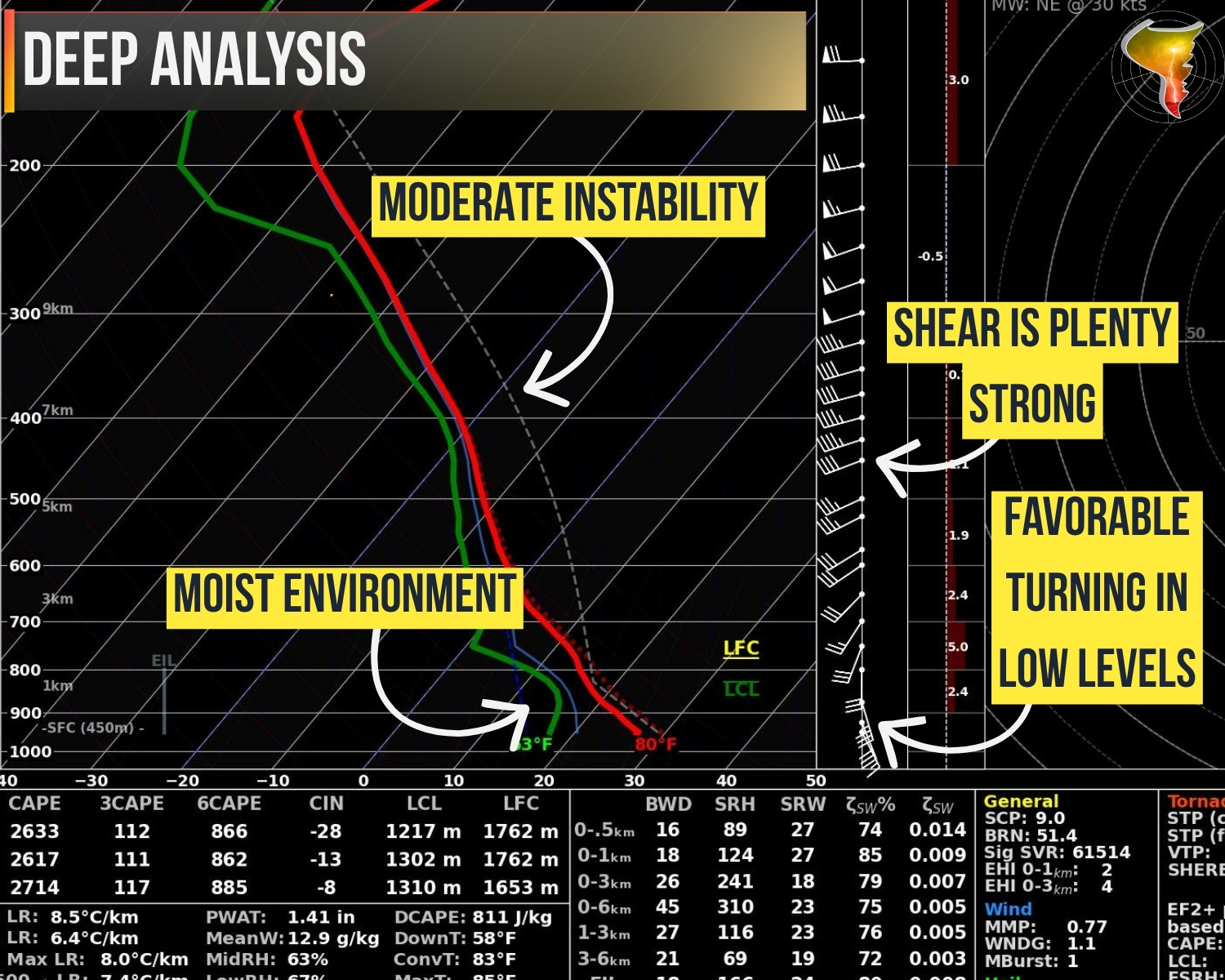
Storms should start firing an hour or so on either side of 4 p.m. and move east/north, likely clustering into a line with time. Here’s how the threats evolve: the early storms bring the biggest hail danger. As they line out, damaging winds take over as the main player. Cloud bases will start high but lower toward sunset, and that’s when the tornado risk really picks up. If a more mature QLCS gets going, that tornado threat could carry into the overnight hours too.
One more thing. It’s going to feel gloomy all day with thick high clouds hanging around, and your phone is probably going to be busy with warnings. A lot of people are going to feel like they’re “in on the action” today. But let me put it in perspective: this is a day you adjust your plans around the weather, not a day the weather cancels your plans. Stay aware, stay flexible, and you’ll be fine.