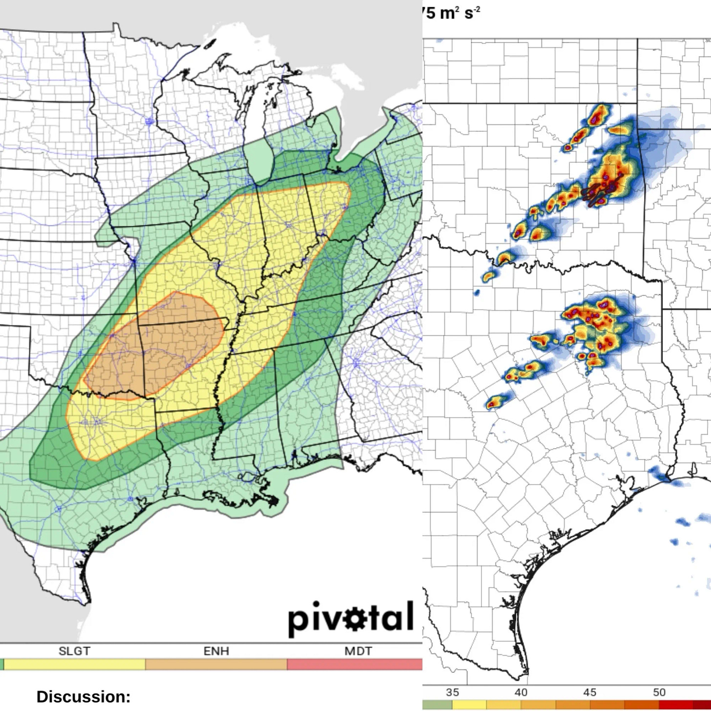
Enhanced Threat of Tornadoes Today 🌪️
Eastern Oklahoma and Arkansas are the main zones to watch for the day.
An Enhanced Risk of severe thunderstorms exists today from southeastern Oklahoma to southern Missouri. Tornadoes, large to very large hail, and strong to locally severe wind gusts are possible.
Location
Southeastern Oklahoma
Arkansas
Southern Missouri
Potentially extending into portions of:
Northeastern Texas
Eastern Oklahoma
Mississippi Valley
Tennessee Valley
Ohio Valley
Threats
Tornadoes
Large to very large hail
Strong to locally severe wind gusts
Timing
This afternoon into the evening
Discussion
Storm Drivers
A cutoff upper-level low over the Southwest U.S. and a separate shortwave impulse over the Central Great Plains will interact to create favorable conditions for storms.
Strong heating near a slow-moving boundary (either dryline or cold front) will increase instability, fueling storm development.
Wind shear increases throughout the day, with small hodographs initially appearing as storms fire.
Storm Evolution
Isolated supercells are likely initially capable of producing all severe hazards, including very large hail.
Storms may form before the noon hour today.
Storms are expected to become more widespread in the late afternoon/early evening, forming clusters.
While the tornado risk may increase initially, the overall severe threat will likely trend downward overnight, with embedded supercells and localized bows posing sporadic risks.
Uncertainties
Ohio Valley: Pre-existing storms this morning could affect how severe the afternoon storms become in areas like Indiana and Ohio. This introduces uncertainty into the forecast for that region.


No live stream today, but be sure to subscribe to our YouTube channel as we’ll be going live starting later this Spring!


Where in Missouri