

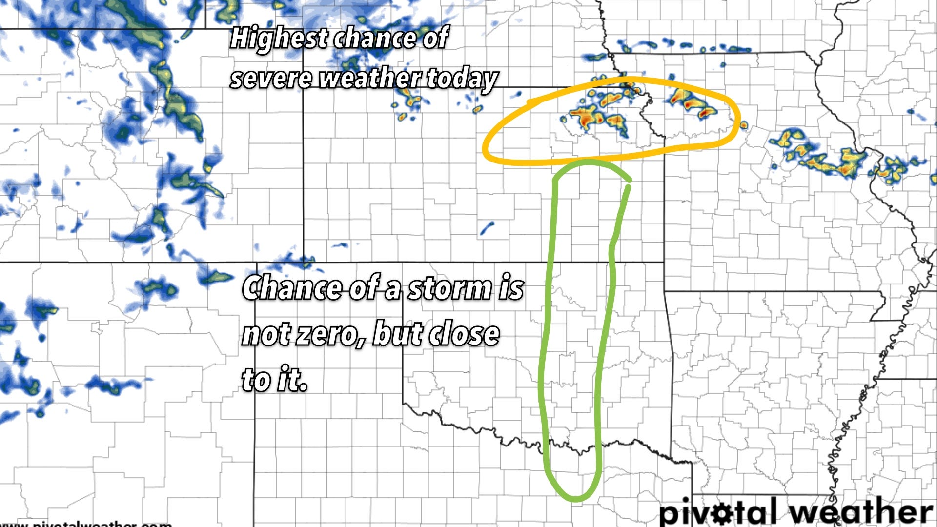
Enhanced Severe Weather Threat on Plains
Northeast Kansas and NW Missouri both look to be in the threat area today.

An Enhanced Risk of severe thunderstorms exists this afternoon and evening for parts of northeastern Kansas and northwestern Missouri. This risk includes the Topeka and Kansas City metro areas. Large to very large hail, severe wind gusts, and a few tornadoes are the main threats. Isolated severe storms are also possible in portions of the Southern Plains, but this risk is very low, and the most likely outcome on the dryline is that no storms will form throughout today.
Location
Northeastern Kansas
Northwestern Missouri
Isolated potential in:
South-central/southeastern Kansas
East-central Oklahoma
Northern Texas
Threats
Large to very large hail
Severe thunderstorm gusts
A few tornadoes (especially early in the event in NE Kansas/NW Missouri)
Timing
This afternoon into the evening
Discussion
Upper-Level Driver: A potent upper-level trough moving over the Western U.S. will drive storm development across the Central Plains.
Ideal Severe Storm Conditions:
Strong wind shear at various levels in the atmosphere supports rotating supercell storms.
Warm, moist air near the surface combined with cooler air aloft creates instability, fueling storm development.
Storms forming along a frontal zone and possible dryline will intensify the potential for significant hail and tornadoes.
Southern Plains Uncertainty: Storm initiation is uncertain in parts of the Southern Plains due to the potential capping of the atmosphere. However, any storms that do form could rapidly become severe. This is a very low risk.
Important Note: Forecast models may not perfectly depict timing of storm initiation. Storms could develop sometime this afternoon, with greatest tornado risk early in the event. But there are now increasing signs models may have been onto something this whole time.
Technical Breakdown
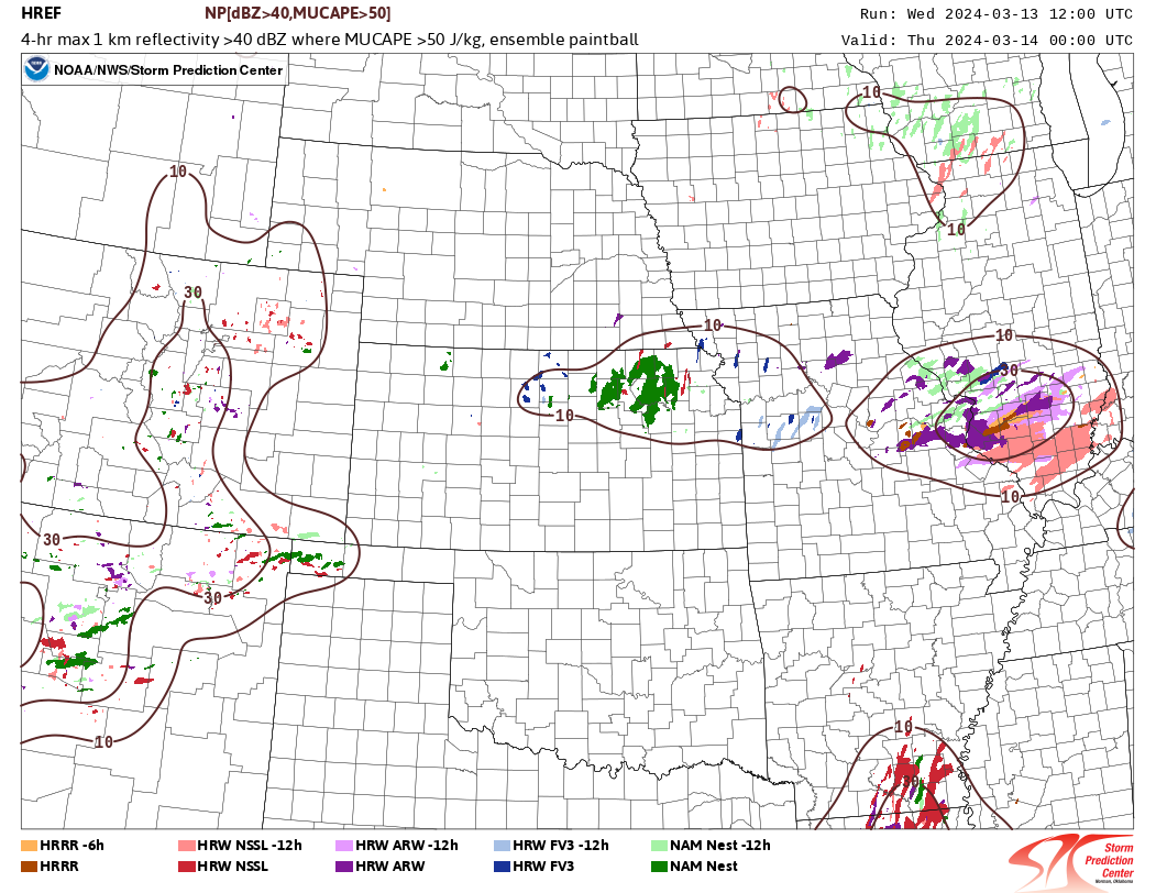
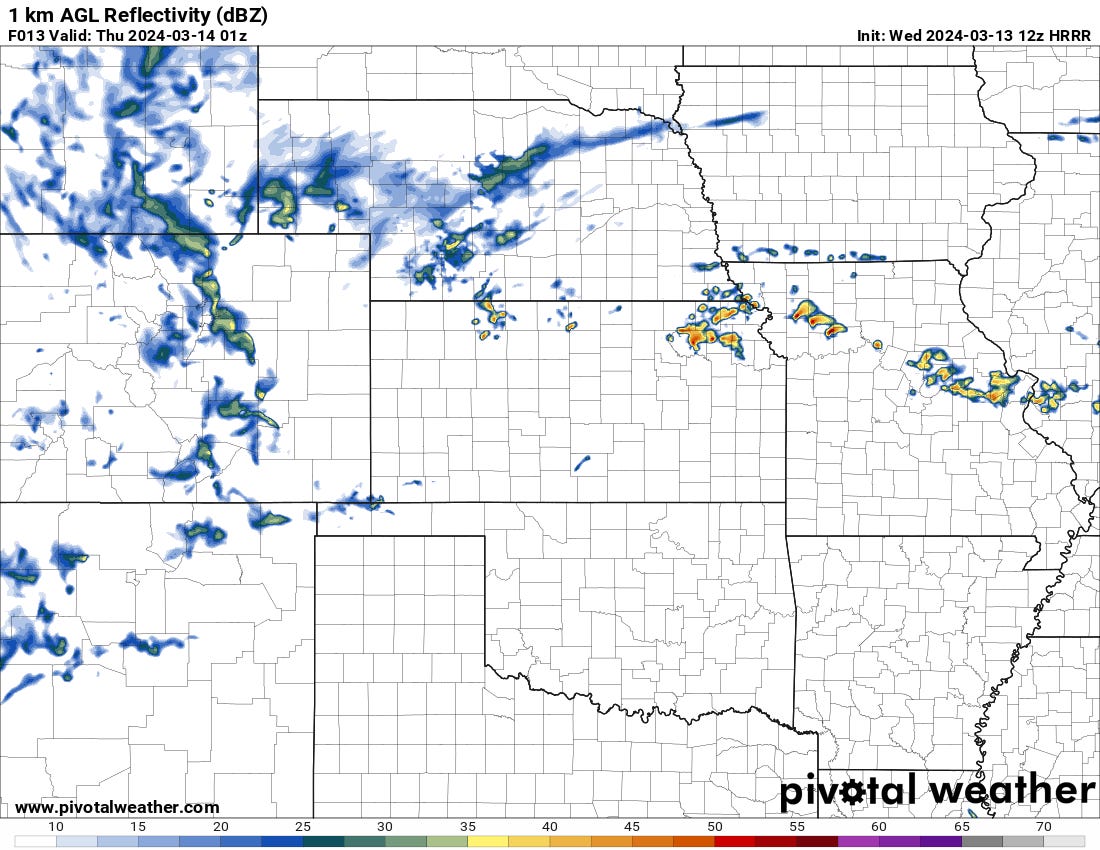
The HREF depicts isolated development beginning by sunset across northern Kansas into NW Missouri ahead of a surface low and along a warm frontal zone. These storms are likely to initially be surface-based supercells capable of large hail and tornadoes.
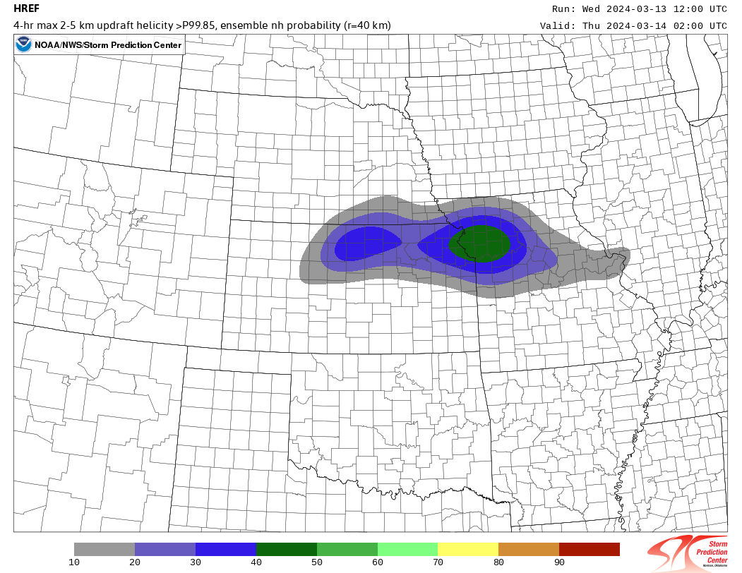
As the day turns to night, the spinny storms index does show favorable areas for supercells to continue into the night. It is possible that storms cross over the warm front and become rooted above the surface into the evening, which would limit the tornado threat after dark, but a very large hail risk would be maintained.
Trends throughout the morning have been for lower storm coverage and later initiation on some CAMs. This makes conceptual sense with a bit of a delayed wave ejection, a northward-moving warm front throughout the day, and capping. All of these point to a more rosy (for storm chasers) scenario of daytime initiation, with tornadoes possible before sunset being less likely.
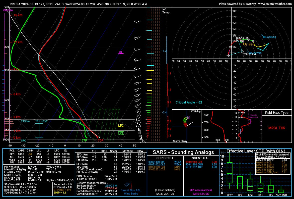
The environment is characterized near the warm front this afternoon by some modest surface capping but favorable shear values for supercells. The tornado risk looks more marginal and would require a storm to interact favorably with the warm front. Given that storm motion vectors cross over the front, it is unlikely any interactions would last very long. The window for a storm to tornado would be measured in a matter of minutes. I see the overall tornado risk as low. It would be unsurprising to see one storm do that thing very quickly, but I think the overall number of tornadoes today will not be high if any do actually occur.

As we move deeper into the night, storms should become elevated hail producers, but around some pretty major population centers like Kansas City. This could be a costly night for folks if a storm’s path aligns perfectly (imperfectly?).