

Enhanced Severe Weather Threat from KS to OK
Tornadoes will be possible.

Today, an enhanced threat has been outlined from Kansas into Northern Oklahoma, with hail, damaging winds, and a tornado possible. Storms will certainly crowd up along the cold front, with a threat of quick spin-up tornadoes lasting well into the night along that aforementioned line.
The big change from yesterday’s data is that storms look like they may go further south just before or at sunset, all the way to Central Oklahoma. By midnight, a sprawling line that spans from Wisconsin to Texas should have taken shape.
Initial Conditions
Initially today, we are looking at mid-upper 60 dewpoints as far north as Southern Oklahoma, with lower 60 dewpoints into Kansas. These should all rise modestly throughout the day, with S to SSW flow continuing across the warm sector. The cold front that will touch off our storms is plainly visible, arcing across Kansas this A.M.
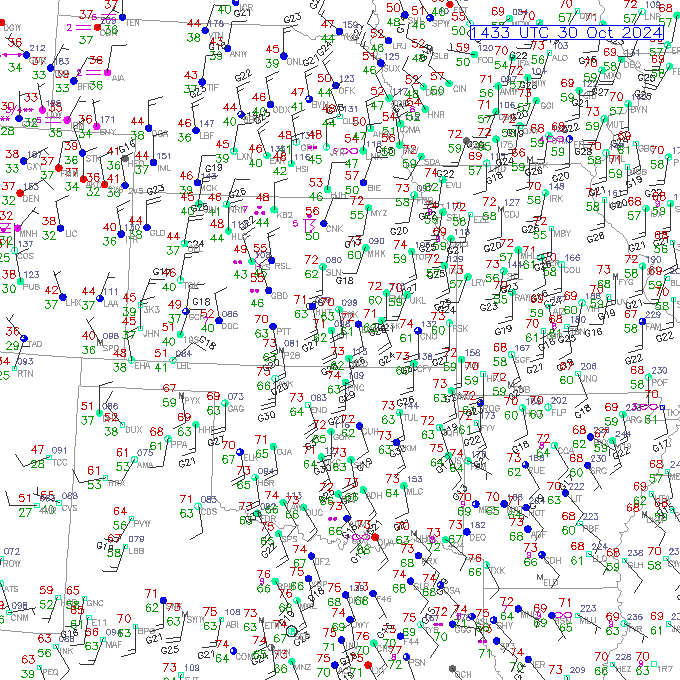
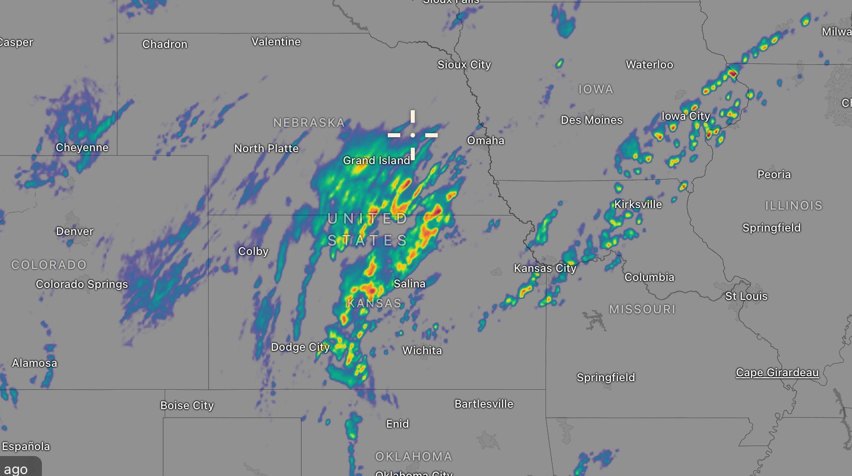
The radar screen is already busy with the main source of upper energy, creating ample lift along the cold front this morning. Widespread storms are present from Nebraska down into Oklahoma.
Today’s Timeline
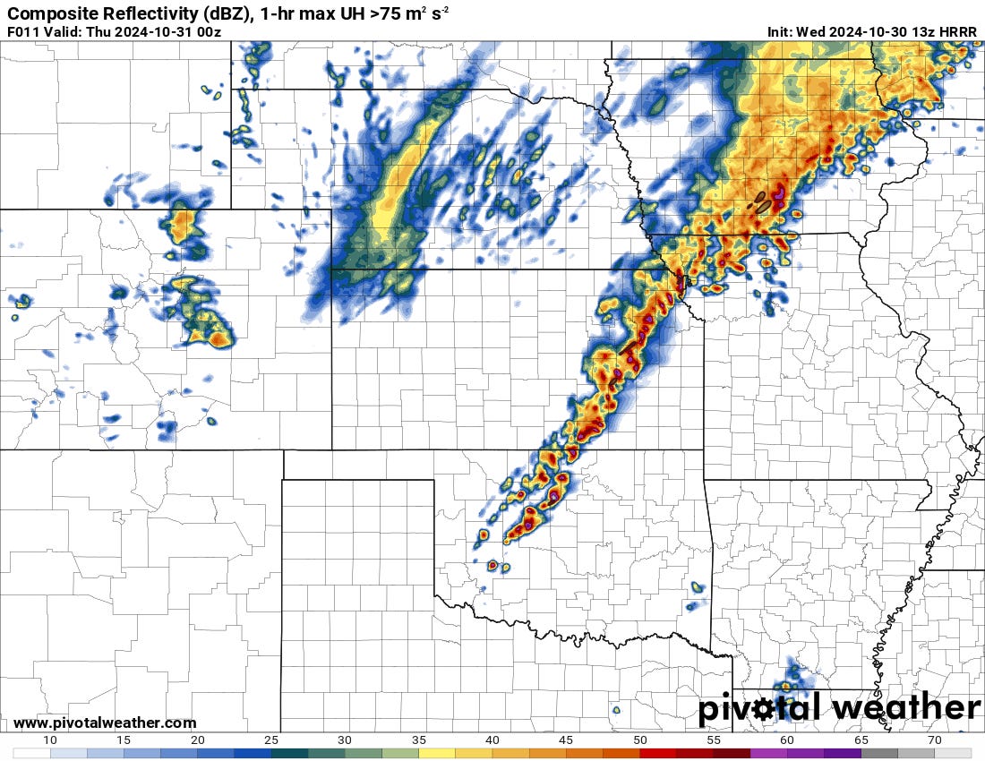
Ongoing storms will intensify and expand throughout the afternoon in Kansas as conditions become more favorable along/ahead of the cold front. A couple of these could be supercells before an expansive line forms.
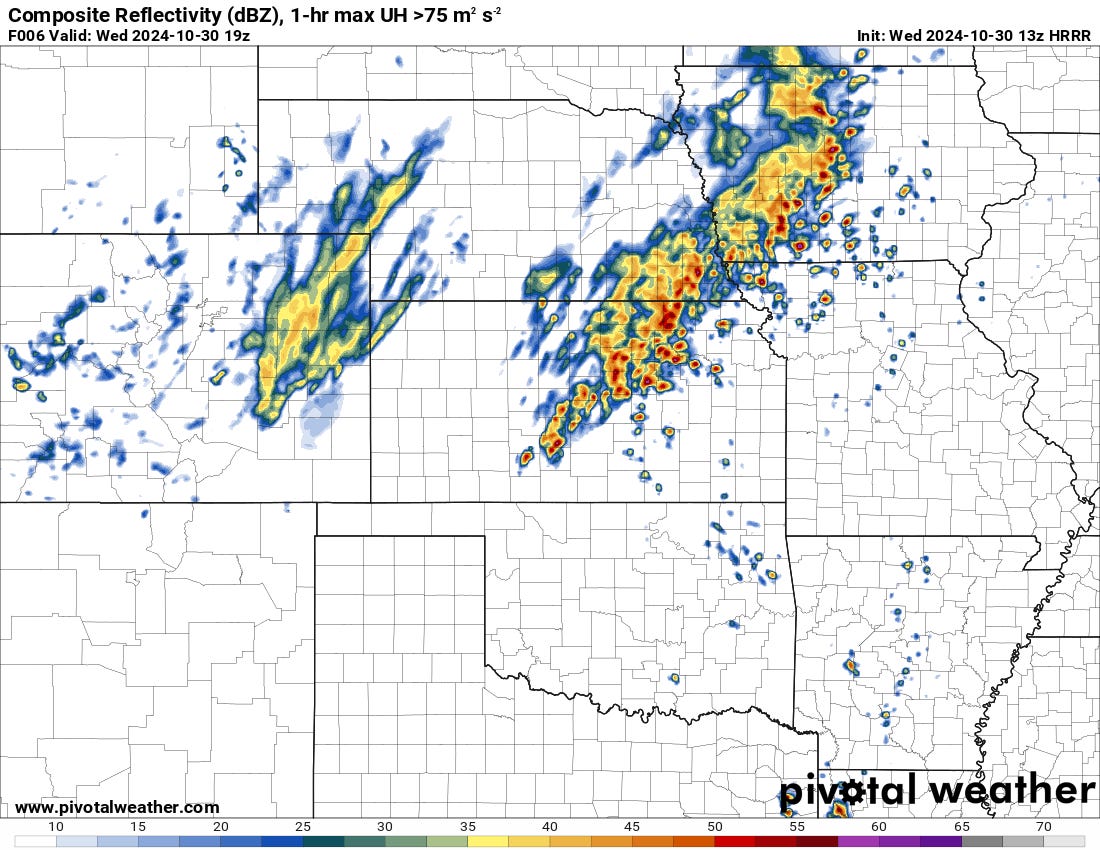
Storms should form as far south as the Oklahoma/Kansas border by late afternoon. In Kansas, a few storms could be spinning with a tornado risk. This will depend on whether these storms can stay rooted on the warm side of the cold front and maintain favorable storm interactions. I’d suspect a few tornado warnings out of this action.
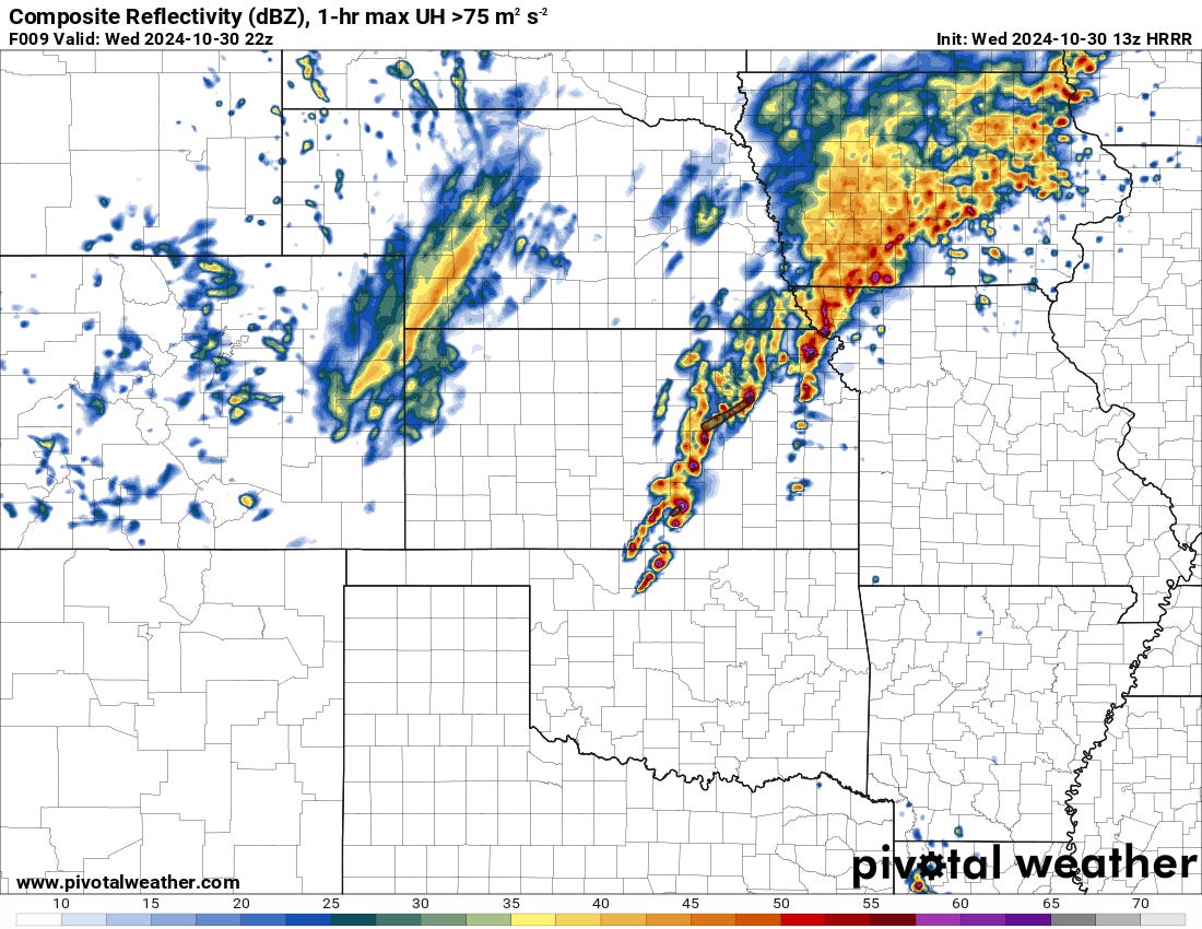
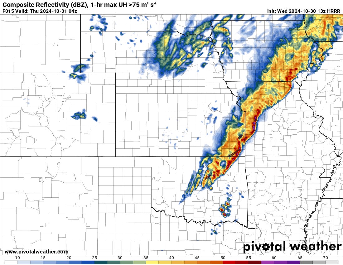
Just after sunset, storms may span as far south as I-40 in Central Oklahoma. Some of these initial cells could be supercells with a large hail and low tornado risk.
How long these cells stay isolated is anyone’s guess. I would suspect a crowded storm mode rapidly into the night, with a line taking shape within a few hours of storm formation. Storm-scale interactions will determine the overall tornado threat.
Environmental Analysis
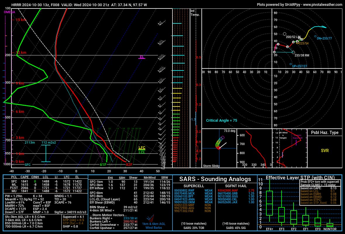
This afternoon's initial environment in Kansas features S/SSW surface winds and strong 3CAPE values. The low-level hodographs are rather small, though, with effective SRH clocking in at 112 m2/s2. This is sufficient for a low tornado risk initially, with SRH increasing into the evening as storms line out. I suspect the quick-spin-up potential will be pretty robust in Kansas to Northern Oklahoma this evening along an eventual line.
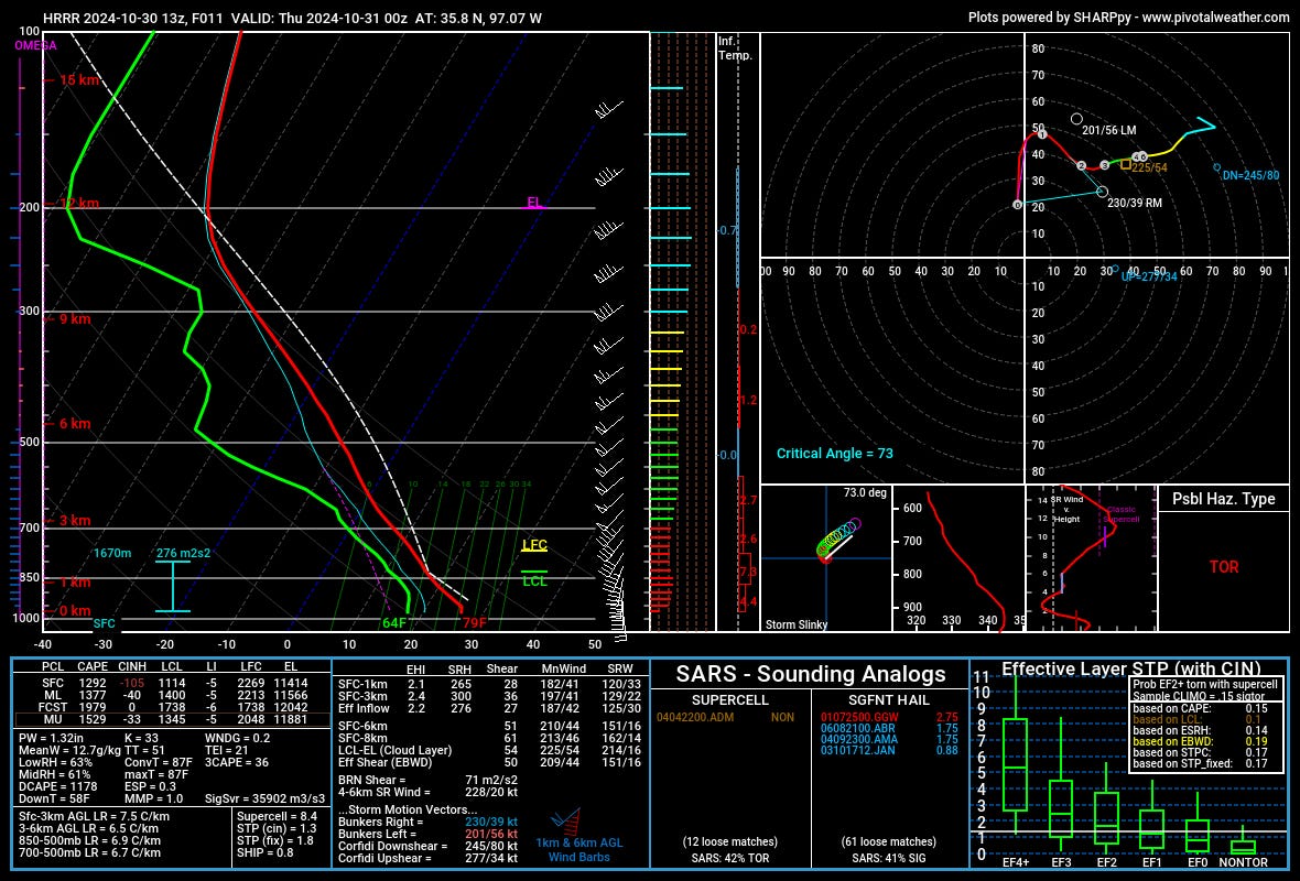
By evening down in Oklahoma, the low-level wind shear will be pretty robust, with effective SRH values of greater than 250. The 3CAPE is pretty meager, though, measuring in at below 50 j/kg, and there is a notable LCL/LFC separation on forecast soundings in several models. This all adds up to the likelihood of supercells with a very large hail threat initially transitioning to a linear mode with damaging winds likely.
The tornado threat in Oklahoma is slightly more uncertain due to warmer temperatures just above the surface. Still, I would suspect a couple of storms do at least prompt a tornado warning. The shear magnitudes from OK to KS are substantial and would support tornado formation if a mesocyclone can become fully surface-based.
Final Thoughts
Today certainly looks like a day with a lot of storms and at least a low tornado threat from Kansas into Oklahoma. If a supercell can form just ahead of the line in the evening hours, I could see a more robust classic tornado threat developing from that. Quick-spin-up tornadoes also feel pretty inevitable along the front edge of the eventual line tonight.
Overall, I expect much of the tornado risk to materialize after sunset today, with large to very large hail also likely. The overall risk will transition to a damaging winds threat the further we get from sunset.
Looking ahead, we’re also watching severe risks possibly coming in this upcoming weekend. Stay tuned.