

Enhanced Severe Threat OK/KS/TX Today
Busy week of storm season continues today...

1)Enhanced Severe Threat Today
Packed. Ready. Let’s Go Storm Chasing.
Yesterday brought a multi-state tornado outbreak, and the atmosphere isn’t finished. Today sets up another busy round of severe weather across the Plains, and I’ll be out live chasing it this afternoon.
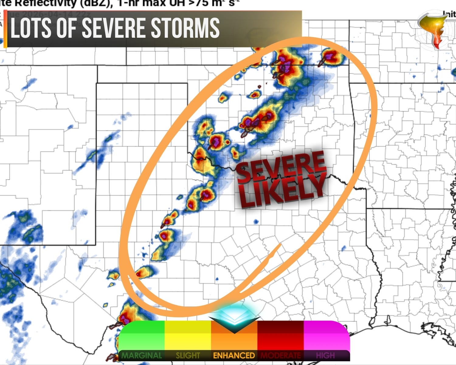
The Storm Prediction Center is highlighting an area from Kansas into Oklahoma and Texas for an enhanced risk. Modest height falls across the central to southern Plains combined with convergence along the dryline should be enough to get storms going. Strong heating through the afternoon will erode the capping, and by mid-afternoon, we should see storms firing along the dryline in Oklahoma and points north and south.
What they fire into is an impressive airmass. We’re looking at 2500 to 3000 J/kg of MLCAPE, which means the atmosphere is extremely unstable and ready to fuel powerful updrafts. Combine that with elongated hodographs and you have an environment that strongly favors supercells. The SPC increased their hail and hail-intensity highlights this morning for good reason. Large to giant hail is a confident bet today with any sustained supercell.
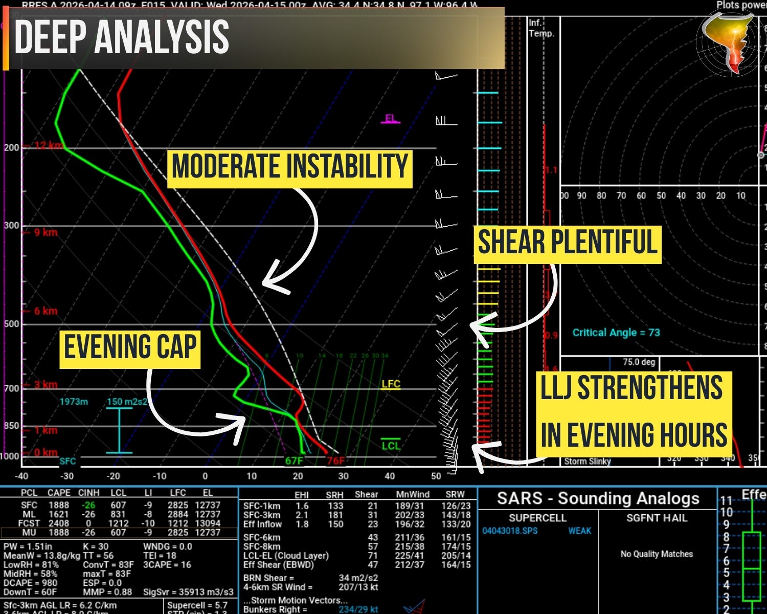
This is where it gets interesting, and where I’ll be paying the closest attention. The strength of low-level shear during the early evening remains the biggest question mark, and that’s exactly the window when the tornado risk could peak. One big key for how today goes is if a dominant supercell can separate itself from the pack. Storm interactions can help spin up tornadoes, but there’s a tipping point. Too many powerful storms firing at once and they start competing for the same air and space. It’s like putting five elite athletes on one lane of a track.
The shear profile overall looks favorable for supercells and a tornado or two is on the table. If a storm can carve out its own territory along the dryline and tap into strengthening low-level shear as the evening progresses, that’s the scenario where today’s tornado potential gets realized.
Even if the tornado threat stays on the lower end, today is not a day to shrug off. Large hail, potentially giant, and damaging winds are going to be the main story from this afternoon well into the overnight hours. The instability alone guarantees that any storm that matures will be capable of producing significant severe weather.
I’ll be positioning along the dryline in Oklahoma this afternoon, watching for initiation and looking for that one storm that starts to separate and organize. If it happens, that’s where I’ll be pointing the car. Come ride along on the live stream later today.