

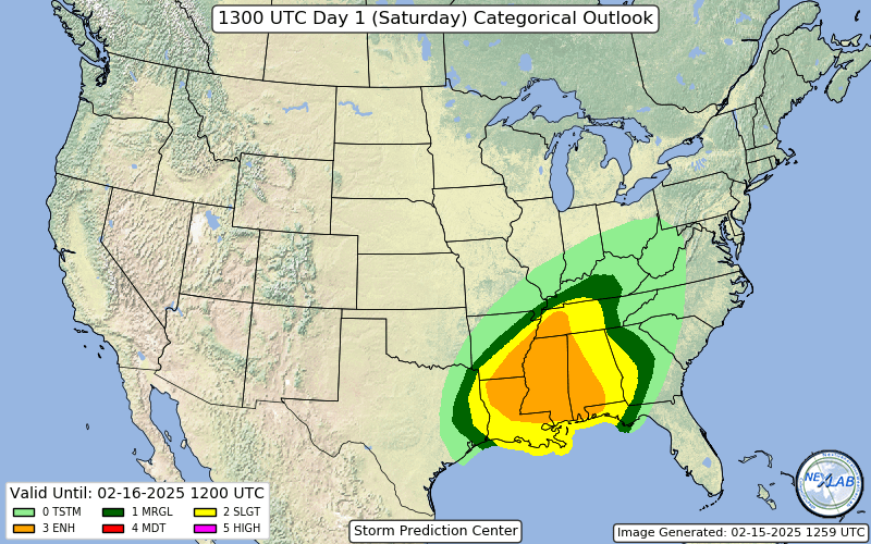
Enhanced Severe Threat in the South
A day with possible strong tornadoes is on the table…

A significant severe weather event is possible table today for parts of the Lower Mississippi Valley, the Mid-South, and into the Southeast. A powerful storm system will bring the potential for damaging winds, several tornadoes, and even a few strong tornadoes late this afternoon into the overnight hours.
The question is, as always, what the eventual storm mode ends up being.
When and Where?
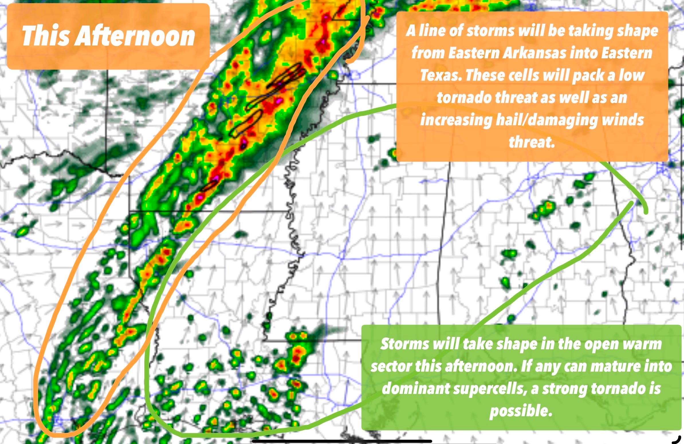
Storms are already developing this morning across Arkansas, Tennessee, and surrounding areas, but these early storms should stay below severe limits. The real show gets going later this afternoon, with storms expected to fire up in far eastern Texas and Louisiana before moving into Mississippi, Alabama, and Tennessee. The greatest risk for severe weather will stretch from late afternoon into the overnight hours as storms push eastward.
What’s Fueling This Setup?
A strong upper-level storm system is sweeping across the Plains today, dragging a cold front with it. Ahead of this front, warm, moist air is surging north from the Gulf of Mexico, creating a primed environment for storms. While the atmosphere isn’t expected to be explosively unstable, there’s just enough fuel to get strong thunderstorms going.
The real kicker today is the wind shear. A powerful low-level jet, essentially fast-moving winds just above the surface, will ramp up providing plenty of spin in the atmosphere. This means any storms that develop, whether discrete or embedded in a line, could rotate, increasing the tornado threat.
While storms may start out as isolated supercells, they are expected to quickly merge into a squall line by evening. Even as a line, embedded tornadoes will remain a concern, along with widespread damaging wind gusts.
Final Thoughts
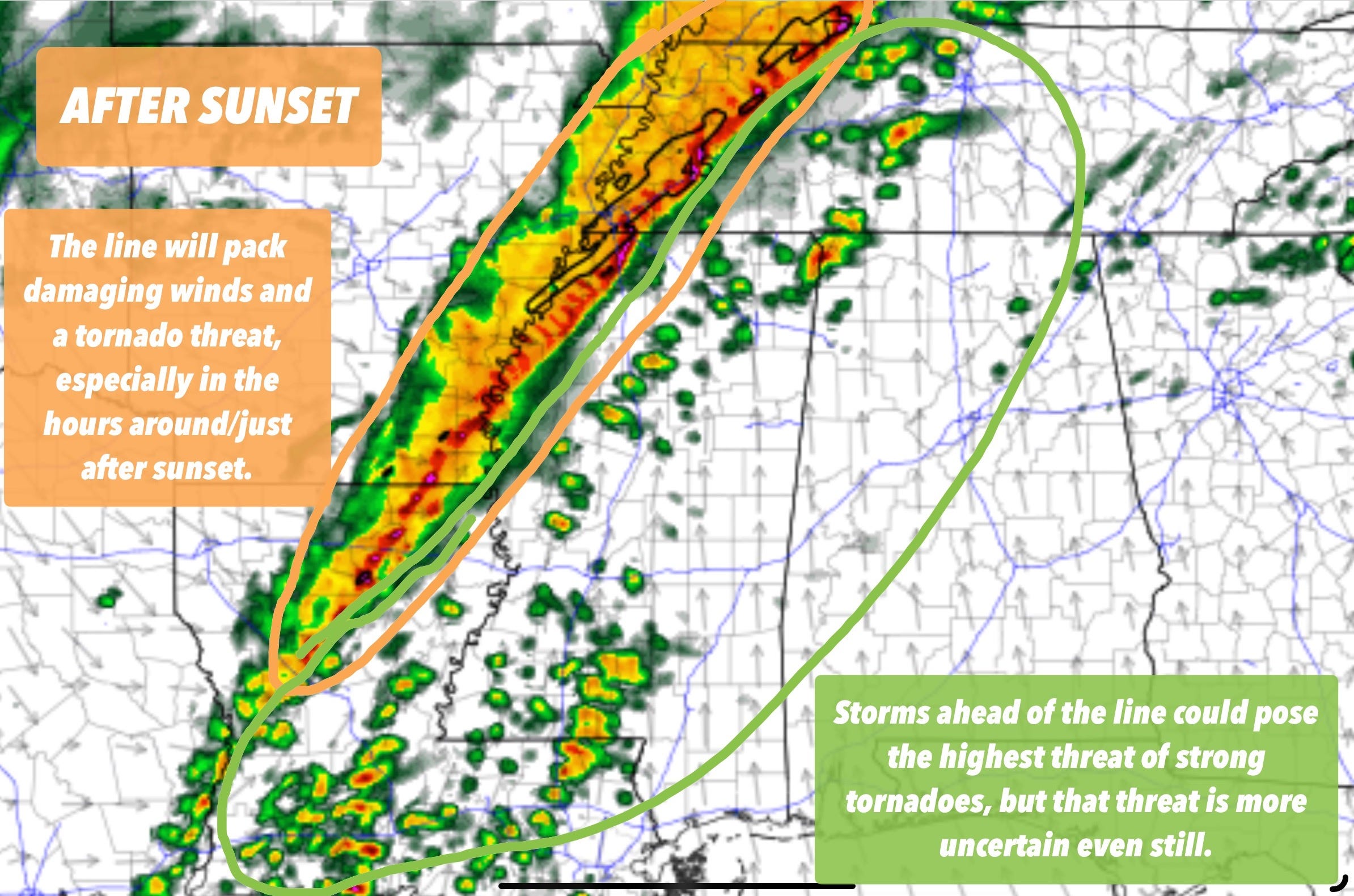
This is shaping up to be a long-duration severe weather event, with storms lasting well into the overnight hours.
While the tornado threat will be highest from late afternoon into the evening, damaging winds will continue deep into the night as the storm line moves east.