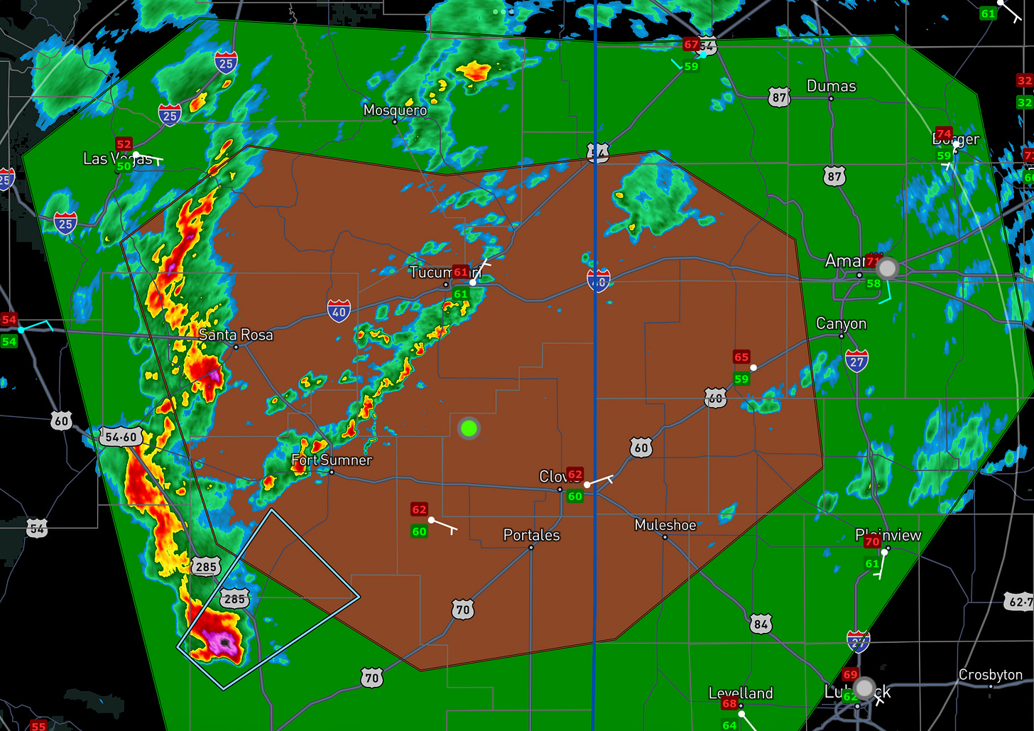
🌪️ Elevated Tornado Risk from New Mexico into the Texas Panhandle
Large hail and a couple of tornadoes possible today.
A compact upper storm system will eject out onto the Southern High Plains today with tons of storms. A few will become supercells in the afternoon with big hail and a tornado or two possible.
We’ll go live on YouTube later today with some LIVE storm chasing!

Synoptic Overview
A potent mid- to upper-level low pressure system and associated trough are currently progressing eastward across Arizona. A robust 70-knot speed maximum at the 500 millibar level is of particular interest, which is expected to round the base of the trough into central New Mexico by early evening. This setup is classic for generating severe weather in the region.
Moisture Content
One key ingredient for severe thunderstorm development is already present: abundant moisture. Recent observations show impressive low-level moisture content that will move north into the target area:
Del Rio: 18.3 g/kg (lowest 100-MB mean mixing ratio)
Midland: 14.9 g/kg (lowest 100-MB mean mixing ratio)
Dewpoints are in the 60s across eastern New Mexico already, with an increase in overall atmospheric moisture apparent.
I generally have a rule that if dews are in the 60s with supercell shear in New Mexico, you chase. It really is that simple.

Frontal Dynamics
A cold front is on the move and is forecasted to reach northeastern New Mexico and parts of the Texas and Oklahoma Panhandles by late afternoon to early evening. This front will serve as a focal point for storm initiation and could enhance the severity of any storms that do develop.
This afternoon, I’ll be watching the area south and west of the front where cloud breaks develop.

Instability and Lapse Rates
The atmospheric profile is primed for instability. The cooler air aloft associated with the upper trough will contribute to MLCAPE values from 1000-2000 j/kg. This moderately unstable airmass is undoubtedly good enough for severe weather.


Storm Outlook
Given the ingredients at play, we anticipate the following scenario:
Scattered thunderstorm development, which is the ‘main show,’ should begin in earnest in the early afternoon hours.
Some of those storms will become supercells.
Primary threats include:
Large hail
Severe wind gusts
A few tornadoes possible
Going Live Later Today
We will be live FROM THE FIELD with today’s storms. Be sure to tune in on YouTube, use the link below to subscribe and get notified when we go live.


