

Dynamic System to End this Next Week
Plus our 2025 season outlook

This week will be mostly quiet until we get towards the latter parts of the week. We’ll have another blog on that system most likely on Thursday.
But let’s talk about it all.
The Pattern
We’re starting this week off with some ridging in the west and a trough sliding underneath it. A cold front has swept south and is limiting moisture across much of the country.
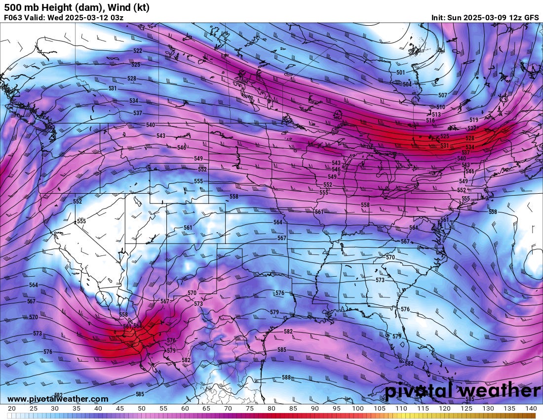
By midweek, a small trough will be digging south into possibly Mexico. This system will slide east, bringing a modest amount of moisture northwards.

The initial system will produce some showers/storms, but it will not be the headline maker this week. Still, it would not be surprising if the combination of low 50 dews coupled with strong wind shear results in a marginal risk type of day for hail.
The Main Event
Now let’s move on to the big event of the week: Friday’s system.
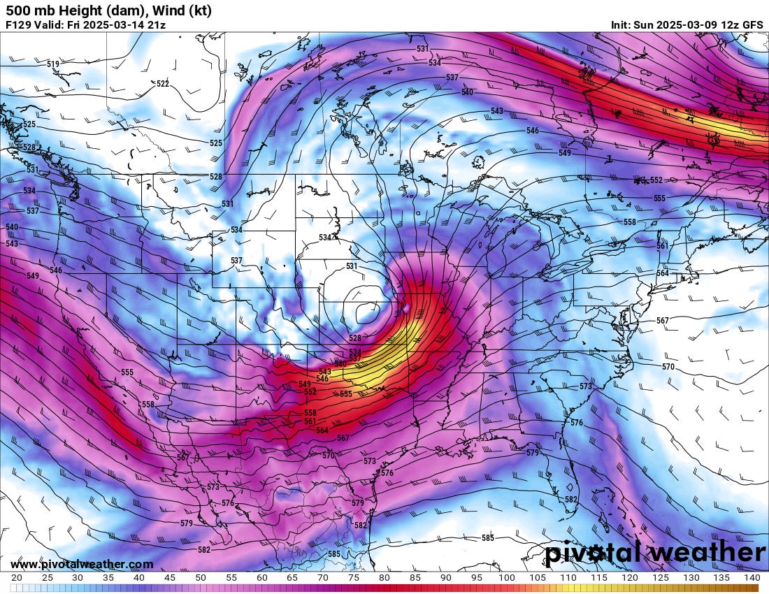
Look at the strength of this trough ejecting out over the Plains. This powerful-looking system starts at the top, and you see similar patterns all the way down.

It is not typical to see 50s/near 50 dewpoints in Canada before mid-March but this system will likely accomplish that feat. You can see the GFS has the dryline into Arkansas, which the Euro also agrees with now. There was a period where both of those models disagreed, but I’m feeling pretty confident in this being an ‘east of the Plains’ severe weather maker.

As far as precipitation impacts go, I am intrigued by the lack of a storm signal further south in Arkansas/Mississippi in the better moisture/instability. This will likely be something that isn’t true as higher resolution models show up, but its worth noting. Further north in the divergent flow aloft nearer the low, you will also see severe thunderstorms though they will move fast and likely become very crowded rather quickly.
Expect a severe weather risk on Friday that spans much of the country, with some possible localized regions with enhanced or moderate risk areas. It’s definitely not a small system and it’ll likely generate some big headlines coming out.
SW/Plains Impacts
For our home region, the impacts from this system will be of the snow and wildfire variety. With a low this deep, powerful winds behind the dryline along with dry air will be present. This will create conditions that are likely to be critical for wildfires. The only thing that might prevent a worse day is surface temperatures being pretty modest on the dry side of this system.
The snow side of this system will likely create at least a localized area of blizzard conditions on the Plains. As of right now, it looks like the most likely areas for snow impacts will be across the Dakotas into Nebraska and adjacent portions of the High Plains. But the storm track will be determinative of where this ends up.
Our 2025 Season Outlook
If you are interested in our thoughts on the upcoming season, our seasonal outlook is now up on YouTube. You can watch at the link:
We’ll be back later this week to talk about this late-week monster system in more detail.
I plan to make preparations to get ready for this monstrous storm and I am on high alert