

Did Someone Order Drought-B-Gone?
Also, record tornadoes in Oklahoma.

So, I understand if weather is not at the top of your brain today.
No, seriously, I get it.
But let’s talk weather.
This has been a record-breaking week, and the storm vibes should continue throughout the rest of the workweek before the patterns settle into something quieter for at least a few days.
The Big Three
Oklahoma has a new November tornado record, with at least 13 tornadoes recorded from this week’s outbreaks. This includes several strong tornadoes, including a pair that hit in the Oklahoma City metro area. If you are keeping track, Oklahoma has set tornado count records for October, November, December, January, and February, all in the last four years. This is not something you see in historical data happening in such a time span to be sure.
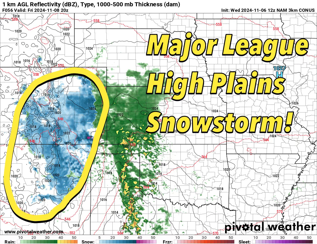
An ongoing major snowstorm is coming into the Central High Plains from the Southwest. Snow totals of over two feet are possible, especially in southern Colorado. This will snarl traffic on I-25, and on a personal note, it has caused the cancellation of the annual Titans team get-together in Denver. It is sometimes a cruel irony being a fan of extreme weather only to have extreme weather cancel plans you were looking forward to.
The rainfall from this system earlier this week left Oklahoma with widespread swaths of five inches or more. The drought monitor map will likely see a lot less bright reds in the region starting tomorrow when it updates.
Science Spotlight
The anatomy of the after-midnight outbreak of strong tornadoes from Southern Oklahoma into Central Oklahoma is a cautionary tale about not ignoring cool-season nocturnal environments.
This was not a well forecast event, but I looked at soundings in hindsight (this is a crucial thing to do if a day confounds your understanding to see what you missed) — and it seems…obvious now.
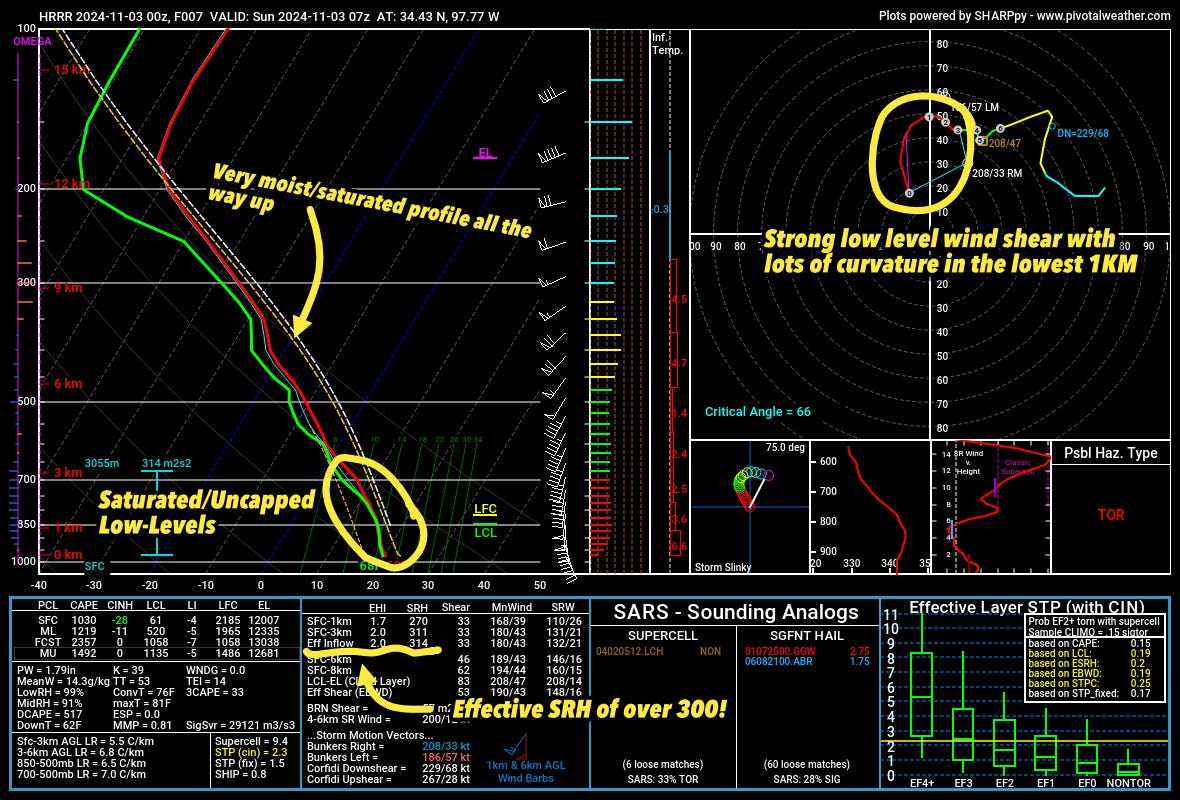
The atmosphere was incredibly moist all the way up. The PW values were near 1.8”, which is the type of atmosphere that can produce efficient rainfall.
Because of extreme warm-air advection from the low-level jet, the lower atmosphere was primed for significant tornadoes with low cloud bases and strong wind shear.
The curvature in the lowest 1km of the atmosphere (seen above) is ridiculously favorable for tornadoes. Anytime I see a hodograph shape like that, I start thinking tornadoes quickly.
Don’t Miss This
This was one of the significant risk days of the Spring (April 27, 2024), with absolutely high-end ingredients in place across Southern Oklahoma and North Texas. As I approached Seymour, Texas, an HP supercell came into view. It was time to do a risky maneuver to get a view of a possible dangerous tornado just outside of town.
Titans Toolkit
I’ve been shooting with the DJI Osmo Pocket 3 recently and let me tell you: this camera is incredible. This camera produces an image that hits well above its weight (literally as well) and is simply a joy to shoot with. Many of the most recent videos on our YouTube channel from the home studio have been shot with this little thing.
If you are looking for a run-and-gun type of small camera to film yourself and random outtakes from a storm chase — get it.