

Calmer Seas Ahead
This week was busy, but next week will likely be the opposite of busy.

We knew the weekend storm system was going to pack a major punch and it unfortunately did just that.
As of this writing it looks like we may be nearing 70 tornadoes total for the outbreak so far as well as thousands of acres burned by wildfires with many structures lost. This was a very typical, but powerful, March system.
For the upcoming week, things will likely be much less interesting weather wise.
Early Week
There is a system pushing into the middle of the country and the Southeast early this next week. This system will likely bring lower-end severe weather threats as it is pretty powerful but will be dealing with a pretty distinct lack of moisture.
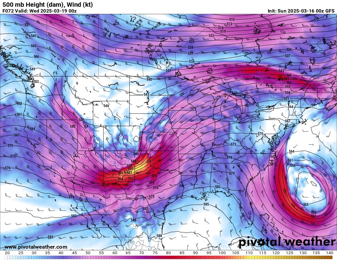
The system has a favorable tilt and a strong core to the jet, but the powerful trough off of the east coast will wreak havoc on moisture return from this system.
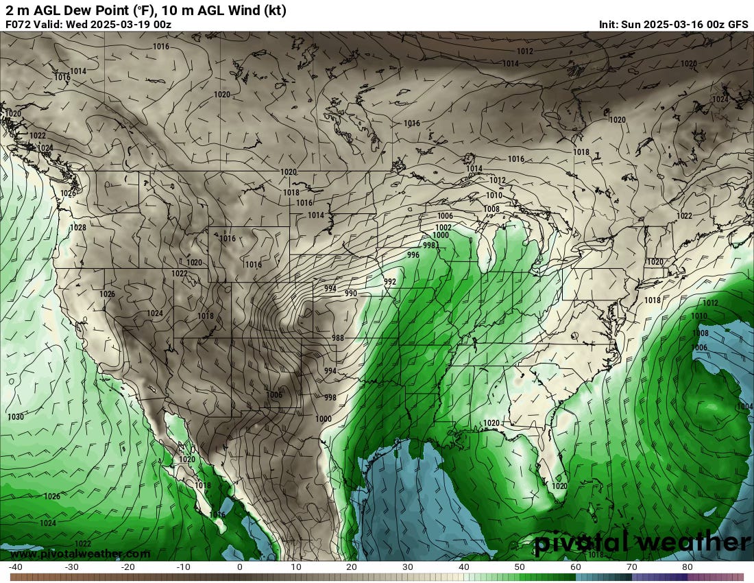
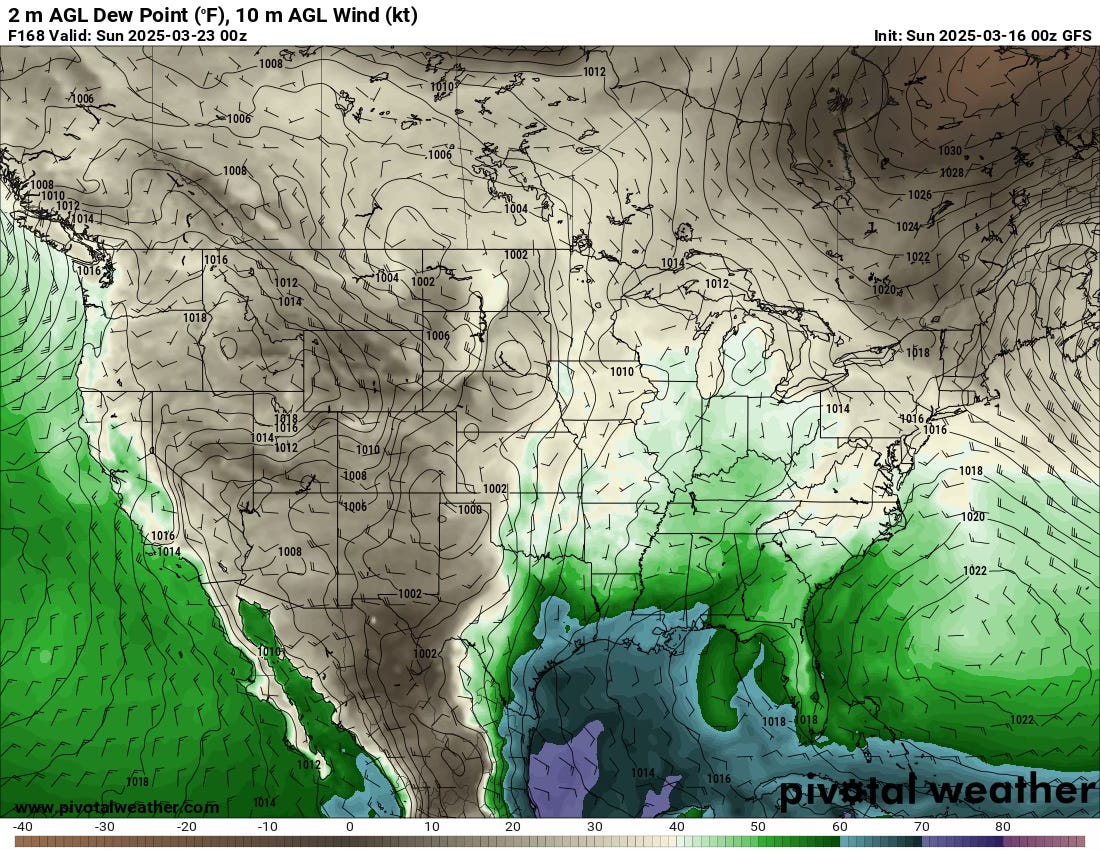
While we will see 50 dews make their way back north, that is almost a bare minimum for this type of system. Thin 60 dews will be nudging onshore by Tuesday as well. But with the northerly flow in the eastern Gulf still persisting, this moisture won’t be of the highest quality (believe it or not there are degrees of quality to moisture).
A couple of storms are possible on the Plains but the more likely scenario is a lower-end risk in the South on Wednesday.
Late Week
As the midweek system slides east and the polar jet does its thing, we’re going to see a pretty unfavorable pattern for much over the Southern tier of the U.S. during the late week period.
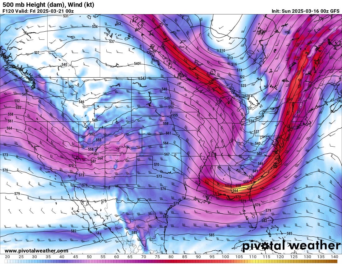
A shallow system emerges out by Thursday, but strong northerly flow just to its east along with the polar jet really diving down will lead to a pattern that is pretty unfavorable for severe weather in ‘tornado country’.
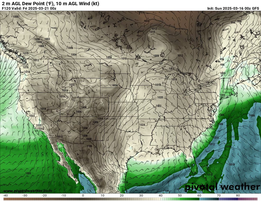
A strong front will still be pushing offshore ahead of the late week trough, with dewpoints into the 30s along the Gulf Coast. There’s no scenario here where sufficient moisture returns in time for severe weather.
Beyond
Beyond this workweek, there’s not much to speak of into the weekend and next week either. The flow should flatten out and become more zonal. This will allow for a gradual moistening of the environment ahead of any troughs out in fantasyland of the models — so we might be priming the pump for a late month severe weather episode somewhere.
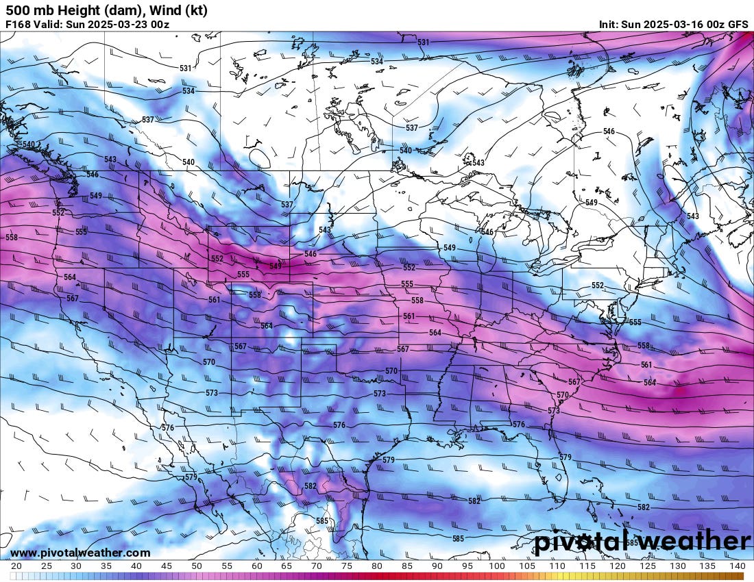
Notice how the flow is much flatter here with a gradual NW to SE tilt? That’s about as unfavorable of a pattern as you can get in the wake of such strong fronts into the Gulf.
However, we will see gradual moistening taking place across the Gulf, recharging that region for any eventual troughs.
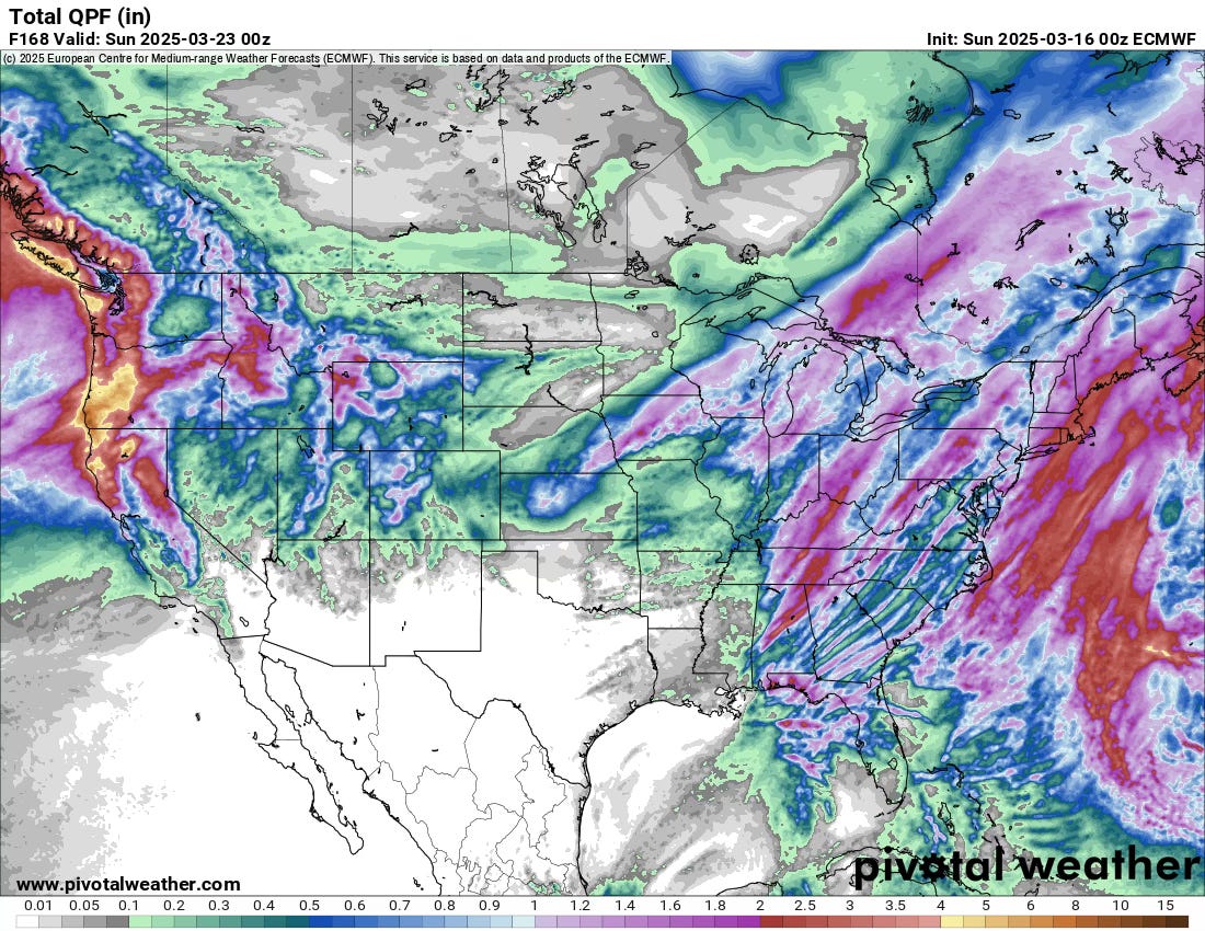
Models are very consistent in producing little to no precipitation over the next week in the broad region.
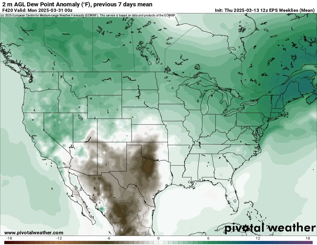
It’s a Good Time to Look Really Long Term
Given that we’re in the wake of the first major system of the Spring and we’re ahead of the next one by quite a bit, it’s a good time to look at where things are stacking up.
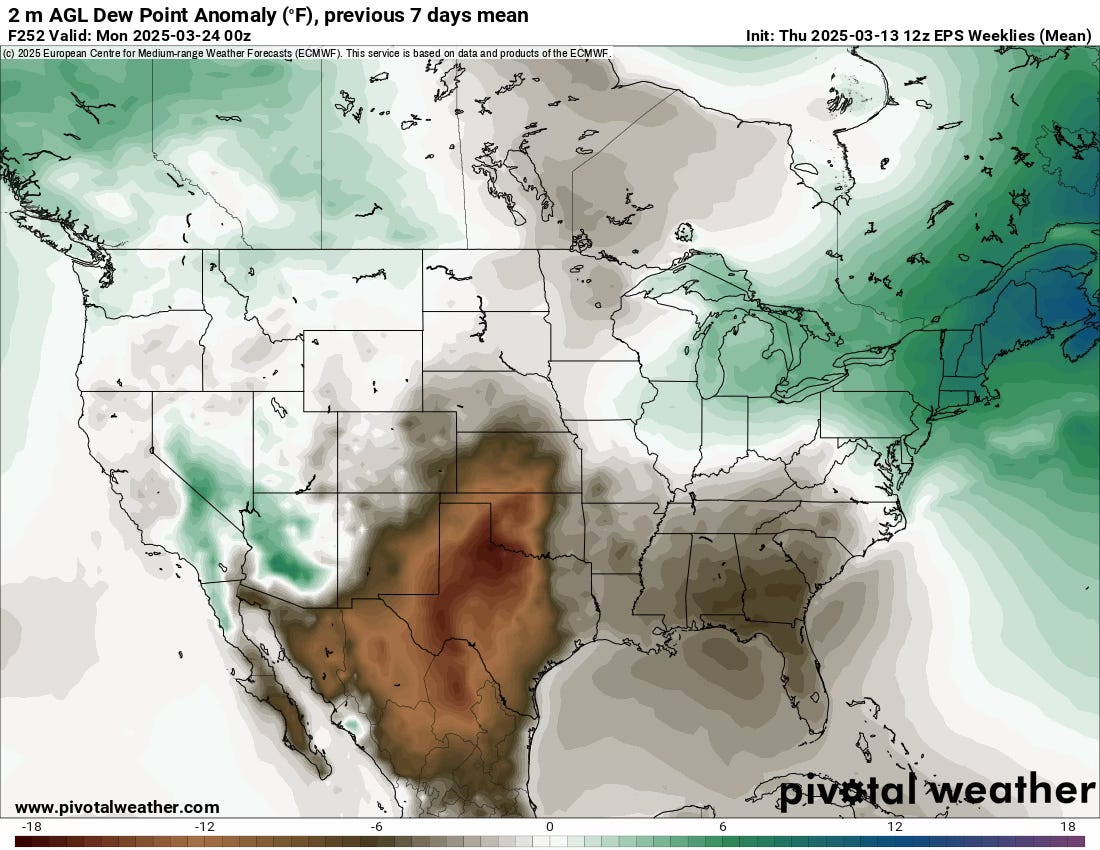
I’m a big fan of the Euro Weeklies ensemble model (amongst others). As you can see, this is what the next week looks like in terms of dewpoint anomalies. Given the lack of a signal for severe weather, the dryness here makes a lot of sense. With that as our baseline let’s see how weeks 2 and 3 stack up.
By late month, you can see a more seasonal return across the Gulf and even some positive anomalies in the Southeast. Ensembles are beginning to point towards another system in the last week of March that will move through but they’re varied on where/when. But it’s likely our next shot.

That is folowed by, yet again, another pretty dry week to start April. However, the signals begin to get mixed at this stage for places like Eastern Oklahoma and the South. My guess is we’ll start to see a more consistent dryline pattern set up by early April, though it’ll be biased quite a bit east.
The storm season over the Plains may be slower to get going, and will likely arrive in fits and spurts with long breaks in between. It’ll likely be a weird Spring in that regard.
A Plug to Become a Member
On our YouTube channel, I am breaking down upcoming setups as much as possible this Spring in a manner similar to this newsletter (but deeper). We also answer member questions with entire videos and more. Check it out.