

Busy weekend and beyond ahead
Not sure yet on BIG days, but lots of severe weather days for sure…

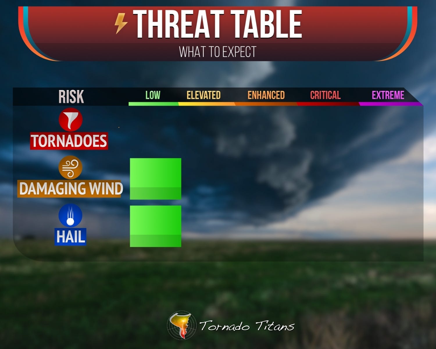
1. Today: Wind/Hail, Low Risk
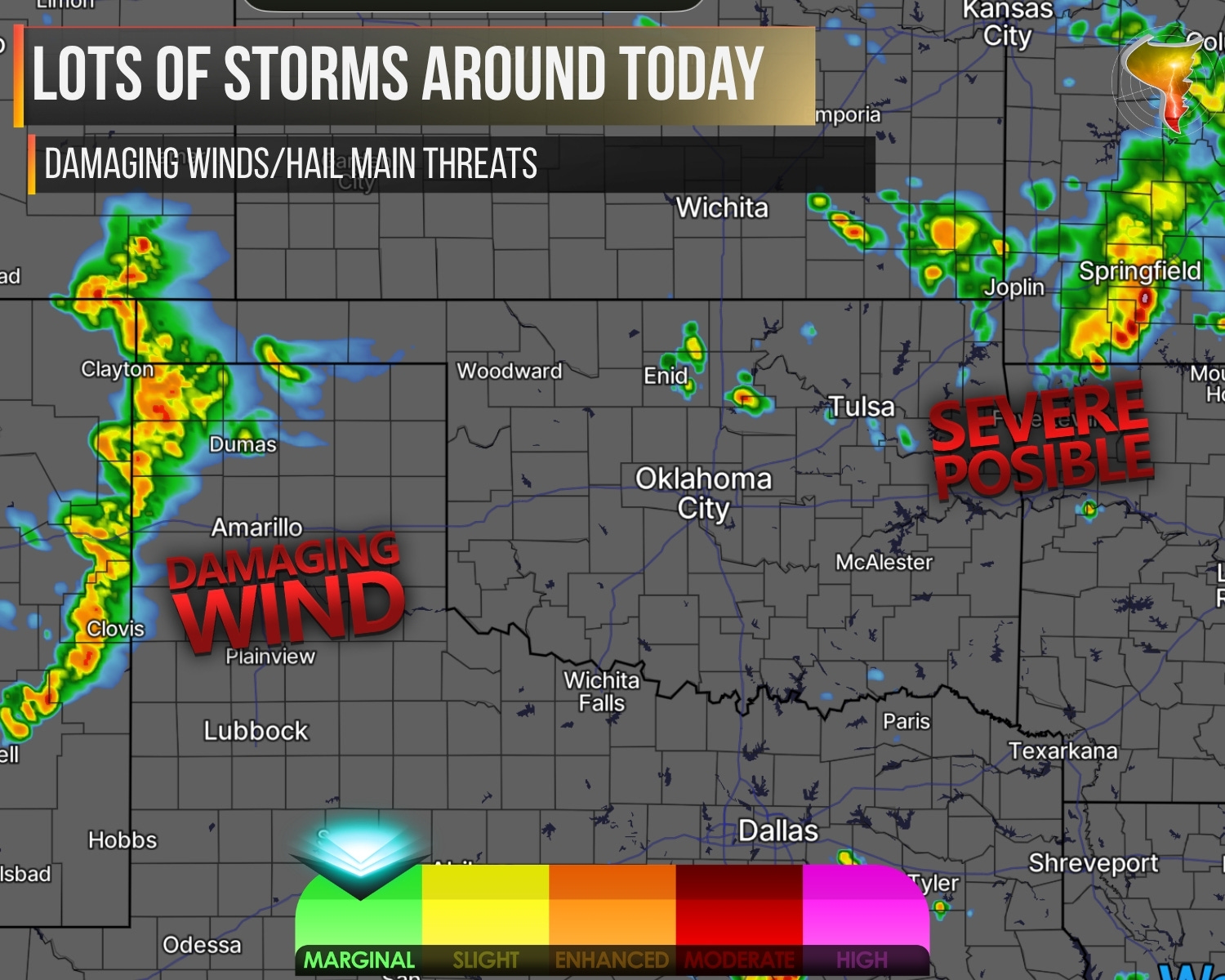
Yesterday brought big hail and damaging winds, and the atmosphere isn’t done yet. I’m genuinely curious what storms can pull off today because the ingredients are there, just not all in the same place.
Two zones to watch. First, a stalled front draped along the OK/KS border stretching into southern Missouri on one end and Colorado on the other. Moisture is more plentiful here, but so are the storms, which means competition for the fuel. The strongest cells should still produce damaging winds and large hail. Not seeing much of a tornado threat again today. The theme of the past few days has been lots of storms but few that had strong rotation, today should continue that trend though the ingredients are ever so slightly better than yesterday.
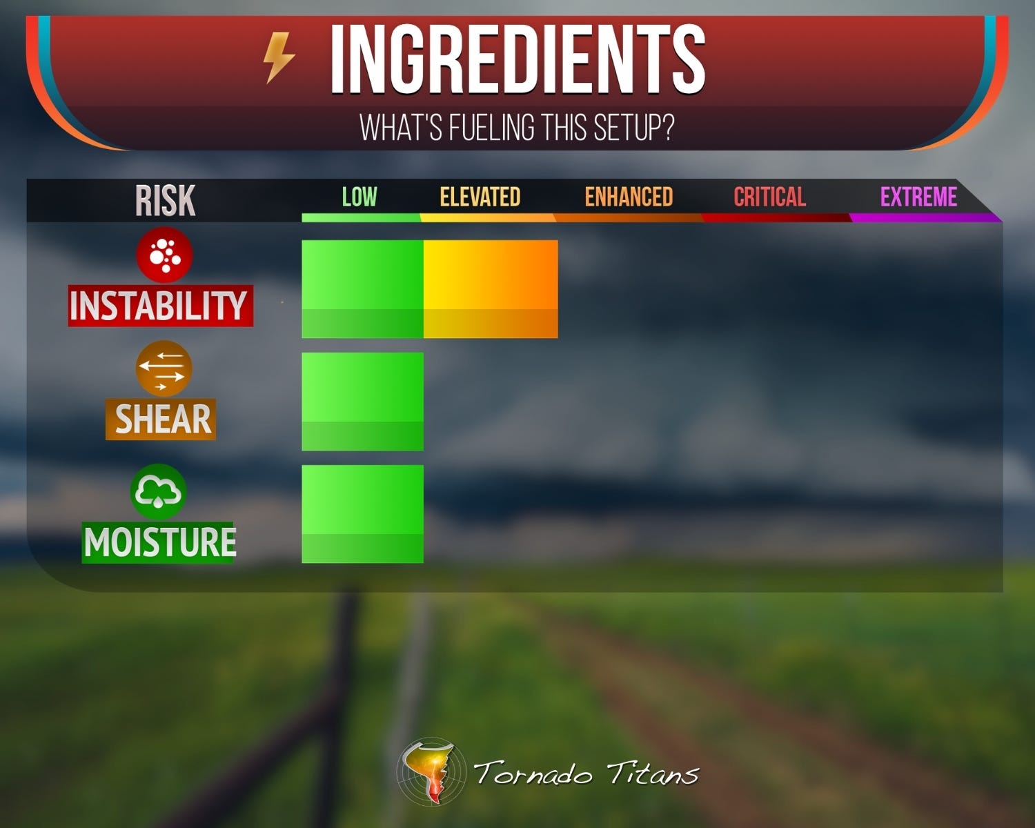
Second, the dryline out across the southern High Plains. Moisture is still lacking but keeps inching up, enough to let storms flex a little harder than they have been. Damaging winds and maybe some near-severe hail across the Panhandles back into New Mexico. Standard low-end risk territory. Nothing that gets a chaser’s blood pumping, but exactly the kind of day that keeps weather-aware people weather-aware.
2. The Weekend…And Beyond!
Now here’s where I start leaning forward in my chair.
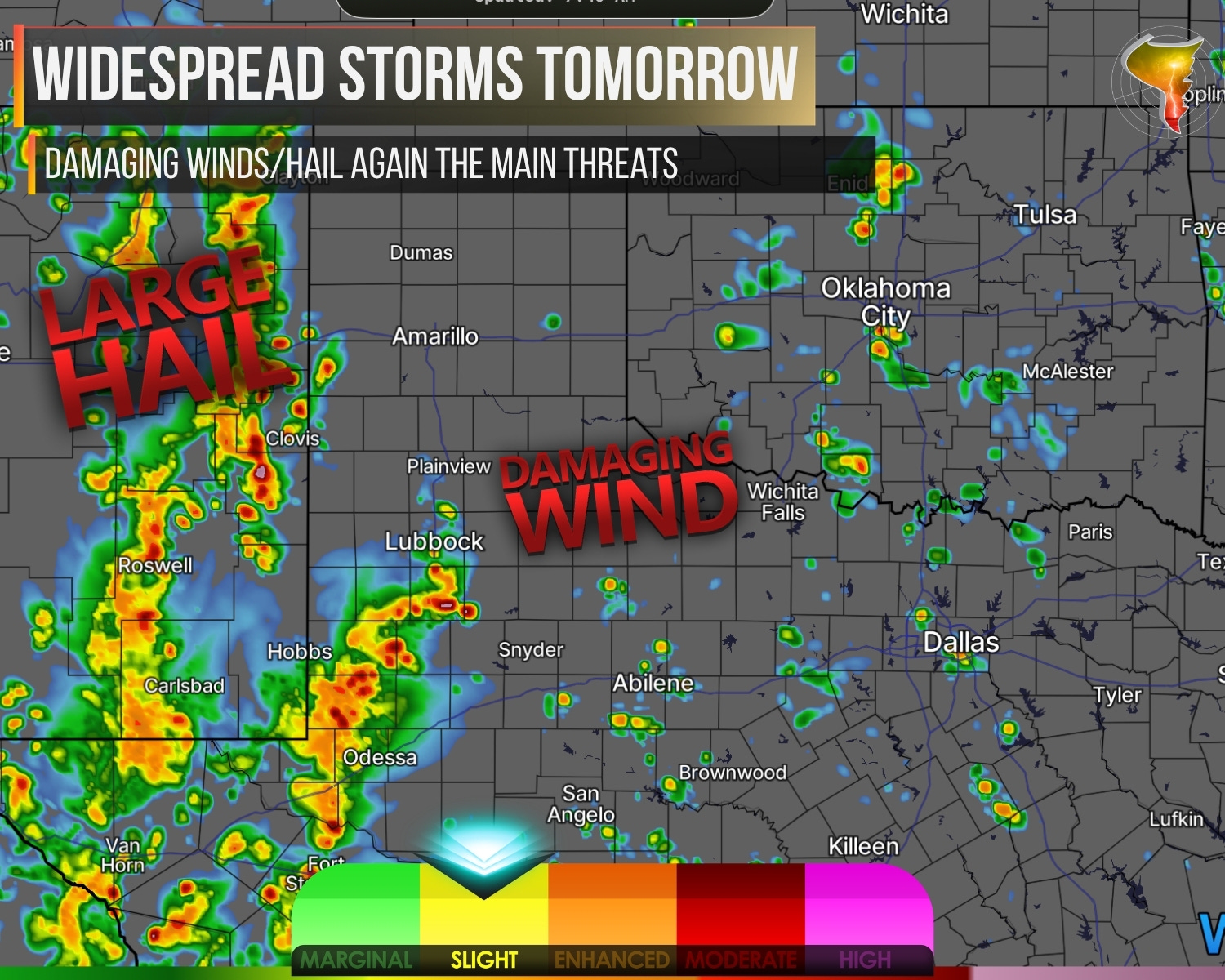
Saturday gets busy. A wave approaches the region with weak capping, which is basically the atmosphere leaving the door wide open. Storms will fire across eastern New Mexico and further east, especially off the caprock and into the open warm sector. Moisture is there. Shear is there. The problem? Storms will know it too, and when everybody shows up to the party at once, they start crowding each other out. Expect a growing complex by evening, but before that messy phase, large hail and damaging winds are a sure bet. And if a robust supercell can get going before the crowd arrives, storm interactions could briefly spin up a low-level mesocyclone. A rogue tornado isn’t out of the question.
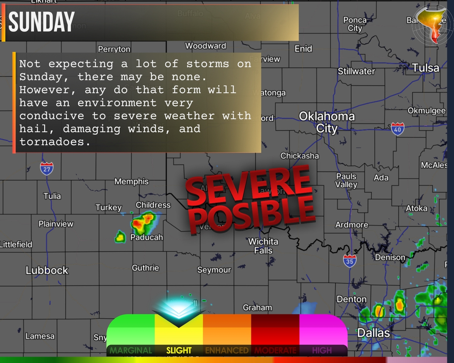
Sunday is the weird kid in the middle. The environment actually favors severe storms with anything that forms, but the atmosphere might not cooperate on the “forming” part. We’re stuck in an awkward gap between a departing wave to the east and a more potent one to the west. Hostile upper levels could keep storm coverage frustratingly low. It’s the meteorological equivalent of having all the groceries but no stove.
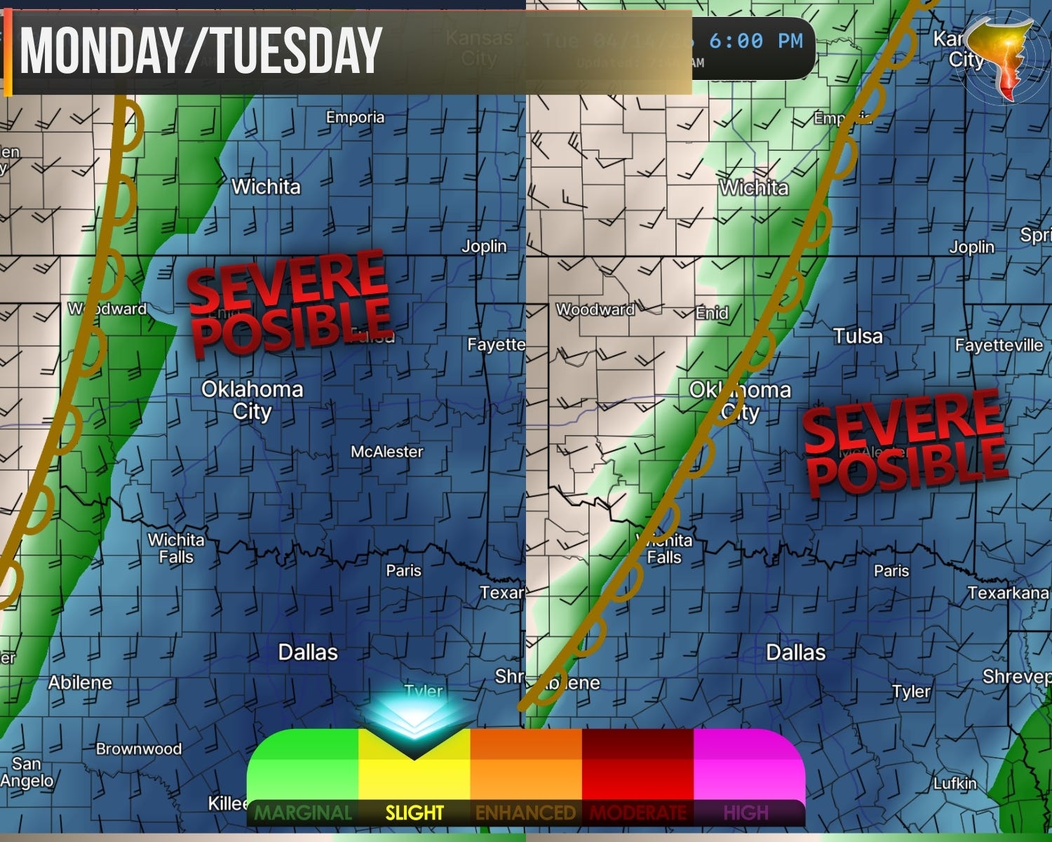
Monday and Tuesday are the ones I’m circling. Large hail and damaging winds are locked in, but the tornado risk starts climbing. The system moving in is one of the strongest we’ve seen this spring, and it’s going to fuel a powerful low-level jet. Chasers know what that means. Strong low-level jets tend to set the table for more tornadic setups. But the details that make or break a tornado day are still TBD. I’ll have a lot more to say about early next week as we get closer.